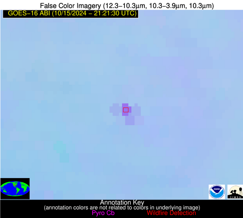
Wildfire Alert Report
| Date: | 2024-10-15 |
|---|---|
| Time: | 21:21:17 |
| Production Date and Time: | 2024-10-15 21:26:02 UTC |
| Primary Instrument: | GOES-16 ABI |
| Wmo Spacecraft Id: | 152 |
| Location/orbit: | GEO |
| L1 File: | OR_ABI-L1b-RadC-M6C14_G16_s20242892121170_e20242892123543_c20242892124038.nc |
| L1 File(s) - Temporal | OR_ABI-L1b-RadC-M6C14_G16_s20242892116170_e20242892118543_c20242892119023.nc |
| Number Of Thermal Anomaly Alerts: | 6 |
Possible Wildfire
| Basic Information | |
|---|---|
| State/Province(s) | Manitoba |
| Country/Countries | Canada |
| County/Locality(s) | Division No. 5, Manitoba |
| NWS WFO | N/A |
| Identification Method | Enhanced Contextual (Clear) |
| Mean Object Date/Time | 2024-10-15 21:21:20UTC |
| Radiative Center (Lat, Lon): | 49.210000°, -99.550000° |
| Nearby Counties (meeting alert criteria): |
|
| Total Radiative Power Anomaly | n/a |
| Total Radiative Power | 31.44 MW |
| Map: | |
| Additional Information | |
| Alert Status | New Feature |
| Type of Event | Nominal Risk |
| Event Priority Ranking | 4 |
| Maximum Observed BT (3.9 um) | 294.16 K |
| Observed - Background BT (3.9 um) | 10.34 K |
| BT Anomaly (3.9 um) | 14.89 K |
| Maximum Observed - Clear RTM BT (3.9 um) | 15.63 K |
| Maximum Observed BTD (3.9-10/11/12 um) | 18.77 K |
| Observed - Background BTD (3.9-10/11/12 um) | 11.17 K |
| BTD Anomaly (3.9-10/11/12 um) | 7.88 K |
| Similar Pixel Count | 2 |
| BT Time Tendency (3.9 um) | 9.60 K |
| Image Interval | 5.00 minutes |
| Fraction of Surrounding LWIR Pixels that are Colder | 0.50 |
| Fraction of Surrounding Red Channel Pixels that are Brighter | 0.99 |
| Maximum Radiative Power | 31.44 MW |
| Maximum Radiative Power Uncertainty | 0.00 MW |
| Total Radiative Power Uncertainty | 0.00 MW |
| Mean Viewing Angle | 61.40° |
| Mean Solar Zenith Angle | 69.80° |
| Mean Glint Angle | 90.00° |
| Water Fraction | 0.00 |
| Total Pixel Area | 10.90 km2 |
| Latest Satellite Imagery: | |
| View all event imagery » | |
Possible Wildfire
| Basic Information | |
|---|---|
| State/Province(s) | KS |
| Country/Countries | USA |
| County/Locality(s) | Saline County, KS |
| NWS WFO | Wichita KS |
| Identification Method | Enhanced Contextual (Cloud) |
| Mean Object Date/Time | 2024-10-15 21:21:50UTC |
| Radiative Center (Lat, Lon): | 38.730000°, -97.820000° |
| Nearby Counties (meeting alert criteria): |
|
| Total Radiative Power Anomaly | n/a |
| Total Radiative Power | 35.98 MW |
| Map: | |
| Additional Information | |
| Alert Status | New Feature |
| Type of Event | Elevated SPC Risk |
| Event Priority Ranking | 3 |
| Maximum Observed BT (3.9 um) | 304.14 K |
| Observed - Background BT (3.9 um) | 11.46 K |
| BT Anomaly (3.9 um) | 11.21 K |
| Maximum Observed - Clear RTM BT (3.9 um) | 21.19 K |
| Maximum Observed BTD (3.9-10/11/12 um) | 15.46 K |
| Observed - Background BTD (3.9-10/11/12 um) | 11.55 K |
| BTD Anomaly (3.9-10/11/12 um) | 24.09 K |
| Similar Pixel Count | 0 |
| BT Time Tendency (3.9 um) | 11.10 K |
| Image Interval | 5.00 minutes |
| Fraction of Surrounding LWIR Pixels that are Colder | 0.55 |
| Fraction of Surrounding Red Channel Pixels that are Brighter | 1.00 |
| Maximum Radiative Power | 35.98 MW |
| Maximum Radiative Power Uncertainty | 0.00 MW |
| Total Radiative Power Uncertainty | 0.00 MW |
| Mean Viewing Angle | 50.90° |
| Mean Solar Zenith Angle | 64.00° |
| Mean Glint Angle | 76.70° |
| Water Fraction | 0.00 |
| Total Pixel Area | 7.60 km2 |
| Latest Satellite Imagery: | |
| View all event imagery » | |
Possible Wildfire
| Basic Information | |
|---|---|
| State/Province(s) | CA |
| Country/Countries | USA |
| County/Locality(s) | Sutter County, CA |
| NWS WFO | Sacramento CA |
| Identification Method | Enhanced Contextual (Clear) |
| Mean Object Date/Time | 2024-10-15 21:21:48UTC |
| Radiative Center (Lat, Lon): | 38.940000°, -121.430000° |
| Nearby Counties (meeting alert criteria): |
|
| Total Radiative Power Anomaly | n/a |
| Total Radiative Power | 71.62 MW |
| Map: | |
| Additional Information | |
| Alert Status | New Feature |
| Type of Event | Nominal Risk |
| Event Priority Ranking | 4 |
| Maximum Observed BT (3.9 um) | 311.07 K |
| Observed - Background BT (3.9 um) | 6.21 K |
| BT Anomaly (3.9 um) | 3.03 K |
| Maximum Observed - Clear RTM BT (3.9 um) | 12.20 K |
| Maximum Observed BTD (3.9-10/11/12 um) | 14.99 K |
| Observed - Background BTD (3.9-10/11/12 um) | 5.19 K |
| BTD Anomaly (3.9-10/11/12 um) | 3.57 K |
| Similar Pixel Count | 12 |
| BT Time Tendency (3.9 um) | 4.30 K |
| Image Interval | 5.00 minutes |
| Fraction of Surrounding LWIR Pixels that are Colder | 0.84 |
| Fraction of Surrounding Red Channel Pixels that are Brighter | 0.68 |
| Maximum Radiative Power | 40.43 MW |
| Maximum Radiative Power Uncertainty | 0.00 MW |
| Total Radiative Power Uncertainty | 0.00 MW |
| Mean Viewing Angle | 65.80° |
| Mean Solar Zenith Angle | 52.10° |
| Mean Glint Angle | 77.10° |
| Water Fraction | 0.00 |
| Total Pixel Area | 32.40 km2 |
| Latest Satellite Imagery: | |
| View all event imagery » | |
Possible Wildfire
| Basic Information | |
|---|---|
| State/Province(s) | MS |
| Country/Countries | USA |
| County/Locality(s) | Pontotoc County, MS |
| NWS WFO | Memphis TN |
| Identification Method | Enhanced Contextual (Clear) |
| Mean Object Date/Time | 2024-10-15 21:22:21UTC |
| Radiative Center (Lat, Lon): | 34.320000°, -88.900000° |
| Nearby Counties (meeting alert criteria): |
|
| Total Radiative Power Anomaly | n/a |
| Total Radiative Power | 12.43 MW |
| Map: | |
| Additional Information | |
| Alert Status | New Feature |
| Type of Event | Nominal Risk |
| Event Priority Ranking | 4 |
| Maximum Observed BT (3.9 um) | 296.55 K |
| Observed - Background BT (3.9 um) | 4.63 K |
| BT Anomaly (3.9 um) | 3.62 K |
| Maximum Observed - Clear RTM BT (3.9 um) | 9.88 K |
| Maximum Observed BTD (3.9-10/11/12 um) | 10.58 K |
| Observed - Background BTD (3.9-10/11/12 um) | 4.01 K |
| BTD Anomaly (3.9-10/11/12 um) | 3.29 K |
| Similar Pixel Count | 1 |
| BT Time Tendency (3.9 um) | -0.10 K |
| Image Interval | 5.00 minutes |
| Fraction of Surrounding LWIR Pixels that are Colder | 0.82 |
| Fraction of Surrounding Red Channel Pixels that are Brighter | 1.00 |
| Maximum Radiative Power | 12.43 MW |
| Maximum Radiative Power Uncertainty | 0.00 MW |
| Total Radiative Power Uncertainty | 0.00 MW |
| Mean Viewing Angle | 42.70° |
| Mean Solar Zenith Angle | 67.60° |
| Mean Glint Angle | 77.20° |
| Water Fraction | 0.00 |
| Total Pixel Area | 6.00 km2 |
| Latest Satellite Imagery: | |
| View all event imagery » | |
Possible Wildfire
| Basic Information | |
|---|---|
| State/Province(s) | TX |
| Country/Countries | USA |
| County/Locality(s) | Coryell County, TX |
| NWS WFO | Fort Worth TX |
| Identification Method | Enhanced Contextual (Cloud) |
| Mean Object Date/Time | 2024-10-15 21:22:20UTC |
| Radiative Center (Lat, Lon): | 31.220000°, -97.800000° |
| Nearby Counties (meeting alert criteria): |
|
| Total Radiative Power Anomaly | n/a |
| Total Radiative Power | 93.37 MW |
| Map: | |
| Additional Information | |
| Alert Status | New Feature |
| Type of Event | Nominal Risk |
| Event Priority Ranking | 4 |
| Maximum Observed BT (3.9 um) | 320.32 K |
| Observed - Background BT (3.9 um) | 10.52 K |
| BT Anomaly (3.9 um) | 8.14 K |
| Maximum Observed - Clear RTM BT (3.9 um) | 18.08 K |
| Maximum Observed BTD (3.9-10/11/12 um) | 17.67 K |
| Observed - Background BTD (3.9-10/11/12 um) | 10.08 K |
| BTD Anomaly (3.9-10/11/12 um) | 14.53 K |
| Similar Pixel Count | 0 |
| BT Time Tendency (3.9 um) | 8.50 K |
| Image Interval | 5.00 minutes |
| Fraction of Surrounding LWIR Pixels that are Colder | 0.69 |
| Fraction of Surrounding Red Channel Pixels that are Brighter | 1.00 |
| Maximum Radiative Power | 52.19 MW |
| Maximum Radiative Power Uncertainty | 0.00 MW |
| Total Radiative Power Uncertainty | 0.00 MW |
| Mean Viewing Angle | 44.10° |
| Mean Solar Zenith Angle | 59.60° |
| Mean Glint Angle | 65.70° |
| Water Fraction | 0.00 |
| Total Pixel Area | 12.70 km2 |
| Latest Satellite Imagery: | |
| View all event imagery » | |
Possible Wildfire
| Basic Information | |
|---|---|
| State/Province(s) | Tamaulipas |
| Country/Countries | Mexico |
| County/Locality(s) | Abasolo, Tamaulipas |
| NWS WFO | N/A |
| Identification Method | Enhanced Contextual (Clear) |
| Mean Object Date/Time | 2024-10-15 21:23:19UTC |
| Radiative Center (Lat, Lon): | 23.990000°, -98.300000° |
| Nearby Counties (meeting alert criteria): |
|
| Total Radiative Power Anomaly | n/a |
| Total Radiative Power | 37.97 MW |
| Map: | |
| Additional Information | |
| Alert Status | New Feature |
| Type of Event | Nominal Risk |
| Event Priority Ranking | 4 |
| Maximum Observed BT (3.9 um) | 319.69 K |
| Observed - Background BT (3.9 um) | 10.29 K |
| BT Anomaly (3.9 um) | 7.89 K |
| Maximum Observed - Clear RTM BT (3.9 um) | 19.16 K |
| Maximum Observed BTD (3.9-10/11/12 um) | 16.73 K |
| Observed - Background BTD (3.9-10/11/12 um) | 9.30 K |
| BTD Anomaly (3.9-10/11/12 um) | 13.58 K |
| Similar Pixel Count | 5 |
| BT Time Tendency (3.9 um) | 4.20 K |
| Image Interval | 5.00 minutes |
| Fraction of Surrounding LWIR Pixels that are Colder | 0.97 |
| Fraction of Surrounding Red Channel Pixels that are Brighter | 0.90 |
| Maximum Radiative Power | 37.97 MW |
| Maximum Radiative Power Uncertainty | 0.00 MW |
| Total Radiative Power Uncertainty | 0.00 MW |
| Mean Viewing Angle | 38.40° |
| Mean Solar Zenith Angle | 55.30° |
| Mean Glint Angle | 54.30° |
| Water Fraction | 0.00 |
| Total Pixel Area | 5.60 km2 |
| Latest Satellite Imagery: | |
| View all event imagery » | |


