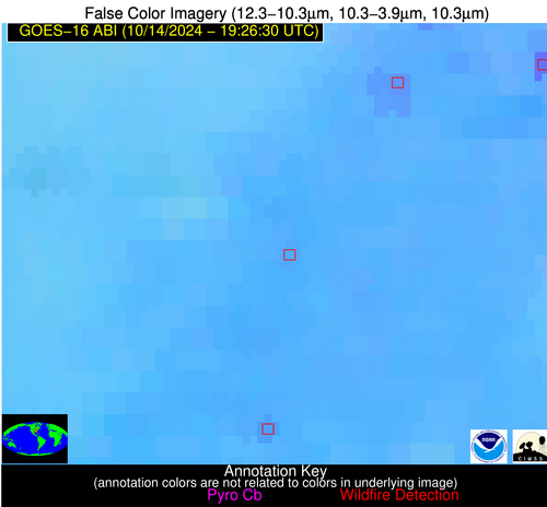
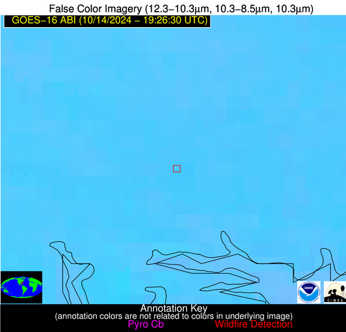
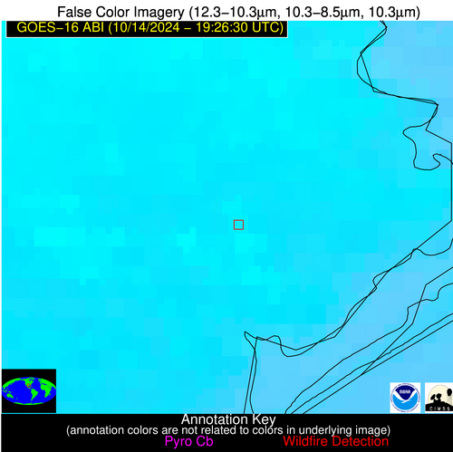
Jan 18 2026: Due to additional data center cooling system construction complications; the NGFS data and/or website may be unstable/slow to respond and/or data outages may occur.
Wildfire Alert Report
| Date: | 2024-10-14 |
|---|---|
| Time: | 19:26:17 |
| Production Date and Time: | 2024-10-14 19:31:03 UTC |
| Primary Instrument: | GOES-16 ABI |
| Wmo Spacecraft Id: | 152 |
| Location/orbit: | GEO |
| L1 File: | OR_ABI-L1b-RadC-M6C14_G16_s20242881926170_e20242881928543_c20242881929029.nc |
| L1 File(s) - Temporal | OR_ABI-L1b-RadC-M6C14_G16_s20242881921170_e20242881923543_c20242881924036.nc |
| Number Of Thermal Anomaly Alerts: | 7 |
Possible Wildfire
| Basic Information | |
|---|---|
| State/Province(s) | Manitoba |
| Country/Countries | Canada |
| County/Locality(s) | Division No. 5, Manitoba |
| NWS WFO | N/A |
| Identification Method | Enhanced Contextual (Clear) |
| Mean Object Date/Time | 2024-10-14 19:26:20UTC |
| Radiative Center (Lat, Lon): | 49.530000°, -101.270000° |
| Nearby Counties (meeting alert criteria): |
|
| Total Radiative Power Anomaly | n/a |
| Total Radiative Power | 14.63 MW |
| Map: | |
| Additional Information | |
| Alert Status | New Feature |
| Type of Event | Nominal Risk |
| Event Priority Ranking | 4 |
| Maximum Observed BT (3.9 um) | 294.73 K |
| Observed - Background BT (3.9 um) | 3.06 K |
| BT Anomaly (3.9 um) | 2.83 K |
| Maximum Observed - Clear RTM BT (3.9 um) | 12.20 K |
| Maximum Observed BTD (3.9-10/11/12 um) | 11.93 K |
| Observed - Background BTD (3.9-10/11/12 um) | 3.59 K |
| BTD Anomaly (3.9-10/11/12 um) | 4.48 K |
| Similar Pixel Count | 24 |
| BT Time Tendency (3.9 um) | 2.80 K |
| Image Interval | 5.00 minutes |
| Fraction of Surrounding LWIR Pixels that are Colder | 0.24 |
| Fraction of Surrounding Red Channel Pixels that are Brighter | 1.00 |
| Maximum Radiative Power | 14.63 MW |
| Maximum Radiative Power Uncertainty | 0.00 MW |
| Total Radiative Power Uncertainty | 0.00 MW |
| Mean Viewing Angle | 62.40° |
| Mean Solar Zenith Angle | 59.20° |
| Mean Glint Angle | 105.30° |
| Water Fraction | 0.00 |
| Total Pixel Area | 11.40 km2 |
| Latest Satellite Imagery: | |
| View all event imagery » | |
Possible Wildfire
| Basic Information | |
|---|---|
| State/Province(s) | AR |
| Country/Countries | USA |
| County/Locality(s) | Lawrence County, AR |
| NWS WFO | Little Rock AR |
| Identification Method | Enhanced Contextual (Clear) |
| Mean Object Date/Time | 2024-10-14 19:27:21UTC |
| Radiative Center (Lat, Lon): | 35.920000°, -91.090000° |
| Nearby Counties (meeting alert criteria): |
|
| Total Radiative Power Anomaly | n/a |
| Total Radiative Power | 4.08 MW |
| Map: | |
| Additional Information | |
| Alert Status | New Feature |
| Type of Event | Nominal Risk |
| Event Priority Ranking | 4 |
| Maximum Observed BT (3.9 um) | 303.62 K |
| Observed - Background BT (3.9 um) | 1.87 K |
| BT Anomaly (3.9 um) | 1.22 K |
| Maximum Observed - Clear RTM BT (3.9 um) | 13.47 K |
| Maximum Observed BTD (3.9-10/11/12 um) | 9.53 K |
| Observed - Background BTD (3.9-10/11/12 um) | 1.58 K |
| BTD Anomaly (3.9-10/11/12 um) | 2.44 K |
| Similar Pixel Count | 25 |
| BT Time Tendency (3.9 um) | 0.50 K |
| Image Interval | 5.00 minutes |
| Fraction of Surrounding LWIR Pixels that are Colder | 0.70 |
| Fraction of Surrounding Red Channel Pixels that are Brighter | 0.84 |
| Maximum Radiative Power | 4.08 MW |
| Maximum Radiative Power Uncertainty | 0.00 MW |
| Total Radiative Power Uncertainty | 0.00 MW |
| Mean Viewing Angle | 45.20° |
| Mean Solar Zenith Angle | 49.70° |
| Mean Glint Angle | 80.40° |
| Water Fraction | 0.00 |
| Total Pixel Area | 6.40 km2 |
| Latest Satellite Imagery: | |
| View all event imagery » | |
Possible Wildfire
| Basic Information | |
|---|---|
| State/Province(s) | OK |
| Country/Countries | USA |
| County/Locality(s) | Wagoner County, OK |
| NWS WFO | Tulsa OK |
| Identification Method | Enhanced Contextual (Clear) |
| Mean Object Date/Time | 2024-10-14 19:27:20UTC |
| Radiative Center (Lat, Lon): | 35.910000°, -95.340000° |
| Nearby Counties (meeting alert criteria): |
|
| Total Radiative Power Anomaly | n/a |
| Total Radiative Power | 7.35 MW |
| Map: | |
| Additional Information | |
| Alert Status | New Feature |
| Type of Event | Nominal Risk |
| Event Priority Ranking | 4 |
| Maximum Observed BT (3.9 um) | 305.71 K |
| Observed - Background BT (3.9 um) | 3.48 K |
| BT Anomaly (3.9 um) | 2.29 K |
| Maximum Observed - Clear RTM BT (3.9 um) | 12.58 K |
| Maximum Observed BTD (3.9-10/11/12 um) | 11.03 K |
| Observed - Background BTD (3.9-10/11/12 um) | 2.39 K |
| BTD Anomaly (3.9-10/11/12 um) | 3.05 K |
| Similar Pixel Count | 18 |
| BT Time Tendency (3.9 um) | 1.80 K |
| Image Interval | 5.00 minutes |
| Fraction of Surrounding LWIR Pixels that are Colder | 0.94 |
| Fraction of Surrounding Red Channel Pixels that are Brighter | 0.96 |
| Maximum Radiative Power | 7.35 MW |
| Maximum Radiative Power Uncertainty | 0.00 MW |
| Total Radiative Power Uncertainty | 0.00 MW |
| Mean Viewing Angle | 47.10° |
| Mean Solar Zenith Angle | 48.10° |
| Mean Glint Angle | 80.00° |
| Water Fraction | 0.00 |
| Total Pixel Area | 6.80 km2 |
| Latest Satellite Imagery: | |
| View all event imagery » | |
Possible Wildfire
| Basic Information | |
|---|---|
| State/Province(s) | TN |
| Country/Countries | USA |
| County/Locality(s) | Bedford County, TN |
| NWS WFO | Nashville TN |
| Identification Method | Enhanced Contextual (Clear) |
| Mean Object Date/Time | 2024-10-14 19:27:21UTC |
| Radiative Center (Lat, Lon): | 35.500000°, -86.310000° |
| Nearby Counties (meeting alert criteria): |
|
| Total Radiative Power Anomaly | n/a |
| Total Radiative Power | 6.47 MW |
| Map: | |
| Additional Information | |
| Alert Status | New Feature |
| Type of Event | Nominal Risk |
| Event Priority Ranking | 4 |
| Maximum Observed BT (3.9 um) | 298.35 K |
| Observed - Background BT (3.9 um) | 3.09 K |
| BT Anomaly (3.9 um) | 1.91 K |
| Maximum Observed - Clear RTM BT (3.9 um) | 12.76 K |
| Maximum Observed BTD (3.9-10/11/12 um) | 7.34 K |
| Observed - Background BTD (3.9-10/11/12 um) | 2.66 K |
| BTD Anomaly (3.9-10/11/12 um) | 4.44 K |
| Similar Pixel Count | 10 |
| BT Time Tendency (3.9 um) | 0.40 K |
| Image Interval | 5.00 minutes |
| Fraction of Surrounding LWIR Pixels that are Colder | 0.61 |
| Fraction of Surrounding Red Channel Pixels that are Brighter | 1.00 |
| Maximum Radiative Power | 6.47 MW |
| Maximum Radiative Power Uncertainty | 0.00 MW |
| Total Radiative Power Uncertainty | 0.00 MW |
| Mean Viewing Angle | 43.10° |
| Mean Solar Zenith Angle | 51.60° |
| Mean Glint Angle | 81.00° |
| Water Fraction | 0.00 |
| Total Pixel Area | 6.00 km2 |
| Latest Satellite Imagery: | |
| View all event imagery » | |
Possible Wildfire
| Basic Information | |
|---|---|
| State/Province(s) | SC |
| Country/Countries | USA |
| County/Locality(s) | Colleton County, SC |
| NWS WFO | Charleston SC |
| Identification Method | Enhanced Contextual (Clear) |
| Mean Object Date/Time | 2024-10-14 19:27:22UTC |
| Radiative Center (Lat, Lon): | 32.670000°, -80.630000° |
| Nearby Counties (meeting alert criteria): |
|
| Total Radiative Power Anomaly | n/a |
| Total Radiative Power | 37.86 MW |
| Map: | |
| Additional Information | |
| Alert Status | New Feature |
| Type of Event | Nominal Risk |
| Event Priority Ranking | 4 |
| Maximum Observed BT (3.9 um) | 307.70 K |
| Observed - Background BT (3.9 um) | 7.32 K |
| BT Anomaly (3.9 um) | 8.83 K |
| Maximum Observed - Clear RTM BT (3.9 um) | 10.65 K |
| Maximum Observed BTD (3.9-10/11/12 um) | 12.33 K |
| Observed - Background BTD (3.9-10/11/12 um) | 7.16 K |
| BTD Anomaly (3.9-10/11/12 um) | 18.70 K |
| Similar Pixel Count | 4 |
| BT Time Tendency (3.9 um) | 5.00 K |
| Image Interval | 5.00 minutes |
| Fraction of Surrounding LWIR Pixels that are Colder | 0.60 |
| Fraction of Surrounding Red Channel Pixels that are Brighter | 1.00 |
| Maximum Radiative Power | 21.69 MW |
| Maximum Radiative Power Uncertainty | 0.00 MW |
| Total Radiative Power Uncertainty | 0.00 MW |
| Mean Viewing Angle | 38.60° |
| Mean Solar Zenith Angle | 52.60° |
| Mean Glint Angle | 79.10° |
| Water Fraction | 0.00 |
| Total Pixel Area | 11.00 km2 |
| Latest Satellite Imagery: | |
| View all event imagery » | |
Possible Wildfire
| Basic Information | |
|---|---|
| State/Province(s) | LA |
| Country/Countries | USA |
| County/Locality(s) | Iberville Parish, LA |
| NWS WFO | New Orleans LA |
| Identification Method | Enhanced Contextual (Cloud) |
| Mean Object Date/Time | 2024-10-14 19:27:20UTC |
| Radiative Center (Lat, Lon): | 30.210000°, -91.110000° |
| Nearby Counties (meeting alert criteria): |
|
| Total Radiative Power Anomaly | n/a |
| Total Radiative Power | 271.89 MW |
| Map: | |
| Additional Information | |
| Alert Status | New Feature |
| Type of Event | Nominal Risk |
| Event Priority Ranking | 4 |
| Maximum Observed BT (3.9 um) | 331.81 K |
| Observed - Background BT (3.9 um) | 25.92 K |
| BT Anomaly (3.9 um) | 9.92 K |
| Maximum Observed - Clear RTM BT (3.9 um) | 31.93 K |
| Maximum Observed BTD (3.9-10/11/12 um) | 36.79 K |
| Observed - Background BTD (3.9-10/11/12 um) | 25.66 K |
| BTD Anomaly (3.9-10/11/12 um) | 14.74 K |
| Similar Pixel Count | 0 |
| BT Time Tendency (3.9 um) | 22.50 K |
| Image Interval | 5.00 minutes |
| Fraction of Surrounding LWIR Pixels that are Colder | 0.58 |
| Fraction of Surrounding Red Channel Pixels that are Brighter | 0.73 |
| Maximum Radiative Power | 183.19 MW |
| Maximum Radiative Power Uncertainty | 0.00 MW |
| Total Radiative Power Uncertainty | 0.00 MW |
| Mean Viewing Angle | 39.50° |
| Mean Solar Zenith Angle | 45.00° |
| Mean Glint Angle | 69.40° |
| Water Fraction | 0.30 |
| Total Pixel Area | 17.10 km2 |
| Latest Satellite Imagery: | |
| View all event imagery » | |
Possible Wildfire
| Basic Information | |
|---|---|
| State/Province(s) | TX |
| Country/Countries | USA |
| County/Locality(s) | Brazoria County, TX |
| NWS WFO | Houston/Galveston TX |
| Identification Method | Enhanced Contextual (Clear) |
| Mean Object Date/Time | 2024-10-14 19:27:50UTC |
| Radiative Center (Lat, Lon): | 29.340000°, -95.170000° |
| Nearby Counties (meeting alert criteria): |
|
| Total Radiative Power Anomaly | n/a |
| Total Radiative Power | 3.37 MW |
| Map: | |
| Additional Information | |
| Alert Status | New Feature |
| Type of Event | Nominal Risk |
| Event Priority Ranking | 4 |
| Maximum Observed BT (3.9 um) | 312.79 K |
| Observed - Background BT (3.9 um) | 2.07 K |
| BT Anomaly (3.9 um) | 1.38 K |
| Maximum Observed - Clear RTM BT (3.9 um) | 10.68 K |
| Maximum Observed BTD (3.9-10/11/12 um) | 11.33 K |
| Observed - Background BTD (3.9-10/11/12 um) | 1.33 K |
| BTD Anomaly (3.9-10/11/12 um) | 2.02 K |
| Similar Pixel Count | 25 |
| BT Time Tendency (3.9 um) | 0.70 K |
| Image Interval | 5.00 minutes |
| Fraction of Surrounding LWIR Pixels that are Colder | 0.78 |
| Fraction of Surrounding Red Channel Pixels that are Brighter | 0.85 |
| Maximum Radiative Power | 3.37 MW |
| Maximum Radiative Power Uncertainty | 0.00 MW |
| Total Radiative Power Uncertainty | 0.00 MW |
| Mean Viewing Angle | 40.80° |
| Mean Solar Zenith Angle | 42.30° |
| Mean Glint Angle | 67.30° |
| Water Fraction | 0.00 |
| Total Pixel Area | 5.90 km2 |
| Latest Satellite Imagery: | |
| View all event imagery » | |


