Jan 2026: Due to an ongoing data center cooling system construction project, NGFS data outages may occur with little or no notice.
NOTE: A data center outage will result in an NGFS outage on Thursday 1/29 from approximately 1800 – 1930 UTC.
Wildfire Alert Report
| Date: | 2024-10-14 |
|---|---|
| Time: | 16:36:17 |
| Production Date and Time: | 2024-10-14 16:40:59 UTC |
| Primary Instrument: | GOES-16 ABI |
| Wmo Spacecraft Id: | 152 |
| Location/orbit: | GEO |
| L1 File: | OR_ABI-L1b-RadC-M6C14_G16_s20242881636170_e20242881638543_c20242881639005.nc |
| L1 File(s) - Temporal | OR_ABI-L1b-RadC-M6C14_G16_s20242881631170_e20242881633543_c20242881634028.nc |
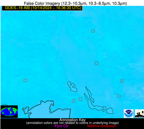
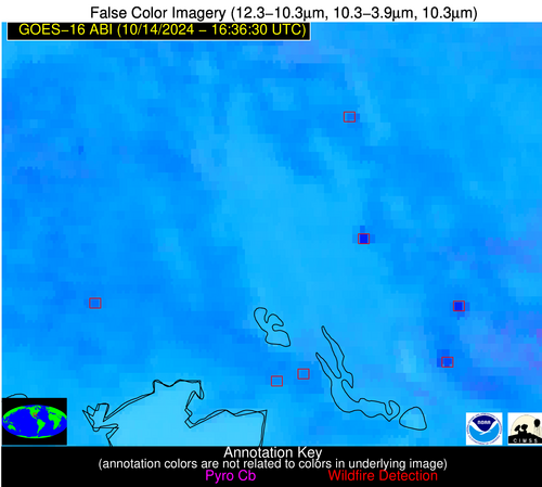
| Number Of Thermal Anomaly Alerts: | 6 |
Possible Wildfire
| Basic Information | |
|---|---|
| State/Province(s) | CA |
| Country/Countries | USA |
| County/Locality(s) | Riverside County, CA |
| NWS WFO | San Diego CA |
| Identification Method | Enhanced Contextual (Clear) |
| Mean Object Date/Time | 2024-10-14 16:37:18UTC |
| Radiative Center (Lat, Lon): | 33.590000°, -116.890000° |
| Nearby Counties (meeting alert criteria): |
|
| Total Radiative Power Anomaly | n/a |
| Total Radiative Power | 9.44 MW |
| Map: | |
| Additional Information | |
| Alert Status | New Feature |
| Type of Event | Nominal Risk |
| Event Priority Ranking | 4 |
| Maximum Observed BT (3.9 um) | 305.85 K |
| Observed - Background BT (3.9 um) | 1.71 K |
| BT Anomaly (3.9 um) | 1.17 K |
| Maximum Observed - Clear RTM BT (3.9 um) | 8.18 K |
| Maximum Observed BTD (3.9-10/11/12 um) | 11.32 K |
| Observed - Background BTD (3.9-10/11/12 um) | 1.61 K |
| BTD Anomaly (3.9-10/11/12 um) | 1.35 K |
| Similar Pixel Count | 25 |
| BT Time Tendency (3.9 um) | 2.60 K |
| Image Interval | 5.00 minutes |
| Fraction of Surrounding LWIR Pixels that are Colder | 0.53 |
| Fraction of Surrounding Red Channel Pixels that are Brighter | 0.95 |
| Maximum Radiative Power | 9.44 MW |
| Maximum Radiative Power Uncertainty | 0.00 MW |
| Total Radiative Power Uncertainty | 0.00 MW |
| Mean Viewing Angle | 59.30° |
| Mean Solar Zenith Angle | 59.30° |
| Mean Glint Angle | 118.50° |
| Water Fraction | 0.00 |
| Total Pixel Area | 11.10 km2 |
| Latest Satellite Imagery: | |
| View all event imagery » | |
Possible Wildfire
| Basic Information | |
|---|---|
| State/Province(s) | Baja California |
| Country/Countries | Mexico |
| County/Locality(s) | Mexicali, Baja California |
| NWS WFO | N/A |
| Identification Method | Enhanced Contextual (Clear) |
| Mean Object Date/Time | 2024-10-14 16:37:18UTC |
| Radiative Center (Lat, Lon): | 32.660000°, -114.800000° |
| Nearby Counties (meeting alert criteria): |
|
| Total Radiative Power Anomaly | n/a |
| Total Radiative Power | 34.14 MW |
| Map: | |
| Additional Information | |
| Alert Status | New Feature |
| Type of Event | Nominal Risk |
| Event Priority Ranking | 4 |
| Maximum Observed BT (3.9 um) | 317.10 K |
| Observed - Background BT (3.9 um) | 4.78 K |
| BT Anomaly (3.9 um) | 4.55 K |
| Maximum Observed - Clear RTM BT (3.9 um) | 12.58 K |
| Maximum Observed BTD (3.9-10/11/12 um) | 15.43 K |
| Observed - Background BTD (3.9-10/11/12 um) | 4.47 K |
| BTD Anomaly (3.9-10/11/12 um) | 5.37 K |
| Similar Pixel Count | 20 |
| BT Time Tendency (3.9 um) | 3.90 K |
| Image Interval | 5.00 minutes |
| Fraction of Surrounding LWIR Pixels that are Colder | 0.66 |
| Fraction of Surrounding Red Channel Pixels that are Brighter | 1.00 |
| Maximum Radiative Power | 34.14 MW |
| Maximum Radiative Power Uncertainty | 0.00 MW |
| Total Radiative Power Uncertainty | 0.00 MW |
| Mean Viewing Angle | 57.10° |
| Mean Solar Zenith Angle | 57.40° |
| Mean Glint Angle | 114.30° |
| Water Fraction | 0.00 |
| Total Pixel Area | 10.00 km2 |
| Latest Satellite Imagery: | |
| View all event imagery » | |
Possible Wildfire
| Basic Information | |
|---|---|
| State/Province(s) | LA |
| Country/Countries | USA |
| County/Locality(s) | West Baton Rouge Parish, LA |
| NWS WFO | New Orleans LA |
| Identification Method | Enhanced Contextual (Clear) |
| Mean Object Date/Time | 2024-10-14 16:37:20UTC |
| Radiative Center (Lat, Lon): | 30.580000°, -91.350000° |
| Nearby Counties (meeting alert criteria): |
|
| Total Radiative Power Anomaly | n/a |
| Total Radiative Power | 44.52 MW |
| Map: | |
| Additional Information | |
| Alert Status | New Feature |
| Type of Event | Nominal Risk |
| Event Priority Ranking | 4 |
| Maximum Observed BT (3.9 um) | 312.90 K |
| Observed - Background BT (3.9 um) | 6.97 K |
| BT Anomaly (3.9 um) | 2.72 K |
| Maximum Observed - Clear RTM BT (3.9 um) | 14.30 K |
| Maximum Observed BTD (3.9-10/11/12 um) | 19.37 K |
| Observed - Background BTD (3.9-10/11/12 um) | 6.46 K |
| BTD Anomaly (3.9-10/11/12 um) | 3.35 K |
| Similar Pixel Count | 18 |
| BT Time Tendency (3.9 um) | 3.20 K |
| Image Interval | 5.00 minutes |
| Fraction of Surrounding LWIR Pixels that are Colder | 0.71 |
| Fraction of Surrounding Red Channel Pixels that are Brighter | 0.83 |
| Maximum Radiative Power | 23.92 MW |
| Maximum Radiative Power Uncertainty | 0.00 MW |
| Total Radiative Power Uncertainty | 0.00 MW |
| Mean Viewing Angle | 39.90° |
| Mean Solar Zenith Angle | 42.90° |
| Mean Glint Angle | 82.80° |
| Water Fraction | 0.00 |
| Total Pixel Area | 11.50 km2 |
| Latest Satellite Imagery: | |
| View all event imagery » | |
Possible Wildfire
| Basic Information | |
|---|---|
| State/Province(s) | LA |
| Country/Countries | USA |
| County/Locality(s) | Assumption Parish, LA |
| NWS WFO | New Orleans LA |
| Identification Method | Enhanced Contextual (Cloud) |
| Mean Object Date/Time | 2024-10-14 16:37:50UTC |
| Radiative Center (Lat, Lon): | 30.040000°, -90.990000° |
| Nearby Counties (meeting alert criteria): |
|
| Total Radiative Power Anomaly | n/a |
| Total Radiative Power | 75.39 MW |
| Map: | |
| Additional Information | |
| Alert Status | New Feature |
| Type of Event | Nominal Risk |
| Event Priority Ranking | 4 |
| Maximum Observed BT (3.9 um) | 322.60 K |
| Observed - Background BT (3.9 um) | 16.25 K |
| BT Anomaly (3.9 um) | 6.89 K |
| Maximum Observed - Clear RTM BT (3.9 um) | 24.69 K |
| Maximum Observed BTD (3.9-10/11/12 um) | 30.18 K |
| Observed - Background BTD (3.9-10/11/12 um) | 15.90 K |
| BTD Anomaly (3.9-10/11/12 um) | 8.00 K |
| Similar Pixel Count | 0 |
| BT Time Tendency (3.9 um) | 12.50 K |
| Image Interval | 5.00 minutes |
| Fraction of Surrounding LWIR Pixels that are Colder | 0.67 |
| Fraction of Surrounding Red Channel Pixels that are Brighter | 0.57 |
| Maximum Radiative Power | 75.39 MW |
| Maximum Radiative Power Uncertainty | 0.00 MW |
| Total Radiative Power Uncertainty | 0.00 MW |
| Mean Viewing Angle | 39.20° |
| Mean Solar Zenith Angle | 42.20° |
| Mean Glint Angle | 81.50° |
| Water Fraction | 0.00 |
| Total Pixel Area | 5.70 km2 |
| Latest Satellite Imagery: | |
| View all event imagery » | |
Possible Wildfire
| Basic Information | |
|---|---|
| State/Province(s) | LA |
| Country/Countries | USA |
| County/Locality(s) | Vermilion Parish, LA |
| NWS WFO | Lake Charles LA |
| Identification Method | Enhanced Contextual (Clear) |
| Mean Object Date/Time | 2024-10-14 16:37:50UTC |
| Radiative Center (Lat, Lon): | 30.050000°, -92.180000° |
| Nearby Counties (meeting alert criteria): |
|
| Total Radiative Power Anomaly | n/a |
| Total Radiative Power | 20.34 MW |
| Map: | |
| Additional Information | |
| Alert Status | New Feature |
| Type of Event | Nominal Risk |
| Event Priority Ranking | 4 |
| Maximum Observed BT (3.9 um) | 315.22 K |
| Observed - Background BT (3.9 um) | 5.58 K |
| BT Anomaly (3.9 um) | 4.43 K |
| Maximum Observed - Clear RTM BT (3.9 um) | 15.86 K |
| Maximum Observed BTD (3.9-10/11/12 um) | 20.38 K |
| Observed - Background BTD (3.9-10/11/12 um) | 4.95 K |
| BTD Anomaly (3.9-10/11/12 um) | 4.74 K |
| Similar Pixel Count | 25 |
| BT Time Tendency (3.9 um) | 3.90 K |
| Image Interval | 5.00 minutes |
| Fraction of Surrounding LWIR Pixels that are Colder | 0.87 |
| Fraction of Surrounding Red Channel Pixels that are Brighter | 0.92 |
| Maximum Radiative Power | 20.34 MW |
| Maximum Radiative Power Uncertainty | 0.00 MW |
| Total Radiative Power Uncertainty | 0.00 MW |
| Mean Viewing Angle | 39.80° |
| Mean Solar Zenith Angle | 42.70° |
| Mean Glint Angle | 82.60° |
| Water Fraction | 0.00 |
| Total Pixel Area | 5.70 km2 |
| Latest Satellite Imagery: | |
| View all event imagery » | |
Possible Wildfire
| Basic Information | |
|---|---|
| State/Province(s) | LA |
| Country/Countries | USA |
| County/Locality(s) | Assumption Parish, LA |
| NWS WFO | New Orleans LA |
| Identification Method | Enhanced Contextual (Cloud) |
| Mean Object Date/Time | 2024-10-14 16:37:50UTC |
| Radiative Center (Lat, Lon): | 29.890000°, -91.030000° |
| Nearby Counties (meeting alert criteria): |
|
| Total Radiative Power Anomaly | n/a |
| Total Radiative Power | 44.53 MW |
| Map: | |
| Additional Information | |
| Alert Status | New Feature |
| Type of Event | Nominal Risk |
| Event Priority Ranking | 4 |
| Maximum Observed BT (3.9 um) | 317.56 K |
| Observed - Background BT (3.9 um) | 13.47 K |
| BT Anomaly (3.9 um) | 4.31 K |
| Maximum Observed - Clear RTM BT (3.9 um) | 19.39 K |
| Maximum Observed BTD (3.9-10/11/12 um) | 25.33 K |
| Observed - Background BTD (3.9-10/11/12 um) | 12.80 K |
| BTD Anomaly (3.9-10/11/12 um) | 4.28 K |
| Similar Pixel Count | 0 |
| BT Time Tendency (3.9 um) | 8.60 K |
| Image Interval | 5.00 minutes |
| Fraction of Surrounding LWIR Pixels that are Colder | 0.88 |
| Fraction of Surrounding Red Channel Pixels that are Brighter | 0.49 |
| Maximum Radiative Power | 44.53 MW |
| Maximum Radiative Power Uncertainty | 0.00 MW |
| Total Radiative Power Uncertainty | 0.00 MW |
| Mean Viewing Angle | 39.10° |
| Mean Solar Zenith Angle | 42.10° |
| Mean Glint Angle | 81.20° |
| Water Fraction | 0.00 |
| Total Pixel Area | 5.60 km2 |
| Latest Satellite Imagery: | |
| View all event imagery » | |


