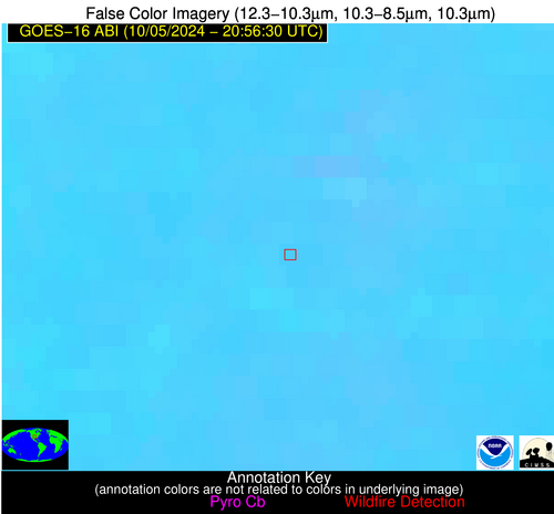
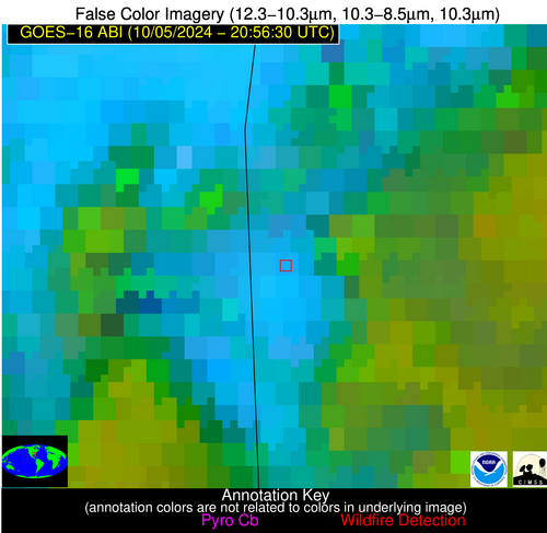
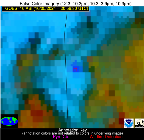
Please consider accessing NGFS detections and satellite imagery through the NOAA/NESDIS Wildland Fire Data Portal: https://fire.data.nesdis.noaa.gov/map/
Wildfire Notification Report
| Date: | 2024-10-05 |
|---|---|
| Time: | 20:56:17 |
| Production Date and Time: | 2024-10-05 21:00:54 UTC |
| Primary Instrument: | GOES-16 ABI |
| Wmo Spacecraft Id: | 152 |
| Location/orbit: | GEO |
| L1 File: | OR_ABI-L1b-RadC-M6C14_G16_s20242792056172_e20242792058545_c20242792059007.nc |
| L1 File(s) - Temporal | OR_ABI-L1b-RadC-M6C14_G16_s20242792051172_e20242792053545_c20242792054025.nc |
| Number Of Thermal Anomaly Notifications: | 5 |
Possible Wildfire
| Basic Information | |
|---|---|
| State/Province(s) | IA |
| Country/Countries | USA |
| County/Locality(s) | Guthrie County, IA |
| NWS WFO | Des Moines IA |
| Identification Method | Enhanced Contextual (Clear) |
| Mean Object Date/Time | 2024-10-05 20:56:50UTC |
| Radiative Center (Lat, Lon): | 41.760000°, -94.630000° |
| Nearby Counties (meeting notification criteria): |
|
| Total Radiative Power Anomaly | n/a |
| Total Radiative Power | 14.60 MW |
| Map: | |
| Additional Information | |
| Notification Status | New Feature |
| Type of Event | Elevated SPC Risk |
| Event Priority Ranking | 3 |
| Maximum Observed BT (3.9 um) | 308.28 K |
| Observed - Background BT (3.9 um) | 3.49 K |
| BT Anomaly (3.9 um) | 5.55 K |
| Maximum Observed - Clear RTM BT (3.9 um) | 9.53 K |
| Maximum Observed BTD (3.9-10/11/12 um) | 13.79 K |
| Observed - Background BTD (3.9-10/11/12 um) | 3.53 K |
| BTD Anomaly (3.9-10/11/12 um) | 3.50 K |
| Similar Pixel Count | 25 |
| BT Time Tendency (3.9 um) | 3.00 K |
| Image Interval | 5.00 minutes |
| Fraction of Surrounding LWIR Pixels that are Colder | 0.47 |
| Fraction of Surrounding Red Channel Pixels that are Brighter | 0.96 |
| Maximum Radiative Power | 14.60 MW |
| Maximum Radiative Power Uncertainty | 0.00 MW |
| Total Radiative Power Uncertainty | 0.00 MW |
| Mean Viewing Angle | 52.40° |
| Mean Solar Zenith Angle | 60.60° |
| Mean Glint Angle | 80.70° |
| Water Fraction | 0.00 |
| Total Pixel Area | 7.80 km2 |
| Latest Satellite Imagery: | |
| View all event imagery » | |
Possible Wildfire
| Basic Information | |
|---|---|
| State/Province(s) | IL |
| Country/Countries | USA |
| County/Locality(s) | Kankakee County, IL |
| NWS WFO | Chicago IL |
| Identification Method | Enhanced Contextual (Cloud) |
| Mean Object Date/Time | 2024-10-05 20:56:51UTC |
| Radiative Center (Lat, Lon): | 41.130000°, -88.000000° |
| Nearby Counties (meeting notification criteria): |
|
| Total Radiative Power Anomaly | n/a |
| Total Radiative Power | 27.51 MW |
| Map: | |
| Additional Information | |
| Notification Status | New Feature |
| Type of Event | Nominal Risk |
| Event Priority Ranking | 4 |
| Maximum Observed BT (3.9 um) | 307.64 K |
| Observed - Background BT (3.9 um) | 6.78 K |
| BT Anomaly (3.9 um) | 9.38 K |
| Maximum Observed - Clear RTM BT (3.9 um) | 12.69 K |
| Maximum Observed BTD (3.9-10/11/12 um) | 15.67 K |
| Observed - Background BTD (3.9-10/11/12 um) | 6.75 K |
| BTD Anomaly (3.9-10/11/12 um) | 17.91 K |
| Similar Pixel Count | 0 |
| BT Time Tendency (3.9 um) | 6.90 K |
| Image Interval | 5.00 minutes |
| Fraction of Surrounding LWIR Pixels that are Colder | 0.46 |
| Fraction of Surrounding Red Channel Pixels that are Brighter | 1.00 |
| Maximum Radiative Power | 27.51 MW |
| Maximum Radiative Power Uncertainty | 0.00 MW |
| Total Radiative Power Uncertainty | 0.00 MW |
| Mean Viewing Angle | 49.60° |
| Mean Solar Zenith Angle | 64.20° |
| Mean Glint Angle | 83.50° |
| Water Fraction | 0.00 |
| Total Pixel Area | 7.00 km2 |
| Latest Satellite Imagery: | |
| View all event imagery » | |
Possible Wildfire
| Basic Information | |
|---|---|
| State/Province(s) | MO |
| Country/Countries | USA |
| County/Locality(s) | Buchanan County, MO |
| NWS WFO | Kansas City/Pleasant Hill MO |
| Identification Method | Enhanced Contextual (Clear) |
| Mean Object Date/Time | 2024-10-05 20:56:50UTC |
| Radiative Center (Lat, Lon): | 39.630000°, -95.010000° |
| Nearby Counties (meeting notification criteria): |
|
| Total Radiative Power Anomaly | n/a |
| Total Radiative Power | 28.71 MW |
| Map: | |
| Additional Information | |
| Notification Status | New Feature |
| Type of Event | Elevated SPC Risk |
| Event Priority Ranking | 3 |
| Maximum Observed BT (3.9 um) | 309.66 K |
| Observed - Background BT (3.9 um) | 4.27 K |
| BT Anomaly (3.9 um) | 6.22 K |
| Maximum Observed - Clear RTM BT (3.9 um) | 8.48 K |
| Maximum Observed BTD (3.9-10/11/12 um) | 9.29 K |
| Observed - Background BTD (3.9-10/11/12 um) | 3.31 K |
| BTD Anomaly (3.9-10/11/12 um) | 4.84 K |
| Similar Pixel Count | 6 |
| BT Time Tendency (3.9 um) | 2.00 K |
| Image Interval | 5.00 minutes |
| Fraction of Surrounding LWIR Pixels that are Colder | 0.99 |
| Fraction of Surrounding Red Channel Pixels that are Brighter | 0.80 |
| Maximum Radiative Power | 16.56 MW |
| Maximum Radiative Power Uncertainty | 0.00 MW |
| Total Radiative Power Uncertainty | 0.00 MW |
| Mean Viewing Angle | 50.50° |
| Mean Solar Zenith Angle | 59.00° |
| Mean Glint Angle | 77.30° |
| Water Fraction | 0.00 |
| Total Pixel Area | 14.80 km2 |
| Latest Satellite Imagery: | |
| View all event imagery » | |
Possible Wildfire
| Basic Information | |
|---|---|
| State/Province(s) | OK |
| Country/Countries | USA |
| County/Locality(s) | Payne County, OK |
| NWS WFO | Norman OK |
| Identification Method | Enhanced Contextual (Clear) |
| Mean Object Date/Time | 2024-10-05 20:57:20UTC |
| Radiative Center (Lat, Lon): | 36.040000°, -97.280000° |
| Nearby Counties (meeting notification criteria): |
|
| Total Radiative Power Anomaly | n/a |
| Total Radiative Power | 15.49 MW |
| Map: | |
| Additional Information | |
| Notification Status | New Feature |
| Type of Event | Oil/gas |
| Event Priority Ranking | 5 |
| Maximum Observed BT (3.9 um) | 311.42 K |
| Observed - Background BT (3.9 um) | 3.97 K |
| BT Anomaly (3.9 um) | 3.63 K |
| Maximum Observed - Clear RTM BT (3.9 um) | 10.90 K |
| Maximum Observed BTD (3.9-10/11/12 um) | 9.49 K |
| Observed - Background BTD (3.9-10/11/12 um) | 3.80 K |
| BTD Anomaly (3.9-10/11/12 um) | 6.78 K |
| Similar Pixel Count | 7 |
| BT Time Tendency (3.9 um) | 1.70 K |
| Image Interval | 5.00 minutes |
| Fraction of Surrounding LWIR Pixels that are Colder | 0.52 |
| Fraction of Surrounding Red Channel Pixels that are Brighter | 0.96 |
| Maximum Radiative Power | 15.49 MW |
| Maximum Radiative Power Uncertainty | 0.00 MW |
| Total Radiative Power Uncertainty | 0.00 MW |
| Mean Viewing Angle | 48.10° |
| Mean Solar Zenith Angle | 55.40° |
| Mean Glint Angle | 70.70° |
| Water Fraction | 0.00 |
| Total Pixel Area | 7.00 km2 |
| Latest Satellite Imagery: | |
| View all event imagery » | |
Possible Wildfire
| Basic Information | |
|---|---|
| State/Province(s) | AL |
| Country/Countries | USA |
| County/Locality(s) | Choctaw County, AL |
| NWS WFO | Mobile AL |
| Identification Method | Enhanced Contextual (Cloud) |
| Mean Object Date/Time | 2024-10-05 20:57:21UTC |
| Radiative Center (Lat, Lon): | 31.730000°, -88.420000° |
| Nearby Counties (meeting notification criteria): |
|
| Total Radiative Power Anomaly | n/a |
| Total Radiative Power | 56.16 MW |
| Map: | |
| Additional Information | |
| Notification Status | New Feature |
| Type of Event | Nominal Risk |
| Event Priority Ranking | 4 |
| Maximum Observed BT (3.9 um) | 313.45 K |
| Observed - Background BT (3.9 um) | 15.85 K |
| BT Anomaly (3.9 um) | 11.95 K |
| Maximum Observed - Clear RTM BT (3.9 um) | 17.95 K |
| Maximum Observed BTD (3.9-10/11/12 um) | 25.42 K |
| Observed - Background BTD (3.9-10/11/12 um) | 15.32 K |
| BTD Anomaly (3.9-10/11/12 um) | 19.84 K |
| Similar Pixel Count | 0 |
| BT Time Tendency (3.9 um) | 49.90 K |
| Image Interval | 5.00 minutes |
| Fraction of Surrounding LWIR Pixels that are Colder | 0.97 |
| Fraction of Surrounding Red Channel Pixels that are Brighter | 1.00 |
| Maximum Radiative Power | 56.16 MW |
| Maximum Radiative Power Uncertainty | 0.00 MW |
| Total Radiative Power Uncertainty | 0.00 MW |
| Mean Viewing Angle | 39.80° |
| Mean Solar Zenith Angle | 59.00° |
| Mean Glint Angle | 69.80° |
| Water Fraction | 0.00 |
| Total Pixel Area | 5.70 km2 |
| Latest Satellite Imagery: | |
| View all event imagery » | |
