0410 UTC 10 Jan 2026: Datacenter cooling problems are again resulting in NGFS product outages.
Wildfire Alert Report
| Date: | 2024-10-04 |
|---|---|
| Time: | 18:41:17 |
| Production Date and Time: | 2024-10-04 18:45:52 UTC |
| Primary Instrument: | GOES-18 ABI |
| Wmo Spacecraft Id: | 665 |
| Location/orbit: | GEO |
| L1 File: | OR_ABI-L1b-RadC-M6C14_G18_s20242781841177_e20242781843550_c20242781844047.nc |
| L1 File(s) - Temporal | OR_ABI-L1b-RadC-M6C14_G18_s20242781836177_e20242781838550_c20242781839043.nc |
| Number Of Thermal Anomaly Alerts: | 1 |
Possible Wildfire
| Basic Information | |
|---|---|
| State/Province(s) | NV |
| Country/Countries | USA |
| County/Locality(s) | Pershing County, NV |
| NWS WFO | Reno NV |
| Identification Method | Enhanced Contextual (Cloud) |
| Mean Object Date/Time | 2024-10-04 18:41:53UTC |
| Radiative Center (Lat, Lon): | 40.170000°, -118.520000° |
| Nearby Counties (meeting alert criteria): |
|
| Total Radiative Power Anomaly | n/a |
| Total Radiative Power | 623.21 MW |
| Map: | |
| Additional Information | |
| Alert Status | New Feature |
| Type of Event | Critical SPC Risk and Red Flag Warning |
| Event Priority Ranking | 1 |
| Maximum Observed BT (3.9 um) | 348.72 K |
| Observed - Background BT (3.9 um) | 36.82 K |
| BT Anomaly (3.9 um) | 32.17 K |
| Maximum Observed - Clear RTM BT (3.9 um) | 47.70 K |
| Maximum Observed BTD (3.9-10/11/12 um) | 47.13 K |
| Observed - Background BTD (3.9-10/11/12 um) | 37.28 K |
| BTD Anomaly (3.9-10/11/12 um) | 53.12 K |
| Similar Pixel Count | 0 |
| BT Time Tendency (3.9 um) | 33.00 K |
| Image Interval | 5.00 minutes |
| Fraction of Surrounding LWIR Pixels that are Colder | 0.36 |
| Fraction of Surrounding Red Channel Pixels that are Brighter | 0.76 |
| Maximum Radiative Power | 429.50 MW |
| Maximum Radiative Power Uncertainty | 0.00 MW |
| Total Radiative Power Uncertainty | 0.00 MW |
| Mean Viewing Angle | 50.50° |
| Mean Solar Zenith Angle | 46.90° |
| Mean Glint Angle | 86.50° |
| Water Fraction | 0.00 |
| Total Pixel Area | 21.90 km2 |
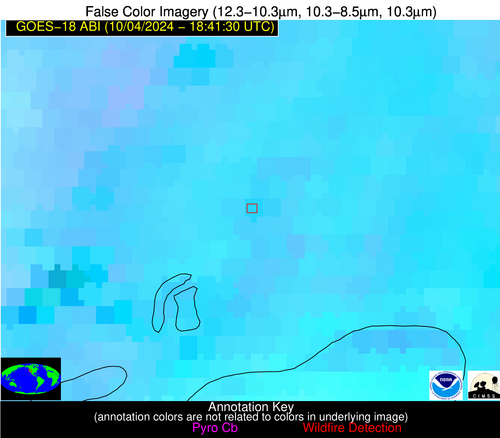
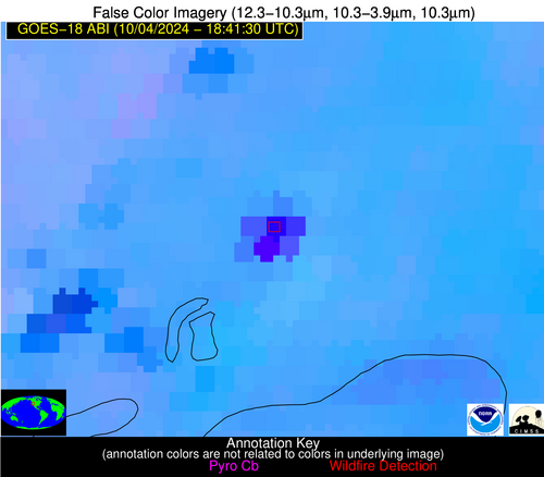
| Latest Satellite Imagery: | |
| View all event imagery » | |


