Wildfire Alert Report
| Date: | 2024-10-04 |
|---|---|
| Time: | 16:26:17 |
| Production Date and Time: | 2024-10-04 16:31:01 UTC |
| Primary Instrument: | GOES-16 ABI |
| Wmo Spacecraft Id: | 152 |
| Location/orbit: | GEO |
| L1 File: | OR_ABI-L1b-RadC-M6C14_G16_s20242781626172_e20242781628545_c20242781629032.nc |
| L1 File(s) - Temporal | OR_ABI-L1b-RadC-M6C14_G16_s20242781621172_e20242781623545_c20242781624047.nc |
| Number Of Thermal Anomaly Alerts: | 7 |
Possible Wildfire
| Basic Information | |
|---|---|
| State/Province(s) | CO |
| Country/Countries | USA |
| County/Locality(s) | Washington County, CO |
| NWS WFO | Denver CO |
| Identification Method | Enhanced Contextual (Clear) |
| Mean Object Date/Time | 2024-10-04 16:26:49UTC |
| Radiative Center (Lat, Lon): | 39.670000°, -103.320000° |
| Nearby Counties (meeting alert criteria): |
|
| Total Radiative Power Anomaly | n/a |
| Total Radiative Power | 12.66 MW |
| Map: | |
| Additional Information | |
| Alert Status | New Feature |
| Type of Event | Nominal Risk |
| Event Priority Ranking | 4 |
| Maximum Observed BT (3.9 um) | 310.03 K |
| Observed - Background BT (3.9 um) | 3.49 K |
| BT Anomaly (3.9 um) | 3.86 K |
| Maximum Observed - Clear RTM BT (3.9 um) | 18.17 K |
| Maximum Observed BTD (3.9-10/11/12 um) | 16.51 K |
| Observed - Background BTD (3.9-10/11/12 um) | 3.30 K |
| BTD Anomaly (3.9-10/11/12 um) | 2.96 K |
| Similar Pixel Count | 25 |
| BT Time Tendency (3.9 um) | 1.20 K |
| Image Interval | 5.00 minutes |
| Fraction of Surrounding LWIR Pixels that are Colder | 0.67 |
| Fraction of Surrounding Red Channel Pixels that are Brighter | 0.94 |
| Maximum Radiative Power | 12.66 MW |
| Maximum Radiative Power Uncertainty | 0.00 MW |
| Total Radiative Power Uncertainty | 0.00 MW |
| Mean Viewing Angle | 54.60° |
| Mean Solar Zenith Angle | 54.10° |
| Mean Glint Angle | 108.60° |
| Water Fraction | 0.00 |
| Total Pixel Area | 8.70 km2 |
| Latest Satellite Imagery: | |
| View all event imagery » | |
Possible Wildfire
| Basic Information | |
|---|---|
| State/Province(s) | CO |
| Country/Countries | USA |
| County/Locality(s) | Kit Carson County, CO |
| NWS WFO | Goodland KS |
| Identification Method | Enhanced Contextual (Clear) |
| Mean Object Date/Time | 2024-10-04 16:26:49UTC |
| Radiative Center (Lat, Lon): | 39.230000°, -102.630000° |
| Nearby Counties (meeting alert criteria): |
|
| Total Radiative Power Anomaly | n/a |
| Total Radiative Power | 8.11 MW |
| Map: | |
| Additional Information | |
| Alert Status | New Feature |
| Type of Event | Nominal Risk |
| Event Priority Ranking | 4 |
| Maximum Observed BT (3.9 um) | 310.03 K |
| Observed - Background BT (3.9 um) | 1.93 K |
| BT Anomaly (3.9 um) | 1.92 K |
| Maximum Observed - Clear RTM BT (3.9 um) | 17.02 K |
| Maximum Observed BTD (3.9-10/11/12 um) | 15.19 K |
| Observed - Background BTD (3.9-10/11/12 um) | 1.47 K |
| BTD Anomaly (3.9-10/11/12 um) | 2.15 K |
| Similar Pixel Count | 25 |
| BT Time Tendency (3.9 um) | 1.00 K |
| Image Interval | 5.00 minutes |
| Fraction of Surrounding LWIR Pixels that are Colder | 0.85 |
| Fraction of Surrounding Red Channel Pixels that are Brighter | 0.93 |
| Maximum Radiative Power | 8.11 MW |
| Maximum Radiative Power Uncertainty | 0.00 MW |
| Total Radiative Power Uncertainty | 0.00 MW |
| Mean Viewing Angle | 53.80° |
| Mean Solar Zenith Angle | 53.40° |
| Mean Glint Angle | 107.20° |
| Water Fraction | 0.00 |
| Total Pixel Area | 8.50 km2 |
| Latest Satellite Imagery: | |
| View all event imagery » | |
Possible Wildfire
| Basic Information | |
|---|---|
| State/Province(s) | KS |
| Country/Countries | USA |
| County/Locality(s) | Kingman County, KS |
| NWS WFO | Wichita KS |
| Identification Method | Enhanced Contextual (Clear) |
| Mean Object Date/Time | 2024-10-04 16:26:50UTC |
| Radiative Center (Lat, Lon): | 37.620000°, -98.410000° |
| Nearby Counties (meeting alert criteria): |
|
| Total Radiative Power Anomaly | n/a |
| Total Radiative Power | 5.05 MW |
| Map: | |
| Additional Information | |
| Alert Status | New Feature |
| Type of Event | Nominal Risk |
| Event Priority Ranking | 4 |
| Maximum Observed BT (3.9 um) | 309.73 K |
| Observed - Background BT (3.9 um) | 3.07 K |
| BT Anomaly (3.9 um) | 2.10 K |
| Maximum Observed - Clear RTM BT (3.9 um) | 12.91 K |
| Maximum Observed BTD (3.9-10/11/12 um) | 15.29 K |
| Observed - Background BTD (3.9-10/11/12 um) | 2.38 K |
| BTD Anomaly (3.9-10/11/12 um) | 2.06 K |
| Similar Pixel Count | 25 |
| BT Time Tendency (3.9 um) | 1.00 K |
| Image Interval | 5.00 minutes |
| Fraction of Surrounding LWIR Pixels that are Colder | 0.94 |
| Fraction of Surrounding Red Channel Pixels that are Brighter | 0.89 |
| Maximum Radiative Power | 5.05 MW |
| Maximum Radiative Power Uncertainty | 0.00 MW |
| Total Radiative Power Uncertainty | 0.00 MW |
| Mean Viewing Angle | 50.20° |
| Mean Solar Zenith Angle | 50.00° |
| Mean Glint Angle | 100.10° |
| Water Fraction | 0.00 |
| Total Pixel Area | 7.40 km2 |
| Latest Satellite Imagery: | |
| View all event imagery » | |
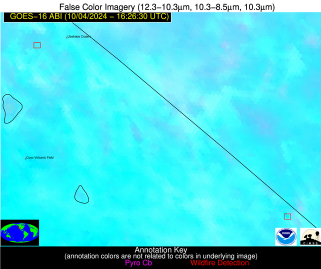
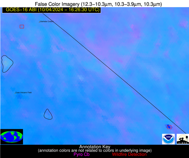
Possible Wildfire
| Basic Information | |
|---|---|
| State/Province(s) | CA |
| Country/Countries | USA |
| County/Locality(s) | Inyo County, CA |
| NWS WFO | Las Vegas NV |
| Identification Method | Enhanced Contextual (Clear) |
| Mean Object Date/Time | 2024-10-04 16:27:18UTC |
| Radiative Center (Lat, Lon): | 36.960000°, -117.720000° |
| Nearby Counties (meeting alert criteria): |
|
| Total Radiative Power Anomaly | n/a |
| Total Radiative Power | 17.21 MW |
| Map: | |
| Additional Information | |
| Alert Status | New Feature |
| Type of Event | Nominal Risk |
| Event Priority Ranking | 4 |
| Maximum Observed BT (3.9 um) | 315.25 K |
| Observed - Background BT (3.9 um) | 2.84 K |
| BT Anomaly (3.9 um) | 1.73 K |
| Maximum Observed - Clear RTM BT (3.9 um) | 12.24 K |
| Maximum Observed BTD (3.9-10/11/12 um) | 14.72 K |
| Observed - Background BTD (3.9-10/11/12 um) | 2.48 K |
| BTD Anomaly (3.9-10/11/12 um) | 3.60 K |
| Similar Pixel Count | 25 |
| BT Time Tendency (3.9 um) | 1.40 K |
| Image Interval | 5.00 minutes |
| Fraction of Surrounding LWIR Pixels that are Colder | 0.67 |
| Fraction of Surrounding Red Channel Pixels that are Brighter | 0.98 |
| Maximum Radiative Power | 17.21 MW |
| Maximum Radiative Power Uncertainty | 0.00 MW |
| Total Radiative Power Uncertainty | 0.00 MW |
| Mean Viewing Angle | 61.90° |
| Mean Solar Zenith Angle | 61.10° |
| Mean Glint Angle | 123.10° |
| Water Fraction | 0.00 |
| Total Pixel Area | 12.80 km2 |
| Latest Satellite Imagery: | |
| View all event imagery » | |
Possible Wildfire
| Basic Information | |
|---|---|
| State/Province(s) | CA |
| Country/Countries | USA |
| County/Locality(s) | San Bernardino County, CA |
| NWS WFO | Las Vegas NV |
| Identification Method | Enhanced Contextual (Cloud) |
| Mean Object Date/Time | 2024-10-04 16:27:18UTC |
| Radiative Center (Lat, Lon): | 35.560000°, -115.470000° |
| Nearby Counties (meeting alert criteria): |
|
| Total Radiative Power Anomaly | n/a |
| Total Radiative Power | 299.67 MW |
| Map: | |
| Additional Information | |
| Alert Status | New Feature |
| Type of Event | Solar panel (database + spectral) |
| Event Priority Ranking | 5 |
| Maximum Observed BT (3.9 um) | 331.04 K |
| Observed - Background BT (3.9 um) | 18.42 K |
| BT Anomaly (3.9 um) | 19.18 K |
| Maximum Observed - Clear RTM BT (3.9 um) | 22.60 K |
| Maximum Observed BTD (3.9-10/11/12 um) | 30.78 K |
| Observed - Background BTD (3.9-10/11/12 um) | 18.80 K |
| BTD Anomaly (3.9-10/11/12 um) | 31.00 K |
| Similar Pixel Count | 0 |
| BT Time Tendency (3.9 um) | 12.90 K |
| Image Interval | 5.00 minutes |
| Fraction of Surrounding LWIR Pixels that are Colder | 0.36 |
| Fraction of Surrounding Red Channel Pixels that are Brighter | 0.00 |
| Maximum Radiative Power | 165.23 MW |
| Maximum Radiative Power Uncertainty | 0.00 MW |
| Total Radiative Power Uncertainty | 0.00 MW |
| Mean Viewing Angle | 59.40° |
| Mean Solar Zenith Angle | 58.90° |
| Mean Glint Angle | 118.30° |
| Water Fraction | 0.00 |
| Total Pixel Area | 22.30 km2 |
| Latest Satellite Imagery: | |
| View all event imagery » | |
Possible Wildfire
| Basic Information | |
|---|---|
| State/Province(s) | TX |
| Country/Countries | USA |
| County/Locality(s) | Hunt County, TX |
| NWS WFO | Fort Worth TX |
| Identification Method | Enhanced Contextual (Clear) |
| Mean Object Date/Time | 2024-10-04 16:27:20UTC |
| Radiative Center (Lat, Lon): | 33.160000°, -95.900000° |
| Nearby Counties (meeting alert criteria): |
|
| Total Radiative Power Anomaly | n/a |
| Total Radiative Power | 6.16 MW |
| Map: | |
| Additional Information | |
| Alert Status | New Feature |
| Type of Event | Nominal Risk |
| Event Priority Ranking | 4 |
| Maximum Observed BT (3.9 um) | 311.65 K |
| Observed - Background BT (3.9 um) | 2.52 K |
| BT Anomaly (3.9 um) | 1.80 K |
| Maximum Observed - Clear RTM BT (3.9 um) | 11.52 K |
| Maximum Observed BTD (3.9-10/11/12 um) | 11.25 K |
| Observed - Background BTD (3.9-10/11/12 um) | 1.97 K |
| BTD Anomaly (3.9-10/11/12 um) | 2.78 K |
| Similar Pixel Count | 25 |
| BT Time Tendency (3.9 um) | 1.30 K |
| Image Interval | 5.00 minutes |
| Fraction of Surrounding LWIR Pixels that are Colder | 0.75 |
| Fraction of Surrounding Red Channel Pixels that are Brighter | 1.00 |
| Maximum Radiative Power | 6.16 MW |
| Maximum Radiative Power Uncertainty | 0.00 MW |
| Total Radiative Power Uncertainty | 0.00 MW |
| Mean Viewing Angle | 44.70° |
| Mean Solar Zenith Angle | 45.20° |
| Mean Glint Angle | 89.90° |
| Water Fraction | 0.00 |
| Total Pixel Area | 6.40 km2 |
| Latest Satellite Imagery: | |
| View all event imagery » | |
Possible Wildfire
| Basic Information | |
|---|---|
| State/Province(s) | TX |
| Country/Countries | USA |
| County/Locality(s) | Hopkins County, TX |
| NWS WFO | Fort Worth TX |
| Identification Method | Enhanced Contextual (Clear) |
| Mean Object Date/Time | 2024-10-04 16:27:20UTC |
| Radiative Center (Lat, Lon): | 33.030000°, -95.620000° |
| Nearby Counties (meeting alert criteria): |
|
| Total Radiative Power Anomaly | n/a |
| Total Radiative Power | 14.08 MW |
| Map: | |
| Additional Information | |
| Alert Status | New Feature |
| Type of Event | Nominal Risk |
| Event Priority Ranking | 4 |
| Maximum Observed BT (3.9 um) | 309.79 K |
| Observed - Background BT (3.9 um) | 2.46 K |
| BT Anomaly (3.9 um) | 1.39 K |
| Maximum Observed - Clear RTM BT (3.9 um) | 9.81 K |
| Maximum Observed BTD (3.9-10/11/12 um) | 11.25 K |
| Observed - Background BTD (3.9-10/11/12 um) | 3.21 K |
| BTD Anomaly (3.9-10/11/12 um) | 3.26 K |
| Similar Pixel Count | 23 |
| BT Time Tendency (3.9 um) | 3.40 K |
| Image Interval | 5.00 minutes |
| Fraction of Surrounding LWIR Pixels that are Colder | 0.16 |
| Fraction of Surrounding Red Channel Pixels that are Brighter | 1.00 |
| Maximum Radiative Power | 14.08 MW |
| Maximum Radiative Power Uncertainty | 0.00 MW |
| Total Radiative Power Uncertainty | 0.00 MW |
| Mean Viewing Angle | 44.50° |
| Mean Solar Zenith Angle | 45.00° |
| Mean Glint Angle | 89.40° |
| Water Fraction | 0.00 |
| Total Pixel Area | 6.40 km2 |
| Latest Satellite Imagery: | |
| View all event imagery » | |
