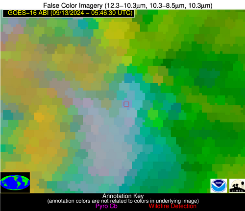
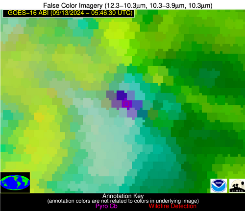
Wildfire Alert Report
| Date: | 2024-09-13 |
|---|---|
| Time: | 05:46:17 |
| Production Date and Time: | 2024-09-13 05:50:45 UTC |
| Primary Instrument: | GOES-16 ABI |
| Wmo Spacecraft Id: | 152 |
| Location/orbit: | GEO |
| L1 File: | OR_ABI-L1b-RadC-M6C14_G16_s20242570546173_e20242570548546_c20242570549029.nc |
| L1 File(s) - Temporal | OR_ABI-L1b-RadC-M6C14_G16_s20242570541173_e20242570543546_c20242570544043.nc |
| Number Of Thermal Anomaly Alerts: | 1 |
Possible Wildfire
| Basic Information | |
|---|---|
| State/Province(s) | WY |
| Country/Countries | USA |
| County/Locality(s) | Converse County, WY |
| NWS WFO | Cheyenne WY |
| Identification Method | Enhanced Contextual (Bias) |
| Mean Object Date/Time | 2024-09-13 05:46:49UTC |
| Radiative Center (Lat, Lon): | 42.430000°, -105.530000° |
| Nearby Counties (meeting alert criteria): |
|
| Total Radiative Power Anomaly | n/a |
| Total Radiative Power | 468.61 MW |
| Map: | |
| Additional Information | |
| Alert Status | New Feature |
| Type of Event | Critical SPC Risk |
| Event Priority Ranking | 2 |
| Maximum Observed BT (3.9 um) | 318.36 K |
| Observed - Background BT (3.9 um) | 38.95 K |
| BT Anomaly (3.9 um) | 49.87 K |
| Maximum Observed - Clear RTM BT (3.9 um) | 39.76 K |
| Maximum Observed BTD (3.9-10/11/12 um) | 37.80 K |
| Observed - Background BTD (3.9-10/11/12 um) | 35.00 K |
| BTD Anomaly (3.9-10/11/12 um) | 66.71 K |
| Similar Pixel Count | 0 |
| BT Time Tendency (3.9 um) | 35.40 K |
| Image Interval | 5.00 minutes |
| Fraction of Surrounding LWIR Pixels that are Colder | 1.00 |
| Fraction of Surrounding Red Channel Pixels that are Brighter | 1.00 |
| Maximum Radiative Power | 324.98 MW |
| Maximum Radiative Power Uncertainty | 0.00 MW |
| Total Radiative Power Uncertainty | 0.00 MW |
| Mean Viewing Angle | 58.10° |
| Mean Solar Zenith Angle | 131.10° |
| Mean Glint Angle | 74.60° |
| Water Fraction | 0.00 |
| Total Pixel Area | 110.00 km2 |
| Latest Satellite Imagery: | |
| View all event imagery » | |


