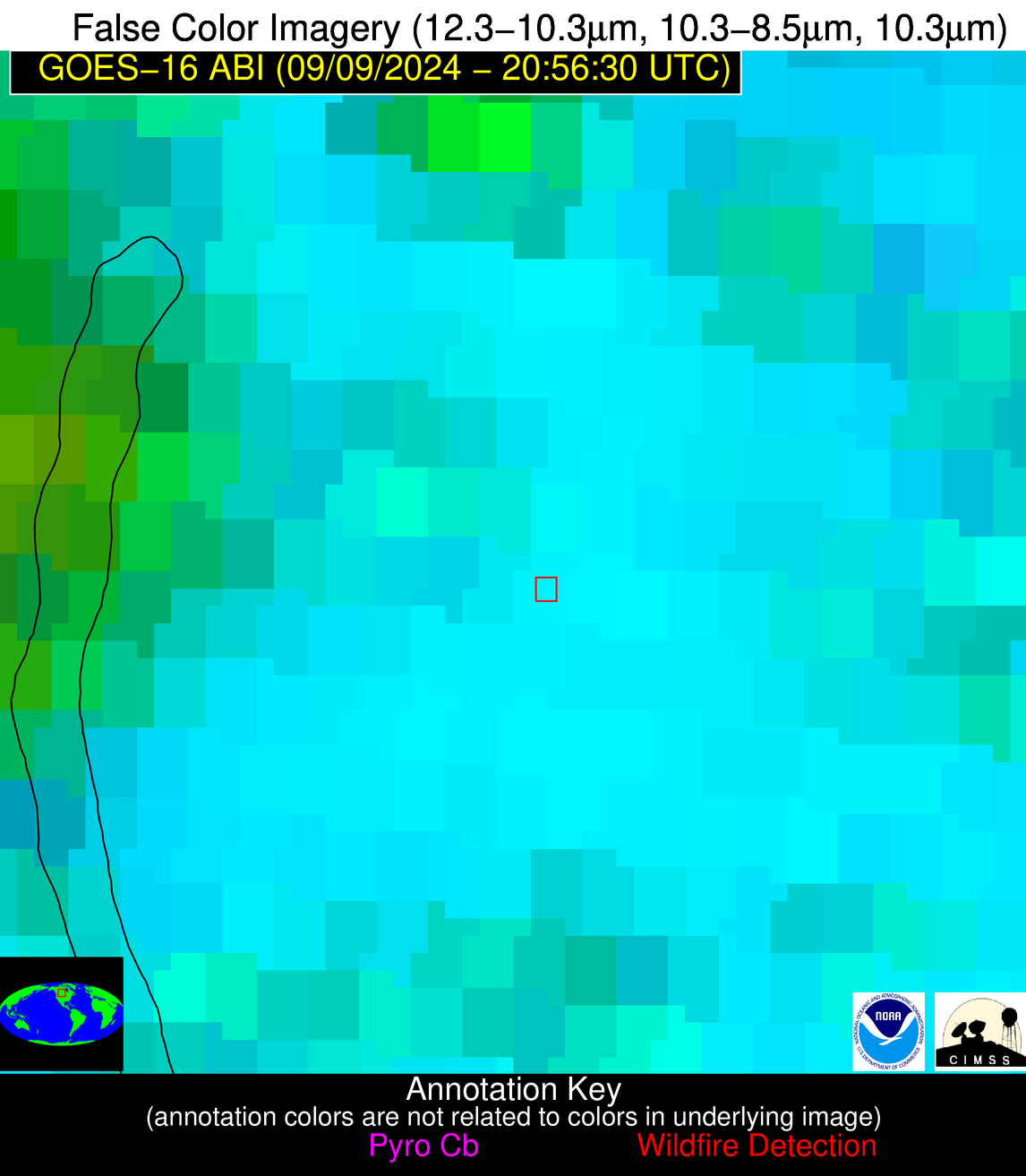
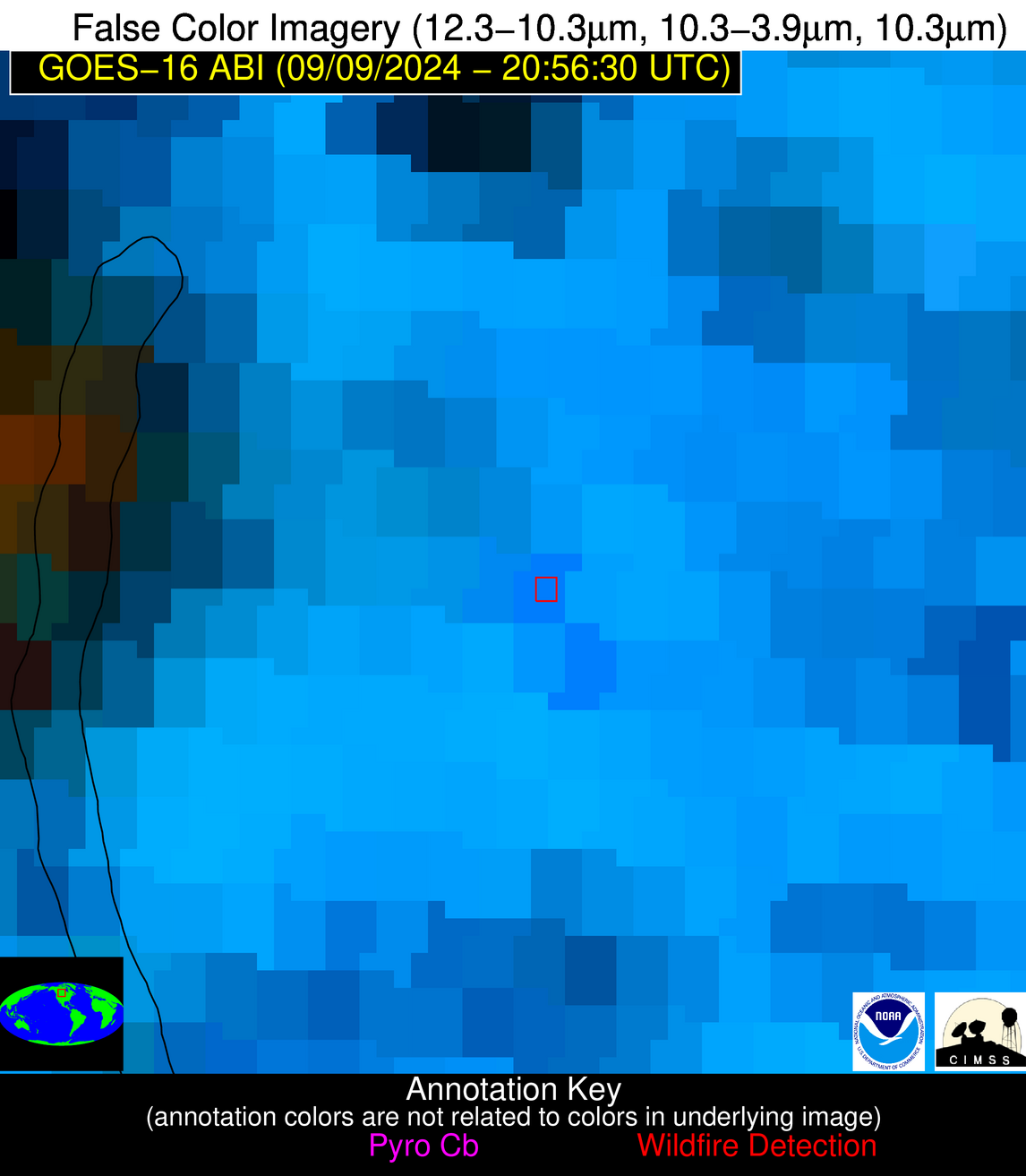
Jan 2026: Due to an ongoing data center cooling system construction project, NGFS data outages may occur with little or no notice.
Wildfire Alert Report
| Date: | 2024-09-09 |
|---|---|
| Time: | 20:56:17 |
| Production Date and Time: | 2024-09-09 21:00:56 UTC |
| Primary Instrument: | GOES-16 ABI |
| Wmo Spacecraft Id: | 152 |
| Location/orbit: | GEO |
| L1 File: | OR_ABI-L1b-RadC-M6C14_G16_s20242532056172_e20242532058545_c20242532059042.nc |
| L1 File(s) - Temporal | OR_ABI-L1b-RadC-M6C14_G16_s20242532051172_e20242532053545_c20242532054006.nc |
| Number Of Thermal Anomaly Alerts: | 6 |
Possible Wildfire
| Basic Information | |
|---|---|
| State/Province(s) | Saskatchewan |
| Country/Countries | Canada |
| County/Locality(s) | Canada |
| NWS WFO | N/A |
| Identification Method | Enhanced Contextual (Cloud) |
| Mean Object Date/Time | 2024-09-09 20:56:20UTC |
| Radiative Center (Lat, Lon): | 51.240000°, -104.870000° |
| Nearby Counties (meeting alert criteria): |
|
| Total Radiative Power Anomaly | n/a |
| Total Radiative Power | 42.25 MW |
| Map: | |
| Additional Information | |
| Alert Status | New Feature |
| Type of Event | Nominal Risk |
| Event Priority Ranking | 4 |
| Maximum Observed BT (3.9 um) | 307.01 K |
| Observed - Background BT (3.9 um) | 5.31 K |
| BT Anomaly (3.9 um) | 5.55 K |
| Maximum Observed - Clear RTM BT (3.9 um) | 5.99 K |
| Maximum Observed BTD (3.9-10/11/12 um) | 18.95 K |
| Observed - Background BTD (3.9-10/11/12 um) | 5.36 K |
| BTD Anomaly (3.9-10/11/12 um) | 4.54 K |
| Similar Pixel Count | 0 |
| BT Time Tendency (3.9 um) | 5.40 K |
| Image Interval | 5.00 minutes |
| Fraction of Surrounding LWIR Pixels that are Colder | 0.77 |
| Fraction of Surrounding Red Channel Pixels that are Brighter | 1.00 |
| Maximum Radiative Power | 42.25 MW |
| Maximum Radiative Power Uncertainty | 0.00 MW |
| Total Radiative Power Uncertainty | 0.00 MW |
| Mean Viewing Angle | 65.30° |
| Mean Solar Zenith Angle | 52.30° |
| Mean Glint Angle | 86.00° |
| Water Fraction | 0.00 |
| Total Pixel Area | 13.50 km2 |
| Latest Satellite Imagery: | |
| View all event imagery » | |
Possible Wildfire
| Basic Information | |
|---|---|
| State/Province(s) | MT |
| Country/Countries | USA |
| County/Locality(s) | Lincoln County, MT |
| NWS WFO | Missoula MT |
| Identification Method | Enhanced Contextual (Cloud) |
| Mean Object Date/Time | 2024-09-09 20:56:19UTC |
| Radiative Center (Lat, Lon): | 48.520000°, -115.800000° |
| Nearby Counties (meeting alert criteria): |
|
| Total Radiative Power Anomaly | n/a |
| Total Radiative Power | 258.38 MW |
| Map: | |
| Additional Information | |
| Alert Status | New Feature |
| Type of Event | Nominal Risk |
| Event Priority Ranking | 4 |
| Maximum Observed BT (3.9 um) | 302.08 K |
| Observed - Background BT (3.9 um) | 10.16 K |
| BT Anomaly (3.9 um) | 6.64 K |
| Maximum Observed - Clear RTM BT (3.9 um) | 9.50 K |
| Maximum Observed BTD (3.9-10/11/12 um) | 26.21 K |
| Observed - Background BTD (3.9-10/11/12 um) | 9.89 K |
| BTD Anomaly (3.9-10/11/12 um) | 8.76 K |
| Similar Pixel Count | 0 |
| BT Time Tendency (3.9 um) | 8.30 K |
| Image Interval | 5.00 minutes |
| Fraction of Surrounding LWIR Pixels that are Colder | 0.56 |
| Fraction of Surrounding Red Channel Pixels that are Brighter | 0.80 |
| Maximum Radiative Power | 258.38 MW |
| Maximum Radiative Power Uncertainty | 0.00 MW |
| Total Radiative Power Uncertainty | 0.00 MW |
| Mean Viewing Angle | 68.40° |
| Mean Solar Zenith Angle | 46.20° |
| Mean Glint Angle | 85.00° |
| Water Fraction | 0.00 |
| Total Pixel Area | 36.20 km2 |
| Latest Satellite Imagery: | |
| View all event imagery » | |
Possible Wildfire
| Basic Information | |
|---|---|
| State/Province(s) | MO |
| Country/Countries | USA |
| County/Locality(s) | Cape Girardeau County, MO |
| NWS WFO | Paducah KY |
| Identification Method | Enhanced Contextual (Clear) |
| Mean Object Date/Time | 2024-09-09 20:56:51UTC |
| Radiative Center (Lat, Lon): | 37.180000°, -89.720000° |
| Nearby Counties (meeting alert criteria): |
|
| Total Radiative Power Anomaly | n/a |
| Total Radiative Power | 33.77 MW |
| Map: | |
| Additional Information | |
| Alert Status | New Feature |
| Type of Event | Nominal Risk |
| Event Priority Ranking | 4 |
| Maximum Observed BT (3.9 um) | 305.88 K |
| Observed - Background BT (3.9 um) | 4.36 K |
| BT Anomaly (3.9 um) | 2.88 K |
| Maximum Observed - Clear RTM BT (3.9 um) | 8.92 K |
| Maximum Observed BTD (3.9-10/11/12 um) | 8.66 K |
| Observed - Background BTD (3.9-10/11/12 um) | 3.65 K |
| BTD Anomaly (3.9-10/11/12 um) | 5.59 K |
| Similar Pixel Count | 4 |
| BT Time Tendency (3.9 um) | 2.40 K |
| Image Interval | 5.00 minutes |
| Fraction of Surrounding LWIR Pixels that are Colder | 0.77 |
| Fraction of Surrounding Red Channel Pixels that are Brighter | 0.96 |
| Maximum Radiative Power | 12.70 MW |
| Maximum Radiative Power Uncertainty | 0.00 MW |
| Total Radiative Power Uncertainty | 0.00 MW |
| Mean Viewing Angle | 46.00° |
| Mean Solar Zenith Angle | 52.00° |
| Mean Glint Angle | 66.70° |
| Water Fraction | 0.00 |
| Total Pixel Area | 19.40 km2 |
| Latest Satellite Imagery: | |
| View all event imagery » | |
Possible Wildfire
| Basic Information | |
|---|---|
| State/Province(s) | AR |
| Country/Countries | USA |
| County/Locality(s) | Clay County, AR |
| NWS WFO | Memphis TN |
| Identification Method | Enhanced Contextual (Clear) |
| Mean Object Date/Time | 2024-09-09 20:56:51UTC |
| Radiative Center (Lat, Lon): | 36.450000°, -90.140000° |
| Nearby Counties (meeting alert criteria): |
|
| Total Radiative Power Anomaly | n/a |
| Total Radiative Power | 22.15 MW |
| Map: | |
| Additional Information | |
| Alert Status | New Feature |
| Type of Event | Nominal Risk |
| Event Priority Ranking | 4 |
| Maximum Observed BT (3.9 um) | 305.25 K |
| Observed - Background BT (3.9 um) | 2.33 K |
| BT Anomaly (3.9 um) | 1.33 K |
| Maximum Observed - Clear RTM BT (3.9 um) | 9.85 K |
| Maximum Observed BTD (3.9-10/11/12 um) | 8.31 K |
| Observed - Background BTD (3.9-10/11/12 um) | 3.01 K |
| BTD Anomaly (3.9-10/11/12 um) | 2.54 K |
| Similar Pixel Count | 8 |
| BT Time Tendency (3.9 um) | 1.30 K |
| Image Interval | 5.00 minutes |
| Fraction of Surrounding LWIR Pixels that are Colder | 0.27 |
| Fraction of Surrounding Red Channel Pixels that are Brighter | 0.98 |
| Maximum Radiative Power | 11.95 MW |
| Maximum Radiative Power Uncertainty | 0.00 MW |
| Total Radiative Power Uncertainty | 0.00 MW |
| Mean Viewing Angle | 45.40° |
| Mean Solar Zenith Angle | 51.30° |
| Mean Glint Angle | 65.30° |
| Water Fraction | 0.00 |
| Total Pixel Area | 12.80 km2 |
| Latest Satellite Imagery: | |
| View all event imagery » | |
Possible Wildfire
| Basic Information | |
|---|---|
| State/Province(s) | AR |
| Country/Countries | USA |
| County/Locality(s) | Poinsett County, AR |
| NWS WFO | Memphis TN |
| Identification Method | Enhanced Contextual (Clear) |
| Mean Object Date/Time | 2024-09-09 20:57:21UTC |
| Radiative Center (Lat, Lon): | 35.640000°, -90.880000° |
| Nearby Counties (meeting alert criteria): |
|
| Total Radiative Power Anomaly | n/a |
| Total Radiative Power | 11.62 MW |
| Map: | |
| Additional Information | |
| Alert Status | New Feature |
| Type of Event | Nominal Risk |
| Event Priority Ranking | 4 |
| Maximum Observed BT (3.9 um) | 303.54 K |
| Observed - Background BT (3.9 um) | 3.15 K |
| BT Anomaly (3.9 um) | 3.13 K |
| Maximum Observed - Clear RTM BT (3.9 um) | 7.92 K |
| Maximum Observed BTD (3.9-10/11/12 um) | 7.77 K |
| Observed - Background BTD (3.9-10/11/12 um) | 3.54 K |
| BTD Anomaly (3.9-10/11/12 um) | 9.16 K |
| Similar Pixel Count | 2 |
| BT Time Tendency (3.9 um) | 2.20 K |
| Image Interval | 5.00 minutes |
| Fraction of Surrounding LWIR Pixels that are Colder | 0.29 |
| Fraction of Surrounding Red Channel Pixels that are Brighter | 0.98 |
| Maximum Radiative Power | 11.62 MW |
| Maximum Radiative Power Uncertainty | 0.00 MW |
| Total Radiative Power Uncertainty | 0.00 MW |
| Mean Viewing Angle | 44.80° |
| Mean Solar Zenith Angle | 50.50° |
| Mean Glint Angle | 63.60° |
| Water Fraction | 0.00 |
| Total Pixel Area | 6.30 km2 |
| Latest Satellite Imagery: | |
| View all event imagery » | |
Possible Wildfire
| Basic Information | |
|---|---|
| State/Province(s) | AR |
| Country/Countries | USA |
| County/Locality(s) | Pulaski County, AR |
| NWS WFO | Little Rock AR |
| Identification Method | Enhanced Contextual (Clear) |
| Mean Object Date/Time | 2024-09-09 20:57:20UTC |
| Radiative Center (Lat, Lon): | 34.560000°, -92.070000° |
| Nearby Counties (meeting alert criteria): |
|
| Total Radiative Power Anomaly | n/a |
| Total Radiative Power | 40.62 MW |
| Map: | |
| Additional Information | |
| Alert Status | New Feature |
| Type of Event | Nominal Risk |
| Event Priority Ranking | 4 |
| Maximum Observed BT (3.9 um) | 309.01 K |
| Observed - Background BT (3.9 um) | 6.55 K |
| BT Anomaly (3.9 um) | 2.36 K |
| Maximum Observed - Clear RTM BT (3.9 um) | 11.76 K |
| Maximum Observed BTD (3.9-10/11/12 um) | 10.97 K |
| Observed - Background BTD (3.9-10/11/12 um) | 6.15 K |
| BTD Anomaly (3.9-10/11/12 um) | 3.06 K |
| Similar Pixel Count | 4 |
| BT Time Tendency (3.9 um) | 6.80 K |
| Image Interval | 5.00 minutes |
| Fraction of Surrounding LWIR Pixels that are Colder | 0.60 |
| Fraction of Surrounding Red Channel Pixels that are Brighter | 0.83 |
| Maximum Radiative Power | 21.04 MW |
| Maximum Radiative Power Uncertainty | 0.00 MW |
| Total Radiative Power Uncertainty | 0.00 MW |
| Mean Viewing Angle | 44.20° |
| Mean Solar Zenith Angle | 49.10° |
| Mean Glint Angle | 61.10° |
| Water Fraction | 0.00 |
| Total Pixel Area | 12.50 km2 |
| Latest Satellite Imagery: | |
| View all event imagery » | |
