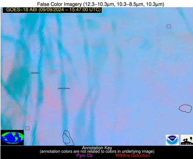
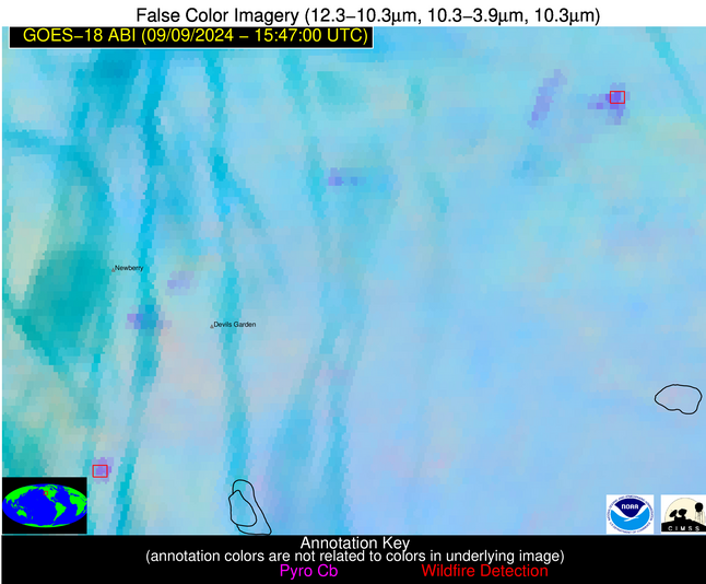
Wildfire Alert Report
| Date: | 2024-09-09 |
|---|---|
| Time: | 15:46:55 |
| Production Date and Time: | 2024-09-09 15:47:37 UTC |
| Primary Instrument: | GOES-18 ABI |
| Wmo Spacecraft Id: | 665 |
| Location/orbit: | GEO |
| L1 File: | OR_ABI-L1b-RadM2-M6C14_G18_s20242531546559_e20242531547016_c20242531547078.nc |
| L1 File(s) - Temporal | OR_ABI-L1b-RadM2-M6C14_G18_s20242531545559_e20242531546016_c20242531546075.nc |
| Number Of Thermal Anomaly Alerts: | 2 |
Possible Wildfire
| Basic Information | |
|---|---|
| State/Province(s) | OR |
| Country/Countries | USA |
| County/Locality(s) | Grant County, OR |
| NWS WFO | Pendleton OR |
| Identification Method | Enhanced Contextual (Clear) |
| Mean Object Date/Time | 2024-09-09 15:46:57UTC |
| Radiative Center (Lat, Lon): | 44.360000°, -119.350000° |
| Nearby Counties (meeting alert criteria): |
|
| Total Radiative Power Anomaly | n/a |
| Total Radiative Power | 110.04 MW |
| Map: | |
| Additional Information | |
| Alert Status | New Feature |
| Type of Event | Nominal Risk, Known Incident: RAIL RIDGE (HIGH, tdiff=0.37642 days, PERIMETER) |
| Event Priority Ranking | 4 |
| Maximum Observed BT (3.9 um) | 306.25 K |
| Observed - Background BT (3.9 um) | 16.00 K |
| BT Anomaly (3.9 um) | 14.83 K |
| Maximum Observed - Clear RTM BT (3.9 um) | 11.61 K |
| Maximum Observed BTD (3.9-10/11/12 um) | 18.34 K |
| Observed - Background BTD (3.9-10/11/12 um) | 14.88 K |
| BTD Anomaly (3.9-10/11/12 um) | 14.54 K |
| Similar Pixel Count | 4 |
| BT Time Tendency (3.9 um) | 0.10 K |
| Image Interval | 1.00 minutes |
| Fraction of Surrounding LWIR Pixels that are Colder | 0.99 |
| Fraction of Surrounding Red Channel Pixels that are Brighter | 0.16 |
| Maximum Radiative Power | 110.04 MW |
| Maximum Radiative Power Uncertainty | 0.00 MW |
| Total Radiative Power Uncertainty | 0.00 MW |
| Mean Viewing Angle | 54.40° |
| Mean Solar Zenith Angle | 66.40° |
| Mean Glint Angle | 70.40° |
| Water Fraction | 0.00 |
| Total Pixel Area | 8.10 km2 |
| Latest Satellite Imagery: | |
| View all event imagery » | |
Possible Wildfire
| Basic Information | |
|---|---|
| State/Province(s) | OR |
| Country/Countries | USA |
| County/Locality(s) | Lake County, OR |
| NWS WFO | Medford OR |
| Identification Method | Enhanced Contextual (Clear) |
| Mean Object Date/Time | 2024-09-09 15:46:56UTC |
| Radiative Center (Lat, Lon): | 42.970000°, -121.280000° |
| Nearby Counties (meeting alert criteria): |
|
| Total Radiative Power Anomaly | n/a |
| Total Radiative Power | 107.68 MW |
| Map: | |
| Additional Information | |
| Alert Status | New Feature |
| Type of Event | Nominal Risk, Known Incident: BUCK CREEK (HIGH, tdiff=0.7165 days, POINT) |
| Event Priority Ranking | 4 |
| Maximum Observed BT (3.9 um) | 301.50 K |
| Observed - Background BT (3.9 um) | 13.25 K |
| BT Anomaly (3.9 um) | 11.63 K |
| Maximum Observed - Clear RTM BT (3.9 um) | 13.42 K |
| Maximum Observed BTD (3.9-10/11/12 um) | 15.07 K |
| Observed - Background BTD (3.9-10/11/12 um) | 11.87 K |
| BTD Anomaly (3.9-10/11/12 um) | 13.47 K |
| Similar Pixel Count | 3 |
| BT Time Tendency (3.9 um) | -0.50 K |
| Image Interval | 1.00 minutes |
| Fraction of Surrounding LWIR Pixels that are Colder | 0.98 |
| Fraction of Surrounding Red Channel Pixels that are Brighter | 0.81 |
| Maximum Radiative Power | 40.96 MW |
| Maximum Radiative Power Uncertainty | 0.00 MW |
| Total Radiative Power Uncertainty | 0.00 MW |
| Mean Viewing Angle | 52.40° |
| Mean Solar Zenith Angle | 67.40° |
| Mean Glint Angle | 70.40° |
| Water Fraction | 0.00 |
| Total Pixel Area | 22.80 km2 |
| Latest Satellite Imagery: | |
| View all event imagery » | |


