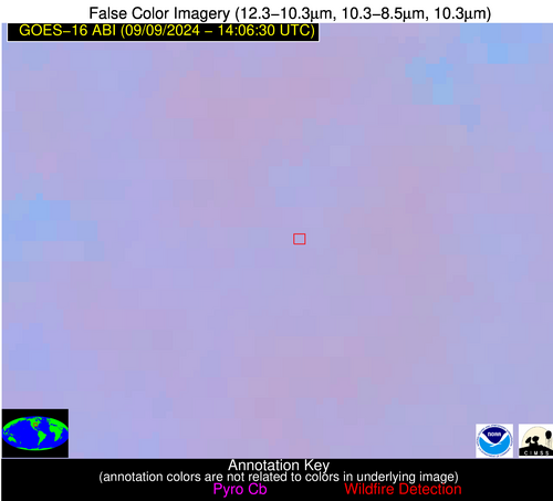
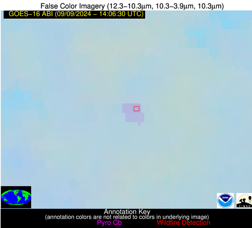
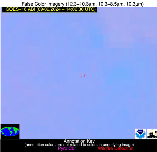
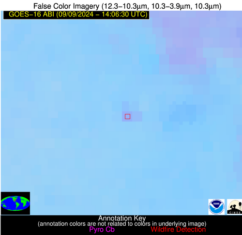
Jan 2026: Due to an ongoing data center cooling system construction project, NGFS data outages may occur with little or no notice. Bitterly cold air in Madison Jan 22-24 increases risk of outages.
Wildfire Alert Report
| Date: | 2024-09-09 |
|---|---|
| Time: | 14:06:17 |
| Production Date and Time: | 2024-09-09 14:10:51 UTC |
| Primary Instrument: | GOES-16 ABI |
| Wmo Spacecraft Id: | 152 |
| Location/orbit: | GEO |
| L1 File: | OR_ABI-L1b-RadC-M6C14_G16_s20242531406172_e20242531408545_c20242531409020.nc |
| L1 File(s) - Temporal | OR_ABI-L1b-RadC-M6C14_G16_s20242531401172_e20242531403545_c20242531404039.nc |
| Number Of Thermal Anomaly Alerts: | 6 |
Possible Wildfire
| Basic Information | |
|---|---|
| State/Province(s) | IL |
| Country/Countries | USA |
| County/Locality(s) | Clark County, IL |
| NWS WFO | Lincoln IL |
| Identification Method | Enhanced Contextual (Clear) |
| Mean Object Date/Time | 2024-09-09 14:06:51UTC |
| Radiative Center (Lat, Lon): | 39.470000°, -87.690000° |
| Nearby Counties (meeting alert criteria): |
|
| Total Radiative Power Anomaly | n/a |
| Total Radiative Power | 5.53 MW |
| Map: | |
| Additional Information | |
| Alert Status | New Feature |
| Type of Event | Nominal Risk |
| Event Priority Ranking | 4 |
| Maximum Observed BT (3.9 um) | 292.40 K |
| Observed - Background BT (3.9 um) | 2.40 K |
| BT Anomaly (3.9 um) | 2.88 K |
| Maximum Observed - Clear RTM BT (3.9 um) | 5.95 K |
| Maximum Observed BTD (3.9-10/11/12 um) | 5.59 K |
| Observed - Background BTD (3.9-10/11/12 um) | 2.36 K |
| BTD Anomaly (3.9-10/11/12 um) | 7.02 K |
| Similar Pixel Count | 4 |
| BT Time Tendency (3.9 um) | 2.40 K |
| Image Interval | 5.00 minutes |
| Fraction of Surrounding LWIR Pixels that are Colder | 0.56 |
| Fraction of Surrounding Red Channel Pixels that are Brighter | 1.00 |
| Maximum Radiative Power | 5.53 MW |
| Maximum Radiative Power Uncertainty | 0.00 MW |
| Total Radiative Power Uncertainty | 0.00 MW |
| Mean Viewing Angle | 47.70° |
| Mean Solar Zenith Angle | 60.30° |
| Mean Glint Angle | 93.90° |
| Water Fraction | 0.00 |
| Total Pixel Area | 6.70 km2 |
| Latest Satellite Imagery: | |
| View all event imagery » | |
Possible Wildfire
| Basic Information | |
|---|---|
| State/Province(s) | MO |
| Country/Countries | USA |
| County/Locality(s) | Dallas County, MO |
| NWS WFO | Springfield MO |
| Identification Method | Enhanced Contextual (Clear) |
| Mean Object Date/Time | 2024-09-09 14:06:50UTC |
| Radiative Center (Lat, Lon): | 37.850000°, -93.010000° |
| Nearby Counties (meeting alert criteria): |
|
| Total Radiative Power Anomaly | n/a |
| Total Radiative Power | 31.59 MW |
| Map: | |
| Additional Information | |
| Alert Status | New Feature |
| Type of Event | Nominal Risk |
| Event Priority Ranking | 4 |
| Maximum Observed BT (3.9 um) | 292.01 K |
| Observed - Background BT (3.9 um) | 5.16 K |
| BT Anomaly (3.9 um) | 4.33 K |
| Maximum Observed - Clear RTM BT (3.9 um) | 6.10 K |
| Maximum Observed BTD (3.9-10/11/12 um) | 6.17 K |
| Observed - Background BTD (3.9-10/11/12 um) | 4.48 K |
| BTD Anomaly (3.9-10/11/12 um) | 17.22 K |
| Similar Pixel Count | 4 |
| BT Time Tendency (3.9 um) | 3.00 K |
| Image Interval | 5.00 minutes |
| Fraction of Surrounding LWIR Pixels that are Colder | 0.71 |
| Fraction of Surrounding Red Channel Pixels that are Brighter | 1.00 |
| Maximum Radiative Power | 16.18 MW |
| Maximum Radiative Power Uncertainty | 0.00 MW |
| Total Radiative Power Uncertainty | 0.00 MW |
| Mean Viewing Angle | 47.90° |
| Mean Solar Zenith Angle | 63.80° |
| Mean Glint Angle | 98.70° |
| Water Fraction | 0.00 |
| Total Pixel Area | 27.40 km2 |
| Latest Satellite Imagery: | |
| View all event imagery » | |
Possible Wildfire
| Basic Information | |
|---|---|
| State/Province(s) | MS |
| Country/Countries | USA |
| County/Locality(s) | Lauderdale County, MS |
| NWS WFO | Jackson MS |
| Identification Method | Enhanced Contextual (Clear) |
| Mean Object Date/Time | 2024-09-09 14:07:21UTC |
| Radiative Center (Lat, Lon): | 32.350000°, -88.850000° |
| Nearby Counties (meeting alert criteria): |
|
| Total Radiative Power Anomaly | n/a |
| Total Radiative Power | 10.27 MW |
| Map: | |
| Additional Information | |
| Alert Status | New Feature |
| Type of Event | Nominal Risk |
| Event Priority Ranking | 4 |
| Maximum Observed BT (3.9 um) | 297.81 K |
| Observed - Background BT (3.9 um) | 3.84 K |
| BT Anomaly (3.9 um) | 4.54 K |
| Maximum Observed - Clear RTM BT (3.9 um) | 6.58 K |
| Maximum Observed BTD (3.9-10/11/12 um) | 6.89 K |
| Observed - Background BTD (3.9-10/11/12 um) | 3.69 K |
| BTD Anomaly (3.9-10/11/12 um) | 4.55 K |
| Similar Pixel Count | 3 |
| BT Time Tendency (3.9 um) | 3.60 K |
| Image Interval | 5.00 minutes |
| Fraction of Surrounding LWIR Pixels that are Colder | 0.69 |
| Fraction of Surrounding Red Channel Pixels that are Brighter | 1.00 |
| Maximum Radiative Power | 10.27 MW |
| Maximum Radiative Power Uncertainty | 0.00 MW |
| Total Radiative Power Uncertainty | 0.00 MW |
| Mean Viewing Angle | 40.60° |
| Mean Solar Zenith Angle | 59.10° |
| Mean Glint Angle | 87.80° |
| Water Fraction | 0.00 |
| Total Pixel Area | 5.80 km2 |
| Latest Satellite Imagery: | |
| View all event imagery » | |
Possible Wildfire
| Basic Information | |
|---|---|
| State/Province(s) | TX |
| Country/Countries | USA |
| County/Locality(s) | Angelina County, TX |
| NWS WFO | Shreveport LA |
| Identification Method | Enhanced Contextual (Clear) |
| Mean Object Date/Time | 2024-09-09 14:07:20UTC |
| Radiative Center (Lat, Lon): | 31.360000°, -94.500000° |
| Nearby Counties (meeting alert criteria): |
|
| Total Radiative Power Anomaly | n/a |
| Total Radiative Power | 15.57 MW |
| Map: | |
| Additional Information | |
| Alert Status | New Feature |
| Type of Event | Nominal Risk |
| Event Priority Ranking | 4 |
| Maximum Observed BT (3.9 um) | 298.53 K |
| Observed - Background BT (3.9 um) | 7.08 K |
| BT Anomaly (3.9 um) | 7.40 K |
| Maximum Observed - Clear RTM BT (3.9 um) | 9.25 K |
| Maximum Observed BTD (3.9-10/11/12 um) | 7.84 K |
| Observed - Background BTD (3.9-10/11/12 um) | 6.59 K |
| BTD Anomaly (3.9-10/11/12 um) | 19.28 K |
| Similar Pixel Count | 1 |
| BT Time Tendency (3.9 um) | 3.60 K |
| Image Interval | 5.00 minutes |
| Fraction of Surrounding LWIR Pixels that are Colder | 0.82 |
| Fraction of Surrounding Red Channel Pixels that are Brighter | 1.00 |
| Maximum Radiative Power | 15.57 MW |
| Maximum Radiative Power Uncertainty | 0.00 MW |
| Total Radiative Power Uncertainty | 0.00 MW |
| Mean Viewing Angle | 42.30° |
| Mean Solar Zenith Angle | 63.60° |
| Mean Glint Angle | 95.30° |
| Water Fraction | 0.00 |
| Total Pixel Area | 6.10 km2 |
| Latest Satellite Imagery: | |
| View all event imagery » | |
Possible Wildfire
| Basic Information | |
|---|---|
| State/Province(s) | TX |
| Country/Countries | USA |
| County/Locality(s) | Mason County, TX |
| NWS WFO | San Angelo TX |
| Identification Method | Enhanced Contextual (Clear) |
| Mean Object Date/Time | 2024-09-09 14:07:19UTC |
| Radiative Center (Lat, Lon): | 30.790000°, -99.460000° |
| Nearby Counties (meeting alert criteria): |
|
| Total Radiative Power Anomaly | n/a |
| Total Radiative Power | 17.27 MW |
| Map: | |
| Additional Information | |
| Alert Status | New Feature |
| Type of Event | Nominal Risk |
| Event Priority Ranking | 4 |
| Maximum Observed BT (3.9 um) | 296.88 K |
| Observed - Background BT (3.9 um) | 5.52 K |
| BT Anomaly (3.9 um) | 7.42 K |
| Maximum Observed - Clear RTM BT (3.9 um) | 6.75 K |
| Maximum Observed BTD (3.9-10/11/12 um) | 6.71 K |
| Observed - Background BTD (3.9-10/11/12 um) | 4.58 K |
| BTD Anomaly (3.9-10/11/12 um) | 17.97 K |
| Similar Pixel Count | 2 |
| BT Time Tendency (3.9 um) | 2.40 K |
| Image Interval | 5.00 minutes |
| Fraction of Surrounding LWIR Pixels that are Colder | 0.92 |
| Fraction of Surrounding Red Channel Pixels that are Brighter | 1.00 |
| Maximum Radiative Power | 17.27 MW |
| Maximum Radiative Power Uncertainty | 0.00 MW |
| Total Radiative Power Uncertainty | 0.00 MW |
| Mean Viewing Angle | 44.70° |
| Mean Solar Zenith Angle | 67.70° |
| Mean Glint Angle | 102.70° |
| Water Fraction | 0.00 |
| Total Pixel Area | 13.00 km2 |
| Latest Satellite Imagery: | |
| View all event imagery » | |
Possible Wildfire
| Basic Information | |
|---|---|
| State/Province(s) | TX |
| Country/Countries | USA |
| County/Locality(s) | DeWitt County, TX |
| NWS WFO | Austin/San Antonio TX |
| Identification Method | Enhanced Contextual (Clear) |
| Mean Object Date/Time | 2024-09-09 14:07:50UTC |
| Radiative Center (Lat, Lon): | 28.970000°, -97.470000° |
| Nearby Counties (meeting alert criteria): |
|
| Total Radiative Power Anomaly | n/a |
| Total Radiative Power | 30.06 MW |
| Map: | |
| Additional Information | |
| Alert Status | New Feature |
| Type of Event | Nominal Risk |
| Event Priority Ranking | 4 |
| Maximum Observed BT (3.9 um) | 304.86 K |
| Observed - Background BT (3.9 um) | 9.50 K |
| BT Anomaly (3.9 um) | 10.59 K |
| Maximum Observed - Clear RTM BT (3.9 um) | 10.84 K |
| Maximum Observed BTD (3.9-10/11/12 um) | 19.82 K |
| Observed - Background BTD (3.9-10/11/12 um) | 9.35 K |
| BTD Anomaly (3.9-10/11/12 um) | 5.21 K |
| Similar Pixel Count | 4 |
| BT Time Tendency (3.9 um) | 1.60 K |
| Image Interval | 5.00 minutes |
| Fraction of Surrounding LWIR Pixels that are Colder | 0.44 |
| Fraction of Surrounding Red Channel Pixels that are Brighter | 0.51 |
| Maximum Radiative Power | 30.06 MW |
| Maximum Radiative Power Uncertainty | 0.00 MW |
| Total Radiative Power Uncertainty | 0.00 MW |
| Mean Viewing Angle | 41.90° |
| Mean Solar Zenith Angle | 65.80° |
| Mean Glint Angle | 98.40° |
| Water Fraction | 0.00 |
| Total Pixel Area | 6.10 km2 |
| Latest Satellite Imagery: | |
| View all event imagery » | |


