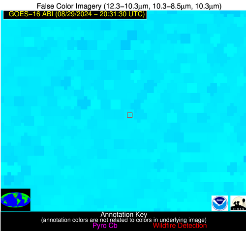
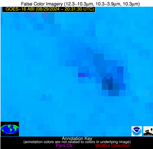
Wildfire Alert Report
| Date: | 2024-08-29 |
|---|---|
| Time: | 20:31:17 |
| Production Date and Time: | 2024-08-29 20:36:06 UTC |
| Primary Instrument: | GOES-16 ABI |
| Wmo Spacecraft Id: | 152 |
| Location/orbit: | GEO |
| L1 File: | OR_ABI-L1b-RadC-M6C14_G16_s20242422031172_e20242422033545_c20242422034046.nc |
| L1 File(s) - Temporal | OR_ABI-L1b-RadC-M6C14_G16_s20242422026172_e20242422028545_c20242422029039.nc |
| Number Of Thermal Anomaly Alerts: | 3 |
Possible Wildfire
| Basic Information | |
|---|---|
| State/Province(s) | ID |
| Country/Countries | USA |
| County/Locality(s) | Ada County, ID |
| NWS WFO | Boise ID |
| Identification Method | Enhanced Contextual (Clear) |
| Mean Object Date/Time | 2024-08-29 20:31:49UTC |
| Radiative Center (Lat, Lon): | 43.440000°, -116.130000° |
| Nearby Counties (meeting alert criteria): |
|
| Total Radiative Power Anomaly | n/a |
| Total Radiative Power | 58.32 MW |
| Map: | |
| Additional Information | |
| Alert Status | New Feature |
| Type of Event | Nominal Risk |
| Event Priority Ranking | 4 |
| Maximum Observed BT (3.9 um) | 316.46 K |
| Observed - Background BT (3.9 um) | 7.41 K |
| BT Anomaly (3.9 um) | 5.46 K |
| Maximum Observed - Clear RTM BT (3.9 um) | 13.52 K |
| Maximum Observed BTD (3.9-10/11/12 um) | 15.75 K |
| Observed - Background BTD (3.9-10/11/12 um) | 7.21 K |
| BTD Anomaly (3.9-10/11/12 um) | 15.56 K |
| Similar Pixel Count | 3 |
| BT Time Tendency (3.9 um) | 6.00 K |
| Image Interval | 5.00 minutes |
| Fraction of Surrounding LWIR Pixels that are Colder | 0.63 |
| Fraction of Surrounding Red Channel Pixels that are Brighter | 0.90 |
| Maximum Radiative Power | 58.32 MW |
| Maximum Radiative Power Uncertainty | 0.00 MW |
| Total Radiative Power Uncertainty | 0.00 MW |
| Mean Viewing Angle | 65.00° |
| Mean Solar Zenith Angle | 35.50° |
| Mean Glint Angle | 79.80° |
| Water Fraction | 0.00 |
| Total Pixel Area | 14.90 km2 |
| Latest Satellite Imagery: | |
| View all event imagery » | |
Possible Wildfire
| Basic Information | |
|---|---|
| State/Province(s) | OK |
| Country/Countries | USA |
| County/Locality(s) | Washita County, OK |
| NWS WFO | Norman OK |
| Identification Method | Enhanced Contextual (Clear) |
| Mean Object Date/Time | 2024-08-29 20:32:20UTC |
| Radiative Center (Lat, Lon): | 35.230000°, -99.090000° |
| Nearby Counties (meeting alert criteria): |
|
| Total Radiative Power Anomaly | n/a |
| Total Radiative Power | 29.60 MW |
| Map: | |
| Additional Information | |
| Alert Status | New Feature |
| Type of Event | Nominal Risk |
| Event Priority Ranking | 4 |
| Maximum Observed BT (3.9 um) | 320.99 K |
| Observed - Background BT (3.9 um) | 5.86 K |
| BT Anomaly (3.9 um) | 5.33 K |
| Maximum Observed - Clear RTM BT (3.9 um) | 14.64 K |
| Maximum Observed BTD (3.9-10/11/12 um) | 27.28 K |
| Observed - Background BTD (3.9-10/11/12 um) | 5.08 K |
| BTD Anomaly (3.9-10/11/12 um) | 5.78 K |
| Similar Pixel Count | 25 |
| BT Time Tendency (3.9 um) | 5.20 K |
| Image Interval | 5.00 minutes |
| Fraction of Surrounding LWIR Pixels that are Colder | 0.87 |
| Fraction of Surrounding Red Channel Pixels that are Brighter | 1.00 |
| Maximum Radiative Power | 29.60 MW |
| Maximum Radiative Power Uncertainty | 0.00 MW |
| Total Radiative Power Uncertainty | 0.00 MW |
| Mean Viewing Angle | 48.40° |
| Mean Solar Zenith Angle | 36.60° |
| Mean Glint Angle | 58.00° |
| Water Fraction | 0.00 |
| Total Pixel Area | 7.10 km2 |
| Latest Satellite Imagery: | |
| View all event imagery » | |
Possible Wildfire
| Basic Information | |
|---|---|
| State/Province(s) | GA |
| Country/Countries | USA |
| County/Locality(s) | Tift County, GA |
| NWS WFO | Tallahassee FL |
| Identification Method | Enhanced Contextual (Clear) |
| Mean Object Date/Time | 2024-08-29 20:32:21UTC |
| Radiative Center (Lat, Lon): | 31.460000°, -83.660000° |
| Nearby Counties (meeting alert criteria): |
|
| Total Radiative Power Anomaly | n/a |
| Total Radiative Power | 47.42 MW |
| Map: | |
| Additional Information | |
| Alert Status | New Feature |
| Type of Event | Nominal Risk |
| Event Priority Ranking | 4 |
| Maximum Observed BT (3.9 um) | 317.75 K |
| Observed - Background BT (3.9 um) | 11.30 K |
| BT Anomaly (3.9 um) | 12.28 K |
| Maximum Observed - Clear RTM BT (3.9 um) | 15.55 K |
| Maximum Observed BTD (3.9-10/11/12 um) | 24.73 K |
| Observed - Background BTD (3.9-10/11/12 um) | 11.83 K |
| BTD Anomaly (3.9-10/11/12 um) | 12.47 K |
| Similar Pixel Count | 11 |
| BT Time Tendency (3.9 um) | 11.30 K |
| Image Interval | 5.00 minutes |
| Fraction of Surrounding LWIR Pixels that are Colder | 0.45 |
| Fraction of Surrounding Red Channel Pixels that are Brighter | 1.00 |
| Maximum Radiative Power | 47.42 MW |
| Maximum Radiative Power Uncertainty | 0.00 MW |
| Total Radiative Power Uncertainty | 0.00 MW |
| Mean Viewing Angle | 37.90° |
| Mean Solar Zenith Angle | 46.30° |
| Mean Glint Angle | 58.40° |
| Water Fraction | 0.00 |
| Total Pixel Area | 5.50 km2 |
| Latest Satellite Imagery: | |
| View all event imagery » | |


