Wildfire Alert Report
| Date: | 2024-08-16 |
|---|---|
| Time: | 18:36:17 |
| Production Date and Time: | 2024-08-16 18:41:06 UTC |
| Primary Instrument: | GOES-16 ABI |
| Wmo Spacecraft Id: | 152 |
| Location/orbit: | GEO |
| L1 File: | OR_ABI-L1b-RadC-M6C14_G16_s20242291836174_e20242291838547_c20242291839032.nc |
| L1 File(s) - Temporal | OR_ABI-L1b-RadC-M6C14_G16_s20242291831174_e20242291833547_c20242291834044.nc |
| Number Of Thermal Anomaly Alerts: | 5 |
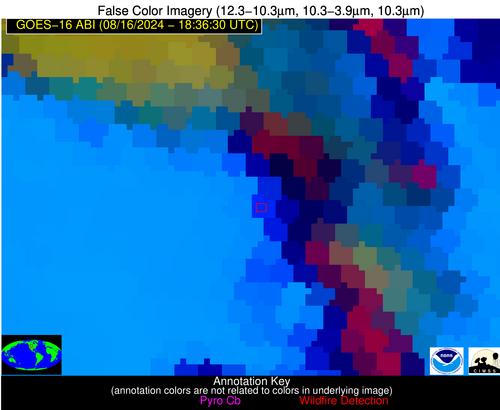
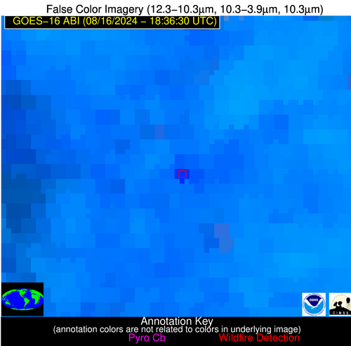
Possible Wildfire
| Basic Information | |
|---|---|
| State/Province(s) | WY |
| Country/Countries | USA |
| County/Locality(s) | Campbell County, WY |
| NWS WFO | Rapid City SD |
| Identification Method | Enhanced Contextual (Cloud) |
| Mean Object Date/Time | 2024-08-16 18:36:19UTC |
| Radiative Center (Lat, Lon): | 44.180000°, -105.600000° |
| Nearby Counties (meeting alert criteria): |
|
| Total Radiative Power Anomaly | n/a |
| Total Radiative Power | 122.76 MW |
| Map: | |
| Additional Information | |
| Alert Status | New Feature |
| Type of Event | Nominal Risk |
| Event Priority Ranking | 4 |
| Maximum Observed BT (3.9 um) | 327.01 K |
| Observed - Background BT (3.9 um) | 14.58 K |
| BT Anomaly (3.9 um) | 9.55 K |
| Maximum Observed - Clear RTM BT (3.9 um) | 21.28 K |
| Maximum Observed BTD (3.9-10/11/12 um) | 34.15 K |
| Observed - Background BTD (3.9-10/11/12 um) | 14.59 K |
| BTD Anomaly (3.9-10/11/12 um) | 7.74 K |
| Similar Pixel Count | 0 |
| BT Time Tendency (3.9 um) | 21.90 K |
| Image Interval | 5.00 minutes |
| Fraction of Surrounding LWIR Pixels that are Colder | 0.71 |
| Fraction of Surrounding Red Channel Pixels that are Brighter | 0.53 |
| Maximum Radiative Power | 122.76 MW |
| Maximum Radiative Power Uncertainty | 0.00 MW |
| Total Radiative Power Uncertainty | 0.00 MW |
| Mean Viewing Angle | 59.60° |
| Mean Solar Zenith Angle | 31.00° |
| Mean Glint Angle | 88.10° |
| Water Fraction | 0.00 |
| Total Pixel Area | 10.60 km2 |
| Latest Satellite Imagery: | |
| View all event imagery » | |
Possible Wildfire
| Basic Information | |
|---|---|
| State/Province(s) | AR |
| Country/Countries | USA |
| County/Locality(s) | Phillips County, AR |
| NWS WFO | Memphis TN |
| Identification Method | Enhanced Contextual (Clear) |
| Mean Object Date/Time | 2024-08-16 18:37:21UTC |
| Radiative Center (Lat, Lon): | 34.400000°, -90.910000° |
| Nearby Counties (meeting alert criteria): |
|
| Total Radiative Power Anomaly | n/a |
| Total Radiative Power | 42.56 MW |
| Map: | |
| Additional Information | |
| Alert Status | New Feature |
| Type of Event | Nominal Risk |
| Event Priority Ranking | 4 |
| Maximum Observed BT (3.9 um) | 318.38 K |
| Observed - Background BT (3.9 um) | 9.43 K |
| BT Anomaly (3.9 um) | 7.88 K |
| Maximum Observed - Clear RTM BT (3.9 um) | 8.35 K |
| Maximum Observed BTD (3.9-10/11/12 um) | 27.08 K |
| Observed - Background BTD (3.9-10/11/12 um) | 8.64 K |
| BTD Anomaly (3.9-10/11/12 um) | 6.75 K |
| Similar Pixel Count | 25 |
| BT Time Tendency (3.9 um) | 6.20 K |
| Image Interval | 5.00 minutes |
| Fraction of Surrounding LWIR Pixels that are Colder | 0.88 |
| Fraction of Surrounding Red Channel Pixels that are Brighter | 0.77 |
| Maximum Radiative Power | 42.56 MW |
| Maximum Radiative Power Uncertainty | 0.00 MW |
| Total Radiative Power Uncertainty | 0.00 MW |
| Mean Viewing Angle | 43.60° |
| Mean Solar Zenith Angle | 21.50° |
| Mean Glint Angle | 60.20° |
| Water Fraction | 0.00 |
| Total Pixel Area | 6.20 km2 |
| Latest Satellite Imagery: | |
| View all event imagery » | |
Possible Wildfire
| Basic Information | |
|---|---|
| State/Province(s) | AR |
| Country/Countries | USA |
| County/Locality(s) | Desha County, AR |
| NWS WFO | Little Rock AR |
| Identification Method | Enhanced Contextual (Clear) |
| Mean Object Date/Time | 2024-08-16 18:37:21UTC |
| Radiative Center (Lat, Lon): | 33.780000°, -91.390000° |
| Nearby Counties (meeting alert criteria): |
|
| Total Radiative Power Anomaly | n/a |
| Total Radiative Power | 43.98 MW |
| Map: | |
| Additional Information | |
| Alert Status | New Feature |
| Type of Event | Nominal Risk |
| Event Priority Ranking | 4 |
| Maximum Observed BT (3.9 um) | 319.24 K |
| Observed - Background BT (3.9 um) | 9.83 K |
| BT Anomaly (3.9 um) | 7.90 K |
| Maximum Observed - Clear RTM BT (3.9 um) | 7.97 K |
| Maximum Observed BTD (3.9-10/11/12 um) | 26.16 K |
| Observed - Background BTD (3.9-10/11/12 um) | 9.46 K |
| BTD Anomaly (3.9-10/11/12 um) | 10.37 K |
| Similar Pixel Count | 6 |
| BT Time Tendency (3.9 um) | 8.30 K |
| Image Interval | 5.00 minutes |
| Fraction of Surrounding LWIR Pixels that are Colder | 0.74 |
| Fraction of Surrounding Red Channel Pixels that are Brighter | 0.51 |
| Maximum Radiative Power | 43.98 MW |
| Maximum Radiative Power Uncertainty | 0.00 MW |
| Total Radiative Power Uncertainty | 0.00 MW |
| Mean Viewing Angle | 43.20° |
| Mean Solar Zenith Angle | 20.80° |
| Mean Glint Angle | 59.10° |
| Water Fraction | 0.00 |
| Total Pixel Area | 6.10 km2 |
| Latest Satellite Imagery: | |
| View all event imagery » | |
Possible Wildfire
| Basic Information | |
|---|---|
| State/Province(s) | Unknown |
| Country/Countries | Mexico |
| County/Locality(s) | Mexico |
| NWS WFO | N/A |
| Identification Method | Enhanced Contextual (Cloud) |
| Mean Object Date/Time | 2024-08-16 18:37:18UTC |
| Radiative Center (Lat, Lon): | 32.460000°, -114.990000° |
| Nearby Counties (meeting alert criteria): |
|
| Total Radiative Power Anomaly | n/a |
| Total Radiative Power | 94.49 MW |
| Map: | |
| Additional Information | |
| Alert Status | New Feature |
| Type of Event | Nominal Risk |
| Event Priority Ranking | 4 |
| Maximum Observed BT (3.9 um) | 322.31 K |
| Observed - Background BT (3.9 um) | 8.50 K |
| BT Anomaly (3.9 um) | 5.83 K |
| Maximum Observed - Clear RTM BT (3.9 um) | 8.11 K |
| Maximum Observed BTD (3.9-10/11/12 um) | 40.50 K |
| Observed - Background BTD (3.9-10/11/12 um) | 8.55 K |
| BTD Anomaly (3.9-10/11/12 um) | 6.19 K |
| Similar Pixel Count | 0 |
| BT Time Tendency (3.9 um) | 3.00 K |
| Image Interval | 5.00 minutes |
| Fraction of Surrounding LWIR Pixels that are Colder | 0.64 |
| Fraction of Surrounding Red Channel Pixels that are Brighter | 0.97 |
| Maximum Radiative Power | 94.49 MW |
| Maximum Radiative Power Uncertainty | 0.00 MW |
| Total Radiative Power Uncertainty | 0.00 MW |
| Mean Viewing Angle | 57.20° |
| Mean Solar Zenith Angle | 24.20° |
| Mean Glint Angle | 80.80° |
| Water Fraction | 0.00 |
| Total Pixel Area | 10.00 km2 |
| Latest Satellite Imagery: | |
| View all event imagery » | |
Possible Wildfire
| Basic Information | |
|---|---|
| State/Province(s) | LA |
| Country/Countries | USA |
| County/Locality(s) | Avoyelles Parish, LA |
| NWS WFO | Lake Charles LA |
| Identification Method | Enhanced Contextual (Clear) |
| Mean Object Date/Time | 2024-08-16 18:37:20UTC |
| Radiative Center (Lat, Lon): | 30.990000°, -92.080000° |
| Nearby Counties (meeting alert criteria): |
|
| Total Radiative Power Anomaly | n/a |
| Total Radiative Power | 68.23 MW |
| Map: | |
| Additional Information | |
| Alert Status | New Feature |
| Type of Event | Nominal Risk |
| Event Priority Ranking | 4 |
| Maximum Observed BT (3.9 um) | 320.16 K |
| Observed - Background BT (3.9 um) | 11.97 K |
| BT Anomaly (3.9 um) | 7.20 K |
| Maximum Observed - Clear RTM BT (3.9 um) | 13.38 K |
| Maximum Observed BTD (3.9-10/11/12 um) | 32.17 K |
| Observed - Background BTD (3.9-10/11/12 um) | 12.41 K |
| BTD Anomaly (3.9-10/11/12 um) | 6.90 K |
| Similar Pixel Count | 11 |
| BT Time Tendency (3.9 um) | 6.40 K |
| Image Interval | 5.00 minutes |
| Fraction of Surrounding LWIR Pixels that are Colder | 0.51 |
| Fraction of Surrounding Red Channel Pixels that are Brighter | 0.65 |
| Maximum Radiative Power | 68.23 MW |
| Maximum Radiative Power Uncertainty | 0.00 MW |
| Total Radiative Power Uncertainty | 0.00 MW |
| Mean Viewing Angle | 40.70° |
| Mean Solar Zenith Angle | 18.00° |
| Mean Glint Angle | 53.80° |
| Water Fraction | 0.00 |
| Total Pixel Area | 5.80 km2 |
| Latest Satellite Imagery: | |
| View all event imagery » | |

