Wildfire Alert Report
| Date: | 2024-07-28 |
|---|---|
| Time: | 22:51:18 |
| Production Date and Time: | 2024-07-28 22:55:58 UTC |
| Primary Instrument: | GOES-18 ABI |
| Wmo Spacecraft Id: | 665 |
| Location/orbit: | GEO |
| L1 File: | OR_ABI-L1b-RadC-M6C14_G18_s20242102251181_e20242102253554_c20242102254041.nc |
| L1 File(s) - Temporal | OR_ABI-L1b-RadC-M6C14_G18_s20242102246181_e20242102248554_c20242102249034.nc |
| Number Of Thermal Anomaly Alerts: | 1 |
Possible Wildfire
| Basic Information | |
|---|---|
| State/Province(s) | CO |
| Country/Countries | USA |
| County/Locality(s) | Rio Blanco County, CO |
| NWS WFO | Grand Junction CO |
| Identification Method | Enhanced Contextual (Clear) |
| Mean Object Date/Time | 2024-07-28 22:51:55UTC |
| Radiative Center (Lat, Lon): | 40.050000°, -108.690000° |
| Nearby Counties (meeting alert criteria): |
|
| Total Radiative Power Anomaly | n/a |
| Total Radiative Power | 34.44 MW |
| Map: | |
| Additional Information | |
| Alert Status | New Feature |
| Type of Event | Elevated SPC Risk and Red Flag Warning |
| Event Priority Ranking | 1 |
| Maximum Observed BT (3.9 um) | 318.90 K |
| Observed - Background BT (3.9 um) | 4.65 K |
| BT Anomaly (3.9 um) | 2.49 K |
| Maximum Observed - Clear RTM BT (3.9 um) | 13.22 K |
| Maximum Observed BTD (3.9-10/11/12 um) | 13.11 K |
| Observed - Background BTD (3.9-10/11/12 um) | 5.27 K |
| BTD Anomaly (3.9-10/11/12 um) | 5.69 K |
| Similar Pixel Count | 10 |
| BT Time Tendency (3.9 um) | 2.60 K |
| Image Interval | 5.00 minutes |
| Fraction of Surrounding LWIR Pixels that are Colder | 0.43 |
| Fraction of Surrounding Red Channel Pixels that are Brighter | 1.00 |
| Maximum Radiative Power | 34.44 MW |
| Maximum Radiative Power Uncertainty | 0.00 MW |
| Total Radiative Power Uncertainty | 0.00 MW |
| Mean Viewing Angle | 55.00° |
| Mean Solar Zenith Angle | 49.50° |
| Mean Glint Angle | 95.50° |
| Water Fraction | 0.00 |
| Total Pixel Area | 8.80 km2 |
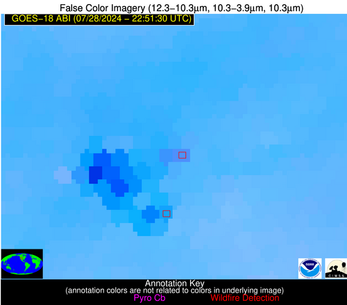
| Latest Satellite Imagery: | |
| View all event imagery » | |


