Wildfire Alert Report
| Date: | 2024-07-25 |
|---|---|
| Time: | 02:01:17 |
| Production Date and Time: | 2024-07-25 02:05:47 UTC |
| Primary Instrument: | GOES-18 ABI |
| Wmo Spacecraft Id: | 665 |
| Location/orbit: | GEO |
| L1 File: | OR_ABI-L1b-RadC-M6C14_G18_s20242070201174_e20242070203547_c20242070204021.nc |
| L1 File(s) - Temporal | OR_ABI-L1b-RadC-M6C14_G18_s20242070156174_e20242070158547_c20242070159032.nc |
| Number Of Thermal Anomaly Alerts: | 1 |
Possible Wildfire
| Basic Information | |
|---|---|
| State/Province(s) | OR |
| Country/Countries | USA |
| County/Locality(s) | Malheur County, OR |
| NWS WFO | Boise ID |
| Identification Method | Enhanced Contextual (Cloud) |
| Mean Object Date/Time | 2024-07-25 02:01:23UTC |
| Radiative Center (Lat, Lon): | 43.180000°, -117.630000° |
| Nearby Counties (meeting alert criteria): |
|
| Total Radiative Power Anomaly | n/a |
| Total Radiative Power | 248.52 MW |
| Map: | |
| Additional Information | |
| Alert Status | New Feature |
| Type of Event | Nominal Risk and Red Flag Warning |
| Event Priority Ranking | 1 |
| Maximum Observed BT (3.9 um) | 307.75 K |
| Observed - Background BT (3.9 um) | 20.85 K |
| BT Anomaly (3.9 um) | 11.20 K |
| Maximum Observed - Clear RTM BT (3.9 um) | 9.25 K |
| Maximum Observed BTD (3.9-10/11/12 um) | 37.05 K |
| Observed - Background BTD (3.9-10/11/12 um) | 20.58 K |
| BTD Anomaly (3.9-10/11/12 um) | 21.81 K |
| Similar Pixel Count | 0 |
| BT Time Tendency (3.9 um) | 39.40 K |
| Image Interval | 5.00 minutes |
| Fraction of Surrounding LWIR Pixels that are Colder | 0.56 |
| Fraction of Surrounding Red Channel Pixels that are Brighter | 0.38 |
| Maximum Radiative Power | 248.52 MW |
| Maximum Radiative Power Uncertainty | 0.00 MW |
| Total Radiative Power Uncertainty | 0.00 MW |
| Mean Viewing Angle | 53.80° |
| Mean Solar Zenith Angle | 77.40° |
| Mean Glint Angle | 91.80° |
| Water Fraction | 0.00 |
| Total Pixel Area | 8.10 km2 |
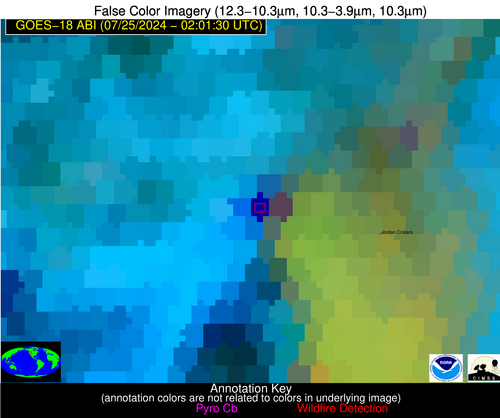
| Latest Satellite Imagery: | |
| View all event imagery » | |


