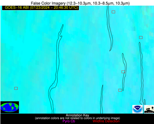
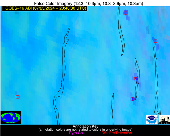
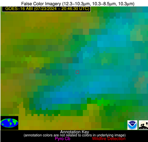
Wildfire Alert Report
| Date: | 2024-07-23 |
|---|---|
| Time: | 20:46:17 |
| Production Date and Time: | 2024-07-23 20:51:04 UTC |
| Primary Instrument: | GOES-16 ABI |
| Wmo Spacecraft Id: | 152 |
| Location/orbit: | GEO |
| L1 File: | OR_ABI-L1b-RadC-M6C14_G16_s20242052046171_e20242052048544_c20242052049036.nc |
| L1 File(s) - Temporal | OR_ABI-L1b-RadC-M6C14_G16_s20242052041171_e20242052043544_c20242052044034.nc |
| Number Of Thermal Anomaly Alerts: | 3 |
Possible Wildfire
| Basic Information | |
|---|---|
| State/Province(s) | British Columbia |
| Country/Countries | Canada |
| County/Locality(s) | Canada |
| NWS WFO | N/A |
| Identification Method | Enhanced Contextual (Clear) |
| Mean Object Date/Time | 2024-07-23 20:46:19UTC |
| Radiative Center (Lat, Lon): | 50.210000°, -116.900000° |
| Nearby Counties (meeting alert criteria): |
|
| Total Radiative Power Anomaly | n/a |
| Total Radiative Power | 211.44 MW |
| Map: | |
| Additional Information | |
| Alert Status | New Feature |
| Type of Event | Nominal Risk |
| Event Priority Ranking | 4 |
| Maximum Observed BT (3.9 um) | 306.77 K |
| Observed - Background BT (3.9 um) | 9.46 K |
| BT Anomaly (3.9 um) | 5.81 K |
| Maximum Observed - Clear RTM BT (3.9 um) | 12.67 K |
| Maximum Observed BTD (3.9-10/11/12 um) | 18.52 K |
| Observed - Background BTD (3.9-10/11/12 um) | 9.97 K |
| BTD Anomaly (3.9-10/11/12 um) | 9.60 K |
| Similar Pixel Count | 5 |
| BT Time Tendency (3.9 um) | 8.40 K |
| Image Interval | 5.00 minutes |
| Fraction of Surrounding LWIR Pixels that are Colder | 0.32 |
| Fraction of Surrounding Red Channel Pixels that are Brighter | 0.40 |
| Maximum Radiative Power | 81.46 MW |
| Maximum Radiative Power Uncertainty | 0.00 MW |
| Total Radiative Power Uncertainty | 0.00 MW |
| Mean Viewing Angle | 70.10° |
| Mean Solar Zenith Angle | 31.70° |
| Mean Glint Angle | 81.60° |
| Water Fraction | 0.00 |
| Total Pixel Area | 61.70 km2 |
| Latest Satellite Imagery: | |
| View all event imagery » | |
Possible Wildfire
| Basic Information | |
|---|---|
| State/Province(s) | British Columbia |
| Country/Countries | Canada |
| County/Locality(s) | Canada |
| NWS WFO | N/A |
| Identification Method | Enhanced Contextual (Clear) |
| Mean Object Date/Time | 2024-07-23 20:46:19UTC |
| Radiative Center (Lat, Lon): | 49.750000°, -120.760000° |
| Nearby Counties (meeting alert criteria): |
|
| Total Radiative Power Anomaly | n/a |
| Total Radiative Power | 53.94 MW |
| Map: | |
| Additional Information | |
| Alert Status | New Feature |
| Type of Event | Nominal Risk |
| Event Priority Ranking | 4 |
| Maximum Observed BT (3.9 um) | 297.99 K |
| Observed - Background BT (3.9 um) | 3.62 K |
| BT Anomaly (3.9 um) | 2.77 K |
| Maximum Observed - Clear RTM BT (3.9 um) | 6.93 K |
| Maximum Observed BTD (3.9-10/11/12 um) | 11.58 K |
| Observed - Background BTD (3.9-10/11/12 um) | 3.35 K |
| BTD Anomaly (3.9-10/11/12 um) | 4.43 K |
| Similar Pixel Count | 20 |
| BT Time Tendency (3.9 um) | 1.60 K |
| Image Interval | 5.00 minutes |
| Fraction of Surrounding LWIR Pixels that are Colder | 0.68 |
| Fraction of Surrounding Red Channel Pixels that are Brighter | 1.00 |
| Maximum Radiative Power | 27.36 MW |
| Maximum Radiative Power Uncertainty | 0.00 MW |
| Total Radiative Power Uncertainty | 0.00 MW |
| Mean Viewing Angle | 72.00° |
| Mean Solar Zenith Angle | 30.40° |
| Mean Glint Angle | 83.90° |
| Water Fraction | 0.00 |
| Total Pixel Area | 49.40 km2 |
| Latest Satellite Imagery: | |
| View all event imagery » | |
Possible Wildfire
| Basic Information | |
|---|---|
| State/Province(s) | MS |
| Country/Countries | USA |
| County/Locality(s) | Winston County, MS |
| NWS WFO | Jackson MS |
| Identification Method | Enhanced Contextual (Cloud) |
| Mean Object Date/Time | 2024-07-23 20:47:21UTC |
| Radiative Center (Lat, Lon): | 33.080000°, -89.290000° |
| Nearby Counties (meeting alert criteria): |
|
| Total Radiative Power Anomaly | n/a |
| Total Radiative Power | 58.79 MW |
| Map: | |
| Additional Information | |
| Alert Status | New Feature |
| Type of Event | Nominal Risk |
| Event Priority Ranking | 4 |
| Maximum Observed BT (3.9 um) | 299.92 K |
| Observed - Background BT (3.9 um) | 12.30 K |
| BT Anomaly (3.9 um) | 6.78 K |
| Maximum Observed - Clear RTM BT (3.9 um) | 6.40 K |
| Maximum Observed BTD (3.9-10/11/12 um) | 34.24 K |
| Observed - Background BTD (3.9-10/11/12 um) | 12.31 K |
| BTD Anomaly (3.9-10/11/12 um) | 10.92 K |
| Similar Pixel Count | 0 |
| BT Time Tendency (3.9 um) | 7.40 K |
| Image Interval | 5.00 minutes |
| Fraction of Surrounding LWIR Pixels that are Colder | 0.74 |
| Fraction of Surrounding Red Channel Pixels that are Brighter | 0.95 |
| Maximum Radiative Power | 58.79 MW |
| Maximum Radiative Power Uncertainty | 0.00 MW |
| Total Radiative Power Uncertainty | 0.00 MW |
| Mean Viewing Angle | 41.60° |
| Mean Solar Zenith Angle | 38.40° |
| Mean Glint Angle | 45.80° |
| Water Fraction | 0.00 |
| Total Pixel Area | 5.90 km2 |
| Latest Satellite Imagery: | |
| View all event imagery » | |


