Wildfire Alert Report
| Date: | 2024-07-23 |
|---|---|
| Time: | 18:21:17 |
| Production Date and Time: | 2024-07-23 18:26:05 UTC |
| Primary Instrument: | GOES-16 ABI |
| Wmo Spacecraft Id: | 152 |
| Location/orbit: | GEO |
| L1 File: | OR_ABI-L1b-RadC-M6C14_G16_s20242051821171_e20242051823544_c20242051824026.nc |
| L1 File(s) - Temporal | OR_ABI-L1b-RadC-M6C14_G16_s20242051816171_e20242051818544_c20242051819036.nc |
| Number Of Thermal Anomaly Alerts: | 3 |
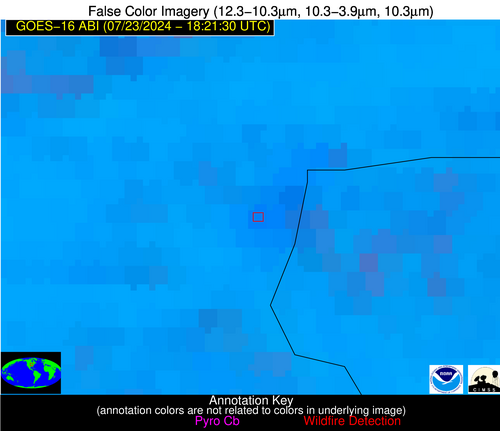
Possible Wildfire
| Basic Information | |
|---|---|
| State/Province(s) | British Columbia |
| Country/Countries | Canada |
| County/Locality(s) | Canada |
| NWS WFO | N/A |
| Identification Method | Enhanced Contextual (Cloud) |
| Mean Object Date/Time | 2024-07-23 18:21:19UTC |
| Radiative Center (Lat, Lon): | 51.250000°, -121.290000° |
| Nearby Counties (meeting alert criteria): |
|
| Total Radiative Power Anomaly | n/a |
| Total Radiative Power | 138.57 MW |
| Map: | |
| Additional Information | |
| Alert Status | New Feature |
| Type of Event | Nominal Risk |
| Event Priority Ranking | 4 |
| Maximum Observed BT (3.9 um) | 309.33 K |
| Observed - Background BT (3.9 um) | 14.88 K |
| BT Anomaly (3.9 um) | 6.30 K |
| Maximum Observed - Clear RTM BT (3.9 um) | 19.07 K |
| Maximum Observed BTD (3.9-10/11/12 um) | 26.42 K |
| Observed - Background BTD (3.9-10/11/12 um) | 14.95 K |
| BTD Anomaly (3.9-10/11/12 um) | 5.74 K |
| Similar Pixel Count | 0 |
| BT Time Tendency (3.9 um) | 13.50 K |
| Image Interval | 5.00 minutes |
| Fraction of Surrounding LWIR Pixels that are Colder | 0.63 |
| Fraction of Surrounding Red Channel Pixels that are Brighter | 0.60 |
| Maximum Radiative Power | 138.57 MW |
| Maximum Radiative Power Uncertainty | 0.00 MW |
| Total Radiative Power Uncertainty | 0.00 MW |
| Mean Viewing Angle | 73.20° |
| Mean Solar Zenith Angle | 37.80° |
| Mean Glint Angle | 110.60° |
| Water Fraction | 0.00 |
| Total Pixel Area | 27.50 km2 |
| Latest Satellite Imagery: | |
| View all event imagery » | |
Possible Wildfire
| Basic Information | |
|---|---|
| State/Province(s) | IA |
| Country/Countries | USA |
| County/Locality(s) | Muscatine County, IA |
| NWS WFO | Quad Cities IL |
| Identification Method | Enhanced Contextual (Clear) |
| Mean Object Date/Time | 2024-07-23 18:21:51UTC |
| Radiative Center (Lat, Lon): | 41.370000°, -91.120000° |
| Nearby Counties (meeting alert criteria): |
|
| Total Radiative Power Anomaly | n/a |
| Total Radiative Power | 7.86 MW |
| Map: | |
| Additional Information | |
| Alert Status | New Feature |
| Type of Event | VIIRS 375m static sources 2013_2018 |
| Event Priority Ranking | 5 |
| Maximum Observed BT (3.9 um) | 304.61 K |
| Observed - Background BT (3.9 um) | 4.70 K |
| BT Anomaly (3.9 um) | 6.16 K |
| Maximum Observed - Clear RTM BT (3.9 um) | 8.17 K |
| Maximum Observed BTD (3.9-10/11/12 um) | 18.10 K |
| Observed - Background BTD (3.9-10/11/12 um) | 4.71 K |
| BTD Anomaly (3.9-10/11/12 um) | 5.76 K |
| Similar Pixel Count | 25 |
| BT Time Tendency (3.9 um) | -0.40 K |
| Image Interval | 5.00 minutes |
| Fraction of Surrounding LWIR Pixels that are Colder | 0.47 |
| Fraction of Surrounding Red Channel Pixels that are Brighter | 0.50 |
| Maximum Radiative Power | 7.86 MW |
| Maximum Radiative Power Uncertainty | 0.00 MW |
| Total Radiative Power Uncertainty | 0.00 MW |
| Mean Viewing Angle | 50.80° |
| Mean Solar Zenith Angle | 21.30° |
| Mean Glint Angle | 69.70° |
| Water Fraction | 0.00 |
| Total Pixel Area | 7.30 km2 |
| Latest Satellite Imagery: | |
| View all event imagery » | |
Possible Wildfire
| Basic Information | |
|---|---|
| State/Province(s) | TX |
| Country/Countries | USA |
| County/Locality(s) | Martin County, TX |
| NWS WFO | Midland/Odessa TX |
| Identification Method | Enhanced Contextual (Clear) |
| Mean Object Date/Time | 2024-07-23 18:22:19UTC |
| Radiative Center (Lat, Lon): | 32.200000°, -101.930000° |
| Nearby Counties (meeting alert criteria): |
|
| Total Radiative Power Anomaly | n/a |
| Total Radiative Power | 20.39 MW |
| Map: | |
| Additional Information | |
| Alert Status | New Feature |
| Type of Event | Oil/gas |
| Event Priority Ranking | 5 |
| Maximum Observed BT (3.9 um) | 321.78 K |
| Observed - Background BT (3.9 um) | 4.86 K |
| BT Anomaly (3.9 um) | 3.47 K |
| Maximum Observed - Clear RTM BT (3.9 um) | 15.36 K |
| Maximum Observed BTD (3.9-10/11/12 um) | 24.22 K |
| Observed - Background BTD (3.9-10/11/12 um) | 3.86 K |
| BTD Anomaly (3.9-10/11/12 um) | 3.27 K |
| Similar Pixel Count | 25 |
| BT Time Tendency (3.9 um) | 1.10 K |
| Image Interval | 5.00 minutes |
| Fraction of Surrounding LWIR Pixels that are Colder | 0.94 |
| Fraction of Surrounding Red Channel Pixels that are Brighter | 1.00 |
| Maximum Radiative Power | 20.39 MW |
| Maximum Radiative Power Uncertainty | 0.00 MW |
| Total Radiative Power Uncertainty | 0.00 MW |
| Mean Viewing Angle | 47.50° |
| Mean Solar Zenith Angle | 14.00° |
| Mean Glint Angle | 61.30° |
| Water Fraction | 0.00 |
| Total Pixel Area | 7.00 km2 |
| Latest Satellite Imagery: | |
| View all event imagery » | |


