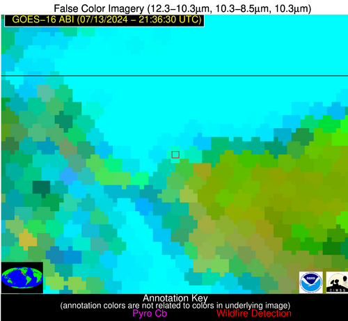
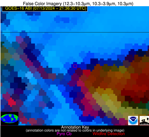
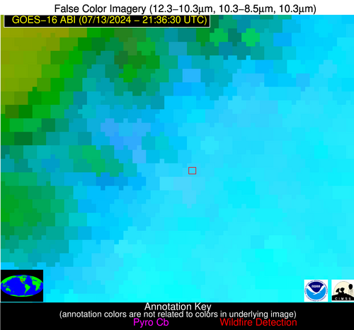
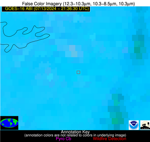
Jan 2026: Due to an ongoing data center cooling system construction project, NGFS data outages may occur with little or no notice.
Wildfire Alert Report
| Date: | 2024-07-13 |
|---|---|
| Time: | 21:36:17 |
| Production Date and Time: | 2024-07-13 21:42:43 UTC |
| Primary Instrument: | GOES-16 ABI |
| Wmo Spacecraft Id: | 152 |
| Location/orbit: | GEO |
| L1 File: | OR_ABI-L1b-RadC-M6C14_G16_s20241952136176_e20241952138549_c20241952139025.nc |
| L1 File(s) - Temporal | OR_ABI-L1b-RadC-M6C14_G16_s20241952131176_e20241952133549_c20241952134042.nc |
| Number Of Thermal Anomaly Alerts: | 4 |
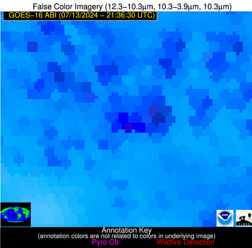
Possible Wildfire
| Basic Information | |
|---|---|
| State/Province(s) | AZ |
| Country/Countries | USA |
| County/Locality(s) | Mohave County, AZ |
| NWS WFO | Las Vegas NV |
| Identification Method | Enhanced Contextual (Clear) |
| Mean Object Date/Time | 2024-07-13 21:37:18UTC |
| Radiative Center (Lat, Lon): | 36.850000°, -112.690000° |
| Nearby Counties (meeting alert criteria): |
|
| Total Radiative Power Anomaly | n/a |
| Total Radiative Power | 1025.99 MW |
| Map: | |
| Additional Information | |
| Alert Status | New Feature |
| Type of Event | Nominal Risk |
| Event Priority Ranking | 4 |
| Maximum Observed BT (3.9 um) | 312.34 K |
| Observed - Background BT (3.9 um) | 15.80 K |
| BT Anomaly (3.9 um) | 5.34 K |
| Maximum Observed - Clear RTM BT (3.9 um) | 3.39 K |
| Maximum Observed BTD (3.9-10/11/12 um) | 40.19 K |
| Observed - Background BTD (3.9-10/11/12 um) | 16.42 K |
| BTD Anomaly (3.9-10/11/12 um) | 6.57 K |
| Similar Pixel Count | 13 |
| BT Time Tendency (3.9 um) | -5.30 K |
| Image Interval | 5.00 minutes |
| Fraction of Surrounding LWIR Pixels that are Colder | 0.50 |
| Fraction of Surrounding Red Channel Pixels that are Brighter | 0.53 |
| Maximum Radiative Power | 862.87 MW |
| Maximum Radiative Power Uncertainty | 0.00 MW |
| Total Radiative Power Uncertainty | 0.00 MW |
| Mean Viewing Angle | 58.30° |
| Mean Solar Zenith Angle | 29.90° |
| Mean Glint Angle | 47.80° |
| Water Fraction | 0.00 |
| Total Pixel Area | 21.00 km2 |
| Latest Satellite Imagery: | |
| View all event imagery » | |
Possible Wildfire
| Basic Information | |
|---|---|
| State/Province(s) | NM |
| Country/Countries | USA |
| County/Locality(s) | San Miguel County, NM |
| NWS WFO | Albuquerque NM |
| Identification Method | Enhanced Contextual (Cloud) |
| Mean Object Date/Time | 2024-07-13 21:37:19UTC |
| Radiative Center (Lat, Lon): | 35.640000°, -105.190000° |
| Nearby Counties (meeting alert criteria): |
|
| Total Radiative Power Anomaly | n/a |
| Total Radiative Power | 344.26 MW |
| Map: | |
| Additional Information | |
| Alert Status | New Feature |
| Type of Event | Solar panel (database + spectral) |
| Event Priority Ranking | 5 |
| Maximum Observed BT (3.9 um) | 333.11 K |
| Observed - Background BT (3.9 um) | 23.90 K |
| BT Anomaly (3.9 um) | 14.03 K |
| Maximum Observed - Clear RTM BT (3.9 um) | 33.36 K |
| Maximum Observed BTD (3.9-10/11/12 um) | 32.91 K |
| Observed - Background BTD (3.9-10/11/12 um) | 24.15 K |
| BTD Anomaly (3.9-10/11/12 um) | 38.43 K |
| Similar Pixel Count | 0 |
| BT Time Tendency (3.9 um) | 25.10 K |
| Image Interval | 5.00 minutes |
| Fraction of Surrounding LWIR Pixels that are Colder | 0.50 |
| Fraction of Surrounding Red Channel Pixels that are Brighter | 0.00 |
| Maximum Radiative Power | 238.27 MW |
| Maximum Radiative Power Uncertainty | 0.00 MW |
| Total Radiative Power Uncertainty | 0.00 MW |
| Mean Viewing Angle | 52.40° |
| Mean Solar Zenith Angle | 35.40° |
| Mean Glint Angle | 42.10° |
| Water Fraction | 0.00 |
| Total Pixel Area | 24.50 km2 |
| Latest Satellite Imagery: | |
| View all event imagery » | |
Possible Wildfire
| Basic Information | |
|---|---|
| State/Province(s) | AR |
| Country/Countries | USA |
| County/Locality(s) | Garland County, AR |
| NWS WFO | Little Rock AR |
| Identification Method | Enhanced Contextual (Clear) |
| Mean Object Date/Time | 2024-07-13 21:37:20UTC |
| Radiative Center (Lat, Lon): | 34.470000°, -93.070000° |
| Nearby Counties (meeting alert criteria): |
|
| Total Radiative Power Anomaly | n/a |
| Total Radiative Power | 21.83 MW |
| Map: | |
| Additional Information | |
| Alert Status | New Feature |
| Type of Event | Likely an Urban Source |
| Event Priority Ranking | 5 |
| Maximum Observed BT (3.9 um) | 308.83 K |
| Observed - Background BT (3.9 um) | 6.09 K |
| BT Anomaly (3.9 um) | 7.37 K |
| Maximum Observed - Clear RTM BT (3.9 um) | 7.58 K |
| Maximum Observed BTD (3.9-10/11/12 um) | 15.62 K |
| Observed - Background BTD (3.9-10/11/12 um) | 5.49 K |
| BTD Anomaly (3.9-10/11/12 um) | 6.35 K |
| Similar Pixel Count | 24 |
| BT Time Tendency (3.9 um) | -0.90 K |
| Image Interval | 5.00 minutes |
| Fraction of Surrounding LWIR Pixels that are Colder | 0.86 |
| Fraction of Surrounding Red Channel Pixels that are Brighter | 0.50 |
| Maximum Radiative Power | 21.83 MW |
| Maximum Radiative Power Uncertainty | 0.00 MW |
| Total Radiative Power Uncertainty | 0.00 MW |
| Mean Viewing Angle | 44.60° |
| Mean Solar Zenith Angle | 45.10° |
| Mean Glint Angle | 43.10° |
| Water Fraction | 0.00 |
| Total Pixel Area | 6.30 km2 |
| Latest Satellite Imagery: | |
| View all event imagery » | |
Possible Wildfire
| Basic Information | |
|---|---|
| State/Province(s) | Unknown |
| Country/Countries | Mexico |
| County/Locality(s) | Mexico |
| NWS WFO | N/A |
| Identification Method | Enhanced Contextual (Cloud) |
| Mean Object Date/Time | 2024-07-13 21:37:48UTC |
| Radiative Center (Lat, Lon): | 30.760000°, -108.390000° |
| Nearby Counties (meeting alert criteria): |
|
| Total Radiative Power Anomaly | n/a |
| Total Radiative Power | 859.22 MW |
| Map: | |
| Additional Information | |
| Alert Status | New Feature |
| Type of Event | Nominal Risk |
| Event Priority Ranking | 4 |
| Maximum Observed BT (3.9 um) | 353.75 K |
| Observed - Background BT (3.9 um) | 36.17 K |
| BT Anomaly (3.9 um) | 13.35 K |
| Maximum Observed - Clear RTM BT (3.9 um) | 47.23 K |
| Maximum Observed BTD (3.9-10/11/12 um) | 54.25 K |
| Observed - Background BTD (3.9-10/11/12 um) | 36.87 K |
| BTD Anomaly (3.9-10/11/12 um) | 15.24 K |
| Similar Pixel Count | 0 |
| BT Time Tendency (3.9 um) | 30.60 K |
| Image Interval | 5.00 minutes |
| Fraction of Surrounding LWIR Pixels that are Colder | 0.41 |
| Fraction of Surrounding Red Channel Pixels that are Brighter | 0.47 |
| Maximum Radiative Power | 369.89 MW |
| Maximum Radiative Power Uncertainty | 0.00 MW |
| Total Radiative Power Uncertainty | 0.00 MW |
| Mean Viewing Angle | 51.00° |
| Mean Solar Zenith Angle | 31.90° |
| Mean Glint Angle | 34.80° |
| Water Fraction | 0.00 |
| Total Pixel Area | 31.50 km2 |
| Latest Satellite Imagery: | |
| View all event imagery » | |
