Wildfire Alert Report
| Date: | 2024-07-08 |
|---|---|
| Time: | 18:11:17 |
| Production Date and Time: | 2024-07-08 18:15:47 UTC |
| Primary Instrument: | GOES-18 ABI |
| Wmo Spacecraft Id: | 665 |
| Location/orbit: | GEO |
| L1 File: | OR_ABI-L1b-RadC-M6C14_G18_s20241901811170_e20241901813543_c20241901814004.nc |
| L1 File(s) - Temporal | OR_ABI-L1b-RadC-M6C14_G18_s20241901806170_e20241901808543_c20241901809031.nc |
| Number Of Thermal Anomaly Alerts: | 2 |
Possible Wildfire
| Basic Information | |
|---|---|
| State/Province(s) | CA |
| Country/Countries | USA |
| County/Locality(s) | Alameda County, CA |
| NWS WFO | San Francisco CA |
| Identification Method | Enhanced Contextual (Clear) |
| Mean Object Date/Time | 2024-07-08 18:11:53UTC |
| Radiative Center (Lat, Lon): | 37.580000°, -121.740000° |
| Nearby Counties (meeting alert criteria): |
|
| Total Radiative Power Anomaly | n/a |
| Total Radiative Power | 62.40 MW |
| Map: | |
| Additional Information | |
| Alert Status | New Feature |
| Type of Event | Nominal Risk |
| Event Priority Ranking | 4 |
| Maximum Observed BT (3.9 um) | 316.51 K |
| Observed - Background BT (3.9 um) | 6.08 K |
| BT Anomaly (3.9 um) | 3.08 K |
| Maximum Observed - Clear RTM BT (3.9 um) | 9.03 K |
| Maximum Observed BTD (3.9-10/11/12 um) | 12.49 K |
| Observed - Background BTD (3.9-10/11/12 um) | 5.95 K |
| BTD Anomaly (3.9-10/11/12 um) | 4.56 K |
| Similar Pixel Count | 2 |
| BT Time Tendency (3.9 um) | 7.10 K |
| Image Interval | 5.00 minutes |
| Fraction of Surrounding LWIR Pixels that are Colder | 0.25 |
| Fraction of Surrounding Red Channel Pixels that are Brighter | 0.92 |
| Maximum Radiative Power | 37.39 MW |
| Maximum Radiative Power Uncertainty | 0.00 MW |
| Total Radiative Power Uncertainty | 0.00 MW |
| Mean Viewing Angle | 46.60° |
| Mean Solar Zenith Angle | 29.80° |
| Mean Glint Angle | 52.30° |
| Water Fraction | 0.00 |
| Total Pixel Area | 13.10 km2 |
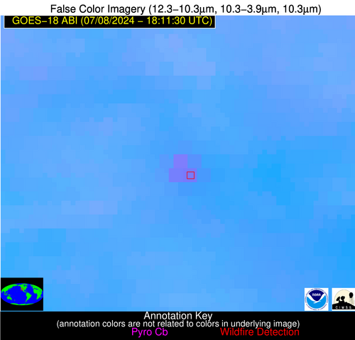
| Latest Satellite Imagery: | |
| View all event imagery » | |
Possible Wildfire
| Basic Information | |
|---|---|
| State/Province(s) | CA |
| Country/Countries | USA |
| County/Locality(s) | Riverside County, CA |
| NWS WFO | Phoenix AZ |
| Identification Method | Enhanced Contextual (Clear) |
| Mean Object Date/Time | 2024-07-08 18:12:24UTC |
| Radiative Center (Lat, Lon): | 33.810000°, -115.380000° |
| Nearby Counties (meeting alert criteria): |
|
| Total Radiative Power Anomaly | n/a |
| Total Radiative Power | 171.17 MW |
| Map: | |
| Additional Information | |
| Alert Status | New Feature |
| Type of Event | Solar panel (database + spectral) |
| Event Priority Ranking | 5 |
| Maximum Observed BT (3.9 um) | 334.94 K |
| Observed - Background BT (3.9 um) | 6.20 K |
| BT Anomaly (3.9 um) | 5.94 K |
| Maximum Observed - Clear RTM BT (3.9 um) | 4.75 K |
| Maximum Observed BTD (3.9-10/11/12 um) | 15.11 K |
| Observed - Background BTD (3.9-10/11/12 um) | 5.54 K |
| BTD Anomaly (3.9-10/11/12 um) | 11.88 K |
| Similar Pixel Count | 20 |
| BT Time Tendency (3.9 um) | 1.20 K |
| Image Interval | 5.00 minutes |
| Fraction of Surrounding LWIR Pixels that are Colder | 0.85 |
| Fraction of Surrounding Red Channel Pixels that are Brighter | 0.50 |
| Maximum Radiative Power | 58.03 MW |
| Maximum Radiative Power Uncertainty | 0.00 MW |
| Total Radiative Power Uncertainty | 0.00 MW |
| Mean Viewing Angle | 45.80° |
| Mean Solar Zenith Angle | 23.60° |
| Mean Glint Angle | 45.30° |
| Water Fraction | 0.00 |
| Total Pixel Area | 19.80 km2 |
| Latest Satellite Imagery: | |
| View all event imagery » | |


