Wildfire Alert Report
| Date: | 2024-05-25 |
|---|---|
| Time: | 21:26:17 |
| Production Date and Time: | 2024-05-25 21:31:02 UTC |
| Primary Instrument: | GOES-16 ABI |
| Wmo Spacecraft Id: | 152 |
| Location/orbit: | GEO |
| L1 File: | OR_ABI-L1b-RadC-M6C14_G16_s20241462126178_e20241462128551_c20241462129041.nc |
| L1 File(s) - Temporal | OR_ABI-L1b-RadC-M6C14_G16_s20241462121178_e20241462123551_c20241462124049.nc |
| Number Of Thermal Anomaly Alerts: | 2 |
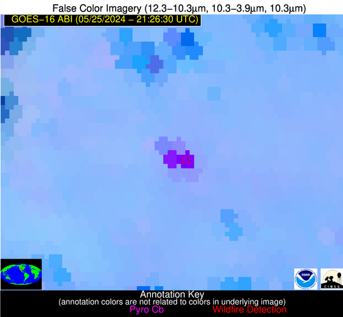
Possible Wildfire
| Basic Information | |
|---|---|
| State/Province(s) | NM |
| Country/Countries | USA |
| County/Locality(s) | San Miguel County, NM |
| NWS WFO | Albuquerque NM |
| Identification Method | Enhanced Contextual (Cloud) |
| Mean Object Date/Time | 2024-05-25 21:27:19UTC |
| Radiative Center (Lat, Lon): | 35.640000°, -105.190000° |
| Nearby Counties (meeting alert criteria): |
|
| Total Radiative Power Anomaly | n/a |
| Total Radiative Power | 327.78 MW |
| Map: | |
| Additional Information | |
| Alert Status | New Feature |
| Type of Event | Solar panel (database + spectral) |
| Event Priority Ranking | 5 |
| Maximum Observed BT (3.9 um) | 336.55 K |
| Observed - Background BT (3.9 um) | 29.17 K |
| BT Anomaly (3.9 um) | 25.03 K |
| Maximum Observed - Clear RTM BT (3.9 um) | 40.00 K |
| Maximum Observed BTD (3.9-10/11/12 um) | 35.18 K |
| Observed - Background BTD (3.9-10/11/12 um) | 28.61 K |
| BTD Anomaly (3.9-10/11/12 um) | 67.60 K |
| Similar Pixel Count | 0 |
| BT Time Tendency (3.9 um) | 24.30 K |
| Image Interval | 5.00 minutes |
| Fraction of Surrounding LWIR Pixels that are Colder | 0.82 |
| Fraction of Surrounding Red Channel Pixels that are Brighter | 0.00 |
| Maximum Radiative Power | 196.45 MW |
| Maximum Radiative Power Uncertainty | 0.00 MW |
| Total Radiative Power Uncertainty | 0.00 MW |
| Mean Viewing Angle | 52.40° |
| Mean Solar Zenith Angle | 35.60° |
| Mean Glint Angle | 43.00° |
| Water Fraction | 0.00 |
| Total Pixel Area | 16.30 km2 |
| Latest Satellite Imagery: | |
| View all event imagery » | |
Possible Wildfire
| Basic Information | |
|---|---|
| State/Province(s) | TX |
| Country/Countries | USA |
| County/Locality(s) | Martin County, TX |
| NWS WFO | Midland/Odessa TX |
| Identification Method | Enhanced Contextual (Clear) |
| Mean Object Date/Time | 2024-05-25 21:27:19UTC |
| Radiative Center (Lat, Lon): | 32.220000°, -101.940000° |
| Nearby Counties (meeting alert criteria): |
|
| Total Radiative Power Anomaly | n/a |
| Total Radiative Power | 14.59 MW |
| Map: | |
| Additional Information | |
| Alert Status | New Feature |
| Type of Event | Oil/gas |
| Event Priority Ranking | 5 |
| Maximum Observed BT (3.9 um) | 323.29 K |
| Observed - Background BT (3.9 um) | 2.47 K |
| BT Anomaly (3.9 um) | 4.22 K |
| Maximum Observed - Clear RTM BT (3.9 um) | 16.51 K |
| Maximum Observed BTD (3.9-10/11/12 um) | 10.39 K |
| Observed - Background BTD (3.9-10/11/12 um) | 2.31 K |
| BTD Anomaly (3.9-10/11/12 um) | 6.56 K |
| Similar Pixel Count | 25 |
| BT Time Tendency (3.9 um) | 2.10 K |
| Image Interval | 5.00 minutes |
| Fraction of Surrounding LWIR Pixels that are Colder | 0.61 |
| Fraction of Surrounding Red Channel Pixels that are Brighter | 1.00 |
| Maximum Radiative Power | 14.59 MW |
| Maximum Radiative Power Uncertainty | 0.00 MW |
| Total Radiative Power Uncertainty | 0.00 MW |
| Mean Viewing Angle | 47.50° |
| Mean Solar Zenith Angle | 37.70° |
| Mean Glint Angle | 36.80° |
| Water Fraction | 0.00 |
| Total Pixel Area | 7.00 km2 |
| Latest Satellite Imagery: | |
| View all event imagery » | |


