Wildfire Alert Report
| Date: | 2024-05-08 |
|---|---|
| Time: | 18:26:17 |
| Production Date and Time: | 2024-05-08 18:31:00 UTC |
| Primary Instrument: | GOES-16 ABI |
| Wmo Spacecraft Id: | 152 |
| Location/orbit: | GEO |
| L1 File: | OR_ABI-L1b-RadC-M6C14_G16_s20241291826173_e20241291828547_c20241291829040.nc |
| L1 File(s) - Temporal | OR_ABI-L1b-RadC-M6C14_G16_s20241291821173_e20241291823546_c20241291823597.nc |
| Number Of Thermal Anomaly Alerts: | 3 |
Possible Wildfire
| Basic Information | |
|---|---|
| State/Province(s) | FL |
| Country/Countries | USA |
| County/Locality(s) | Indian River County, FL |
| NWS WFO | Melbourne FL |
| Identification Method | Enhanced Contextual (Cloud) |
| Mean Object Date/Time | 2024-05-08 18:27:52UTC |
| Radiative Center (Lat, Lon): | 27.600000°, -80.530000° |
| Nearby Counties (meeting alert criteria): |
|
| Total Radiative Power Anomaly | n/a |
| Total Radiative Power | 303.48 MW |
| Map: | |
| Additional Information | |
| Alert Status | New Feature |
| Type of Event | Solar panel |
| Event Priority Ranking | 5 |
| Maximum Observed BT (3.9 um) | 342.78 K |
| Observed - Background BT (3.9 um) | 26.34 K |
| BT Anomaly (3.9 um) | 17.06 K |
| Maximum Observed - Clear RTM BT (3.9 um) | 36.21 K |
| Maximum Observed BTD (3.9-10/11/12 um) | 43.16 K |
| Observed - Background BTD (3.9-10/11/12 um) | 26.45 K |
| BTD Anomaly (3.9-10/11/12 um) | 17.29 K |
| Similar Pixel Count | 0 |
| BT Time Tendency (3.9 um) | 10.50 K |
| Image Interval | 5.00 minutes |
| Fraction of Surrounding LWIR Pixels that are Colder | 0.68 |
| Fraction of Surrounding Red Channel Pixels that are Brighter | 0.00 |
| Maximum Radiative Power | 303.48 MW |
| Maximum Radiative Power Uncertainty | 0.00 MW |
| Total Radiative Power Uncertainty | 0.00 MW |
| Mean Viewing Angle | 32.90° |
| Mean Solar Zenith Angle | 18.80° |
| Mean Glint Angle | 42.40° |
| Water Fraction | 0.00 |
| Total Pixel Area | 15.10 km2 |
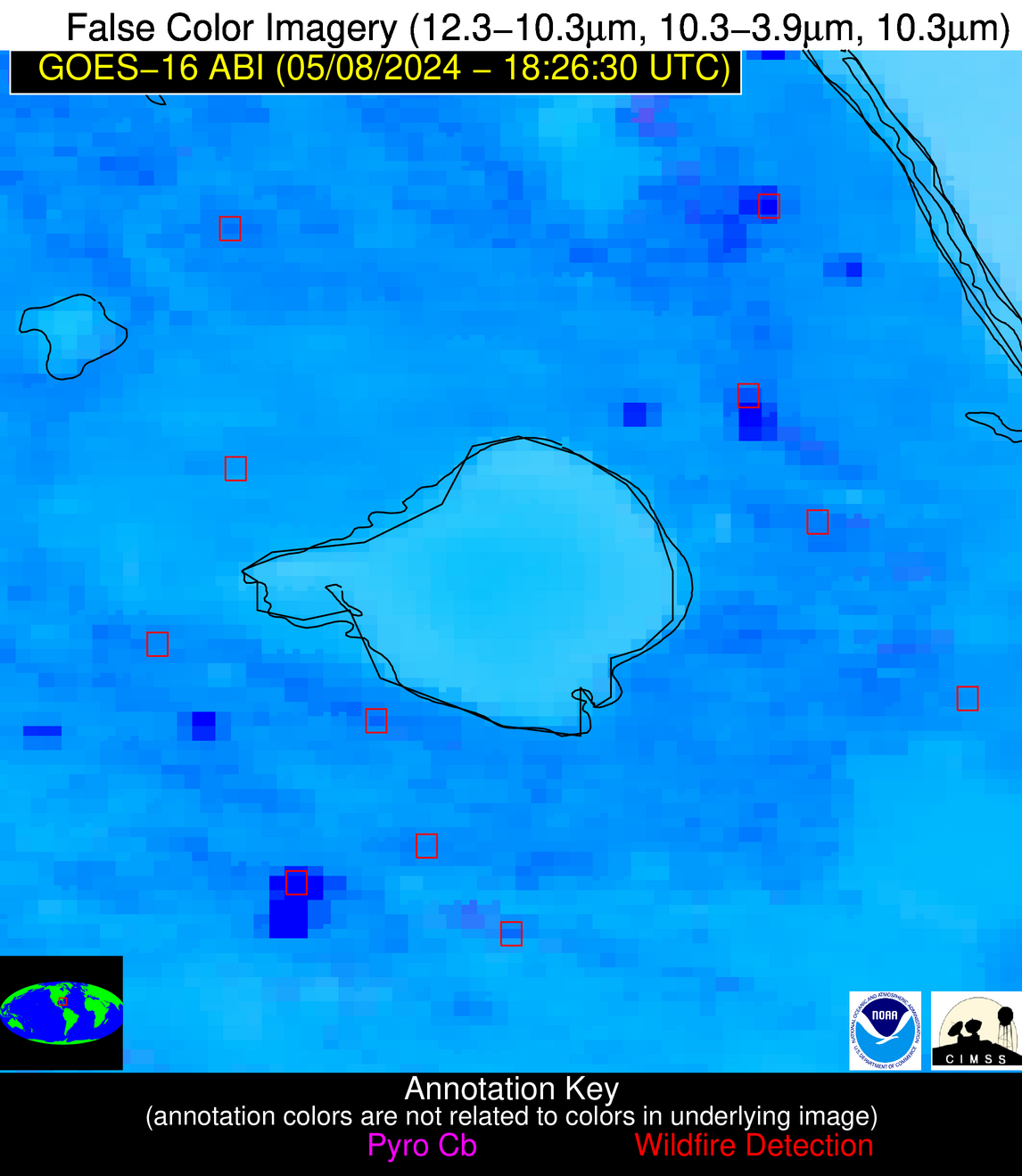
| Latest Satellite Imagery: | |
| View all event imagery » | |
Possible Wildfire
| Basic Information | |
|---|---|
| State/Province(s) | TX |
| Country/Countries | USA |
| County/Locality(s) | Duval County, TX |
| NWS WFO | Corpus Christi TX |
| Identification Method | Enhanced Contextual (Clear) |
| Mean Object Date/Time | 2024-05-08 18:27:49UTC |
| Radiative Center (Lat, Lon): | 27.490000°, -98.590000° |
| Nearby Counties (meeting alert criteria): |
|
| Total Radiative Power Anomaly | n/a |
| Total Radiative Power | 138.22 MW |
| Map: | |
| Additional Information | |
| Alert Status | New Feature |
| Type of Event | Nominal Risk |
| Event Priority Ranking | 4 |
| Maximum Observed BT (3.9 um) | 319.67 K |
| Observed - Background BT (3.9 um) | 11.55 K |
| BT Anomaly (3.9 um) | 6.57 K |
| Maximum Observed - Clear RTM BT (3.9 um) | 8.62 K |
| Maximum Observed BTD (3.9-10/11/12 um) | 27.63 K |
| Observed - Background BTD (3.9-10/11/12 um) | 11.46 K |
| BTD Anomaly (3.9-10/11/12 um) | 6.82 K |
| Similar Pixel Count | 6 |
| BT Time Tendency (3.9 um) | 1.50 K |
| Image Interval | 5.00 minutes |
| Fraction of Surrounding LWIR Pixels that are Colder | 0.68 |
| Fraction of Surrounding Red Channel Pixels that are Brighter | 1.00 |
| Maximum Radiative Power | 138.22 MW |
| Maximum Radiative Power Uncertainty | 0.00 MW |
| Total Radiative Power Uncertainty | 0.00 MW |
| Mean Viewing Angle | 41.40° |
| Mean Solar Zenith Angle | 10.40° |
| Mean Glint Angle | 50.00° |
| Water Fraction | 0.00 |
| Total Pixel Area | 6.00 km2 |
| Latest Satellite Imagery: | |
| View all event imagery » | |
Possible Wildfire
| Basic Information | |
|---|---|
| State/Province(s) | FL |
| Country/Countries | USA |
| County/Locality(s) | Hendry County, FL |
| NWS WFO | Miami FL |
| Identification Method | Enhanced Contextual (Bias) |
| Mean Object Date/Time | 2024-05-08 18:27:52UTC |
| Radiative Center (Lat, Lon): | 26.430000°, -81.040000° |
| Nearby Counties (meeting alert criteria): |
|
| Total Radiative Power Anomaly | n/a |
| Total Radiative Power | 5156.50 MW |
| Map: | |
| Additional Information | |
| Alert Status | New Feature |
| Type of Event | Nominal Risk |
| Event Priority Ranking | 4 |
| Maximum Observed BT (3.9 um) | 408.46 K |
| Observed - Background BT (3.9 um) | 96.21 K |
| BT Anomaly (3.9 um) | 31.44 K |
| Maximum Observed - Clear RTM BT (3.9 um) | 100.48 K |
| Maximum Observed BTD (3.9-10/11/12 um) | 109.01 K |
| Observed - Background BTD (3.9-10/11/12 um) | 94.33 K |
| BTD Anomaly (3.9-10/11/12 um) | 41.26 K |
| Similar Pixel Count | 0 |
| BT Time Tendency (3.9 um) | 87.90 K |
| Image Interval | 5.00 minutes |
| Fraction of Surrounding LWIR Pixels that are Colder | 0.87 |
| Fraction of Surrounding Red Channel Pixels that are Brighter | 0.00 |
| Maximum Radiative Power | 1621.30 MW |
| Maximum Radiative Power Uncertainty | 0.00 MW |
| Total Radiative Power Uncertainty | 0.00 MW |
| Mean Viewing Angle | 31.70° |
| Mean Solar Zenith Angle | 17.90° |
| Mean Glint Angle | 39.80° |
| Water Fraction | 0.00 |
| Total Pixel Area | 84.30 km2 |
| Latest Satellite Imagery: | |
| View all event imagery » | |


