Wildfire Alert Report
| Date: | 2024-04-22 |
|---|---|
| Time: | 00:11:17 |
| Production Date and Time: | 2024-04-22 00:16:09 UTC |
| Primary Instrument: | GOES-16 ABI |
| Wmo Spacecraft Id: | 152 |
| Location/orbit: | GEO |
| L1 File: | OR_ABI-L1b-RadC-M6C14_G16_s20241130011171_e20241130013544_c20241130014035.nc |
| L1 File(s) - Temporal | OR_ABI-L1b-RadC-M6C14_G16_s20241130006171_e20241130008544_c20241130009014.nc |
| Number Of Thermal Anomaly Alerts: | 2 |
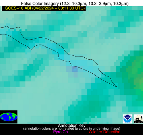
Possible Wildfire
| Basic Information | |
|---|---|
| State/Province(s) | AL |
| Country/Countries | USA |
| County/Locality(s) | Morgan County, AL |
| NWS WFO | Huntsville AL |
| Identification Method | Enhanced Contextual (Clear) |
| Mean Object Date/Time | 2024-04-22 00:12:21UTC |
| Radiative Center (Lat, Lon): | 34.650000°, -87.080000° |
| Nearby Counties (meeting alert criteria): |
|
| Total Radiative Power Anomaly | n/a |
| Total Radiative Power | 10.51 MW |
| Map: | |
| Additional Information | |
| Alert Status | New Feature |
| Type of Event | Ferrous-metal |
| Event Priority Ranking | 5 |
| Maximum Observed BT (3.9 um) | 290.86 K |
| Observed - Background BT (3.9 um) | 7.79 K |
| BT Anomaly (3.9 um) | 7.00 K |
| Maximum Observed - Clear RTM BT (3.9 um) | 11.59 K |
| Maximum Observed BTD (3.9-10/11/12 um) | 9.44 K |
| Observed - Background BTD (3.9-10/11/12 um) | 6.34 K |
| BTD Anomaly (3.9-10/11/12 um) | 8.11 K |
| Similar Pixel Count | 1 |
| BT Time Tendency (3.9 um) | 4.50 K |
| Image Interval | 5.00 minutes |
| Fraction of Surrounding LWIR Pixels that are Colder | 0.97 |
| Fraction of Surrounding Red Channel Pixels that are Brighter | 0.99 |
| Maximum Radiative Power | 10.51 MW |
| Maximum Radiative Power Uncertainty | 0.00 MW |
| Total Radiative Power Uncertainty | 0.00 MW |
| Mean Viewing Angle | 42.40° |
| Mean Solar Zenith Angle | 88.10° |
| Mean Glint Angle | 66.40° |
| Water Fraction | 0.00 |
| Total Pixel Area | 6.00 km2 |
| Latest Satellite Imagery: | |
| View all event imagery » | |
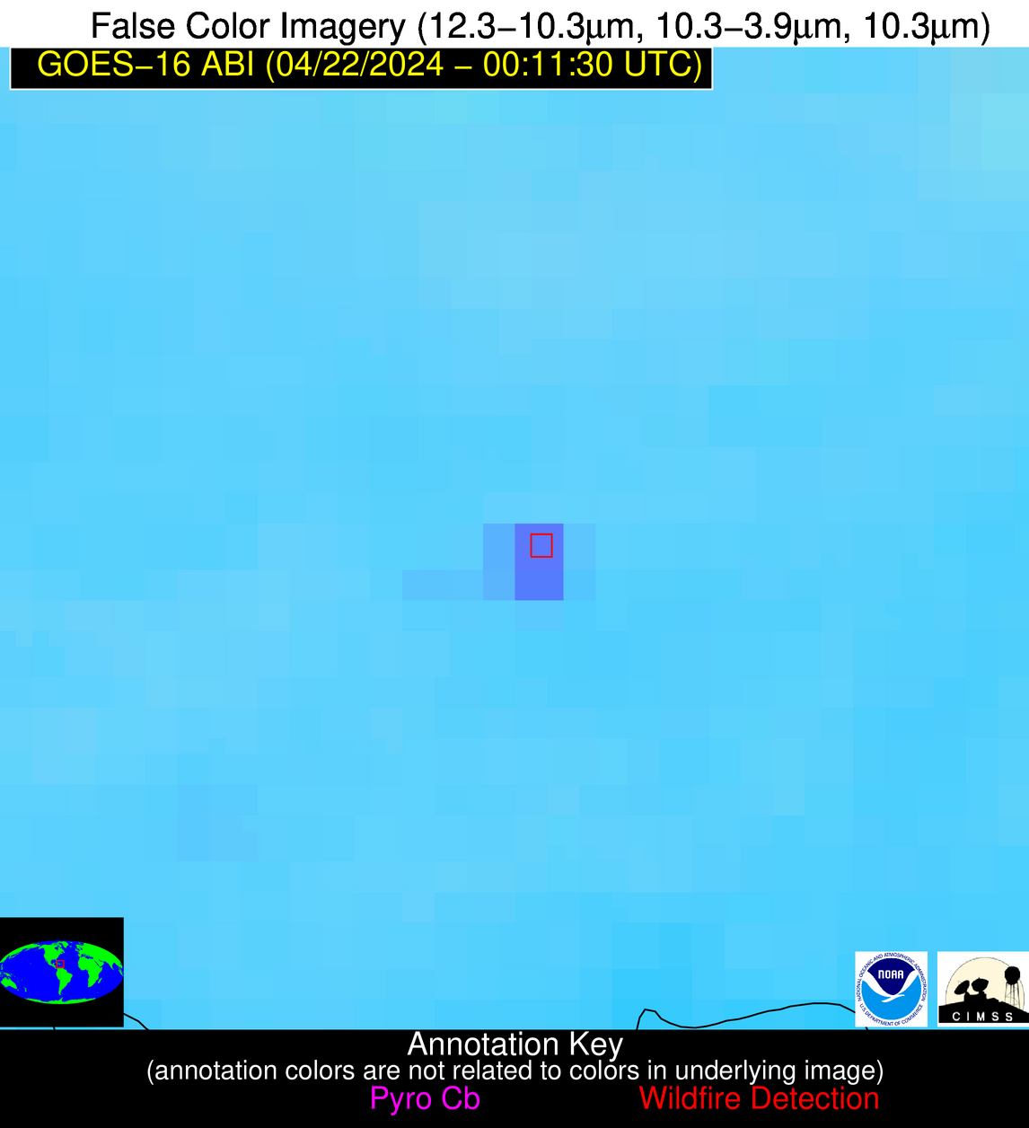
Possible Wildfire
| Basic Information | |
|---|---|
| State/Province(s) | Unknown |
| Country/Countries | Dominican Republic |
| County/Locality(s) | Dominican Republic |
| NWS WFO | N/A |
| Identification Method | Enhanced Contextual (Cloud) |
| Mean Object Date/Time | 2024-04-22 00:13:53UTC |
| Radiative Center (Lat, Lon): | 18.700000°, -69.370000° |
| Nearby Counties (meeting alert criteria): |
|
| Total Radiative Power Anomaly | n/a |
| Total Radiative Power | 58.88 MW |
| Map: | |
| Additional Information | |
| Alert Status | New Feature |
| Type of Event | Nominal Risk |
| Event Priority Ranking | 4 |
| Maximum Observed BT (3.9 um) | 306.60 K |
| Observed - Background BT (3.9 um) | 12.54 K |
| BT Anomaly (3.9 um) | 26.67 K |
| Maximum Observed - Clear RTM BT (3.9 um) | 12.76 K |
| Maximum Observed BTD (3.9-10/11/12 um) | 16.14 K |
| Observed - Background BTD (3.9-10/11/12 um) | 12.27 K |
| BTD Anomaly (3.9-10/11/12 um) | 37.37 K |
| Similar Pixel Count | 0 |
| BT Time Tendency (3.9 um) | 12.30 K |
| Image Interval | 5.00 minutes |
| Fraction of Surrounding LWIR Pixels that are Colder | 0.83 |
| Fraction of Surrounding Red Channel Pixels that are Brighter | 1.00 |
| Maximum Radiative Power | 30.13 MW |
| Maximum Radiative Power Uncertainty | 0.00 MW |
| Total Radiative Power Uncertainty | 0.00 MW |
| Mean Viewing Angle | 23.00° |
| Mean Solar Zenith Angle | 107.90° |
| Mean Glint Angle | 105.50° |
| Water Fraction | 0.00 |
| Total Pixel Area | 9.00 km2 |
| Latest Satellite Imagery: | |
| View all event imagery » | |


