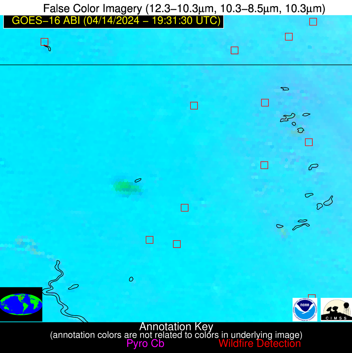
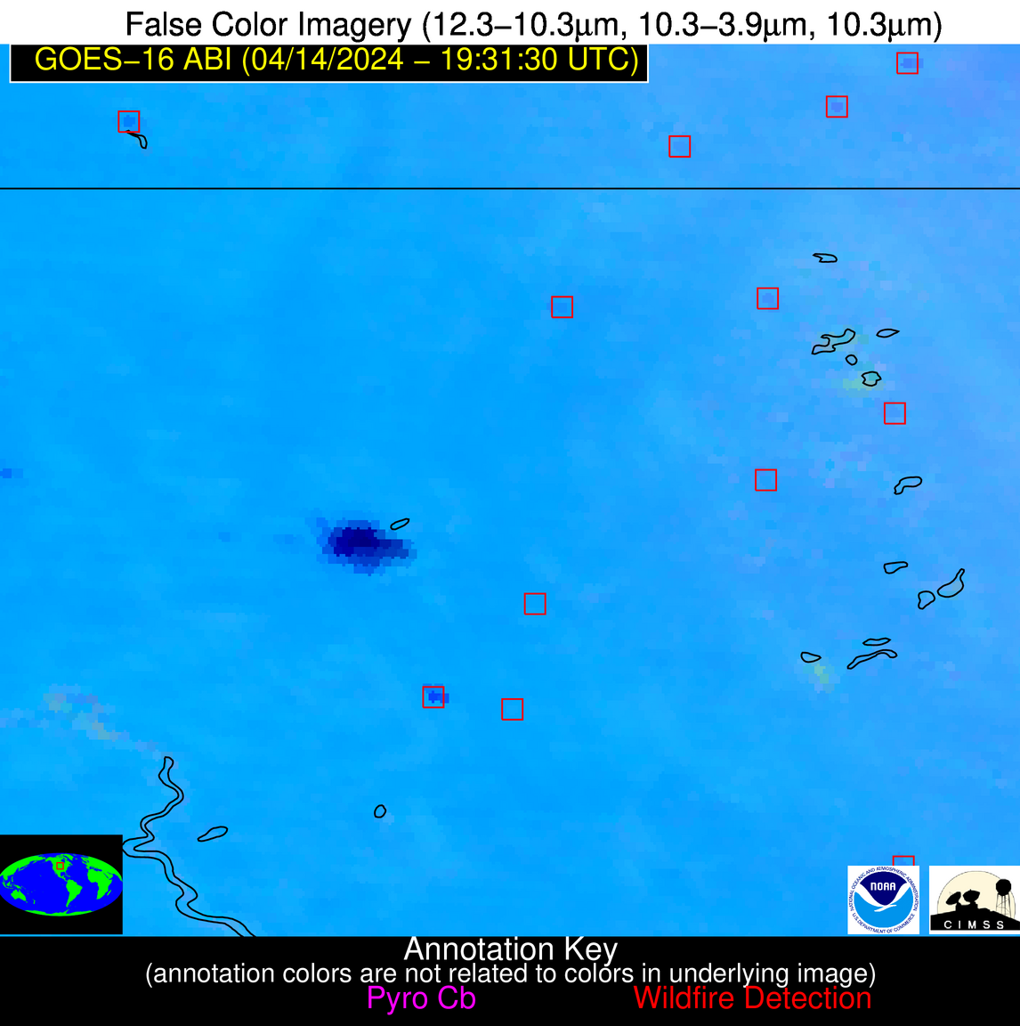
Please consider accessing NGFS detections and satellite imagery through the NOAA/NESDIS Wildland Fire Data Portal: https://fire.data.nesdis.noaa.gov/map/
Wildfire Notification Report
| Date: | 2024-04-14 |
|---|---|
| Time: | 19:31:17 |
| Production Date and Time: | 2024-04-14 19:36:05 UTC |
| Primary Instrument: | GOES-16 ABI |
| Wmo Spacecraft Id: | 152 |
| Location/orbit: | GEO |
| L1 File: | OR_ABI-L1b-RadC-M6C14_G16_s20241051931173_e20241051933546_c20241051934057.nc |
| L1 File(s) - Temporal | OR_ABI-L1b-RadC-M6C14_G16_s20241051926173_e20241051928546_c20241051929034.nc |
| Number Of Thermal Anomaly Notifications: | 8 |
Possible Wildfire
| Basic Information | |
|---|---|
| State/Province(s) | ND |
| Country/Countries | USA |
| County/Locality(s) | McIntosh County, ND |
| NWS WFO | Bismarck ND |
| Identification Method | Enhanced Contextual (Clear) |
| Mean Object Date/Time | 2024-04-14 19:31:20UTC |
| Radiative Center (Lat, Lon): | 46.160000°, -99.460000° |
| Nearby Counties (meeting notification criteria): |
|
| Total Radiative Power Anomaly | n/a |
| Total Radiative Power | 31.98 MW |
| Map: | |
| Additional Information | |
| Notification Status | New Feature |
| Type of Event | Nominal Risk |
| Event Priority Ranking | 4 |
| Maximum Observed BT (3.9 um) | 310.75 K |
| Observed - Background BT (3.9 um) | 4.55 K |
| BT Anomaly (3.9 um) | 3.64 K |
| Maximum Observed - Clear RTM BT (3.9 um) | 17.97 K |
| Maximum Observed BTD (3.9-10/11/12 um) | 17.19 K |
| Observed - Background BTD (3.9-10/11/12 um) | 5.28 K |
| BTD Anomaly (3.9-10/11/12 um) | 9.64 K |
| Similar Pixel Count | 16 |
| BT Time Tendency (3.9 um) | 5.60 K |
| Image Interval | 5.00 minutes |
| Fraction of Surrounding LWIR Pixels that are Colder | 0.24 |
| Fraction of Surrounding Red Channel Pixels that are Brighter | 1.00 |
| Maximum Radiative Power | 31.98 MW |
| Maximum Radiative Power Uncertainty | 0.00 MW |
| Total Radiative Power Uncertainty | 0.00 MW |
| Mean Viewing Angle | 58.60° |
| Mean Solar Zenith Angle | 38.50° |
| Mean Glint Angle | 84.70° |
| Water Fraction | 0.00 |
| Total Pixel Area | 9.70 km2 |
| Latest Satellite Imagery: | |
| View all event imagery » | |
Possible Wildfire
| Basic Information | |
|---|---|
| State/Province(s) | SD |
| Country/Countries | USA |
| County/Locality(s) | Day County, SD |
| NWS WFO | Aberdeen SD |
| Identification Method | Enhanced Contextual (Clear) |
| Mean Object Date/Time | 2024-04-14 19:31:20UTC |
| Radiative Center (Lat, Lon): | 45.560000°, -97.610000° |
| Nearby Counties (meeting notification criteria): |
|
| Total Radiative Power Anomaly | n/a |
| Total Radiative Power | 17.21 MW |
| Map: | |
| Additional Information | |
| Notification Status | New Feature |
| Type of Event | Nominal Risk |
| Event Priority Ranking | 4 |
| Maximum Observed BT (3.9 um) | 304.79 K |
| Observed - Background BT (3.9 um) | 2.80 K |
| BT Anomaly (3.9 um) | 1.52 K |
| Maximum Observed - Clear RTM BT (3.9 um) | 12.70 K |
| Maximum Observed BTD (3.9-10/11/12 um) | 12.88 K |
| Observed - Background BTD (3.9-10/11/12 um) | 3.33 K |
| BTD Anomaly (3.9-10/11/12 um) | 4.36 K |
| Similar Pixel Count | 25 |
| BT Time Tendency (3.9 um) | 1.90 K |
| Image Interval | 5.00 minutes |
| Fraction of Surrounding LWIR Pixels that are Colder | 0.22 |
| Fraction of Surrounding Red Channel Pixels that are Brighter | 1.00 |
| Maximum Radiative Power | 17.21 MW |
| Maximum Radiative Power Uncertainty | 0.00 MW |
| Total Radiative Power Uncertainty | 0.00 MW |
| Mean Viewing Angle | 57.30° |
| Mean Solar Zenith Angle | 38.40° |
| Mean Glint Angle | 83.00° |
| Water Fraction | 0.00 |
| Total Pixel Area | 9.20 km2 |
| Latest Satellite Imagery: | |
| View all event imagery » | |
Possible Wildfire
| Basic Information | |
|---|---|
| State/Province(s) | SD |
| Country/Countries | USA |
| County/Locality(s) | McCook County, SD |
| NWS WFO | Sioux Falls SD |
| Identification Method | Enhanced Contextual (Clear) |
| Mean Object Date/Time | 2024-04-14 19:31:20UTC |
| Radiative Center (Lat, Lon): | 43.620000°, -97.220000° |
| Nearby Counties (meeting notification criteria): |
|
| Total Radiative Power Anomaly | n/a |
| Total Radiative Power | 31.40 MW |
| Map: | |
| Additional Information | |
| Notification Status | New Feature |
| Type of Event | Nominal Risk |
| Event Priority Ranking | 4 |
| Maximum Observed BT (3.9 um) | 313.85 K |
| Observed - Background BT (3.9 um) | 3.64 K |
| BT Anomaly (3.9 um) | 3.22 K |
| Maximum Observed - Clear RTM BT (3.9 um) | 20.30 K |
| Maximum Observed BTD (3.9-10/11/12 um) | 14.38 K |
| Observed - Background BTD (3.9-10/11/12 um) | 2.97 K |
| BTD Anomaly (3.9-10/11/12 um) | 6.20 K |
| Similar Pixel Count | 25 |
| BT Time Tendency (3.9 um) | 2.50 K |
| Image Interval | 5.00 minutes |
| Fraction of Surrounding LWIR Pixels that are Colder | 0.82 |
| Fraction of Surrounding Red Channel Pixels that are Brighter | 1.00 |
| Maximum Radiative Power | 15.80 MW |
| Maximum Radiative Power Uncertainty | 0.00 MW |
| Total Radiative Power Uncertainty | 0.00 MW |
| Mean Viewing Angle | 55.30° |
| Mean Solar Zenith Angle | 36.80° |
| Mean Glint Angle | 79.30° |
| Water Fraction | 0.00 |
| Total Pixel Area | 17.20 km2 |
| Latest Satellite Imagery: | |
| View all event imagery » | |
Possible Wildfire
| Basic Information | |
|---|---|
| State/Province(s) | IA |
| Country/Countries | USA |
| County/Locality(s) | Jackson County, IA |
| NWS WFO | Quad Cities IL |
| Identification Method | Enhanced Contextual (Clear) |
| Mean Object Date/Time | 2024-04-14 19:31:51UTC |
| Radiative Center (Lat, Lon): | 42.240000°, -90.670000° |
| Nearby Counties (meeting notification criteria): |
|
| Total Radiative Power Anomaly | n/a |
| Total Radiative Power | 33.48 MW |
| Map: | |
| Additional Information | |
| Notification Status | New Feature |
| Type of Event | Nominal Risk |
| Event Priority Ranking | 4 |
| Maximum Observed BT (3.9 um) | 315.06 K |
| Observed - Background BT (3.9 um) | 6.56 K |
| BT Anomaly (3.9 um) | 3.77 K |
| Maximum Observed - Clear RTM BT (3.9 um) | 20.84 K |
| Maximum Observed BTD (3.9-10/11/12 um) | 16.80 K |
| Observed - Background BTD (3.9-10/11/12 um) | 6.51 K |
| BTD Anomaly (3.9-10/11/12 um) | 6.93 K |
| Similar Pixel Count | 8 |
| BT Time Tendency (3.9 um) | 4.40 K |
| Image Interval | 5.00 minutes |
| Fraction of Surrounding LWIR Pixels that are Colder | 0.61 |
| Fraction of Surrounding Red Channel Pixels that are Brighter | 0.96 |
| Maximum Radiative Power | 33.48 MW |
| Maximum Radiative Power Uncertainty | 0.00 MW |
| Total Radiative Power Uncertainty | 0.00 MW |
| Mean Viewing Angle | 51.50° |
| Mean Solar Zenith Angle | 38.10° |
| Mean Glint Angle | 75.90° |
| Water Fraction | 0.00 |
| Total Pixel Area | 7.40 km2 |
| Latest Satellite Imagery: | |
| View all event imagery » | |
Possible Wildfire
| Basic Information | |
|---|---|
| State/Province(s) | OR |
| Country/Countries | USA |
| County/Locality(s) | Harney County, OR |
| NWS WFO | Boise ID |
| Identification Method | Enhanced Contextual (Cloud) |
| Mean Object Date/Time | 2024-04-14 19:31:48UTC |
| Radiative Center (Lat, Lon): | 43.040000°, -119.920000° |
| Nearby Counties (meeting notification criteria): |
|
| Total Radiative Power Anomaly | n/a |
| Total Radiative Power | 802.82 MW |
| Map: | |
| Additional Information | |
| Notification Status | New Feature |
| Type of Event | Nominal Risk |
| Event Priority Ranking | 4 |
| Maximum Observed BT (3.9 um) | 299.01 K |
| Observed - Background BT (3.9 um) | 25.81 K |
| BT Anomaly (3.9 um) | 4.90 K |
| Maximum Observed - Clear RTM BT (3.9 um) | 17.21 K |
| Maximum Observed BTD (3.9-10/11/12 um) | 37.18 K |
| Observed - Background BTD (3.9-10/11/12 um) | 26.03 K |
| BTD Anomaly (3.9-10/11/12 um) | 5.53 K |
| Similar Pixel Count | 0 |
| BT Time Tendency (3.9 um) | 5.90 K |
| Image Interval | 5.00 minutes |
| Fraction of Surrounding LWIR Pixels that are Colder | 0.52 |
| Fraction of Surrounding Red Channel Pixels that are Brighter | 0.56 |
| Maximum Radiative Power | 414.91 MW |
| Maximum Radiative Power Uncertainty | 0.00 MW |
| Total Radiative Power Uncertainty | 0.00 MW |
| Mean Viewing Angle | 67.10° |
| Mean Solar Zenith Angle | 34.20° |
| Mean Glint Angle | 93.30° |
| Water Fraction | 0.00 |
| Total Pixel Area | 35.00 km2 |
| Latest Satellite Imagery: | |
| View all event imagery » | |
Possible Wildfire
| Basic Information | |
|---|---|
| State/Province(s) | KS |
| Country/Countries | USA |
| County/Locality(s) | Shawnee County, KS |
| NWS WFO | Topeka KS |
| Identification Method | Enhanced Contextual (Clear) |
| Mean Object Date/Time | 2024-04-14 19:31:50UTC |
| Radiative Center (Lat, Lon): | 39.200000°, -95.660000° |
| Nearby Counties (meeting notification criteria): |
|
| Total Radiative Power Anomaly | n/a |
| Total Radiative Power | 14.61 MW |
| Map: | |
| Additional Information | |
| Notification Status | New Feature |
| Type of Event | Nominal Risk |
| Event Priority Ranking | 4 |
| Maximum Observed BT (3.9 um) | 313.28 K |
| Observed - Background BT (3.9 um) | 2.36 K |
| BT Anomaly (3.9 um) | 1.27 K |
| Maximum Observed - Clear RTM BT (3.9 um) | 12.75 K |
| Maximum Observed BTD (3.9-10/11/12 um) | 14.66 K |
| Observed - Background BTD (3.9-10/11/12 um) | 2.57 K |
| BTD Anomaly (3.9-10/11/12 um) | 3.03 K |
| Similar Pixel Count | 25 |
| BT Time Tendency (3.9 um) | 1.70 K |
| Image Interval | 5.00 minutes |
| Fraction of Surrounding LWIR Pixels that are Colder | 0.40 |
| Fraction of Surrounding Red Channel Pixels that are Brighter | 1.00 |
| Maximum Radiative Power | 14.61 MW |
| Maximum Radiative Power Uncertainty | 0.00 MW |
| Total Radiative Power Uncertainty | 0.00 MW |
| Mean Viewing Angle | 50.30° |
| Mean Solar Zenith Angle | 33.50° |
| Mean Glint Angle | 70.40° |
| Water Fraction | 0.00 |
| Total Pixel Area | 7.40 km2 |
| Latest Satellite Imagery: | |
| View all event imagery » | |
Possible Wildfire
| Basic Information | |
|---|---|
| State/Province(s) | KS |
| Country/Countries | USA |
| County/Locality(s) | Osage County, KS |
| NWS WFO | Topeka KS |
| Identification Method | Enhanced Contextual (Clear) |
| Mean Object Date/Time | 2024-04-14 19:31:50UTC |
| Radiative Center (Lat, Lon): | 38.850000°, -95.640000° |
| Nearby Counties (meeting notification criteria): |
|
| Total Radiative Power Anomaly | n/a |
| Total Radiative Power | 23.76 MW |
| Map: | |
| Additional Information | |
| Notification Status | New Feature |
| Type of Event | Nominal Risk |
| Event Priority Ranking | 4 |
| Maximum Observed BT (3.9 um) | 315.35 K |
| Observed - Background BT (3.9 um) | 3.08 K |
| BT Anomaly (3.9 um) | 2.46 K |
| Maximum Observed - Clear RTM BT (3.9 um) | 15.18 K |
| Maximum Observed BTD (3.9-10/11/12 um) | 14.73 K |
| Observed - Background BTD (3.9-10/11/12 um) | 2.64 K |
| BTD Anomaly (3.9-10/11/12 um) | 4.50 K |
| Similar Pixel Count | 25 |
| BT Time Tendency (3.9 um) | 0.90 K |
| Image Interval | 5.00 minutes |
| Fraction of Surrounding LWIR Pixels that are Colder | 0.73 |
| Fraction of Surrounding Red Channel Pixels that are Brighter | 1.00 |
| Maximum Radiative Power | 12.97 MW |
| Maximum Radiative Power Uncertainty | 0.00 MW |
| Total Radiative Power Uncertainty | 0.00 MW |
| Mean Viewing Angle | 50.00° |
| Mean Solar Zenith Angle | 33.20° |
| Mean Glint Angle | 69.80° |
| Water Fraction | 0.00 |
| Total Pixel Area | 14.60 km2 |
| Latest Satellite Imagery: | |
| View all event imagery » | |
Possible Wildfire
| Basic Information | |
|---|---|
| State/Province(s) | OK |
| Country/Countries | USA |
| County/Locality(s) | Craig County, OK |
| NWS WFO | Tulsa OK |
| Identification Method | Enhanced Contextual (Clear) |
| Mean Object Date/Time | 2024-04-14 19:31:50UTC |
| Radiative Center (Lat, Lon): | 36.980000°, -95.380000° |
| Nearby Counties (meeting notification criteria): |
|
| Total Radiative Power Anomaly | n/a |
| Total Radiative Power | 21.43 MW |
| Map: | |
| Additional Information | |
| Notification Status | New Feature |
| Type of Event | Nominal Risk |
| Event Priority Ranking | 4 |
| Maximum Observed BT (3.9 um) | 311.22 K |
| Observed - Background BT (3.9 um) | 5.27 K |
| BT Anomaly (3.9 um) | 3.84 K |
| Maximum Observed - Clear RTM BT (3.9 um) | 15.35 K |
| Maximum Observed BTD (3.9-10/11/12 um) | 13.60 K |
| Observed - Background BTD (3.9-10/11/12 um) | 4.73 K |
| BTD Anomaly (3.9-10/11/12 um) | 7.16 K |
| Similar Pixel Count | 6 |
| BT Time Tendency (3.9 um) | 3.10 K |
| Image Interval | 5.00 minutes |
| Fraction of Surrounding LWIR Pixels that are Colder | 0.81 |
| Fraction of Surrounding Red Channel Pixels that are Brighter | 1.00 |
| Maximum Radiative Power | 21.43 MW |
| Maximum Radiative Power Uncertainty | 0.00 MW |
| Total Radiative Power Uncertainty | 0.00 MW |
| Mean Viewing Angle | 48.10° |
| Mean Solar Zenith Angle | 31.80° |
| Mean Glint Angle | 66.00° |
| Water Fraction | 0.00 |
| Total Pixel Area | 6.90 km2 |
| Latest Satellite Imagery: | |
| View all event imagery » | |

