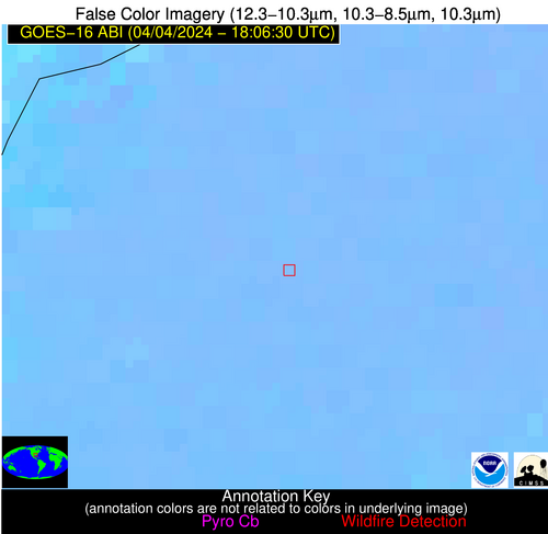
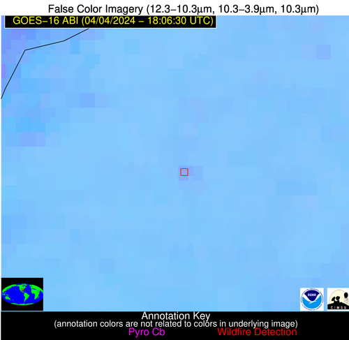
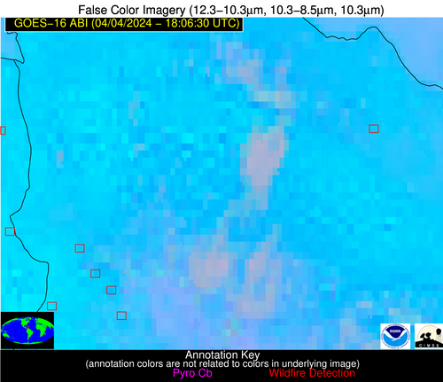
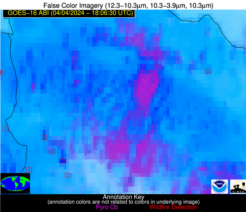
Wildfire Alert Report
| Date: | 2024-04-04 |
|---|---|
| Time: | 18:06:17 |
| Production Date and Time: | 2024-04-04 18:11:10 UTC |
| Primary Instrument: | GOES-16 ABI |
| Wmo Spacecraft Id: | 152 |
| Location/orbit: | GEO |
| L1 File: | OR_ABI-L1b-RadC-M6C14_G16_s20240951806171_e20240951808544_c20240951809034.nc |
| L1 File(s) - Temporal | OR_ABI-L1b-RadC-M6C14_G16_s20240951801171_e20240951803543_c20240951804043.nc |
| Number Of Thermal Anomaly Alerts: | 9 |
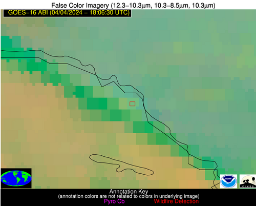
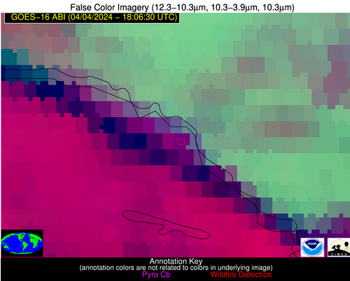
Possible Wildfire
| Basic Information | |
|---|---|
| State/Province(s) | MI |
| Country/Countries | USA |
| County/Locality(s) | Marquette County, MI |
| NWS WFO | Marquette MI |
| Identification Method | Enhanced Contextual (Cloud) |
| Mean Object Date/Time | 2024-04-04 18:06:21UTC |
| Radiative Center (Lat, Lon): | 46.770000°, -87.630000° |
| Nearby Counties (meeting alert criteria): |
|
| Total Radiative Power Anomaly | n/a |
| Total Radiative Power | 60.12 MW |
| Map: | |
| Additional Information | |
| Alert Status | New Feature |
| Type of Event | Nominal Risk |
| Event Priority Ranking | 4 |
| Maximum Observed BT (3.9 um) | 298.13 K |
| Observed - Background BT (3.9 um) | 20.74 K |
| BT Anomaly (3.9 um) | 5.14 K |
| Maximum Observed - Clear RTM BT (3.9 um) | 27.31 K |
| Maximum Observed BTD (3.9-10/11/12 um) | 31.94 K |
| Observed - Background BTD (3.9-10/11/12 um) | 21.76 K |
| BTD Anomaly (3.9-10/11/12 um) | 4.75 K |
| Similar Pixel Count | 0 |
| BT Time Tendency (3.9 um) | 8.50 K |
| Image Interval | 5.00 minutes |
| Fraction of Surrounding LWIR Pixels that are Colder | 0.52 |
| Fraction of Surrounding Red Channel Pixels that are Brighter | 0.47 |
| Maximum Radiative Power | 60.12 MW |
| Maximum Radiative Power Uncertainty | 0.00 MW |
| Total Radiative Power Uncertainty | 0.00 MW |
| Mean Viewing Angle | 55.40° |
| Mean Solar Zenith Angle | 41.20° |
| Mean Glint Angle | 94.40° |
| Water Fraction | 0.00 |
| Total Pixel Area | 8.20 km2 |
| Latest Satellite Imagery: | |
| View all event imagery » | |
Possible Wildfire
| Basic Information | |
|---|---|
| State/Province(s) | NE |
| Country/Countries | USA |
| County/Locality(s) | Keya Paha County, NE |
| NWS WFO | North Platte NE |
| Identification Method | Enhanced Contextual (Clear) |
| Mean Object Date/Time | 2024-04-04 18:06:50UTC |
| Radiative Center (Lat, Lon): | 42.870000°, -99.300000° |
| Nearby Counties (meeting alert criteria): |
|
| Total Radiative Power Anomaly | n/a |
| Total Radiative Power | 9.28 MW |
| Map: | |
| Additional Information | |
| Alert Status | New Feature |
| Type of Event | Nominal Risk |
| Event Priority Ranking | 4 |
| Maximum Observed BT (3.9 um) | 304.06 K |
| Observed - Background BT (3.9 um) | 2.05 K |
| BT Anomaly (3.9 um) | 1.52 K |
| Maximum Observed - Clear RTM BT (3.9 um) | 16.24 K |
| Maximum Observed BTD (3.9-10/11/12 um) | 11.14 K |
| Observed - Background BTD (3.9-10/11/12 um) | 2.08 K |
| BTD Anomaly (3.9-10/11/12 um) | 3.13 K |
| Similar Pixel Count | 25 |
| BT Time Tendency (3.9 um) | 1.70 K |
| Image Interval | 5.00 minutes |
| Fraction of Surrounding LWIR Pixels that are Colder | 0.50 |
| Fraction of Surrounding Red Channel Pixels that are Brighter | 1.00 |
| Maximum Radiative Power | 9.28 MW |
| Maximum Radiative Power Uncertainty | 0.00 MW |
| Total Radiative Power Uncertainty | 0.00 MW |
| Mean Viewing Angle | 55.40° |
| Mean Solar Zenith Angle | 37.90° |
| Mean Glint Angle | 91.70° |
| Water Fraction | 0.00 |
| Total Pixel Area | 8.70 km2 |
| Latest Satellite Imagery: | |
| View all event imagery » | |
Possible Wildfire
| Basic Information | |
|---|---|
| State/Province(s) | NE |
| Country/Countries | USA |
| County/Locality(s) | Garfield County, NE |
| NWS WFO | North Platte NE |
| Identification Method | Enhanced Contextual (Clear) |
| Mean Object Date/Time | 2024-04-04 18:06:50UTC |
| Radiative Center (Lat, Lon): | 41.970000°, -98.770000° |
| Nearby Counties (meeting alert criteria): |
|
| Total Radiative Power Anomaly | n/a |
| Total Radiative Power | 9.21 MW |
| Map: | |
| Additional Information | |
| Alert Status | New Feature |
| Type of Event | Nominal Risk |
| Event Priority Ranking | 4 |
| Maximum Observed BT (3.9 um) | 305.08 K |
| Observed - Background BT (3.9 um) | 1.84 K |
| BT Anomaly (3.9 um) | 1.24 K |
| Maximum Observed - Clear RTM BT (3.9 um) | 17.40 K |
| Maximum Observed BTD (3.9-10/11/12 um) | 11.93 K |
| Observed - Background BTD (3.9-10/11/12 um) | 2.11 K |
| BTD Anomaly (3.9-10/11/12 um) | 4.49 K |
| Similar Pixel Count | 25 |
| BT Time Tendency (3.9 um) | 1.90 K |
| Image Interval | 5.00 minutes |
| Fraction of Surrounding LWIR Pixels that are Colder | 0.50 |
| Fraction of Surrounding Red Channel Pixels that are Brighter | 1.00 |
| Maximum Radiative Power | 9.21 MW |
| Maximum Radiative Power Uncertainty | 0.00 MW |
| Total Radiative Power Uncertainty | 0.00 MW |
| Mean Viewing Angle | 54.40° |
| Mean Solar Zenith Angle | 37.00° |
| Mean Glint Angle | 89.70° |
| Water Fraction | 0.00 |
| Total Pixel Area | 8.40 km2 |
| Latest Satellite Imagery: | |
| View all event imagery » | |
Possible Wildfire
| Basic Information | |
|---|---|
| State/Province(s) | KS |
| Country/Countries | USA |
| County/Locality(s) | Butler County, KS |
| NWS WFO | Wichita KS |
| Identification Method | Enhanced Contextual (Clear) |
| Mean Object Date/Time | 2024-04-04 18:06:50UTC |
| Radiative Center (Lat, Lon): | 38.000000°, -96.850000° |
| Nearby Counties (meeting alert criteria): |
|
| Total Radiative Power Anomaly | n/a |
| Total Radiative Power | 32.76 MW |
| Map: | |
| Additional Information | |
| Alert Status | New Feature |
| Type of Event | Nominal Risk |
| Event Priority Ranking | 4 |
| Maximum Observed BT (3.9 um) | 313.25 K |
| Observed - Background BT (3.9 um) | 8.33 K |
| BT Anomaly (3.9 um) | 2.74 K |
| Maximum Observed - Clear RTM BT (3.9 um) | 24.31 K |
| Maximum Observed BTD (3.9-10/11/12 um) | 17.70 K |
| Observed - Background BTD (3.9-10/11/12 um) | 7.70 K |
| BTD Anomaly (3.9-10/11/12 um) | 2.67 K |
| Similar Pixel Count | 4 |
| BT Time Tendency (3.9 um) | 7.50 K |
| Image Interval | 5.00 minutes |
| Fraction of Surrounding LWIR Pixels that are Colder | 0.86 |
| Fraction of Surrounding Red Channel Pixels that are Brighter | 1.00 |
| Maximum Radiative Power | 32.76 MW |
| Maximum Radiative Power Uncertainty | 0.00 MW |
| Total Radiative Power Uncertainty | 0.00 MW |
| Mean Viewing Angle | 49.80° |
| Mean Solar Zenith Angle | 32.80° |
| Mean Glint Angle | 80.80° |
| Water Fraction | 0.00 |
| Total Pixel Area | 7.30 km2 |
| Latest Satellite Imagery: | |
| View all event imagery » | |
Possible Wildfire
| Basic Information | |
|---|---|
| State/Province(s) | OK |
| Country/Countries | USA |
| County/Locality(s) | Alfalfa County, OK |
| NWS WFO | Norman OK |
| Identification Method | Enhanced Contextual (Clear) |
| Mean Object Date/Time | 2024-04-04 18:06:50UTC |
| Radiative Center (Lat, Lon): | 36.540000°, -98.530000° |
| Nearby Counties (meeting alert criteria): |
|
| Total Radiative Power Anomaly | n/a |
| Total Radiative Power | 22.27 MW |
| Map: | |
| Additional Information | |
| Alert Status | New Feature |
| Type of Event | Nominal Risk |
| Event Priority Ranking | 4 |
| Maximum Observed BT (3.9 um) | 309.91 K |
| Observed - Background BT (3.9 um) | 3.15 K |
| BT Anomaly (3.9 um) | 1.98 K |
| Maximum Observed - Clear RTM BT (3.9 um) | 18.40 K |
| Maximum Observed BTD (3.9-10/11/12 um) | 12.99 K |
| Observed - Background BTD (3.9-10/11/12 um) | 2.88 K |
| BTD Anomaly (3.9-10/11/12 um) | 4.93 K |
| Similar Pixel Count | 22 |
| BT Time Tendency (3.9 um) | 1.10 K |
| Image Interval | 5.00 minutes |
| Fraction of Surrounding LWIR Pixels that are Colder | 0.60 |
| Fraction of Surrounding Red Channel Pixels that are Brighter | 1.00 |
| Maximum Radiative Power | 12.08 MW |
| Maximum Radiative Power Uncertainty | 0.00 MW |
| Total Radiative Power Uncertainty | 0.00 MW |
| Mean Viewing Angle | 49.30° |
| Mean Solar Zenith Angle | 31.70° |
| Mean Glint Angle | 79.40° |
| Water Fraction | 0.00 |
| Total Pixel Area | 14.50 km2 |
| Latest Satellite Imagery: | |
| View all event imagery » | |
Possible Wildfire
| Basic Information | |
|---|---|
| State/Province(s) | TX |
| Country/Countries | USA |
| County/Locality(s) | Van Zandt County, TX |
| NWS WFO | Fort Worth TX |
| Identification Method | Enhanced Contextual (Clear) |
| Mean Object Date/Time | 2024-04-04 18:07:20UTC |
| Radiative Center (Lat, Lon): | 32.440000°, -95.940000° |
| Nearby Counties (meeting alert criteria): |
|
| Total Radiative Power Anomaly | n/a |
| Total Radiative Power | 7.33 MW |
| Map: | |
| Additional Information | |
| Alert Status | New Feature |
| Type of Event | Nominal Risk |
| Event Priority Ranking | 4 |
| Maximum Observed BT (3.9 um) | 305.88 K |
| Observed - Background BT (3.9 um) | 3.21 K |
| BT Anomaly (3.9 um) | 2.42 K |
| Maximum Observed - Clear RTM BT (3.9 um) | 12.07 K |
| Maximum Observed BTD (3.9-10/11/12 um) | 9.28 K |
| Observed - Background BTD (3.9-10/11/12 um) | 2.63 K |
| BTD Anomaly (3.9-10/11/12 um) | 3.94 K |
| Similar Pixel Count | 24 |
| BT Time Tendency (3.9 um) | 0.60 K |
| Image Interval | 5.00 minutes |
| Fraction of Surrounding LWIR Pixels that are Colder | 0.81 |
| Fraction of Surrounding Red Channel Pixels that are Brighter | 1.00 |
| Maximum Radiative Power | 7.33 MW |
| Maximum Radiative Power Uncertainty | 0.00 MW |
| Total Radiative Power Uncertainty | 0.00 MW |
| Mean Viewing Angle | 44.10° |
| Mean Solar Zenith Angle | 27.20° |
| Mean Glint Angle | 69.60° |
| Water Fraction | 0.00 |
| Total Pixel Area | 6.30 km2 |
| Latest Satellite Imagery: | |
| View all event imagery » | |
Possible Wildfire
| Basic Information | |
|---|---|
| State/Province(s) | MS |
| Country/Countries | USA |
| County/Locality(s) | Jefferson County, MS |
| NWS WFO | Jackson MS |
| Identification Method | Enhanced Contextual (Clear) |
| Mean Object Date/Time | 2024-04-04 18:07:20UTC |
| Radiative Center (Lat, Lon): | 31.660000°, -91.060000° |
| Nearby Counties (meeting alert criteria): |
|
| Total Radiative Power Anomaly | n/a |
| Total Radiative Power | 8.97 MW |
| Map: | |
| Additional Information | |
| Alert Status | New Feature |
| Type of Event | Nominal Risk |
| Event Priority Ranking | 4 |
| Maximum Observed BT (3.9 um) | 301.16 K |
| Observed - Background BT (3.9 um) | 3.08 K |
| BT Anomaly (3.9 um) | 3.96 K |
| Maximum Observed - Clear RTM BT (3.9 um) | 10.21 K |
| Maximum Observed BTD (3.9-10/11/12 um) | 7.83 K |
| Observed - Background BTD (3.9-10/11/12 um) | 3.26 K |
| BTD Anomaly (3.9-10/11/12 um) | 9.11 K |
| Similar Pixel Count | 4 |
| BT Time Tendency (3.9 um) | 0.90 K |
| Image Interval | 5.00 minutes |
| Fraction of Surrounding LWIR Pixels that are Colder | 0.38 |
| Fraction of Surrounding Red Channel Pixels that are Brighter | 1.00 |
| Maximum Radiative Power | 8.97 MW |
| Maximum Radiative Power Uncertainty | 0.00 MW |
| Total Radiative Power Uncertainty | 0.00 MW |
| Mean Viewing Angle | 40.90° |
| Mean Solar Zenith Angle | 26.00° |
| Mean Glint Angle | 64.80° |
| Water Fraction | 0.00 |
| Total Pixel Area | 5.80 km2 |
| Latest Satellite Imagery: | |
| View all event imagery » | |
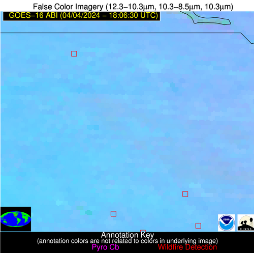
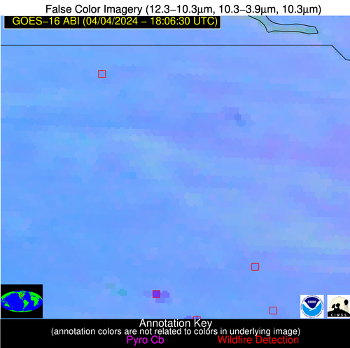
Possible Wildfire
| Basic Information | |
|---|---|
| State/Province(s) | Unknown |
| Country/Countries | Dominican Republic |
| County/Locality(s) | Dominican Republic |
| NWS WFO | N/A |
| Identification Method | Enhanced Contextual (Clear) |
| Mean Object Date/Time | 2024-04-04 18:08:23UTC |
| Radiative Center (Lat, Lon): | 19.540000°, -70.460000° |
| Nearby Counties (meeting alert criteria): |
|
| Total Radiative Power Anomaly | n/a |
| Total Radiative Power | 23.48 MW |
| Map: | |
| Additional Information | |
| Alert Status | New Feature |
| Type of Event | Nominal Risk |
| Event Priority Ranking | 4 |
| Maximum Observed BT (3.9 um) | 314.15 K |
| Observed - Background BT (3.9 um) | 4.92 K |
| BT Anomaly (3.9 um) | 2.28 K |
| Maximum Observed - Clear RTM BT (3.9 um) | 3.99 K |
| Maximum Observed BTD (3.9-10/11/12 um) | 15.73 K |
| Observed - Background BTD (3.9-10/11/12 um) | 4.75 K |
| BTD Anomaly (3.9-10/11/12 um) | 2.57 K |
| Similar Pixel Count | 12 |
| BT Time Tendency (3.9 um) | 4.00 K |
| Image Interval | 5.00 minutes |
| Fraction of Surrounding LWIR Pixels that are Colder | 0.56 |
| Fraction of Surrounding Red Channel Pixels that are Brighter | 1.00 |
| Maximum Radiative Power | 23.48 MW |
| Maximum Radiative Power Uncertainty | 0.00 MW |
| Total Radiative Power Uncertainty | 0.00 MW |
| Mean Viewing Angle | 23.70° |
| Mean Solar Zenith Angle | 24.20° |
| Mean Glint Angle | 44.20° |
| Water Fraction | 0.00 |
| Total Pixel Area | 4.50 km2 |
| Latest Satellite Imagery: | |
| View all event imagery » | |
Possible Wildfire
| Basic Information | |
|---|---|
| State/Province(s) | Unknown |
| Country/Countries | Dominican Republic |
| County/Locality(s) | Dominican Republic |
| NWS WFO | N/A |
| Identification Method | Enhanced Contextual (Clear) |
| Mean Object Date/Time | 2024-04-04 18:08:53UTC |
| Radiative Center (Lat, Lon): | 19.260000°, -71.520000° |
| Nearby Counties (meeting alert criteria): |
|
| Total Radiative Power Anomaly | n/a |
| Total Radiative Power | 58.99 MW |
| Map: | |
| Additional Information | |
| Alert Status | New Feature |
| Type of Event | Nominal Risk |
| Event Priority Ranking | 4 |
| Maximum Observed BT (3.9 um) | 322.85 K |
| Observed - Background BT (3.9 um) | 10.60 K |
| BT Anomaly (3.9 um) | 3.38 K |
| Maximum Observed - Clear RTM BT (3.9 um) | 14.09 K |
| Maximum Observed BTD (3.9-10/11/12 um) | 24.13 K |
| Observed - Background BTD (3.9-10/11/12 um) | 10.75 K |
| BTD Anomaly (3.9-10/11/12 um) | 4.16 K |
| Similar Pixel Count | 6 |
| BT Time Tendency (3.9 um) | 6.40 K |
| Image Interval | 5.00 minutes |
| Fraction of Surrounding LWIR Pixels that are Colder | 0.34 |
| Fraction of Surrounding Red Channel Pixels that are Brighter | 0.20 |
| Maximum Radiative Power | 58.99 MW |
| Maximum Radiative Power Uncertainty | 0.00 MW |
| Total Radiative Power Uncertainty | 0.00 MW |
| Mean Viewing Angle | 23.10° |
| Mean Solar Zenith Angle | 23.20° |
| Mean Glint Angle | 42.50° |
| Water Fraction | 0.00 |
| Total Pixel Area | 4.50 km2 |
| Latest Satellite Imagery: | |
| View all event imagery » | |
