Wildfire Alert Report
| Date: | 2024-03-28 |
|---|---|
| Time: | 22:06:15 |
| Production Date and Time: | 2024-03-28 22:13:39 UTC |
| Primary Instrument: | GOES-16 ABI |
| Wmo Spacecraft Id: | 152 |
| Location/orbit: | GEO |
| L1 File: | OR_ABI-L1b-RadC-M6C14_G16_s20240882206153_e20240882208526_c20240882209004.nc |
| L1 File(s) - Temporal | OR_ABI-L1b-RadC-M6C14_G16_s20240882201153_e20240882203526_c20240882204029.nc |
| Number Of Thermal Anomaly Alerts: | 3 |
Possible Wildfire
| Basic Information | |
|---|---|
| State/Province(s) | MO |
| Country/Countries | USA |
| County/Locality(s) | Sullivan County, MO |
| NWS WFO | Kansas City/Pleasant Hill MO |
| Identification Method | Enhanced Contextual (Clear) |
| Mean Object Date/Time | 2024-03-28 22:06:49UTC |
| Radiative Center (Lat, Lon): | 40.040000°, -92.860000° |
| Nearby Counties (meeting alert criteria): |
|
| Total Radiative Power Anomaly | n/a |
| Total Radiative Power | 15.38 MW |
| Map: | |
| Additional Information | |
| Alert Status | New Feature |
| Type of Event | Nominal Risk |
| Event Priority Ranking | 4 |
| Maximum Observed BT (3.9 um) | 297.63 K |
| Observed - Background BT (3.9 um) | 5.42 K |
| BT Anomaly (3.9 um) | 5.97 K |
| Maximum Observed - Clear RTM BT (3.9 um) | 15.16 K |
| Maximum Observed BTD (3.9-10/11/12 um) | 11.42 K |
| Observed - Background BTD (3.9-10/11/12 um) | 5.51 K |
| BTD Anomaly (3.9-10/11/12 um) | 9.56 K |
| Similar Pixel Count | 2 |
| BT Time Tendency (3.9 um) | 2.20 K |
| Image Interval | 5.00 minutes |
| Fraction of Surrounding LWIR Pixels that are Colder | 0.49 |
| Fraction of Surrounding Red Channel Pixels that are Brighter | 1.00 |
| Maximum Radiative Power | 15.38 MW |
| Maximum Radiative Power Uncertainty | 0.00 MW |
| Total Radiative Power Uncertainty | 0.00 MW |
| Mean Viewing Angle | 50.00° |
| Mean Solar Zenith Angle | 63.60° |
| Mean Glint Angle | 68.80° |
| Water Fraction | 0.00 |
| Total Pixel Area | 7.20 km2 |
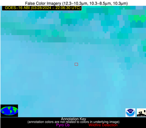
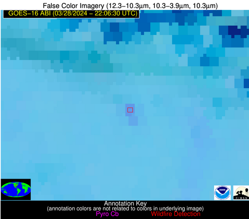
| Latest Satellite Imagery: | |
| View all event imagery » | |
Possible Wildfire
| Basic Information | |
|---|---|
| State/Province(s) | OK |
| Country/Countries | USA |
| County/Locality(s) | Garfield County, OK |
| NWS WFO | Norman OK |
| Identification Method | Enhanced Contextual (Clear) |
| Mean Object Date/Time | 2024-03-28 22:06:48UTC |
| Radiative Center (Lat, Lon): | 36.550000°, -98.080000° |
| Nearby Counties (meeting alert criteria): |
|
| Total Radiative Power Anomaly | n/a |
| Total Radiative Power | 12.57 MW |
| Map: | |
| Additional Information | |
| Alert Status | New Feature |
| Type of Event | Nominal Risk |
| Event Priority Ranking | 4 |
| Maximum Observed BT (3.9 um) | 299.49 K |
| Observed - Background BT (3.9 um) | 5.10 K |
| BT Anomaly (3.9 um) | 4.17 K |
| Maximum Observed - Clear RTM BT (3.9 um) | 13.61 K |
| Maximum Observed BTD (3.9-10/11/12 um) | 9.80 K |
| Observed - Background BTD (3.9-10/11/12 um) | 4.45 K |
| BTD Anomaly (3.9-10/11/12 um) | 6.16 K |
| Similar Pixel Count | 2 |
| BT Time Tendency (3.9 um) | 0.80 K |
| Image Interval | 5.00 minutes |
| Fraction of Surrounding LWIR Pixels that are Colder | 0.83 |
| Fraction of Surrounding Red Channel Pixels that are Brighter | 1.00 |
| Maximum Radiative Power | 12.57 MW |
| Maximum Radiative Power Uncertainty | 0.00 MW |
| Total Radiative Power Uncertainty | 0.00 MW |
| Mean Viewing Angle | 49.00° |
| Mean Solar Zenith Angle | 58.50° |
| Mean Glint Angle | 60.80° |
| Water Fraction | 0.00 |
| Total Pixel Area | 7.20 km2 |
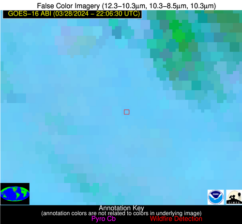
| Latest Satellite Imagery: | |
| View all event imagery » | |
Possible Wildfire
| Basic Information | |
|---|---|
| State/Province(s) | CA |
| Country/Countries | USA |
| County/Locality(s) | Monterey County, CA |
| NWS WFO | San Francisco CA |
| Identification Method | Enhanced Contextual (Clear) |
| Mean Object Date/Time | 2024-03-28 22:07:16UTC |
| Radiative Center (Lat, Lon): | 36.110000°, -121.200000° |
| Nearby Counties (meeting alert criteria): |
|
| Total Radiative Power Anomaly | n/a |
| Total Radiative Power | 73.99 MW |
| Map: | |
| Additional Information | |
| Alert Status | New Feature |
| Type of Event | Nominal Risk |
| Event Priority Ranking | 4 |
| Maximum Observed BT (3.9 um) | 292.01 K |
| Observed - Background BT (3.9 um) | 14.20 K |
| BT Anomaly (3.9 um) | 6.82 K |
| Maximum Observed - Clear RTM BT (3.9 um) | 7.59 K |
| Maximum Observed BTD (3.9-10/11/12 um) | 34.13 K |
| Observed - Background BTD (3.9-10/11/12 um) | 13.48 K |
| BTD Anomaly (3.9-10/11/12 um) | 6.00 K |
| Similar Pixel Count | 11 |
| BT Time Tendency (3.9 um) | 9.70 K |
| Image Interval | 5.00 minutes |
| Fraction of Surrounding LWIR Pixels that are Colder | 0.51 |
| Fraction of Surrounding Red Channel Pixels that are Brighter | 0.90 |
| Maximum Radiative Power | 73.99 MW |
| Maximum Radiative Power Uncertainty | 0.00 MW |
| Total Radiative Power Uncertainty | 0.00 MW |
| Mean Viewing Angle | 64.10° |
| Mean Solar Zenith Angle | 42.70° |
| Mean Glint Angle | 60.60° |
| Water Fraction | 0.00 |
| Total Pixel Area | 14.50 km2 |
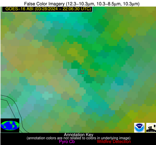
| Latest Satellite Imagery: | |
| View all event imagery » | |


