Wildfire Alert Report
| Date: | 2024-03-22 |
|---|---|
| Time: | 00:01:15 |
| Production Date and Time: | 2024-03-22 00:06:14 UTC |
| Primary Instrument: | GOES-16 ABI |
| Wmo Spacecraft Id: | 152 |
| Location/orbit: | GEO |
| L1 File: | OR_ABI-L1b-RadC-M6C14_G16_s20240820001152_e20240820003525_c20240820004013.nc |
| L1 File(s) - Temporal | OR_ABI-L1b-RadC-M6C14_G16_s20240812351152_e20240812353525_c20240812353597.nc |
| Number Of Thermal Anomaly Alerts: | 6 |
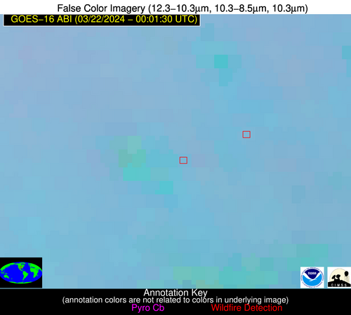
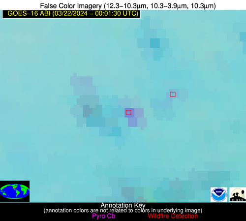
Possible Wildfire
| Basic Information | |
|---|---|
| State/Province(s) | IN |
| Country/Countries | USA |
| County/Locality(s) | DeKalb County, IN |
| NWS WFO | Northern Indiana IN |
| Identification Method | Enhanced Contextual (Clear) |
| Mean Object Date/Time | 2024-03-22 00:01:49UTC |
| Radiative Center (Lat, Lon): | 41.360000°, -84.920000° |
| Nearby Counties (meeting alert criteria): |
|
| Total Radiative Power Anomaly | n/a |
| Total Radiative Power | 4.85 MW |
| Map: | |
| Additional Information | |
| Alert Status | New Feature |
| Type of Event | Ferrous-metal |
| Event Priority Ranking | 5 |
| Maximum Observed BT (3.9 um) | 273.82 K |
| Observed - Background BT (3.9 um) | 5.34 K |
| BT Anomaly (3.9 um) | 5.93 K |
| Maximum Observed - Clear RTM BT (3.9 um) | 5.46 K |
| Maximum Observed BTD (3.9-10/11/12 um) | 5.02 K |
| Observed - Background BTD (3.9-10/11/12 um) | 4.73 K |
| BTD Anomaly (3.9-10/11/12 um) | 13.45 K |
| Similar Pixel Count | 1 |
| BT Time Tendency (3.9 um) | 0.30 K |
| Image Interval | 10.00 minutes |
| Fraction of Surrounding LWIR Pixels that are Colder | 0.86 |
| Fraction of Surrounding Red Channel Pixels that are Brighter | 1.00 |
| Maximum Radiative Power | 4.85 MW |
| Maximum Radiative Power Uncertainty | 0.00 MW |
| Total Radiative Power Uncertainty | 0.00 MW |
| Mean Viewing Angle | 49.10° |
| Mean Solar Zenith Angle | 92.40° |
| Mean Glint Angle | 78.50° |
| Water Fraction | 0.00 |
| Total Pixel Area | 6.90 km2 |
| Latest Satellite Imagery: | |
| View all event imagery » | |
Possible Wildfire
| Basic Information | |
|---|---|
| State/Province(s) | OH |
| Country/Countries | USA |
| County/Locality(s) | Darke County, OH |
| NWS WFO | Wilmington OH |
| Identification Method | Enhanced Contextual (Clear) |
| Mean Object Date/Time | 2024-03-22 00:01:49UTC |
| Radiative Center (Lat, Lon): | 40.300000°, -84.460000° |
| Nearby Counties (meeting alert criteria): |
|
| Total Radiative Power Anomaly | n/a |
| Total Radiative Power | 4.41 MW |
| Map: | |
| Additional Information | |
| Alert Status | New Feature |
| Type of Event | Nominal Risk |
| Event Priority Ranking | 4 |
| Maximum Observed BT (3.9 um) | 273.24 K |
| Observed - Background BT (3.9 um) | 3.98 K |
| BT Anomaly (3.9 um) | 6.44 K |
| Maximum Observed - Clear RTM BT (3.9 um) | 3.73 K |
| Maximum Observed BTD (3.9-10/11/12 um) | 4.13 K |
| Observed - Background BTD (3.9-10/11/12 um) | 4.15 K |
| BTD Anomaly (3.9-10/11/12 um) | 15.30 K |
| Similar Pixel Count | 1 |
| BT Time Tendency (3.9 um) | 3.00 K |
| Image Interval | 10.00 minutes |
| Fraction of Surrounding LWIR Pixels that are Colder | 0.32 |
| Fraction of Surrounding Red Channel Pixels that are Brighter | 1.00 |
| Maximum Radiative Power | 4.41 MW |
| Maximum Radiative Power Uncertainty | 0.00 MW |
| Total Radiative Power Uncertainty | 0.00 MW |
| Mean Viewing Angle | 47.80° |
| Mean Solar Zenith Angle | 92.80° |
| Mean Glint Angle | 79.20° |
| Water Fraction | 0.00 |
| Total Pixel Area | 6.60 km2 |
| Latest Satellite Imagery: | |
| View all event imagery » | |
Possible Wildfire
| Basic Information | |
|---|---|
| State/Province(s) | IL |
| Country/Countries | USA |
| County/Locality(s) | Crawford County, IL |
| NWS WFO | Lincoln IL |
| Identification Method | Enhanced Contextual (Clear) |
| Mean Object Date/Time | 2024-03-22 00:01:49UTC |
| Radiative Center (Lat, Lon): | 39.040000°, -87.820000° |
| Nearby Counties (meeting alert criteria): |
|
| Total Radiative Power Anomaly | n/a |
| Total Radiative Power | 12.10 MW |
| Map: | |
| Additional Information | |
| Alert Status | New Feature |
| Type of Event | Nominal Risk |
| Event Priority Ranking | 4 |
| Maximum Observed BT (3.9 um) | 282.88 K |
| Observed - Background BT (3.9 um) | 8.61 K |
| BT Anomaly (3.9 um) | 9.08 K |
| Maximum Observed - Clear RTM BT (3.9 um) | 8.08 K |
| Maximum Observed BTD (3.9-10/11/12 um) | 10.62 K |
| Observed - Background BTD (3.9-10/11/12 um) | 9.62 K |
| BTD Anomaly (3.9-10/11/12 um) | 12.11 K |
| Similar Pixel Count | 1 |
| BT Time Tendency (3.9 um) | 4.70 K |
| Image Interval | 10.00 minutes |
| Fraction of Surrounding LWIR Pixels that are Colder | 0.31 |
| Fraction of Surrounding Red Channel Pixels that are Brighter | 1.00 |
| Maximum Radiative Power | 12.10 MW |
| Maximum Radiative Power Uncertainty | 0.00 MW |
| Total Radiative Power Uncertainty | 0.00 MW |
| Mean Viewing Angle | 47.30° |
| Mean Solar Zenith Angle | 90.30° |
| Mean Glint Angle | 75.20° |
| Water Fraction | 0.00 |
| Total Pixel Area | 6.60 km2 |
| Latest Satellite Imagery: | |
| View all event imagery » | |
Possible Wildfire
| Basic Information | |
|---|---|
| State/Province(s) | KS |
| Country/Countries | USA |
| County/Locality(s) | Marion County, KS |
| NWS WFO | Wichita KS |
| Identification Method | Enhanced Contextual (Clear) |
| Mean Object Date/Time | 2024-03-22 00:01:48UTC |
| Radiative Center (Lat, Lon): | 38.170000°, -97.070000° |
| Nearby Counties (meeting alert criteria): |
|
| Total Radiative Power Anomaly | n/a |
| Total Radiative Power | 24.74 MW |
| Map: | |
| Additional Information | |
| Alert Status | New Feature |
| Type of Event | Nominal Risk |
| Event Priority Ranking | 4 |
| Maximum Observed BT (3.9 um) | 296.45 K |
| Observed - Background BT (3.9 um) | 10.06 K |
| BT Anomaly (3.9 um) | 13.87 K |
| Maximum Observed - Clear RTM BT (3.9 um) | 11.47 K |
| Maximum Observed BTD (3.9-10/11/12 um) | 13.28 K |
| Observed - Background BTD (3.9-10/11/12 um) | 9.87 K |
| BTD Anomaly (3.9-10/11/12 um) | 11.49 K |
| Similar Pixel Count | 2 |
| BT Time Tendency (3.9 um) | 8.40 K |
| Image Interval | 10.00 minutes |
| Fraction of Surrounding LWIR Pixels that are Colder | 0.52 |
| Fraction of Surrounding Red Channel Pixels that are Brighter | 1.00 |
| Maximum Radiative Power | 24.74 MW |
| Maximum Radiative Power Uncertainty | 0.00 MW |
| Total Radiative Power Uncertainty | 0.00 MW |
| Mean Viewing Angle | 50.00° |
| Mean Solar Zenith Angle | 83.00° |
| Mean Glint Angle | 64.00° |
| Water Fraction | 0.00 |
| Total Pixel Area | 7.30 km2 |
| Latest Satellite Imagery: | |
| View all event imagery » | |
Possible Wildfire
| Basic Information | |
|---|---|
| State/Province(s) | KY |
| Country/Countries | USA |
| County/Locality(s) | Taylor County, KY |
| NWS WFO | Louisville KY |
| Identification Method | Enhanced Contextual (Clear) |
| Mean Object Date/Time | 2024-03-22 00:01:49UTC |
| Radiative Center (Lat, Lon): | 37.410000°, -85.450000° |
| Nearby Counties (meeting alert criteria): |
|
| Total Radiative Power Anomaly | n/a |
| Total Radiative Power | 11.11 MW |
| Map: | |
| Additional Information | |
| Alert Status | New Feature |
| Type of Event | Nominal Risk |
| Event Priority Ranking | 4 |
| Maximum Observed BT (3.9 um) | 284.78 K |
| Observed - Background BT (3.9 um) | 7.07 K |
| BT Anomaly (3.9 um) | 7.77 K |
| Maximum Observed - Clear RTM BT (3.9 um) | 9.19 K |
| Maximum Observed BTD (3.9-10/11/12 um) | 8.77 K |
| Observed - Background BTD (3.9-10/11/12 um) | 7.23 K |
| BTD Anomaly (3.9-10/11/12 um) | 16.16 K |
| Similar Pixel Count | 1 |
| BT Time Tendency (3.9 um) | 6.80 K |
| Image Interval | 10.00 minutes |
| Fraction of Surrounding LWIR Pixels that are Colder | 0.43 |
| Fraction of Surrounding Red Channel Pixels that are Brighter | 1.00 |
| Maximum Radiative Power | 11.11 MW |
| Maximum Radiative Power Uncertainty | 0.00 MW |
| Total Radiative Power Uncertainty | 0.00 MW |
| Mean Viewing Angle | 44.90° |
| Mean Solar Zenith Angle | 92.20° |
| Mean Glint Angle | 78.30° |
| Water Fraction | 0.00 |
| Total Pixel Area | 6.20 km2 |
| Latest Satellite Imagery: | |
| View all event imagery » | |
Possible Wildfire
| Basic Information | |
|---|---|
| State/Province(s) | Unknown |
| Country/Countries | Mexico |
| County/Locality(s) | Mexico |
| NWS WFO | N/A |
| Identification Method | Enhanced Contextual (Clear) |
| Mean Object Date/Time | 2024-03-22 00:02:47UTC |
| Radiative Center (Lat, Lon): | 25.410000°, -103.450000° |
| Nearby Counties (meeting alert criteria): |
|
| Total Radiative Power Anomaly | n/a |
| Total Radiative Power | 26.31 MW |
| Map: | |
| Additional Information | |
| Alert Status | New Feature |
| Type of Event | Nominal Risk |
| Event Priority Ranking | 4 |
| Maximum Observed BT (3.9 um) | 304.68 K |
| Observed - Background BT (3.9 um) | 5.40 K |
| BT Anomaly (3.9 um) | 6.85 K |
| Maximum Observed - Clear RTM BT (3.9 um) | 6.98 K |
| Maximum Observed BTD (3.9-10/11/12 um) | 8.20 K |
| Observed - Background BTD (3.9-10/11/12 um) | 4.64 K |
| BTD Anomaly (3.9-10/11/12 um) | 6.89 K |
| Similar Pixel Count | 2 |
| BT Time Tendency (3.9 um) | 3.40 K |
| Image Interval | 10.00 minutes |
| Fraction of Surrounding LWIR Pixels that are Colder | 0.86 |
| Fraction of Surrounding Red Channel Pixels that are Brighter | 0.76 |
| Maximum Radiative Power | 15.50 MW |
| Maximum Radiative Power Uncertainty | 0.00 MW |
| Total Radiative Power Uncertainty | 0.00 MW |
| Mean Viewing Angle | 43.40° |
| Mean Solar Zenith Angle | 76.40° |
| Mean Glint Angle | 49.70° |
| Water Fraction | 0.00 |
| Total Pixel Area | 12.60 km2 |
| Latest Satellite Imagery: | |
| View all event imagery » | |
