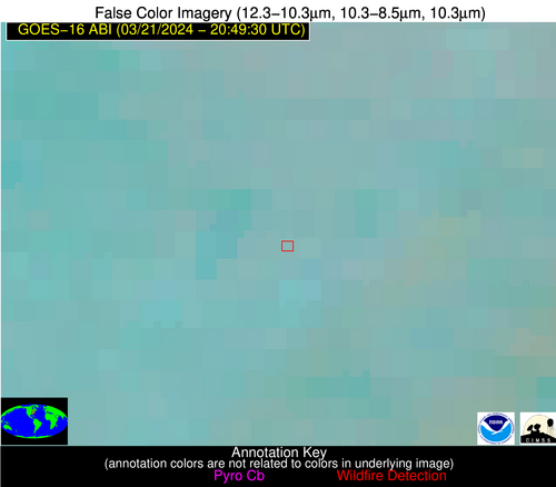
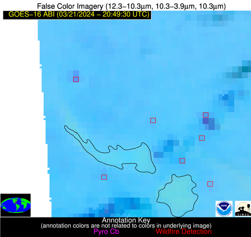
Wildfire Alert Report
| Date: | 2024-03-21 |
|---|---|
| Time: | 20:49:23 |
| Production Date and Time: | 2024-03-21 20:50:02 UTC |
| Primary Instrument: | GOES-16 ABI |
| Wmo Spacecraft Id: | 152 |
| Location/orbit: | GEO |
| L1 File: | OR_ABI-L1b-RadM1-M6C14_G16_s20240812049231_e20240812049288_c20240812049343.nc |
| L1 File(s) - Temporal | OR_ABI-L1b-RadM1-M6C14_G16_s20240812047231_e20240812047288_c20240812047342.nc |
| Number Of Thermal Anomaly Alerts: | 3 |
Possible Wildfire
| Basic Information | |
|---|---|
| State/Province(s) | PA |
| Country/Countries | USA |
| County/Locality(s) | Westmoreland County, PA |
| NWS WFO | Pittsburgh PA |
| Identification Method | Enhanced Contextual (Clear) |
| Mean Object Date/Time | 2024-03-21 20:49:24UTC |
| Radiative Center (Lat, Lon): | 40.360°, -79.400° |
| Nearby Counties (meeting alert criteria): |
|
| Total Radiative Power Anomaly | n/a |
| Total Radiative Power | 9.01 MW |
| Map: | |
| Additional Information | |
| Alert Status | New Feature |
| Type of Event | Nominal Risk |
| Event Priority Ranking | 4 |
| Maximum Observed BT (3.9 um) | 288.16 K |
| Observed - Background BT (3.9 um) | 5.27 K |
| BT Anomaly (3.9 um) | 5.83 K |
| Maximum Observed - Clear RTM BT (3.9 um) | 15.13 K |
| Maximum Observed BTD (3.9-10/11/12 um) | 10.89 K |
| Observed - Background BTD (3.9-10/11/12 um) | 4.77 K |
| BTD Anomaly (3.9-10/11/12 um) | 12.53 K |
| Similar Pixel Count | 1 |
| BT Time Tendency (3.9 um) | 2.30 K |
| Image Interval | 2.00 minutes |
| Fraction of Surrounding LWIR Pixels that are Colder | 0.73 |
| Fraction of Surrounding Red Channel Pixels that are Brighter | 1.00 |
| Maximum Radiative Power | 9.01 MW |
| Maximum Radiative Power Uncertainty | 0.00 MW |
| Total Radiative Power Uncertainty | 0.00 MW |
| Mean Viewing Angle | 47.10° |
| Mean Solar Zenith Angle | 61.30° |
| Mean Glint Angle | 84.40° |
| Water Fraction | 0.00 |
| Total Pixel Area | 6.50 km2 |
| Latest Satellite Imagery: | |
| View all event imagery » | |
Possible Wildfire
| Basic Information | |
|---|---|
| State/Province(s) | SC |
| Country/Countries | USA |
| County/Locality(s) | Sumter County, SC |
| NWS WFO | Columbia SC |
| Identification Method | Enhanced Contextual (Clear) |
| Mean Object Date/Time | 2024-03-21 20:49:27UTC |
| Radiative Center (Lat, Lon): | 33.790°, -80.490° |
| Nearby Counties (meeting alert criteria): |
|
| Total Radiative Power Anomaly | n/a |
| Total Radiative Power | 33.78 MW |
| Map: | |
| Additional Information | |
| Alert Status | New Feature |
| Type of Event | Nominal Risk |
| Event Priority Ranking | 4 |
| Maximum Observed BT (3.9 um) | 304.65 K |
| Observed - Background BT (3.9 um) | 6.89 K |
| BT Anomaly (3.9 um) | 4.59 K |
| Maximum Observed - Clear RTM BT (3.9 um) | 15.31 K |
| Maximum Observed BTD (3.9-10/11/12 um) | 12.55 K |
| Observed - Background BTD (3.9-10/11/12 um) | 6.94 K |
| BTD Anomaly (3.9-10/11/12 um) | 10.52 K |
| Similar Pixel Count | 2 |
| BT Time Tendency (3.9 um) | 4.40 K |
| Image Interval | 2.00 minutes |
| Fraction of Surrounding LWIR Pixels that are Colder | 0.41 |
| Fraction of Surrounding Red Channel Pixels that are Brighter | 0.89 |
| Maximum Radiative Power | 20.24 MW |
| Maximum Radiative Power Uncertainty | 0.00 MW |
| Total Radiative Power Uncertainty | 0.00 MW |
| Mean Viewing Angle | 39.90° |
| Mean Solar Zenith Angle | 57.60° |
| Mean Glint Angle | 74.50° |
| Water Fraction | 0.00 |
| Total Pixel Area | 11.30 km2 |
| Latest Satellite Imagery: | |
| View all event imagery » | |
Possible Wildfire
| Basic Information | |
|---|---|
| State/Province(s) | SC |
| Country/Countries | USA |
| County/Locality(s) | Berkeley County, SC |
| NWS WFO | Charleston SC |
| Identification Method | Enhanced Contextual (Clear) |
| Mean Object Date/Time | 2024-03-21 20:49:27UTC |
| Radiative Center (Lat, Lon): | 33.450°, -80.040° |
| Nearby Counties (meeting alert criteria): |
|
| Total Radiative Power Anomaly | n/a |
| Total Radiative Power | 7.25 MW |
| Map: | |
| Additional Information | |
| Alert Status | New Feature |
| Type of Event | Nominal Risk |
| Event Priority Ranking | 4 |
| Maximum Observed BT (3.9 um) | 298.53 K |
| Observed - Background BT (3.9 um) | 3.46 K |
| BT Anomaly (3.9 um) | 2.09 K |
| Maximum Observed - Clear RTM BT (3.9 um) | 8.49 K |
| Maximum Observed BTD (3.9-10/11/12 um) | 9.26 K |
| Observed - Background BTD (3.9-10/11/12 um) | 3.83 K |
| BTD Anomaly (3.9-10/11/12 um) | 3.49 K |
| Similar Pixel Count | 11 |
| BT Time Tendency (3.9 um) | 1.90 K |
| Image Interval | 2.00 minutes |
| Fraction of Surrounding LWIR Pixels that are Colder | 0.41 |
| Fraction of Surrounding Red Channel Pixels that are Brighter | 1.00 |
| Maximum Radiative Power | 7.25 MW |
| Maximum Radiative Power Uncertainty | 0.00 MW |
| Total Radiative Power Uncertainty | 0.00 MW |
| Mean Viewing Angle | 39.40° |
| Mean Solar Zenith Angle | 57.80° |
| Mean Glint Angle | 74.50° |
| Water Fraction | 0.00 |
| Total Pixel Area | 5.60 km2 |
| Latest Satellite Imagery: | |
| View all event imagery » | |


