Wildfire Alert Report
| Date: | 2024-03-19 |
|---|---|
| Time: | 22:06:17 |
| Production Date and Time: | 2024-03-19 22:14:26 UTC |
| Primary Instrument: | GOES-16 ABI |
| Wmo Spacecraft Id: | 152 |
| Location/orbit: | GEO |
| L1 File: | OR_ABI-L1b-RadC-M6C14_G16_s20240792206170_e20240792208543_c20240792209013.nc |
| L1 File(s) - Temporal | OR_ABI-L1b-RadC-M6C14_G16_s20240792201170_e20240792203543_c20240792204027.nc |
| Number Of Thermal Anomaly Alerts: | 10 |
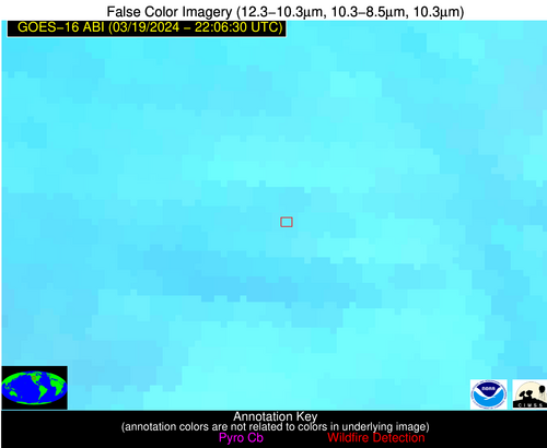
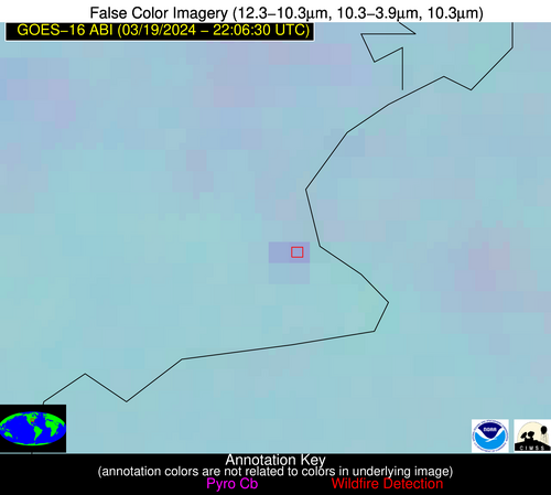
Possible Wildfire
| Basic Information | |
|---|---|
| State/Province(s) | WY |
| Country/Countries | USA |
| County/Locality(s) | Big Horn County, WY |
| NWS WFO | Riverton WY |
| Identification Method | Enhanced Contextual (Clear) |
| Mean Object Date/Time | 2024-03-19 22:06:19UTC |
| Radiative Center (Lat, Lon): | 44.480000°, -108.320000° |
| Nearby Counties (meeting alert criteria): |
|
| Total Radiative Power Anomaly | n/a |
| Total Radiative Power | 23.14 MW |
| Map: | |
| Additional Information | |
| Alert Status | New Feature |
| Type of Event | Nominal Risk |
| Event Priority Ranking | 4 |
| Maximum Observed BT (3.9 um) | 305.71 K |
| Observed - Background BT (3.9 um) | 4.53 K |
| BT Anomaly (3.9 um) | 5.61 K |
| Maximum Observed - Clear RTM BT (3.9 um) | 18.21 K |
| Maximum Observed BTD (3.9-10/11/12 um) | 12.69 K |
| Observed - Background BTD (3.9-10/11/12 um) | 4.60 K |
| BTD Anomaly (3.9-10/11/12 um) | 9.65 K |
| Similar Pixel Count | 11 |
| BT Time Tendency (3.9 um) | 3.10 K |
| Image Interval | 5.00 minutes |
| Fraction of Surrounding LWIR Pixels that are Colder | 0.47 |
| Fraction of Surrounding Red Channel Pixels that are Brighter | 1.00 |
| Maximum Radiative Power | 23.14 MW |
| Maximum Radiative Power Uncertainty | 0.00 MW |
| Total Radiative Power Uncertainty | 0.00 MW |
| Mean Viewing Angle | 61.30° |
| Mean Solar Zenith Angle | 58.10° |
| Mean Glint Angle | 72.20° |
| Water Fraction | 0.00 |
| Total Pixel Area | 11.60 km2 |
| Latest Satellite Imagery: | |
| View all event imagery » | |
Possible Wildfire
| Basic Information | |
|---|---|
| State/Province(s) | KS |
| Country/Countries | USA |
| County/Locality(s) | Smith County, KS |
| NWS WFO | Hastings NE |
| Identification Method | Enhanced Contextual (Clear) |
| Mean Object Date/Time | 2024-03-19 22:06:50UTC |
| Radiative Center (Lat, Lon): | 39.960000°, -98.730000° |
| Nearby Counties (meeting alert criteria): |
|
| Total Radiative Power Anomaly | n/a |
| Total Radiative Power | 57.04 MW |
| Map: | |
| Additional Information | |
| Alert Status | New Feature |
| Type of Event | Nominal Risk |
| Event Priority Ranking | 4 |
| Maximum Observed BT (3.9 um) | 305.47 K |
| Observed - Background BT (3.9 um) | 8.39 K |
| BT Anomaly (3.9 um) | 16.10 K |
| Maximum Observed - Clear RTM BT (3.9 um) | 18.43 K |
| Maximum Observed BTD (3.9-10/11/12 um) | 14.01 K |
| Observed - Background BTD (3.9-10/11/12 um) | 8.56 K |
| BTD Anomaly (3.9-10/11/12 um) | 25.39 K |
| Similar Pixel Count | 3 |
| BT Time Tendency (3.9 um) | 7.80 K |
| Image Interval | 5.00 minutes |
| Fraction of Surrounding LWIR Pixels that are Colder | 0.26 |
| Fraction of Surrounding Red Channel Pixels that are Brighter | 1.00 |
| Maximum Radiative Power | 31.07 MW |
| Maximum Radiative Power Uncertainty | 0.00 MW |
| Total Radiative Power Uncertainty | 0.00 MW |
| Mean Viewing Angle | 52.50° |
| Mean Solar Zenith Angle | 61.50° |
| Mean Glint Angle | 68.60° |
| Water Fraction | 0.00 |
| Total Pixel Area | 15.90 km2 |
| Latest Satellite Imagery: | |
| View all event imagery » | |
Possible Wildfire
| Basic Information | |
|---|---|
| State/Province(s) | KS |
| Country/Countries | USA |
| County/Locality(s) | Marshall County, KS |
| NWS WFO | Topeka KS |
| Identification Method | Enhanced Contextual (Clear) |
| Mean Object Date/Time | 2024-03-19 22:06:50UTC |
| Radiative Center (Lat, Lon): | 39.770000°, -96.400000° |
| Nearby Counties (meeting alert criteria): |
|
| Total Radiative Power Anomaly | n/a |
| Total Radiative Power | 23.43 MW |
| Map: | |
| Additional Information | |
| Alert Status | New Feature |
| Type of Event | Nominal Risk |
| Event Priority Ranking | 4 |
| Maximum Observed BT (3.9 um) | 300.96 K |
| Observed - Background BT (3.9 um) | 4.27 K |
| BT Anomaly (3.9 um) | 8.89 K |
| Maximum Observed - Clear RTM BT (3.9 um) | 15.62 K |
| Maximum Observed BTD (3.9-10/11/12 um) | 10.14 K |
| Observed - Background BTD (3.9-10/11/12 um) | 4.45 K |
| BTD Anomaly (3.9-10/11/12 um) | 14.96 K |
| Similar Pixel Count | 4 |
| BT Time Tendency (3.9 um) | 2.50 K |
| Image Interval | 5.00 minutes |
| Fraction of Surrounding LWIR Pixels that are Colder | 0.32 |
| Fraction of Surrounding Red Channel Pixels that are Brighter | 1.00 |
| Maximum Radiative Power | 23.43 MW |
| Maximum Radiative Power Uncertainty | 0.00 MW |
| Total Radiative Power Uncertainty | 0.00 MW |
| Mean Viewing Angle | 51.30° |
| Mean Solar Zenith Angle | 63.10° |
| Mean Glint Angle | 69.70° |
| Water Fraction | 0.00 |
| Total Pixel Area | 15.20 km2 |
| Latest Satellite Imagery: | |
| View all event imagery » | |
Possible Wildfire
| Basic Information | |
|---|---|
| State/Province(s) | KS |
| Country/Countries | USA |
| County/Locality(s) | Rice County, KS |
| NWS WFO | Wichita KS |
| Identification Method | Enhanced Contextual (Clear) |
| Mean Object Date/Time | 2024-03-19 22:06:50UTC |
| Radiative Center (Lat, Lon): | 38.360000°, -97.940000° |
| Nearby Counties (meeting alert criteria): |
|
| Total Radiative Power Anomaly | n/a |
| Total Radiative Power | 16.57 MW |
| Map: | |
| Additional Information | |
| Alert Status | New Feature |
| Type of Event | Nominal Risk |
| Event Priority Ranking | 4 |
| Maximum Observed BT (3.9 um) | 303.32 K |
| Observed - Background BT (3.9 um) | 4.79 K |
| BT Anomaly (3.9 um) | 5.04 K |
| Maximum Observed - Clear RTM BT (3.9 um) | 15.64 K |
| Maximum Observed BTD (3.9-10/11/12 um) | 10.39 K |
| Observed - Background BTD (3.9-10/11/12 um) | 4.81 K |
| BTD Anomaly (3.9-10/11/12 um) | 7.35 K |
| Similar Pixel Count | 2 |
| BT Time Tendency (3.9 um) | 0.90 K |
| Image Interval | 5.00 minutes |
| Fraction of Surrounding LWIR Pixels that are Colder | 0.48 |
| Fraction of Surrounding Red Channel Pixels that are Brighter | 1.00 |
| Maximum Radiative Power | 16.57 MW |
| Maximum Radiative Power Uncertainty | 0.00 MW |
| Total Radiative Power Uncertainty | 0.00 MW |
| Mean Viewing Angle | 50.60° |
| Mean Solar Zenith Angle | 61.40° |
| Mean Glint Angle | 66.90° |
| Water Fraction | 0.00 |
| Total Pixel Area | 7.50 km2 |
| Latest Satellite Imagery: | |
| View all event imagery » | |
Possible Wildfire
| Basic Information | |
|---|---|
| State/Province(s) | IL |
| Country/Countries | USA |
| County/Locality(s) | Hardin County, IL |
| NWS WFO | Paducah KY |
| Identification Method | Enhanced Contextual (Clear) |
| Mean Object Date/Time | 2024-03-19 22:06:51UTC |
| Radiative Center (Lat, Lon): | 37.580000°, -88.160000° |
| Nearby Counties (meeting alert criteria): |
|
| Total Radiative Power Anomaly | n/a |
| Total Radiative Power | 19.14 MW |
| Map: | |
| Additional Information | |
| Alert Status | New Feature |
| Type of Event | Nominal Risk |
| Event Priority Ranking | 4 |
| Maximum Observed BT (3.9 um) | 291.95 K |
| Observed - Background BT (3.9 um) | 4.65 K |
| BT Anomaly (3.9 um) | 5.48 K |
| Maximum Observed - Clear RTM BT (3.9 um) | 11.98 K |
| Maximum Observed BTD (3.9-10/11/12 um) | 8.54 K |
| Observed - Background BTD (3.9-10/11/12 um) | 4.95 K |
| BTD Anomaly (3.9-10/11/12 um) | 8.35 K |
| Similar Pixel Count | 2 |
| BT Time Tendency (3.9 um) | 2.80 K |
| Image Interval | 5.00 minutes |
| Fraction of Surrounding LWIR Pixels that are Colder | 0.12 |
| Fraction of Surrounding Red Channel Pixels that are Brighter | 1.00 |
| Maximum Radiative Power | 10.80 MW |
| Maximum Radiative Power Uncertainty | 0.00 MW |
| Total Radiative Power Uncertainty | 0.00 MW |
| Mean Viewing Angle | 45.90° |
| Mean Solar Zenith Angle | 68.20° |
| Mean Glint Angle | 73.70° |
| Water Fraction | 0.00 |
| Total Pixel Area | 12.90 km2 |
| Latest Satellite Imagery: | |
| View all event imagery » | |
Possible Wildfire
| Basic Information | |
|---|---|
| State/Province(s) | GA |
| Country/Countries | USA |
| County/Locality(s) | Murray County, GA |
| NWS WFO | Peachtree City GA |
| Identification Method | Enhanced Contextual (Clear) |
| Mean Object Date/Time | 2024-03-19 22:07:21UTC |
| Radiative Center (Lat, Lon): | 34.970000°, -84.730000° |
| Nearby Counties (meeting alert criteria): |
|
| Total Radiative Power Anomaly | n/a |
| Total Radiative Power | 21.27 MW |
| Map: | |
| Additional Information | |
| Alert Status | New Feature |
| Type of Event | Nominal Risk |
| Event Priority Ranking | 4 |
| Maximum Observed BT (3.9 um) | 292.12 K |
| Observed - Background BT (3.9 um) | 6.41 K |
| BT Anomaly (3.9 um) | 5.29 K |
| Maximum Observed - Clear RTM BT (3.9 um) | 14.07 K |
| Maximum Observed BTD (3.9-10/11/12 um) | 8.47 K |
| Observed - Background BTD (3.9-10/11/12 um) | 6.11 K |
| BTD Anomaly (3.9-10/11/12 um) | 16.76 K |
| Similar Pixel Count | 2 |
| BT Time Tendency (3.9 um) | 1.50 K |
| Image Interval | 5.00 minutes |
| Fraction of Surrounding LWIR Pixels that are Colder | 0.47 |
| Fraction of Surrounding Red Channel Pixels that are Brighter | 1.00 |
| Maximum Radiative Power | 11.25 MW |
| Maximum Radiative Power Uncertainty | 0.00 MW |
| Total Radiative Power Uncertainty | 0.00 MW |
| Mean Viewing Angle | 42.10° |
| Mean Solar Zenith Angle | 70.00° |
| Mean Glint Angle | 74.80° |
| Water Fraction | 0.00 |
| Total Pixel Area | 11.80 km2 |
| Latest Satellite Imagery: | |
| View all event imagery » | |
Possible Wildfire
| Basic Information | |
|---|---|
| State/Province(s) | OK |
| Country/Countries | USA |
| County/Locality(s) | Le Flore County, OK |
| NWS WFO | Tulsa OK |
| Identification Method | Enhanced Contextual (Clear) |
| Mean Object Date/Time | 2024-03-19 22:07:20UTC |
| Radiative Center (Lat, Lon): | 34.520000°, -94.700000° |
| Nearby Counties (meeting alert criteria): |
|
| Total Radiative Power Anomaly | n/a |
| Total Radiative Power | 8.40 MW |
| Map: | |
| Additional Information | |
| Alert Status | New Feature |
| Type of Event | Nominal Risk |
| Event Priority Ranking | 4 |
| Maximum Observed BT (3.9 um) | 295.23 K |
| Observed - Background BT (3.9 um) | 4.21 K |
| BT Anomaly (3.9 um) | 7.55 K |
| Maximum Observed - Clear RTM BT (3.9 um) | 11.82 K |
| Maximum Observed BTD (3.9-10/11/12 um) | 6.36 K |
| Observed - Background BTD (3.9-10/11/12 um) | 3.71 K |
| BTD Anomaly (3.9-10/11/12 um) | 15.38 K |
| Similar Pixel Count | 3 |
| BT Time Tendency (3.9 um) | 1.10 K |
| Image Interval | 5.00 minutes |
| Fraction of Surrounding LWIR Pixels that are Colder | 0.89 |
| Fraction of Surrounding Red Channel Pixels that are Brighter | 1.00 |
| Maximum Radiative Power | 8.40 MW |
| Maximum Radiative Power Uncertainty | 0.00 MW |
| Total Radiative Power Uncertainty | 0.00 MW |
| Mean Viewing Angle | 45.40° |
| Mean Solar Zenith Angle | 62.10° |
| Mean Glint Angle | 64.20° |
| Water Fraction | 0.00 |
| Total Pixel Area | 6.50 km2 |
| Latest Satellite Imagery: | |
| View all event imagery » | |
Possible Wildfire
| Basic Information | |
|---|---|
| State/Province(s) | AL |
| Country/Countries | USA |
| County/Locality(s) | St. Clair County, AL |
| NWS WFO | Birmingham AL |
| Identification Method | Enhanced Contextual (Clear) |
| Mean Object Date/Time | 2024-03-19 22:07:21UTC |
| Radiative Center (Lat, Lon): | 33.820000°, -86.130000° |
| Nearby Counties (meeting alert criteria): |
|
| Total Radiative Power Anomaly | n/a |
| Total Radiative Power | 27.52 MW |
| Map: | |
| Additional Information | |
| Alert Status | New Feature |
| Type of Event | Nominal Risk |
| Event Priority Ranking | 4 |
| Maximum Observed BT (3.9 um) | 295.87 K |
| Observed - Background BT (3.9 um) | 8.44 K |
| BT Anomaly (3.9 um) | 17.96 K |
| Maximum Observed - Clear RTM BT (3.9 um) | 17.02 K |
| Maximum Observed BTD (3.9-10/11/12 um) | 10.50 K |
| Observed - Background BTD (3.9-10/11/12 um) | 8.12 K |
| BTD Anomaly (3.9-10/11/12 um) | 31.04 K |
| Similar Pixel Count | 2 |
| BT Time Tendency (3.9 um) | 5.10 K |
| Image Interval | 5.00 minutes |
| Fraction of Surrounding LWIR Pixels that are Colder | 0.80 |
| Fraction of Surrounding Red Channel Pixels that are Brighter | 1.00 |
| Maximum Radiative Power | 27.52 MW |
| Maximum Radiative Power Uncertainty | 0.00 MW |
| Total Radiative Power Uncertainty | 0.00 MW |
| Mean Viewing Angle | 41.20° |
| Mean Solar Zenith Angle | 68.60° |
| Mean Glint Angle | 72.10° |
| Water Fraction | 0.00 |
| Total Pixel Area | 11.60 km2 |
| Latest Satellite Imagery: | |
| View all event imagery » | |
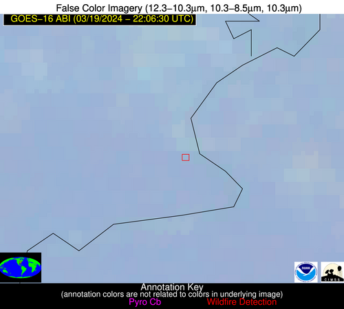
Possible Wildfire
| Basic Information | |
|---|---|
| State/Province(s) | Unknown |
| Country/Countries | Dominican Republic |
| County/Locality(s) | Dominican Republic |
| NWS WFO | N/A |
| Identification Method | Enhanced Contextual (Clear) |
| Mean Object Date/Time | 2024-03-19 22:08:53UTC |
| Radiative Center (Lat, Lon): | 18.560000°, -69.640000° |
| Nearby Counties (meeting alert criteria): |
|
| Total Radiative Power Anomaly | n/a |
| Total Radiative Power | 45.43 MW |
| Map: | |
| Additional Information | |
| Alert Status | New Feature |
| Type of Event | Nominal Risk |
| Event Priority Ranking | 4 |
| Maximum Observed BT (3.9 um) | 304.97 K |
| Observed - Background BT (3.9 um) | 5.73 K |
| BT Anomaly (3.9 um) | 9.52 K |
| Maximum Observed - Clear RTM BT (3.9 um) | 7.05 K |
| Maximum Observed BTD (3.9-10/11/12 um) | 10.29 K |
| Observed - Background BTD (3.9-10/11/12 um) | 5.38 K |
| BTD Anomaly (3.9-10/11/12 um) | 11.39 K |
| Similar Pixel Count | 4 |
| BT Time Tendency (3.9 um) | 2.00 K |
| Image Interval | 5.00 minutes |
| Fraction of Surrounding LWIR Pixels that are Colder | 0.89 |
| Fraction of Surrounding Red Channel Pixels that are Brighter | 0.68 |
| Maximum Radiative Power | 13.29 MW |
| Maximum Radiative Power Uncertainty | 0.00 MW |
| Total Radiative Power Uncertainty | 0.00 MW |
| Mean Viewing Angle | 22.80° |
| Mean Solar Zenith Angle | 80.70° |
| Mean Glint Angle | 89.30° |
| Water Fraction | 0.00 |
| Total Pixel Area | 17.90 km2 |
| Latest Satellite Imagery: | |
| View all event imagery » | |
Possible Wildfire
| Basic Information | |
|---|---|
| State/Province(s) | Unknown |
| Country/Countries | Dominican Republic |
| County/Locality(s) | Dominican Republic |
| NWS WFO | N/A |
| Identification Method | Enhanced Contextual (Cloud) |
| Mean Object Date/Time | 2024-03-19 22:08:53UTC |
| Radiative Center (Lat, Lon): | 18.520000°, -69.070000° |
| Nearby Counties (meeting alert criteria): |
|
| Total Radiative Power Anomaly | n/a |
| Total Radiative Power | 44.71 MW |
| Map: | |
| Additional Information | |
| Alert Status | New Feature |
| Type of Event | Nominal Risk |
| Event Priority Ranking | 4 |
| Maximum Observed BT (3.9 um) | 314.33 K |
| Observed - Background BT (3.9 um) | 15.10 K |
| BT Anomaly (3.9 um) | 29.54 K |
| Maximum Observed - Clear RTM BT (3.9 um) | 16.45 K |
| Maximum Observed BTD (3.9-10/11/12 um) | 19.46 K |
| Observed - Background BTD (3.9-10/11/12 um) | 15.09 K |
| BTD Anomaly (3.9-10/11/12 um) | 38.65 K |
| Similar Pixel Count | 0 |
| BT Time Tendency (3.9 um) | 15.10 K |
| Image Interval | 5.00 minutes |
| Fraction of Surrounding LWIR Pixels that are Colder | 0.51 |
| Fraction of Surrounding Red Channel Pixels that are Brighter | 0.99 |
| Maximum Radiative Power | 44.71 MW |
| Maximum Radiative Power Uncertainty | 0.00 MW |
| Total Radiative Power Uncertainty | 0.00 MW |
| Mean Viewing Angle | 22.90° |
| Mean Solar Zenith Angle | 81.30° |
| Mean Glint Angle | 90.40° |
| Water Fraction | 0.00 |
| Total Pixel Area | 4.50 km2 |
| Latest Satellite Imagery: | |
| View all event imagery » | |
