Wildfire Alert Report
| Date: | 2024-03-19 |
|---|---|
| Time: | 17:29:54 |
| Production Date and Time: | 2024-03-19 17:31:04 UTC |
| Primary Instrument: | GOES-16 ABI |
| Wmo Spacecraft Id: | 152 |
| Location/orbit: | GEO |
| L1 File: | OR_ABI-L1b-RadM2-M6C14_G16_s20240791729549_e20240791730008_c20240791730060.nc |
| L1 File(s) - Temporal | OR_ABI-L1b-RadM2-M6C14_G16_s20240791727549_e20240791728006_c20240791728069.nc |
| Number Of Thermal Anomaly Alerts: | 4 |
Possible Wildfire
| Basic Information | |
|---|---|
| State/Province(s) | AR |
| Country/Countries | USA |
| County/Locality(s) | Fulton County, AR |
| NWS WFO | Little Rock AR |
| Identification Method | Enhanced Contextual (Clear) |
| Mean Object Date/Time | 2024-03-19 17:29:58UTC |
| Radiative Center (Lat, Lon): | 36.420000°, -91.710000° |
| Nearby Counties (meeting alert criteria): |
|
| Total Radiative Power Anomaly | n/a |
| Total Radiative Power | 10.26 MW |
| Map: | |
| Additional Information | |
| Alert Status | New Feature |
| Type of Event | Nominal Risk |
| Event Priority Ranking | 4 |
| Maximum Observed BT (3.9 um) | 303.01 K |
| Observed - Background BT (3.9 um) | 3.18 K |
| BT Anomaly (3.9 um) | 7.28 K |
| Maximum Observed - Clear RTM BT (3.9 um) | 18.29 K |
| Maximum Observed BTD (3.9-10/11/12 um) | 12.48 K |
| Observed - Background BTD (3.9-10/11/12 um) | 3.32 K |
| BTD Anomaly (3.9-10/11/12 um) | 13.68 K |
| Similar Pixel Count | 25 |
| BT Time Tendency (3.9 um) | 2.50 K |
| Image Interval | 2.00 minutes |
| Fraction of Surrounding LWIR Pixels that are Colder | 0.31 |
| Fraction of Surrounding Red Channel Pixels that are Brighter | 1.00 |
| Maximum Radiative Power | 10.26 MW |
| Maximum Radiative Power Uncertainty | 0.00 MW |
| Total Radiative Power Uncertainty | 0.00 MW |
| Mean Viewing Angle | 45.90° |
| Mean Solar Zenith Angle | 38.50° |
| Mean Glint Angle | 84.10° |
| Water Fraction | 0.00 |
| Total Pixel Area | 6.50 km2 |
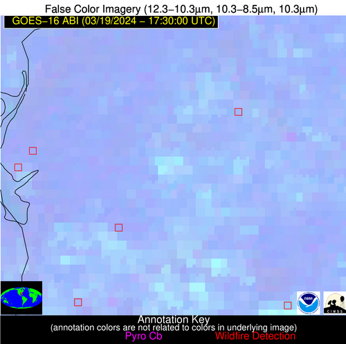
| Latest Satellite Imagery: | |
| View all event imagery » | |
Possible Wildfire
| Basic Information | |
|---|---|
| State/Province(s) | SC |
| Country/Countries | USA |
| County/Locality(s) | Lancaster County, SC |
| NWS WFO | Columbia SC |
| Identification Method | Enhanced Contextual (Clear) |
| Mean Object Date/Time | 2024-03-19 17:30:00UTC |
| Radiative Center (Lat, Lon): | 34.540000°, -80.700000° |
| Nearby Counties (meeting alert criteria): |
|
| Total Radiative Power Anomaly | n/a |
| Total Radiative Power | 24.25 MW |
| Map: | |
| Additional Information | |
| Alert Status | New Feature |
| Type of Event | Nominal Risk |
| Event Priority Ranking | 4 |
| Maximum Observed BT (3.9 um) | 302.74 K |
| Observed - Background BT (3.9 um) | 5.72 K |
| BT Anomaly (3.9 um) | 3.96 K |
| Maximum Observed - Clear RTM BT (3.9 um) | 18.48 K |
| Maximum Observed BTD (3.9-10/11/12 um) | 12.64 K |
| Observed - Background BTD (3.9-10/11/12 um) | 4.99 K |
| BTD Anomaly (3.9-10/11/12 um) | 7.87 K |
| Similar Pixel Count | 4 |
| BT Time Tendency (3.9 um) | 2.80 K |
| Image Interval | 2.00 minutes |
| Fraction of Surrounding LWIR Pixels that are Colder | 0.89 |
| Fraction of Surrounding Red Channel Pixels that are Brighter | 1.00 |
| Maximum Radiative Power | 12.83 MW |
| Maximum Radiative Power Uncertainty | 0.00 MW |
| Total Radiative Power Uncertainty | 0.00 MW |
| Mean Viewing Angle | 40.80° |
| Mean Solar Zenith Angle | 35.20° |
| Mean Glint Angle | 75.60° |
| Water Fraction | 0.00 |
| Total Pixel Area | 11.40 km2 |
| Latest Satellite Imagery: | |
| View all event imagery » | |
Possible Wildfire
| Basic Information | |
|---|---|
| State/Province(s) | GA |
| Country/Countries | USA |
| County/Locality(s) | Webster County, GA |
| NWS WFO | Peachtree City GA |
| Identification Method | Enhanced Contextual (Clear) |
| Mean Object Date/Time | 2024-03-19 17:29:59UTC |
| Radiative Center (Lat, Lon): | 31.940000°, -84.490000° |
| Nearby Counties (meeting alert criteria): |
|
| Total Radiative Power Anomaly | n/a |
| Total Radiative Power | 5.78 MW |
| Map: | |
| Additional Information | |
| Alert Status | New Feature |
| Type of Event | Nominal Risk |
| Event Priority Ranking | 4 |
| Maximum Observed BT (3.9 um) | 300.59 K |
| Observed - Background BT (3.9 um) | 1.78 K |
| BT Anomaly (3.9 um) | 1.28 K |
| Maximum Observed - Clear RTM BT (3.9 um) | 12.38 K |
| Maximum Observed BTD (3.9-10/11/12 um) | 9.36 K |
| Observed - Background BTD (3.9-10/11/12 um) | 2.17 K |
| BTD Anomaly (3.9-10/11/12 um) | 3.18 K |
| Similar Pixel Count | 23 |
| BT Time Tendency (3.9 um) | 1.20 K |
| Image Interval | 2.00 minutes |
| Fraction of Surrounding LWIR Pixels that are Colder | 0.19 |
| Fraction of Surrounding Red Channel Pixels that are Brighter | 1.00 |
| Maximum Radiative Power | 5.78 MW |
| Maximum Radiative Power Uncertainty | 0.00 MW |
| Total Radiative Power Uncertainty | 0.00 MW |
| Mean Viewing Angle | 38.70° |
| Mean Solar Zenith Angle | 32.80° |
| Mean Glint Angle | 71.20° |
| Water Fraction | 0.00 |
| Total Pixel Area | 5.50 km2 |
| Latest Satellite Imagery: | |
| View all event imagery » | |
Possible Wildfire
| Basic Information | |
|---|---|
| State/Province(s) | GA |
| Country/Countries | USA |
| County/Locality(s) | Randolph County, GA |
| NWS WFO | Tallahassee FL |
| Identification Method | Enhanced Contextual (Clear) |
| Mean Object Date/Time | 2024-03-19 17:29:59UTC |
| Radiative Center (Lat, Lon): | 31.620000°, -84.810000° |
| Nearby Counties (meeting alert criteria): |
|
| Total Radiative Power Anomaly | n/a |
| Total Radiative Power | 38.08 MW |
| Map: | |
| Additional Information | |
| Alert Status | New Feature |
| Type of Event | Nominal Risk |
| Event Priority Ranking | 4 |
| Maximum Observed BT (3.9 um) | 311.88 K |
| Observed - Background BT (3.9 um) | 12.43 K |
| BT Anomaly (3.9 um) | 8.93 K |
| Maximum Observed - Clear RTM BT (3.9 um) | 22.82 K |
| Maximum Observed BTD (3.9-10/11/12 um) | 19.72 K |
| Observed - Background BTD (3.9-10/11/12 um) | 12.46 K |
| BTD Anomaly (3.9-10/11/12 um) | 17.18 K |
| Similar Pixel Count | 1 |
| BT Time Tendency (3.9 um) | 10.40 K |
| Image Interval | 2.00 minutes |
| Fraction of Surrounding LWIR Pixels that are Colder | 0.48 |
| Fraction of Surrounding Red Channel Pixels that are Brighter | 0.94 |
| Maximum Radiative Power | 38.08 MW |
| Maximum Radiative Power Uncertainty | 0.00 MW |
| Total Radiative Power Uncertainty | 0.00 MW |
| Mean Viewing Angle | 38.40° |
| Mean Solar Zenith Angle | 32.50° |
| Mean Glint Angle | 70.60° |
| Water Fraction | 0.00 |
| Total Pixel Area | 5.50 km2 |
| Latest Satellite Imagery: | |
| View all event imagery » | |
