Wildfire Alert Report
| Date: | 2024-03-18 |
|---|---|
| Time: | 21:26:17 |
| Production Date and Time: | 2024-03-18 21:32:45 UTC |
| Primary Instrument: | GOES-16 ABI |
| Wmo Spacecraft Id: | 152 |
| Location/orbit: | GEO |
| L1 File: | OR_ABI-L1b-RadC-M6C14_G16_s20240782126170_e20240782128543_c20240782129042.nc |
| L1 File(s) - Temporal | OR_ABI-L1b-RadC-M6C14_G16_s20240782116170_e20240782118543_c20240782119024.nc |
| Number Of Thermal Anomaly Alerts: | 12 |
Possible Wildfire
| Basic Information | |
|---|---|
| State/Province(s) | KS |
| Country/Countries | USA |
| County/Locality(s) | Ottawa County, KS |
| NWS WFO | Topeka KS |
| Identification Method | Enhanced Contextual (Clear) |
| Mean Object Date/Time | 2024-03-18 21:26:50UTC |
| Radiative Center (Lat, Lon): | 38.980000°, -97.400000° |
| Nearby Counties (meeting alert criteria): |
|
| Total Radiative Power Anomaly | n/a |
| Total Radiative Power | 36.52 MW |
| Map: | |
| Additional Information | |
| Alert Status | New Feature |
| Type of Event | Nominal Risk |
| Event Priority Ranking | 4 |
| Maximum Observed BT (3.9 um) | 296.79 K |
| Observed - Background BT (3.9 um) | 5.43 K |
| BT Anomaly (3.9 um) | 3.92 K |
| Maximum Observed - Clear RTM BT (3.9 um) | 18.54 K |
| Maximum Observed BTD (3.9-10/11/12 um) | 11.99 K |
| Observed - Background BTD (3.9-10/11/12 um) | 6.09 K |
| BTD Anomaly (3.9-10/11/12 um) | 4.60 K |
| Similar Pixel Count | 4 |
| BT Time Tendency (3.9 um) | 3.40 K |
| Image Interval | 10.00 minutes |
| Fraction of Surrounding LWIR Pixels that are Colder | 0.12 |
| Fraction of Surrounding Red Channel Pixels that are Brighter | 1.00 |
| Maximum Radiative Power | 25.02 MW |
| Maximum Radiative Power Uncertainty | 0.00 MW |
| Total Radiative Power Uncertainty | 0.00 MW |
| Mean Viewing Angle | 51.00° |
| Mean Solar Zenith Angle | 55.60° |
| Mean Glint Angle | 70.90° |
| Water Fraction | 0.00 |
| Total Pixel Area | 22.70 km2 |
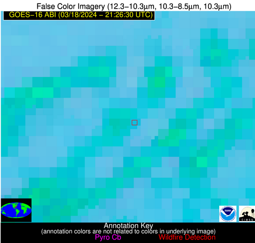
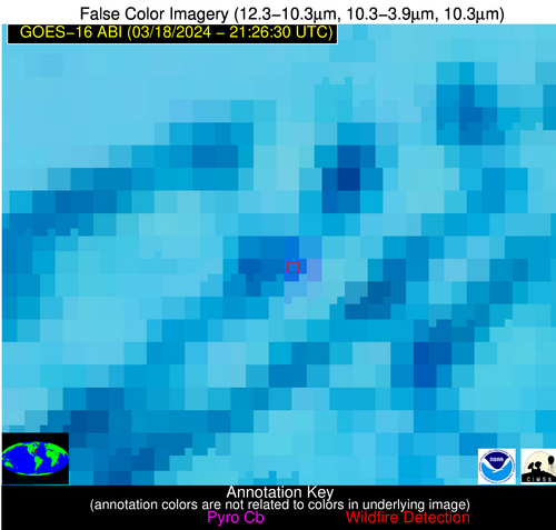
| Latest Satellite Imagery: | |
| View all event imagery » | |
Possible Wildfire
| Basic Information | |
|---|---|
| State/Province(s) | KS |
| Country/Countries | USA |
| County/Locality(s) | Marion County, KS |
| NWS WFO | Wichita KS |
| Identification Method | Enhanced Contextual (Clear) |
| Mean Object Date/Time | 2024-03-18 21:26:50UTC |
| Radiative Center (Lat, Lon): | 38.260000°, -97.340000° |
| Nearby Counties (meeting alert criteria): |
|
| Total Radiative Power Anomaly | n/a |
| Total Radiative Power | 16.28 MW |
| Map: | |
| Additional Information | |
| Alert Status | New Feature |
| Type of Event | Nominal Risk |
| Event Priority Ranking | 4 |
| Maximum Observed BT (3.9 um) | 298.79 K |
| Observed - Background BT (3.9 um) | 6.77 K |
| BT Anomaly (3.9 um) | 7.08 K |
| Maximum Observed - Clear RTM BT (3.9 um) | 20.14 K |
| Maximum Observed BTD (3.9-10/11/12 um) | 11.79 K |
| Observed - Background BTD (3.9-10/11/12 um) | 6.00 K |
| BTD Anomaly (3.9-10/11/12 um) | 15.22 K |
| Similar Pixel Count | 2 |
| BT Time Tendency (3.9 um) | 3.90 K |
| Image Interval | 10.00 minutes |
| Fraction of Surrounding LWIR Pixels that are Colder | 0.83 |
| Fraction of Surrounding Red Channel Pixels that are Brighter | 1.00 |
| Maximum Radiative Power | 16.28 MW |
| Maximum Radiative Power Uncertainty | 0.00 MW |
| Total Radiative Power Uncertainty | 0.00 MW |
| Mean Viewing Angle | 50.20° |
| Mean Solar Zenith Angle | 55.20° |
| Mean Glint Angle | 69.80° |
| Water Fraction | 0.00 |
| Total Pixel Area | 7.40 km2 |
| Latest Satellite Imagery: | |
| View all event imagery » | |
Possible Wildfire
| Basic Information | |
|---|---|
| State/Province(s) | KS |
| Country/Countries | USA |
| County/Locality(s) | Anderson County, KS |
| NWS WFO | Topeka KS |
| Identification Method | Enhanced Contextual (Clear) |
| Mean Object Date/Time | 2024-03-18 21:26:50UTC |
| Radiative Center (Lat, Lon): | 38.060000°, -95.110000° |
| Nearby Counties (meeting alert criteria): |
|
| Total Radiative Power Anomaly | n/a |
| Total Radiative Power | 9.52 MW |
| Map: | |
| Additional Information | |
| Alert Status | New Feature |
| Type of Event | Nominal Risk |
| Event Priority Ranking | 4 |
| Maximum Observed BT (3.9 um) | 292.84 K |
| Observed - Background BT (3.9 um) | 4.22 K |
| BT Anomaly (3.9 um) | 4.03 K |
| Maximum Observed - Clear RTM BT (3.9 um) | 15.92 K |
| Maximum Observed BTD (3.9-10/11/12 um) | 9.69 K |
| Observed - Background BTD (3.9-10/11/12 um) | 4.03 K |
| BTD Anomaly (3.9-10/11/12 um) | 6.51 K |
| Similar Pixel Count | 4 |
| BT Time Tendency (3.9 um) | 3.20 K |
| Image Interval | 10.00 minutes |
| Fraction of Surrounding LWIR Pixels that are Colder | 0.61 |
| Fraction of Surrounding Red Channel Pixels that are Brighter | 1.00 |
| Maximum Radiative Power | 9.52 MW |
| Maximum Radiative Power Uncertainty | 0.00 MW |
| Total Radiative Power Uncertainty | 0.00 MW |
| Mean Viewing Angle | 49.00° |
| Mean Solar Zenith Angle | 56.60° |
| Mean Glint Angle | 70.50° |
| Water Fraction | 0.00 |
| Total Pixel Area | 7.10 km2 |
| Latest Satellite Imagery: | |
| View all event imagery » | |
Possible Wildfire
| Basic Information | |
|---|---|
| State/Province(s) | KS |
| Country/Countries | USA |
| County/Locality(s) | Reno County, KS |
| NWS WFO | Wichita KS |
| Identification Method | Enhanced Contextual (Clear) |
| Mean Object Date/Time | 2024-03-18 21:26:50UTC |
| Radiative Center (Lat, Lon): | 38.120000°, -98.330000° |
| Nearby Counties (meeting alert criteria): |
|
| Total Radiative Power Anomaly | n/a |
| Total Radiative Power | 6.61 MW |
| Map: | |
| Additional Information | |
| Alert Status | New Feature |
| Type of Event | Nominal Risk |
| Event Priority Ranking | 4 |
| Maximum Observed BT (3.9 um) | 296.83 K |
| Observed - Background BT (3.9 um) | 1.91 K |
| BT Anomaly (3.9 um) | 2.24 K |
| Maximum Observed - Clear RTM BT (3.9 um) | 16.69 K |
| Maximum Observed BTD (3.9-10/11/12 um) | 8.38 K |
| Observed - Background BTD (3.9-10/11/12 um) | 2.29 K |
| BTD Anomaly (3.9-10/11/12 um) | 4.76 K |
| Similar Pixel Count | 22 |
| BT Time Tendency (3.9 um) | 1.40 K |
| Image Interval | 10.00 minutes |
| Fraction of Surrounding LWIR Pixels that are Colder | 0.29 |
| Fraction of Surrounding Red Channel Pixels that are Brighter | 1.00 |
| Maximum Radiative Power | 6.61 MW |
| Maximum Radiative Power Uncertainty | 0.00 MW |
| Total Radiative Power Uncertainty | 0.00 MW |
| Mean Viewing Angle | 50.60° |
| Mean Solar Zenith Angle | 54.50° |
| Mean Glint Angle | 69.20° |
| Water Fraction | 0.00 |
| Total Pixel Area | 7.50 km2 |
| Latest Satellite Imagery: | |
| View all event imagery » | |
Possible Wildfire
| Basic Information | |
|---|---|
| State/Province(s) | KS |
| Country/Countries | USA |
| County/Locality(s) | Kingman County, KS |
| NWS WFO | Wichita KS |
| Identification Method | Enhanced Contextual (Clear) |
| Mean Object Date/Time | 2024-03-18 21:26:50UTC |
| Radiative Center (Lat, Lon): | 37.720000°, -98.370000° |
| Nearby Counties (meeting alert criteria): |
|
| Total Radiative Power Anomaly | n/a |
| Total Radiative Power | 14.94 MW |
| Map: | |
| Additional Information | |
| Alert Status | New Feature |
| Type of Event | Nominal Risk |
| Event Priority Ranking | 4 |
| Maximum Observed BT (3.9 um) | 298.17 K |
| Observed - Background BT (3.9 um) | 3.58 K |
| BT Anomaly (3.9 um) | 3.33 K |
| Maximum Observed - Clear RTM BT (3.9 um) | 17.53 K |
| Maximum Observed BTD (3.9-10/11/12 um) | 8.68 K |
| Observed - Background BTD (3.9-10/11/12 um) | 3.13 K |
| BTD Anomaly (3.9-10/11/12 um) | 6.88 K |
| Similar Pixel Count | 9 |
| BT Time Tendency (3.9 um) | 0.60 K |
| Image Interval | 10.00 minutes |
| Fraction of Surrounding LWIR Pixels that are Colder | 0.73 |
| Fraction of Surrounding Red Channel Pixels that are Brighter | 1.00 |
| Maximum Radiative Power | 8.00 MW |
| Maximum Radiative Power Uncertainty | 0.00 MW |
| Total Radiative Power Uncertainty | 0.00 MW |
| Mean Viewing Angle | 50.30° |
| Mean Solar Zenith Angle | 54.30° |
| Mean Glint Angle | 68.60° |
| Water Fraction | 0.00 |
| Total Pixel Area | 14.90 km2 |
| Latest Satellite Imagery: | |
| View all event imagery » | |
Possible Wildfire
| Basic Information | |
|---|---|
| State/Province(s) | OK |
| Country/Countries | USA |
| County/Locality(s) | Alfalfa County, OK |
| NWS WFO | Norman OK |
| Identification Method | Enhanced Contextual (Clear) |
| Mean Object Date/Time | 2024-03-18 21:26:50UTC |
| Radiative Center (Lat, Lon): | 36.540000°, -98.530000° |
| Nearby Counties (meeting alert criteria): |
|
| Total Radiative Power Anomaly | n/a |
| Total Radiative Power | 28.91 MW |
| Map: | |
| Additional Information | |
| Alert Status | New Feature |
| Type of Event | Nominal Risk |
| Event Priority Ranking | 4 |
| Maximum Observed BT (3.9 um) | 304.54 K |
| Observed - Background BT (3.9 um) | 9.12 K |
| BT Anomaly (3.9 um) | 6.21 K |
| Maximum Observed - Clear RTM BT (3.9 um) | 22.99 K |
| Maximum Observed BTD (3.9-10/11/12 um) | 14.52 K |
| Observed - Background BTD (3.9-10/11/12 um) | 9.12 K |
| BTD Anomaly (3.9-10/11/12 um) | 15.75 K |
| Similar Pixel Count | 2 |
| BT Time Tendency (3.9 um) | 6.30 K |
| Image Interval | 10.00 minutes |
| Fraction of Surrounding LWIR Pixels that are Colder | 0.46 |
| Fraction of Surrounding Red Channel Pixels that are Brighter | 1.00 |
| Maximum Radiative Power | 28.91 MW |
| Maximum Radiative Power Uncertainty | 0.00 MW |
| Total Radiative Power Uncertainty | 0.00 MW |
| Mean Viewing Angle | 49.30° |
| Mean Solar Zenith Angle | 53.50° |
| Mean Glint Angle | 66.70° |
| Water Fraction | 0.00 |
| Total Pixel Area | 7.20 km2 |
| Latest Satellite Imagery: | |
| View all event imagery » | |
Possible Wildfire
| Basic Information | |
|---|---|
| State/Province(s) | AZ |
| Country/Countries | USA |
| County/Locality(s) | Coconino County, AZ |
| NWS WFO | Flagstaff AZ |
| Identification Method | Enhanced Contextual (Cloud) |
| Mean Object Date/Time | 2024-03-18 21:27:18UTC |
| Radiative Center (Lat, Lon): | 36.640000°, -111.840000° |
| Nearby Counties (meeting alert criteria): |
|
| Total Radiative Power Anomaly | n/a |
| Total Radiative Power | 35.93 MW |
| Map: | |
| Additional Information | |
| Alert Status | New Feature |
| Type of Event | Likely an Urban Source |
| Event Priority Ranking | 5 |
| Maximum Observed BT (3.9 um) | 301.37 K |
| Observed - Background BT (3.9 um) | 7.60 K |
| BT Anomaly (3.9 um) | 5.10 K |
| Maximum Observed - Clear RTM BT (3.9 um) | 17.88 K |
| Maximum Observed BTD (3.9-10/11/12 um) | 24.27 K |
| Observed - Background BTD (3.9-10/11/12 um) | 8.39 K |
| BTD Anomaly (3.9-10/11/12 um) | 9.11 K |
| Similar Pixel Count | 0 |
| BT Time Tendency (3.9 um) | 2.60 K |
| Image Interval | 10.00 minutes |
| Fraction of Surrounding LWIR Pixels that are Colder | 0.61 |
| Fraction of Surrounding Red Channel Pixels that are Brighter | 0.62 |
| Maximum Radiative Power | 35.93 MW |
| Maximum Radiative Power Uncertainty | 0.00 MW |
| Total Radiative Power Uncertainty | 0.00 MW |
| Mean Viewing Angle | 57.60° |
| Mean Solar Zenith Angle | 45.60° |
| Mean Glint Angle | 66.70° |
| Water Fraction | 0.00 |
| Total Pixel Area | 10.10 km2 |
| Latest Satellite Imagery: | |
| View all event imagery » | |
Possible Wildfire
| Basic Information | |
|---|---|
| State/Province(s) | SC |
| Country/Countries | USA |
| County/Locality(s) | Williamsburg County, SC |
| NWS WFO | Wilmington NC |
| Identification Method | Enhanced Contextual (Clear) |
| Mean Object Date/Time | 2024-03-18 21:27:22UTC |
| Radiative Center (Lat, Lon): | 33.710000°, -79.650000° |
| Nearby Counties (meeting alert criteria): |
|
| Total Radiative Power Anomaly | n/a |
| Total Radiative Power | 23.79 MW |
| Map: | |
| Additional Information | |
| Alert Status | New Feature |
| Type of Event | Nominal Risk |
| Event Priority Ranking | 4 |
| Maximum Observed BT (3.9 um) | 302.08 K |
| Observed - Background BT (3.9 um) | 10.25 K |
| BT Anomaly (3.9 um) | 12.30 K |
| Maximum Observed - Clear RTM BT (3.9 um) | 14.78 K |
| Maximum Observed BTD (3.9-10/11/12 um) | 19.25 K |
| Observed - Background BTD (3.9-10/11/12 um) | 10.29 K |
| BTD Anomaly (3.9-10/11/12 um) | 4.97 K |
| Similar Pixel Count | 8 |
| BT Time Tendency (3.9 um) | 8.40 K |
| Image Interval | 10.00 minutes |
| Fraction of Surrounding LWIR Pixels that are Colder | 0.47 |
| Fraction of Surrounding Red Channel Pixels that are Brighter | 0.89 |
| Maximum Radiative Power | 23.79 MW |
| Maximum Radiative Power Uncertainty | 0.00 MW |
| Total Radiative Power Uncertainty | 0.00 MW |
| Mean Viewing Angle | 39.70° |
| Mean Solar Zenith Angle | 66.00° |
| Mean Glint Angle | 78.20° |
| Water Fraction | 0.00 |
| Total Pixel Area | 5.60 km2 |
| Latest Satellite Imagery: | |
| View all event imagery » | |
Possible Wildfire
| Basic Information | |
|---|---|
| State/Province(s) | GA |
| Country/Countries | USA |
| County/Locality(s) | Toombs County, GA |
| NWS WFO | Peachtree City GA |
| Identification Method | Enhanced Contextual (Clear) |
| Mean Object Date/Time | 2024-03-18 21:27:22UTC |
| Radiative Center (Lat, Lon): | 32.190000°, -82.340000° |
| Nearby Counties (meeting alert criteria): |
|
| Total Radiative Power Anomaly | n/a |
| Total Radiative Power | 8.83 MW |
| Map: | |
| Additional Information | |
| Alert Status | New Feature |
| Type of Event | Nominal Risk |
| Event Priority Ranking | 4 |
| Maximum Observed BT (3.9 um) | 296.69 K |
| Observed - Background BT (3.9 um) | 4.41 K |
| BT Anomaly (3.9 um) | 7.33 K |
| Maximum Observed - Clear RTM BT (3.9 um) | 10.49 K |
| Maximum Observed BTD (3.9-10/11/12 um) | 8.47 K |
| Observed - Background BTD (3.9-10/11/12 um) | 4.04 K |
| BTD Anomaly (3.9-10/11/12 um) | 8.93 K |
| Similar Pixel Count | 2 |
| BT Time Tendency (3.9 um) | 0.50 K |
| Image Interval | 10.00 minutes |
| Fraction of Surrounding LWIR Pixels that are Colder | 0.88 |
| Fraction of Surrounding Red Channel Pixels that are Brighter | 1.00 |
| Maximum Radiative Power | 8.83 MW |
| Maximum Radiative Power Uncertainty | 0.00 MW |
| Total Radiative Power Uncertainty | 0.00 MW |
| Mean Viewing Angle | 38.40° |
| Mean Solar Zenith Angle | 63.30° |
| Mean Glint Angle | 73.30° |
| Water Fraction | 0.00 |
| Total Pixel Area | 5.50 km2 |
| Latest Satellite Imagery: | |
| View all event imagery » | |
Possible Wildfire
| Basic Information | |
|---|---|
| State/Province(s) | Unknown |
| Country/Countries | Cuba |
| County/Locality(s) | Cuba |
| NWS WFO | N/A |
| Identification Method | Enhanced Contextual (Clear) |
| Mean Object Date/Time | 2024-03-18 21:28:22UTC |
| Radiative Center (Lat, Lon): | 22.780000°, -82.100000° |
| Nearby Counties (meeting alert criteria): |
|
| Total Radiative Power Anomaly | n/a |
| Total Radiative Power | 9.09 MW |
| Map: | |
| Additional Information | |
| Alert Status | New Feature |
| Type of Event | Nominal Risk |
| Event Priority Ranking | 4 |
| Maximum Observed BT (3.9 um) | 308.83 K |
| Observed - Background BT (3.9 um) | 5.13 K |
| BT Anomaly (3.9 um) | 3.05 K |
| Maximum Observed - Clear RTM BT (3.9 um) | 7.70 K |
| Maximum Observed BTD (3.9-10/11/12 um) | 13.67 K |
| Observed - Background BTD (3.9-10/11/12 um) | 4.56 K |
| BTD Anomaly (3.9-10/11/12 um) | 3.73 K |
| Similar Pixel Count | 25 |
| BT Time Tendency (3.9 um) | 0.60 K |
| Image Interval | 10.00 minutes |
| Fraction of Surrounding LWIR Pixels that are Colder | 0.83 |
| Fraction of Surrounding Red Channel Pixels that are Brighter | 1.00 |
| Maximum Radiative Power | 9.09 MW |
| Maximum Radiative Power Uncertainty | 0.00 MW |
| Total Radiative Power Uncertainty | 0.00 MW |
| Mean Viewing Angle | 27.90° |
| Mean Solar Zenith Angle | 60.70° |
| Mean Glint Angle | 63.30° |
| Water Fraction | 0.00 |
| Total Pixel Area | 4.70 km2 |
| Latest Satellite Imagery: | |
| View all event imagery » | |
Possible Wildfire
| Basic Information | |
|---|---|
| State/Province(s) | Unknown |
| Country/Countries | Cuba |
| County/Locality(s) | Cuba |
| NWS WFO | N/A |
| Identification Method | Enhanced Contextual (Clear) |
| Mean Object Date/Time | 2024-03-18 21:28:22UTC |
| Radiative Center (Lat, Lon): | 22.600000°, -81.110000° |
| Nearby Counties (meeting alert criteria): |
|
| Total Radiative Power Anomaly | n/a |
| Total Radiative Power | 14.65 MW |
| Map: | |
| Additional Information | |
| Alert Status | New Feature |
| Type of Event | Nominal Risk |
| Event Priority Ranking | 4 |
| Maximum Observed BT (3.9 um) | 307.21 K |
| Observed - Background BT (3.9 um) | 5.20 K |
| BT Anomaly (3.9 um) | 3.61 K |
| Maximum Observed - Clear RTM BT (3.9 um) | 6.34 K |
| Maximum Observed BTD (3.9-10/11/12 um) | 15.56 K |
| Observed - Background BTD (3.9-10/11/12 um) | 4.53 K |
| BTD Anomaly (3.9-10/11/12 um) | 3.59 K |
| Similar Pixel Count | 17 |
| BT Time Tendency (3.9 um) | 3.50 K |
| Image Interval | 10.00 minutes |
| Fraction of Surrounding LWIR Pixels that are Colder | 0.87 |
| Fraction of Surrounding Red Channel Pixels that are Brighter | 1.00 |
| Maximum Radiative Power | 14.65 MW |
| Maximum Radiative Power Uncertainty | 0.00 MW |
| Total Radiative Power Uncertainty | 0.00 MW |
| Mean Viewing Angle | 27.40° |
| Mean Solar Zenith Angle | 61.60° |
| Mean Glint Angle | 64.70° |
| Water Fraction | 0.00 |
| Total Pixel Area | 4.70 km2 |
| Latest Satellite Imagery: | |
| View all event imagery » | |
Possible Wildfire
| Basic Information | |
|---|---|
| State/Province(s) | Unknown |
| Country/Countries | Haiti |
| County/Locality(s) | Haiti |
| NWS WFO | N/A |
| Identification Method | Enhanced Contextual (Clear) |
| Mean Object Date/Time | 2024-03-18 21:28:53UTC |
| Radiative Center (Lat, Lon): | 19.400000°, -71.750000° |
| Nearby Counties (meeting alert criteria): |
|
| Total Radiative Power Anomaly | n/a |
| Total Radiative Power | 9.96 MW |
| Map: | |
| Additional Information | |
| Alert Status | New Feature |
| Type of Event | Nominal Risk |
| Event Priority Ranking | 4 |
| Maximum Observed BT (3.9 um) | 303.95 K |
| Observed - Background BT (3.9 um) | 2.89 K |
| BT Anomaly (3.9 um) | 1.32 K |
| Maximum Observed - Clear RTM BT (3.9 um) | 4.14 K |
| Maximum Observed BTD (3.9-10/11/12 um) | 10.71 K |
| Observed - Background BTD (3.9-10/11/12 um) | 3.19 K |
| BTD Anomaly (3.9-10/11/12 um) | 2.61 K |
| Similar Pixel Count | 18 |
| BT Time Tendency (3.9 um) | 1.80 K |
| Image Interval | 10.00 minutes |
| Fraction of Surrounding LWIR Pixels that are Colder | 0.45 |
| Fraction of Surrounding Red Channel Pixels that are Brighter | 1.00 |
| Maximum Radiative Power | 9.96 MW |
| Maximum Radiative Power Uncertainty | 0.00 MW |
| Total Radiative Power Uncertainty | 0.00 MW |
| Mean Viewing Angle | 23.20° |
| Mean Solar Zenith Angle | 69.50° |
| Mean Glint Angle | 78.40° |
| Water Fraction | 0.00 |
| Total Pixel Area | 4.50 km2 |
| Latest Satellite Imagery: | |
| View all event imagery » | |
