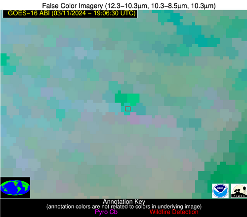
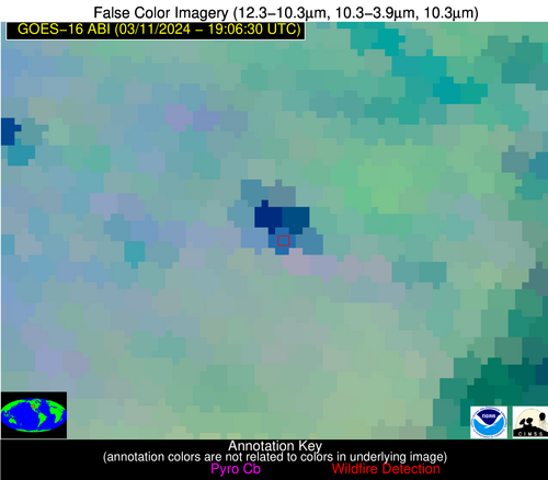
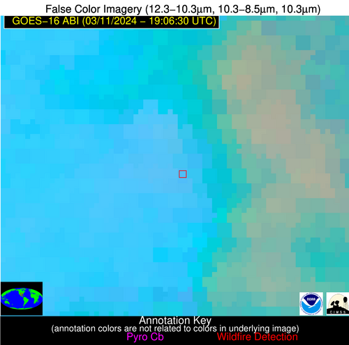
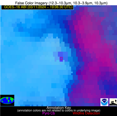
Wildfire Alert Report
| Date: | 2024-03-11 |
|---|---|
| Time: | 19:06:17 |
| Production Date and Time: | 2024-03-11 19:12:50 UTC |
| Primary Instrument: | GOES-16 ABI |
| Wmo Spacecraft Id: | 152 |
| Location/orbit: | GEO |
| L1 File: | OR_ABI-L1b-RadC-M6C14_G16_s20240711906173_e20240711908546_c20240711909029.nc |
| L1 File(s) - Temporal | OR_ABI-L1b-RadC-M6C14_G16_s20240711901173_e20240711903546_c20240711904018.nc |
| Number Of Thermal Anomaly Alerts: | 8 |
Possible Wildfire
| Basic Information | |
|---|---|
| State/Province(s) | CO |
| Country/Countries | USA |
| County/Locality(s) | Moffat County, CO |
| NWS WFO | Grand Junction CO |
| Identification Method | Enhanced Contextual (Clear) |
| Mean Object Date/Time | 2024-03-11 19:06:49UTC |
| Radiative Center (Lat, Lon): | 40.370000°, -107.450000° |
| Nearby Counties (meeting alert criteria): |
|
| Total Radiative Power Anomaly | n/a |
| Total Radiative Power | 26.43 MW |
| Map: | |
| Additional Information | |
| Alert Status | New Feature |
| Type of Event | Nominal Risk |
| Event Priority Ranking | 4 |
| Maximum Observed BT (3.9 um) | 292.56 K |
| Observed - Background BT (3.9 um) | 11.14 K |
| BT Anomaly (3.9 um) | 7.15 K |
| Maximum Observed - Clear RTM BT (3.9 um) | 18.28 K |
| Maximum Observed BTD (3.9-10/11/12 um) | 19.11 K |
| Observed - Background BTD (3.9-10/11/12 um) | 10.93 K |
| BTD Anomaly (3.9-10/11/12 um) | 9.96 K |
| Similar Pixel Count | 2 |
| BT Time Tendency (3.9 um) | 3.30 K |
| Image Interval | 5.00 minutes |
| Fraction of Surrounding LWIR Pixels that are Colder | 0.53 |
| Fraction of Surrounding Red Channel Pixels that are Brighter | 0.88 |
| Maximum Radiative Power | 26.43 MW |
| Maximum Radiative Power Uncertainty | 0.00 MW |
| Total Radiative Power Uncertainty | 0.00 MW |
| Mean Viewing Angle | 57.50° |
| Mean Solar Zenith Angle | 44.30° |
| Mean Glint Angle | 94.10° |
| Water Fraction | 0.00 |
| Total Pixel Area | 9.90 km2 |
| Latest Satellite Imagery: | |
| View all event imagery » | |
Possible Wildfire
| Basic Information | |
|---|---|
| State/Province(s) | IL |
| Country/Countries | USA |
| County/Locality(s) | Christian County, IL |
| NWS WFO | Lincoln IL |
| Identification Method | Enhanced Contextual (Clear) |
| Mean Object Date/Time | 2024-03-11 19:06:51UTC |
| Radiative Center (Lat, Lon): | 39.410000°, -89.320000° |
| Nearby Counties (meeting alert criteria): |
|
| Total Radiative Power Anomaly | n/a |
| Total Radiative Power | 34.30 MW |
| Map: | |
| Additional Information | |
| Alert Status | New Feature |
| Type of Event | Nominal Risk |
| Event Priority Ranking | 4 |
| Maximum Observed BT (3.9 um) | 310.12 K |
| Observed - Background BT (3.9 um) | 9.38 K |
| BT Anomaly (3.9 um) | 5.47 K |
| Maximum Observed - Clear RTM BT (3.9 um) | 23.53 K |
| Maximum Observed BTD (3.9-10/11/12 um) | 19.95 K |
| Observed - Background BTD (3.9-10/11/12 um) | 9.75 K |
| BTD Anomaly (3.9-10/11/12 um) | 7.29 K |
| Similar Pixel Count | 3 |
| BT Time Tendency (3.9 um) | 7.70 K |
| Image Interval | 5.00 minutes |
| Fraction of Surrounding LWIR Pixels that are Colder | 0.25 |
| Fraction of Surrounding Red Channel Pixels that are Brighter | 1.00 |
| Maximum Radiative Power | 34.30 MW |
| Maximum Radiative Power Uncertainty | 0.00 MW |
| Total Radiative Power Uncertainty | 0.00 MW |
| Mean Viewing Angle | 48.10° |
| Mean Solar Zenith Angle | 45.30° |
| Mean Glint Angle | 85.40° |
| Water Fraction | 0.00 |
| Total Pixel Area | 6.80 km2 |
| Latest Satellite Imagery: | |
| View all event imagery » | |
Possible Wildfire
| Basic Information | |
|---|---|
| State/Province(s) | OK |
| Country/Countries | USA |
| County/Locality(s) | Ottawa County, OK |
| NWS WFO | Tulsa OK |
| Identification Method | Enhanced Contextual (Clear) |
| Mean Object Date/Time | 2024-03-11 19:06:50UTC |
| Radiative Center (Lat, Lon): | 36.950000°, -94.700000° |
| Nearby Counties (meeting alert criteria): |
|
| Total Radiative Power Anomaly | n/a |
| Total Radiative Power | 10.85 MW |
| Map: | |
| Additional Information | |
| Alert Status | New Feature |
| Type of Event | Nominal Risk |
| Event Priority Ranking | 4 |
| Maximum Observed BT (3.9 um) | 303.95 K |
| Observed - Background BT (3.9 um) | 4.04 K |
| BT Anomaly (3.9 um) | 5.00 K |
| Maximum Observed - Clear RTM BT (3.9 um) | 16.19 K |
| Maximum Observed BTD (3.9-10/11/12 um) | 10.55 K |
| Observed - Background BTD (3.9-10/11/12 um) | 3.08 K |
| BTD Anomaly (3.9-10/11/12 um) | 5.49 K |
| Similar Pixel Count | 25 |
| BT Time Tendency (3.9 um) | 1.60 K |
| Image Interval | 5.00 minutes |
| Fraction of Surrounding LWIR Pixels that are Colder | 0.94 |
| Fraction of Surrounding Red Channel Pixels that are Brighter | 1.00 |
| Maximum Radiative Power | 10.85 MW |
| Maximum Radiative Power Uncertainty | 0.00 MW |
| Total Radiative Power Uncertainty | 0.00 MW |
| Mean Viewing Angle | 47.80° |
| Mean Solar Zenith Angle | 41.70° |
| Mean Glint Angle | 81.30° |
| Water Fraction | 0.00 |
| Total Pixel Area | 6.90 km2 |
| Latest Satellite Imagery: | |
| View all event imagery » | |
Possible Wildfire
| Basic Information | |
|---|---|
| State/Province(s) | MO |
| Country/Countries | USA |
| County/Locality(s) | Oregon County, MO |
| NWS WFO | Springfield MO |
| Identification Method | Enhanced Contextual (Clear) |
| Mean Object Date/Time | 2024-03-11 19:06:51UTC |
| Radiative Center (Lat, Lon): | 36.580000°, -91.310000° |
| Nearby Counties (meeting alert criteria): |
|
| Total Radiative Power Anomaly | n/a |
| Total Radiative Power | 14.57 MW |
| Map: | |
| Additional Information | |
| Alert Status | New Feature |
| Type of Event | Nominal Risk |
| Event Priority Ranking | 4 |
| Maximum Observed BT (3.9 um) | 305.22 K |
| Observed - Background BT (3.9 um) | 4.96 K |
| BT Anomaly (3.9 um) | 7.14 K |
| Maximum Observed - Clear RTM BT (3.9 um) | 18.29 K |
| Maximum Observed BTD (3.9-10/11/12 um) | 11.07 K |
| Observed - Background BTD (3.9-10/11/12 um) | 4.51 K |
| BTD Anomaly (3.9-10/11/12 um) | 13.88 K |
| Similar Pixel Count | 4 |
| BT Time Tendency (3.9 um) | 2.60 K |
| Image Interval | 5.00 minutes |
| Fraction of Surrounding LWIR Pixels that are Colder | 0.79 |
| Fraction of Surrounding Red Channel Pixels that are Brighter | 1.00 |
| Maximum Radiative Power | 14.57 MW |
| Maximum Radiative Power Uncertainty | 0.00 MW |
| Total Radiative Power Uncertainty | 0.00 MW |
| Mean Viewing Angle | 45.90° |
| Mean Solar Zenith Angle | 42.10° |
| Mean Glint Angle | 79.90° |
| Water Fraction | 0.00 |
| Total Pixel Area | 6.50 km2 |
| Latest Satellite Imagery: | |
| View all event imagery » | |
Possible Wildfire
| Basic Information | |
|---|---|
| State/Province(s) | AR |
| Country/Countries | USA |
| County/Locality(s) | Yell County, AR |
| NWS WFO | Little Rock AR |
| Identification Method | Enhanced Contextual (Clear) |
| Mean Object Date/Time | 2024-03-11 19:07:20UTC |
| Radiative Center (Lat, Lon): | 35.090000°, -93.160000° |
| Nearby Counties (meeting alert criteria): |
|
| Total Radiative Power Anomaly | n/a |
| Total Radiative Power | 6.87 MW |
| Map: | |
| Additional Information | |
| Alert Status | New Feature |
| Type of Event | Nominal Risk |
| Event Priority Ranking | 4 |
| Maximum Observed BT (3.9 um) | 300.92 K |
| Observed - Background BT (3.9 um) | 3.50 K |
| BT Anomaly (3.9 um) | 2.70 K |
| Maximum Observed - Clear RTM BT (3.9 um) | 13.93 K |
| Maximum Observed BTD (3.9-10/11/12 um) | 9.36 K |
| Observed - Background BTD (3.9-10/11/12 um) | 2.71 K |
| BTD Anomaly (3.9-10/11/12 um) | 5.23 K |
| Similar Pixel Count | 25 |
| BT Time Tendency (3.9 um) | 1.60 K |
| Image Interval | 5.00 minutes |
| Fraction of Surrounding LWIR Pixels that are Colder | 0.84 |
| Fraction of Surrounding Red Channel Pixels that are Brighter | 1.00 |
| Maximum Radiative Power | 6.87 MW |
| Maximum Radiative Power Uncertainty | 0.00 MW |
| Total Radiative Power Uncertainty | 0.00 MW |
| Mean Viewing Angle | 45.20° |
| Mean Solar Zenith Angle | 40.20° |
| Mean Glint Angle | 77.20° |
| Water Fraction | 0.00 |
| Total Pixel Area | 6.40 km2 |
| Latest Satellite Imagery: | |
| View all event imagery » | |
Possible Wildfire
| Basic Information | |
|---|---|
| State/Province(s) | SC |
| Country/Countries | USA |
| County/Locality(s) | Clarendon County, SC |
| NWS WFO | Columbia SC |
| Identification Method | Enhanced Contextual (Clear) |
| Mean Object Date/Time | 2024-03-11 19:07:22UTC |
| Radiative Center (Lat, Lon): | 33.640000°, -80.450000° |
| Nearby Counties (meeting alert criteria): |
|
| Total Radiative Power Anomaly | n/a |
| Total Radiative Power | 6.56 MW |
| Map: | |
| Additional Information | |
| Alert Status | New Feature |
| Type of Event | Nominal Risk |
| Event Priority Ranking | 4 |
| Maximum Observed BT (3.9 um) | 301.16 K |
| Observed - Background BT (3.9 um) | 3.35 K |
| BT Anomaly (3.9 um) | 3.15 K |
| Maximum Observed - Clear RTM BT (3.9 um) | 12.59 K |
| Maximum Observed BTD (3.9-10/11/12 um) | 8.11 K |
| Observed - Background BTD (3.9-10/11/12 um) | 2.38 K |
| BTD Anomaly (3.9-10/11/12 um) | 3.08 K |
| Similar Pixel Count | 19 |
| BT Time Tendency (3.9 um) | 1.30 K |
| Image Interval | 5.00 minutes |
| Fraction of Surrounding LWIR Pixels that are Colder | 0.95 |
| Fraction of Surrounding Red Channel Pixels that are Brighter | 1.00 |
| Maximum Radiative Power | 6.56 MW |
| Maximum Radiative Power Uncertainty | 0.00 MW |
| Total Radiative Power Uncertainty | 0.00 MW |
| Mean Viewing Angle | 39.70° |
| Mean Solar Zenith Angle | 43.60° |
| Mean Glint Angle | 75.80° |
| Water Fraction | 0.00 |
| Total Pixel Area | 5.60 km2 |
| Latest Satellite Imagery: | |
| View all event imagery » | |
Possible Wildfire
| Basic Information | |
|---|---|
| State/Province(s) | MS |
| Country/Countries | USA |
| County/Locality(s) | Adams County, MS |
| NWS WFO | Jackson MS |
| Identification Method | Enhanced Contextual (Clear) |
| Mean Object Date/Time | 2024-03-11 19:07:20UTC |
| Radiative Center (Lat, Lon): | 31.600000°, -91.420000° |
| Nearby Counties (meeting alert criteria): |
|
| Total Radiative Power Anomaly | n/a |
| Total Radiative Power | 13.53 MW |
| Map: | |
| Additional Information | |
| Alert Status | New Feature |
| Type of Event | Nominal Risk |
| Event Priority Ranking | 4 |
| Maximum Observed BT (3.9 um) | 304.21 K |
| Observed - Background BT (3.9 um) | 4.90 K |
| BT Anomaly (3.9 um) | 4.12 K |
| Maximum Observed - Clear RTM BT (3.9 um) | 13.57 K |
| Maximum Observed BTD (3.9-10/11/12 um) | 13.53 K |
| Observed - Background BTD (3.9-10/11/12 um) | 4.80 K |
| BTD Anomaly (3.9-10/11/12 um) | 3.20 K |
| Similar Pixel Count | 16 |
| BT Time Tendency (3.9 um) | 1.50 K |
| Image Interval | 5.00 minutes |
| Fraction of Surrounding LWIR Pixels that are Colder | 0.56 |
| Fraction of Surrounding Red Channel Pixels that are Brighter | 1.00 |
| Maximum Radiative Power | 13.53 MW |
| Maximum Radiative Power Uncertainty | 0.00 MW |
| Total Radiative Power Uncertainty | 0.00 MW |
| Mean Viewing Angle | 41.00° |
| Mean Solar Zenith Angle | 37.40° |
| Mean Glint Angle | 69.80° |
| Water Fraction | 0.00 |
| Total Pixel Area | 17.60 km2 |
| Latest Satellite Imagery: | |
| View all event imagery » | |
Possible Wildfire
| Basic Information | |
|---|---|
| State/Province(s) | TX |
| Country/Countries | USA |
| County/Locality(s) | Montgomery County, TX |
| NWS WFO | Houston/Galveston TX |
| Identification Method | Enhanced Contextual (Clear) |
| Mean Object Date/Time | 2024-03-11 19:07:20UTC |
| Radiative Center (Lat, Lon): | 30.500000°, -95.700000° |
| Nearby Counties (meeting alert criteria): |
|
| Total Radiative Power Anomaly | n/a |
| Total Radiative Power | 58.70 MW |
| Map: | |
| Additional Information | |
| Alert Status | New Feature |
| Type of Event | Nominal Risk |
| Event Priority Ranking | 4 |
| Maximum Observed BT (3.9 um) | 313.64 K |
| Observed - Background BT (3.9 um) | 14.49 K |
| BT Anomaly (3.9 um) | 7.84 K |
| Maximum Observed - Clear RTM BT (3.9 um) | 22.10 K |
| Maximum Observed BTD (3.9-10/11/12 um) | 24.50 K |
| Observed - Background BTD (3.9-10/11/12 um) | 15.47 K |
| BTD Anomaly (3.9-10/11/12 um) | 8.07 K |
| Similar Pixel Count | 7 |
| BT Time Tendency (3.9 um) | 2.10 K |
| Image Interval | 5.00 minutes |
| Fraction of Surrounding LWIR Pixels that are Colder | 0.64 |
| Fraction of Surrounding Red Channel Pixels that are Brighter | 0.99 |
| Maximum Radiative Power | 58.70 MW |
| Maximum Radiative Power Uncertainty | 0.00 MW |
| Total Radiative Power Uncertainty | 0.00 MW |
| Mean Viewing Angle | 42.20° |
| Mean Solar Zenith Angle | 35.20° |
| Mean Glint Angle | 68.80° |
| Water Fraction | 0.00 |
| Total Pixel Area | 6.10 km2 |
| Latest Satellite Imagery: | |
| View all event imagery » | |
