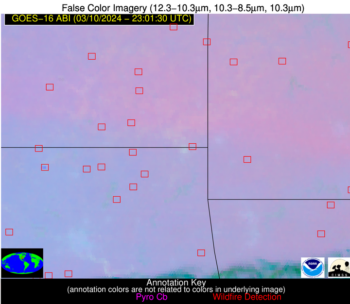
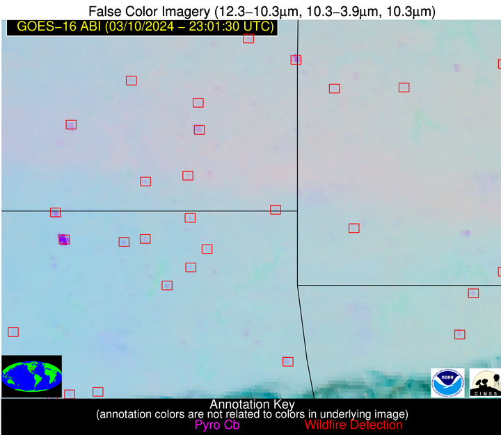
Wildfire Alert Report
| Date: | 2024-03-10 |
|---|---|
| Time: | 23:01:17 |
| Production Date and Time: | 2024-03-10 23:09:25 UTC |
| Primary Instrument: | GOES-16 ABI |
| Wmo Spacecraft Id: | 152 |
| Location/orbit: | GEO |
| L1 File: | OR_ABI-L1b-RadC-M6C14_G16_s20240702301172_e20240702303545_c20240702304038.nc |
| L1 File(s) - Temporal | OR_ABI-L1b-RadC-M6C14_G16_s20240702256172_e20240702258545_c20240702259045.nc |
| Number Of Thermal Anomaly Alerts: | 5 |
Possible Wildfire
| Basic Information | |
|---|---|
| State/Province(s) | KS |
| Country/Countries | USA |
| County/Locality(s) | Bourbon County, KS |
| NWS WFO | Springfield MO |
| Identification Method | Enhanced Contextual (Cloud) |
| Mean Object Date/Time | 2024-03-10 23:01:50UTC |
| Radiative Center (Lat, Lon): | 38.020000°, -94.630000° |
| Nearby Counties (meeting alert criteria): |
|
| Total Radiative Power Anomaly | n/a |
| Total Radiative Power | 36.53 MW |
| Map: | |
| Additional Information | |
| Alert Status | New Feature |
| Type of Event | Nominal Risk |
| Event Priority Ranking | 4 |
| Maximum Observed BT (3.9 um) | 300.79 K |
| Observed - Background BT (3.9 um) | 14.51 K |
| BT Anomaly (3.9 um) | 144.74 K |
| Maximum Observed - Clear RTM BT (3.9 um) | 20.24 K |
| Maximum Observed BTD (3.9-10/11/12 um) | 16.43 K |
| Observed - Background BTD (3.9-10/11/12 um) | 14.00 K |
| BTD Anomaly (3.9-10/11/12 um) | 61.34 K |
| Similar Pixel Count | 0 |
| BT Time Tendency (3.9 um) | 11.90 K |
| Image Interval | 5.00 minutes |
| Fraction of Surrounding LWIR Pixels that are Colder | 0.97 |
| Fraction of Surrounding Red Channel Pixels that are Brighter | 1.00 |
| Maximum Radiative Power | 36.53 MW |
| Maximum Radiative Power Uncertainty | 0.00 MW |
| Total Radiative Power Uncertainty | 0.00 MW |
| Mean Viewing Angle | 48.80° |
| Mean Solar Zenith Angle | 75.60° |
| Mean Glint Angle | 71.20° |
| Water Fraction | 0.00 |
| Total Pixel Area | 7.00 km2 |
| Latest Satellite Imagery: | |
| View all event imagery » | |
Possible Wildfire
| Basic Information | |
|---|---|
| State/Province(s) | OK |
| Country/Countries | USA |
| County/Locality(s) | Craig County, OK |
| NWS WFO | Tulsa OK |
| Identification Method | Enhanced Contextual (Clear) |
| Mean Object Date/Time | 2024-03-10 23:01:50UTC |
| Radiative Center (Lat, Lon): | 36.950000°, -95.370000° |
| Nearby Counties (meeting alert criteria): |
|
| Total Radiative Power Anomaly | n/a |
| Total Radiative Power | 6.73 MW |
| Map: | |
| Additional Information | |
| Alert Status | New Feature |
| Type of Event | Nominal Risk |
| Event Priority Ranking | 4 |
| Maximum Observed BT (3.9 um) | 291.15 K |
| Observed - Background BT (3.9 um) | 3.38 K |
| BT Anomaly (3.9 um) | 7.10 K |
| Maximum Observed - Clear RTM BT (3.9 um) | 9.38 K |
| Maximum Observed BTD (3.9-10/11/12 um) | 5.68 K |
| Observed - Background BTD (3.9-10/11/12 um) | 3.16 K |
| BTD Anomaly (3.9-10/11/12 um) | 12.14 K |
| Similar Pixel Count | 2 |
| BT Time Tendency (3.9 um) | 1.50 K |
| Image Interval | 5.00 minutes |
| Fraction of Surrounding LWIR Pixels that are Colder | 0.68 |
| Fraction of Surrounding Red Channel Pixels that are Brighter | 1.00 |
| Maximum Radiative Power | 6.73 MW |
| Maximum Radiative Power Uncertainty | 0.00 MW |
| Total Radiative Power Uncertainty | 0.00 MW |
| Mean Viewing Angle | 48.10° |
| Mean Solar Zenith Angle | 74.80° |
| Mean Glint Angle | 69.50° |
| Water Fraction | 0.00 |
| Total Pixel Area | 6.90 km2 |
| Latest Satellite Imagery: | |
| View all event imagery » | |
Possible Wildfire
| Basic Information | |
|---|---|
| State/Province(s) | OK |
| Country/Countries | USA |
| County/Locality(s) | Rogers County, OK |
| NWS WFO | Tulsa OK |
| Identification Method | Enhanced Contextual (Clear) |
| Mean Object Date/Time | 2024-03-10 23:01:50UTC |
| Radiative Center (Lat, Lon): | 36.500000°, -95.530000° |
| Nearby Counties (meeting alert criteria): |
|
| Total Radiative Power Anomaly | n/a |
| Total Radiative Power | 12.05 MW |
| Map: | |
| Additional Information | |
| Alert Status | New Feature |
| Type of Event | Nominal Risk |
| Event Priority Ranking | 4 |
| Maximum Observed BT (3.9 um) | 293.75 K |
| Observed - Background BT (3.9 um) | 5.71 K |
| BT Anomaly (3.9 um) | 8.45 K |
| Maximum Observed - Clear RTM BT (3.9 um) | 10.76 K |
| Maximum Observed BTD (3.9-10/11/12 um) | 7.91 K |
| Observed - Background BTD (3.9-10/11/12 um) | 5.46 K |
| BTD Anomaly (3.9-10/11/12 um) | 16.27 K |
| Similar Pixel Count | 2 |
| BT Time Tendency (3.9 um) | 4.40 K |
| Image Interval | 5.00 minutes |
| Fraction of Surrounding LWIR Pixels that are Colder | 0.64 |
| Fraction of Surrounding Red Channel Pixels that are Brighter | 1.00 |
| Maximum Radiative Power | 12.05 MW |
| Maximum Radiative Power Uncertainty | 0.00 MW |
| Total Radiative Power Uncertainty | 0.00 MW |
| Mean Viewing Angle | 47.70° |
| Mean Solar Zenith Angle | 74.50° |
| Mean Glint Angle | 69.00° |
| Water Fraction | 0.00 |
| Total Pixel Area | 6.90 km2 |
| Latest Satellite Imagery: | |
| View all event imagery » | |
Possible Wildfire
| Basic Information | |
|---|---|
| State/Province(s) | AR |
| Country/Countries | USA |
| County/Locality(s) | Carroll County, AR |
| NWS WFO | Tulsa OK |
| Identification Method | Enhanced Contextual (Clear) |
| Mean Object Date/Time | 2024-03-10 23:02:20UTC |
| Radiative Center (Lat, Lon): | 36.170000°, -93.480000° |
| Nearby Counties (meeting alert criteria): |
|
| Total Radiative Power Anomaly | n/a |
| Total Radiative Power | 17.09 MW |
| Map: | |
| Additional Information | |
| Alert Status | New Feature |
| Type of Event | Nominal Risk |
| Event Priority Ranking | 4 |
| Maximum Observed BT (3.9 um) | 290.57 K |
| Observed - Background BT (3.9 um) | 5.12 K |
| BT Anomaly (3.9 um) | 19.81 K |
| Maximum Observed - Clear RTM BT (3.9 um) | 10.93 K |
| Maximum Observed BTD (3.9-10/11/12 um) | 6.92 K |
| Observed - Background BTD (3.9-10/11/12 um) | 5.13 K |
| BTD Anomaly (3.9-10/11/12 um) | 17.77 K |
| Similar Pixel Count | 2 |
| BT Time Tendency (3.9 um) | 2.70 K |
| Image Interval | 5.00 minutes |
| Fraction of Surrounding LWIR Pixels that are Colder | 0.44 |
| Fraction of Surrounding Red Channel Pixels that are Brighter | 1.00 |
| Maximum Radiative Power | 17.09 MW |
| Maximum Radiative Power Uncertainty | 0.00 MW |
| Total Radiative Power Uncertainty | 0.00 MW |
| Mean Viewing Angle | 46.50° |
| Mean Solar Zenith Angle | 76.00° |
| Mean Glint Angle | 70.90° |
| Water Fraction | 0.00 |
| Total Pixel Area | 13.20 km2 |
| Latest Satellite Imagery: | |
| View all event imagery » | |
Possible Wildfire
| Basic Information | |
|---|---|
| State/Province(s) | OK |
| Country/Countries | USA |
| County/Locality(s) | Creek County, OK |
| NWS WFO | Tulsa OK |
| Identification Method | Enhanced Contextual (Cloud) |
| Mean Object Date/Time | 2024-03-10 23:02:20UTC |
| Radiative Center (Lat, Lon): | 35.970000°, -96.350000° |
| Nearby Counties (meeting alert criteria): |
|
| Total Radiative Power Anomaly | n/a |
| Total Radiative Power | 44.70 MW |
| Map: | |
| Additional Information | |
| Alert Status | New Feature |
| Type of Event | Nominal Risk |
| Event Priority Ranking | 4 |
| Maximum Observed BT (3.9 um) | 305.25 K |
| Observed - Background BT (3.9 um) | 15.81 K |
| BT Anomaly (3.9 um) | 31.22 K |
| Maximum Observed - Clear RTM BT (3.9 um) | 21.13 K |
| Maximum Observed BTD (3.9-10/11/12 um) | 17.82 K |
| Observed - Background BTD (3.9-10/11/12 um) | 15.24 K |
| BTD Anomaly (3.9-10/11/12 um) | 56.09 K |
| Similar Pixel Count | 0 |
| BT Time Tendency (3.9 um) | 12.30 K |
| Image Interval | 5.00 minutes |
| Fraction of Surrounding LWIR Pixels that are Colder | 1.00 |
| Fraction of Surrounding Red Channel Pixels that are Brighter | 1.00 |
| Maximum Radiative Power | 44.70 MW |
| Maximum Radiative Power Uncertainty | 0.00 MW |
| Total Radiative Power Uncertainty | 0.00 MW |
| Mean Viewing Angle | 47.60° |
| Mean Solar Zenith Angle | 73.70° |
| Mean Glint Angle | 67.70° |
| Water Fraction | 0.00 |
| Total Pixel Area | 6.90 km2 |
| Latest Satellite Imagery: | |
| View all event imagery » | |


