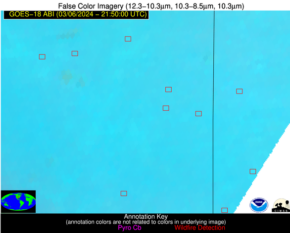
Wildfire Alert Report
| Date: | 2024-03-06 |
|---|---|
| Time: | 21:49:55 |
| Production Date and Time: | 2024-03-06 21:50:38 UTC |
| Primary Instrument: | GOES-18 ABI |
| Wmo Spacecraft Id: | 665 |
| Location/orbit: | GEO |
| L1 File: | OR_ABI-L1b-RadM2-M6C14_G18_s20240662149552_e20240662150011_c20240662150067.nc |
| L1 File(s) - Temporal | OR_ABI-L1b-RadM2-M6C14_G18_s20240662148552_e20240662149010_c20240662149061.nc |
| Number Of Thermal Anomaly Alerts: | 2 |
Possible Wildfire
| Basic Information | |
|---|---|
| State/Province(s) | KS |
| Country/Countries | USA |
| County/Locality(s) | Lyon County, KS |
| NWS WFO | Topeka KS |
| Identification Method | Enhanced Contextual (Clear) |
| Mean Object Date/Time | 2024-03-06 21:50:01UTC |
| Radiative Center (Lat, Lon): | 38.370000°, -96.010000° |
| Nearby Counties (meeting alert criteria): |
|
| Total Radiative Power Anomaly | n/a |
| Total Radiative Power | 11.88 MW |
| Map: | |
| Additional Information | |
| Alert Status | New Feature |
| Type of Event | Nominal Risk |
| Event Priority Ranking | 4 |
| Maximum Observed BT (3.9 um) | 303.54 K |
| Observed - Background BT (3.9 um) | 3.62 K |
| BT Anomaly (3.9 um) | 4.00 K |
| Maximum Observed - Clear RTM BT (3.9 um) | 19.45 K |
| Maximum Observed BTD (3.9-10/11/12 um) | 15.49 K |
| Observed - Background BTD (3.9-10/11/12 um) | 2.86 K |
| BTD Anomaly (3.9-10/11/12 um) | 5.23 K |
| Similar Pixel Count | 25 |
| BT Time Tendency (3.9 um) | 0.70 K |
| Image Interval | 1.00 minutes |
| Fraction of Surrounding LWIR Pixels that are Colder | 0.95 |
| Fraction of Surrounding Red Channel Pixels that are Brighter | 1.00 |
| Maximum Radiative Power | 11.88 MW |
| Maximum Radiative Power Uncertainty | 0.00 MW |
| Total Radiative Power Uncertainty | 0.00 MW |
| Mean Viewing Angle | 61.70° |
| Mean Solar Zenith Angle | 63.00° |
| Mean Glint Angle | 124.70° |
| Water Fraction | 0.00 |
| Total Pixel Area | 12.40 km2 |
| Latest Satellite Imagery: | |
| View all event imagery » | |
Possible Wildfire
| Basic Information | |
|---|---|
| State/Province(s) | MO |
| Country/Countries | USA |
| County/Locality(s) | Vernon County, MO |
| NWS WFO | Springfield MO |
| Identification Method | Enhanced Contextual (Clear) |
| Mean Object Date/Time | 2024-03-06 21:50:01UTC |
| Radiative Center (Lat, Lon): | 37.700000°, -94.290000° |
| Nearby Counties (meeting alert criteria): |
|
| Total Radiative Power Anomaly | n/a |
| Total Radiative Power | 29.43 MW |
| Map: | |
| Additional Information | |
| Alert Status | New Feature |
| Type of Event | Nominal Risk |
| Event Priority Ranking | 4 |
| Maximum Observed BT (3.9 um) | 305.75 K |
| Observed - Background BT (3.9 um) | 6.02 K |
| BT Anomaly (3.9 um) | 7.14 K |
| Maximum Observed - Clear RTM BT (3.9 um) | 21.76 K |
| Maximum Observed BTD (3.9-10/11/12 um) | 17.11 K |
| Observed - Background BTD (3.9-10/11/12 um) | 5.28 K |
| BTD Anomaly (3.9-10/11/12 um) | 8.22 K |
| Similar Pixel Count | 12 |
| BT Time Tendency (3.9 um) | 1.00 K |
| Image Interval | 1.00 minutes |
| Fraction of Surrounding LWIR Pixels that are Colder | 1.00 |
| Fraction of Surrounding Red Channel Pixels that are Brighter | 0.56 |
| Maximum Radiative Power | 29.43 MW |
| Maximum Radiative Power Uncertainty | 0.00 MW |
| Total Radiative Power Uncertainty | 0.00 MW |
| Mean Viewing Angle | 62.50° |
| Mean Solar Zenith Angle | 63.80° |
| Mean Glint Angle | 126.30° |
| Water Fraction | 0.00 |
| Total Pixel Area | 13.00 km2 |
| Latest Satellite Imagery: | |
| View all event imagery » | |


