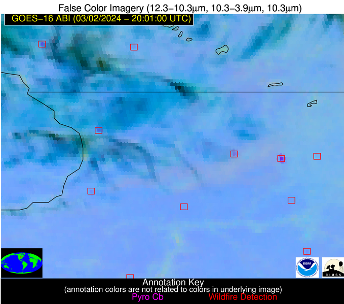
Wildfire Alert Report
| Date: | 2024-03-02 |
|---|---|
| Time: | 20:00:55 |
| Production Date and Time: | 2024-03-02 20:01:53 UTC |
| Primary Instrument: | GOES-16 ABI |
| Wmo Spacecraft Id: | 152 |
| Location/orbit: | GEO |
| L1 File: | OR_ABI-L1b-RadM2-M6C14_G16_s20240622000554_e20240622001011_c20240622001061.nc |
| L1 File(s) - Temporal | OR_ABI-L1b-RadM2-M6C14_G16_s20240621958554_e20240621959011_c20240621959059.nc |
| Number Of Thermal Anomaly Alerts: | 5 |
Possible Wildfire
| Basic Information | |
|---|---|
| State/Province(s) | WI |
| Country/Countries | USA |
| County/Locality(s) | Grant County, WI |
| NWS WFO | La Crosse WI |
| Identification Method | Enhanced Contextual (Cloud) |
| Mean Object Date/Time | 2024-03-02 20:00:56UTC |
| Radiative Center (Lat, Lon): | 42.930000°, -90.520000° |
| Nearby Counties (meeting alert criteria): |
|
| Total Radiative Power Anomaly | n/a |
| Total Radiative Power | 40.22 MW |
| Map: | |
| Additional Information | |
| Alert Status | New Feature |
| Type of Event | Nominal Risk |
| Event Priority Ranking | 4 |
| Maximum Observed BT (3.9 um) | 305.01 K |
| Observed - Background BT (3.9 um) | 10.79 K |
| BT Anomaly (3.9 um) | 7.16 K |
| Maximum Observed - Clear RTM BT (3.9 um) | 21.51 K |
| Maximum Observed BTD (3.9-10/11/12 um) | 20.84 K |
| Observed - Background BTD (3.9-10/11/12 um) | 10.55 K |
| BTD Anomaly (3.9-10/11/12 um) | 10.21 K |
| Similar Pixel Count | 0 |
| BT Time Tendency (3.9 um) | 10.70 K |
| Image Interval | 2.00 minutes |
| Fraction of Surrounding LWIR Pixels that are Colder | 0.90 |
| Fraction of Surrounding Red Channel Pixels that are Brighter | 1.00 |
| Maximum Radiative Power | 40.22 MW |
| Maximum Radiative Power Uncertainty | 0.00 MW |
| Total Radiative Power Uncertainty | 0.00 MW |
| Mean Viewing Angle | 52.20° |
| Mean Solar Zenith Angle | 55.70° |
| Mean Glint Angle | 91.90° |
| Water Fraction | 0.00 |
| Total Pixel Area | 7.60 km2 |
| Latest Satellite Imagery: | |
| View all event imagery » | |
Possible Wildfire
| Basic Information | |
|---|---|
| State/Province(s) | IN |
| Country/Countries | USA |
| County/Locality(s) | Steuben County, IN |
| NWS WFO | Northern Indiana IN |
| Identification Method | Enhanced Contextual (Clear) |
| Mean Object Date/Time | 2024-03-02 20:00:57UTC |
| Radiative Center (Lat, Lon): | 41.740000°, -85.170000° |
| Nearby Counties (meeting alert criteria): |
|
| Total Radiative Power Anomaly | n/a |
| Total Radiative Power | 5.52 MW |
| Map: | |
| Additional Information | |
| Alert Status | New Feature |
| Type of Event | Nominal Risk |
| Event Priority Ranking | 4 |
| Maximum Observed BT (3.9 um) | 296.74 K |
| Observed - Background BT (3.9 um) | 2.53 K |
| BT Anomaly (3.9 um) | 2.84 K |
| Maximum Observed - Clear RTM BT (3.9 um) | 14.60 K |
| Maximum Observed BTD (3.9-10/11/12 um) | 10.10 K |
| Observed - Background BTD (3.9-10/11/12 um) | 1.96 K |
| BTD Anomaly (3.9-10/11/12 um) | 2.67 K |
| Similar Pixel Count | 25 |
| BT Time Tendency (3.9 um) | 1.90 K |
| Image Interval | 2.00 minutes |
| Fraction of Surrounding LWIR Pixels that are Colder | 0.80 |
| Fraction of Surrounding Red Channel Pixels that are Brighter | 1.00 |
| Maximum Radiative Power | 5.52 MW |
| Maximum Radiative Power Uncertainty | 0.00 MW |
| Total Radiative Power Uncertainty | 0.00 MW |
| Mean Viewing Angle | 49.50° |
| Mean Solar Zenith Angle | 57.10° |
| Mean Glint Angle | 91.50° |
| Water Fraction | 0.00 |
| Total Pixel Area | 6.90 km2 |
| Latest Satellite Imagery: | |
| View all event imagery » | |
Possible Wildfire
| Basic Information | |
|---|---|
| State/Province(s) | IL |
| Country/Countries | USA |
| County/Locality(s) | Kankakee County, IL |
| NWS WFO | Chicago IL |
| Identification Method | Enhanced Contextual (Clear) |
| Mean Object Date/Time | 2024-03-02 20:00:57UTC |
| Radiative Center (Lat, Lon): | 41.080000°, -88.230000° |
| Nearby Counties (meeting alert criteria): |
|
| Total Radiative Power Anomaly | n/a |
| Total Radiative Power | 11.45 MW |
| Map: | |
| Additional Information | |
| Alert Status | New Feature |
| Type of Event | Nominal Risk |
| Event Priority Ranking | 4 |
| Maximum Observed BT (3.9 um) | 303.62 K |
| Observed - Background BT (3.9 um) | 4.47 K |
| BT Anomaly (3.9 um) | 5.92 K |
| Maximum Observed - Clear RTM BT (3.9 um) | 19.80 K |
| Maximum Observed BTD (3.9-10/11/12 um) | 12.32 K |
| Observed - Background BTD (3.9-10/11/12 um) | 3.29 K |
| BTD Anomaly (3.9-10/11/12 um) | 10.68 K |
| Similar Pixel Count | 25 |
| BT Time Tendency (3.9 um) | 2.60 K |
| Image Interval | 2.00 minutes |
| Fraction of Surrounding LWIR Pixels that are Colder | 0.96 |
| Fraction of Surrounding Red Channel Pixels that are Brighter | 1.00 |
| Maximum Radiative Power | 11.45 MW |
| Maximum Radiative Power Uncertainty | 0.00 MW |
| Total Radiative Power Uncertainty | 0.00 MW |
| Mean Viewing Angle | 49.60° |
| Mean Solar Zenith Angle | 55.10° |
| Mean Glint Angle | 89.20° |
| Water Fraction | 0.00 |
| Total Pixel Area | 7.00 km2 |
| Latest Satellite Imagery: | |
| View all event imagery » | |
Possible Wildfire
| Basic Information | |
|---|---|
| State/Province(s) | AR |
| Country/Countries | USA |
| County/Locality(s) | Jackson County, AR |
| NWS WFO | Little Rock AR |
| Identification Method | Enhanced Contextual (Clear) |
| Mean Object Date/Time | 2024-03-02 20:00:59UTC |
| Radiative Center (Lat, Lon): | 35.670000°, -91.080000° |
| Nearby Counties (meeting alert criteria): |
|
| Total Radiative Power Anomaly | n/a |
| Total Radiative Power | 48.57 MW |
| Map: | |
| Additional Information | |
| Alert Status | New Feature |
| Type of Event | Nominal Risk |
| Event Priority Ranking | 4 |
| Maximum Observed BT (3.9 um) | 308.09 K |
| Observed - Background BT (3.9 um) | 7.61 K |
| BT Anomaly (3.9 um) | 4.77 K |
| Maximum Observed - Clear RTM BT (3.9 um) | 20.21 K |
| Maximum Observed BTD (3.9-10/11/12 um) | 17.56 K |
| Observed - Background BTD (3.9-10/11/12 um) | 6.87 K |
| BTD Anomaly (3.9-10/11/12 um) | 4.85 K |
| Similar Pixel Count | 4 |
| BT Time Tendency (3.9 um) | 6.20 K |
| Image Interval | 2.00 minutes |
| Fraction of Surrounding LWIR Pixels that are Colder | 0.89 |
| Fraction of Surrounding Red Channel Pixels that are Brighter | 0.99 |
| Maximum Radiative Power | 25.07 MW |
| Maximum Radiative Power Uncertainty | 0.00 MW |
| Total Radiative Power Uncertainty | 0.00 MW |
| Mean Viewing Angle | 44.90° |
| Mean Solar Zenith Angle | 49.40° |
| Mean Glint Angle | 78.40° |
| Water Fraction | 0.00 |
| Total Pixel Area | 12.70 km2 |
| Latest Satellite Imagery: | |
| View all event imagery » | |
Possible Wildfire
| Basic Information | |
|---|---|
| State/Province(s) | TN |
| Country/Countries | USA |
| County/Locality(s) | Shelby County, TN |
| NWS WFO | Memphis TN |
| Identification Method | Enhanced Contextual (Clear) |
| Mean Object Date/Time | 2024-03-02 20:00:59UTC |
| Radiative Center (Lat, Lon): | 35.040000°, -90.170000° |
| Nearby Counties (meeting alert criteria): |
|
| Total Radiative Power Anomaly | n/a |
| Total Radiative Power | 14.71 MW |
| Map: | |
| Additional Information | |
| Alert Status | New Feature |
| Type of Event | Ferrous-metal |
| Event Priority Ranking | 5 |
| Maximum Observed BT (3.9 um) | 305.32 K |
| Observed - Background BT (3.9 um) | 3.88 K |
| BT Anomaly (3.9 um) | 1.81 K |
| Maximum Observed - Clear RTM BT (3.9 um) | 16.40 K |
| Maximum Observed BTD (3.9-10/11/12 um) | 12.62 K |
| Observed - Background BTD (3.9-10/11/12 um) | 4.37 K |
| BTD Anomaly (3.9-10/11/12 um) | 3.64 K |
| Similar Pixel Count | 1 |
| BT Time Tendency (3.9 um) | 5.40 K |
| Image Interval | 2.00 minutes |
| Fraction of Surrounding LWIR Pixels that are Colder | 0.40 |
| Fraction of Surrounding Red Channel Pixels that are Brighter | 0.99 |
| Maximum Radiative Power | 14.71 MW |
| Maximum Radiative Power Uncertainty | 0.00 MW |
| Total Radiative Power Uncertainty | 0.00 MW |
| Mean Viewing Angle | 43.90° |
| Mean Solar Zenith Angle | 49.40° |
| Mean Glint Angle | 77.50° |
| Water Fraction | 0.00 |
| Total Pixel Area | 6.20 km2 |
| Latest Satellite Imagery: | |
| View all event imagery » | |


