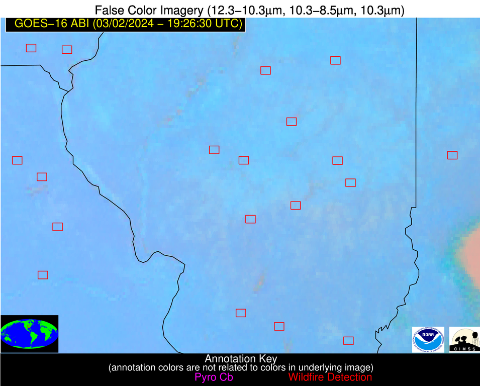
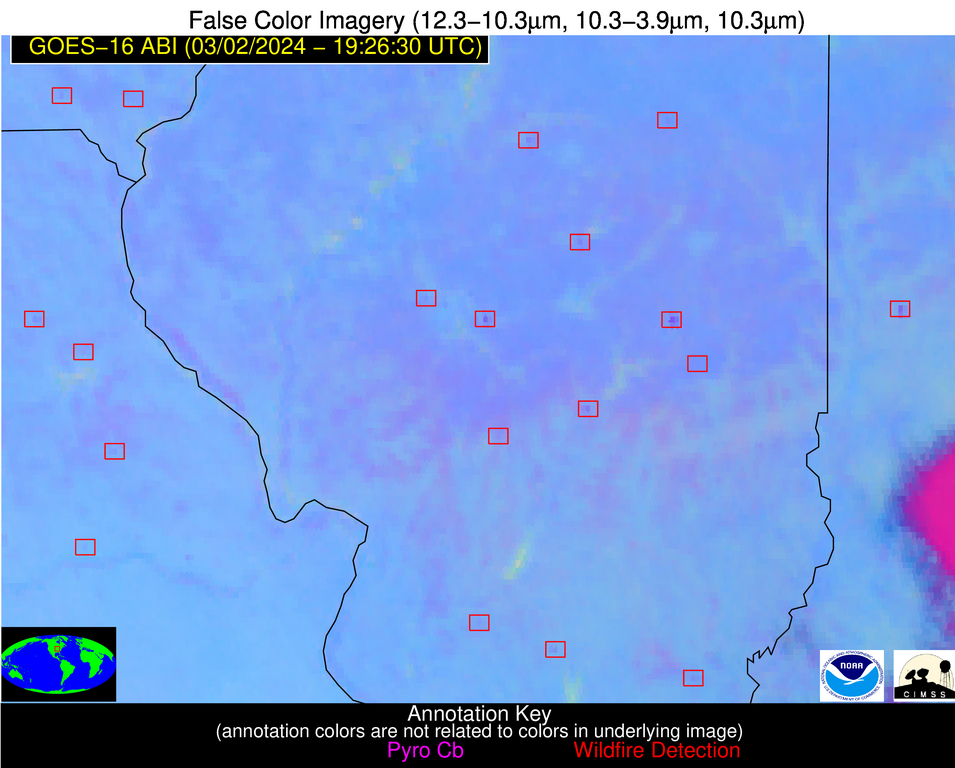
Wildfire Alert Report
| Date: | 2024-03-02 |
|---|---|
| Time: | 19:26:17 |
| Production Date and Time: | 2024-03-02 19:31:16 UTC |
| Primary Instrument: | GOES-16 ABI |
| Wmo Spacecraft Id: | 152 |
| Location/orbit: | GEO |
| L1 File: | OR_ABI-L1b-RadC-M6C14_G16_s20240621926175_e20240621928548_c20240621929025.nc |
| L1 File(s) - Temporal | OR_ABI-L1b-RadC-M6C14_G16_s20240621921175_e20240621923548_c20240621924039.nc |
| Number Of Thermal Anomaly Alerts: | 11 |
Possible Wildfire
| Basic Information | |
|---|---|
| State/Province(s) | IA |
| Country/Countries | USA |
| County/Locality(s) | Van Buren County, IA |
| NWS WFO | Quad Cities IL |
| Identification Method | Enhanced Contextual (Clear) |
| Mean Object Date/Time | 2024-03-02 19:26:51UTC |
| Radiative Center (Lat, Lon): | 40.750000°, -91.840000° |
| Nearby Counties (meeting alert criteria): |
|
| Total Radiative Power Anomaly | n/a |
| Total Radiative Power | 9.46 MW |
| Map: | |
| Additional Information | |
| Alert Status | New Feature |
| Type of Event | Nominal Risk |
| Event Priority Ranking | 4 |
| Maximum Observed BT (3.9 um) | 302.82 K |
| Observed - Background BT (3.9 um) | 2.93 K |
| BT Anomaly (3.9 um) | 1.89 K |
| Maximum Observed - Clear RTM BT (3.9 um) | 16.80 K |
| Maximum Observed BTD (3.9-10/11/12 um) | 10.91 K |
| Observed - Background BTD (3.9-10/11/12 um) | 2.64 K |
| BTD Anomaly (3.9-10/11/12 um) | 2.93 K |
| Similar Pixel Count | 24 |
| BT Time Tendency (3.9 um) | 2.30 K |
| Image Interval | 5.00 minutes |
| Fraction of Surrounding LWIR Pixels that are Colder | 0.68 |
| Fraction of Surrounding Red Channel Pixels that are Brighter | 0.98 |
| Maximum Radiative Power | 9.46 MW |
| Maximum Radiative Power Uncertainty | 0.00 MW |
| Total Radiative Power Uncertainty | 0.00 MW |
| Mean Viewing Angle | 50.40° |
| Mean Solar Zenith Angle | 50.40° |
| Mean Glint Angle | 90.20° |
| Water Fraction | 0.00 |
| Total Pixel Area | 7.30 km2 |
| Latest Satellite Imagery: | |
| View all event imagery » | |
Possible Wildfire
| Basic Information | |
|---|---|
| State/Province(s) | IL |
| Country/Countries | USA |
| County/Locality(s) | Livingston County, IL |
| NWS WFO | Chicago IL |
| Identification Method | Enhanced Contextual (Clear) |
| Mean Object Date/Time | 2024-03-02 19:26:51UTC |
| Radiative Center (Lat, Lon): | 40.640000°, -88.430000° |
| Nearby Counties (meeting alert criteria): |
|
| Total Radiative Power Anomaly | n/a |
| Total Radiative Power | 7.36 MW |
| Map: | |
| Additional Information | |
| Alert Status | New Feature |
| Type of Event | Nominal Risk |
| Event Priority Ranking | 4 |
| Maximum Observed BT (3.9 um) | 303.20 K |
| Observed - Background BT (3.9 um) | 2.18 K |
| BT Anomaly (3.9 um) | 3.14 K |
| Maximum Observed - Clear RTM BT (3.9 um) | 18.43 K |
| Maximum Observed BTD (3.9-10/11/12 um) | 12.22 K |
| Observed - Background BTD (3.9-10/11/12 um) | 1.85 K |
| BTD Anomaly (3.9-10/11/12 um) | 4.99 K |
| Similar Pixel Count | 25 |
| BT Time Tendency (3.9 um) | 1.30 K |
| Image Interval | 5.00 minutes |
| Fraction of Surrounding LWIR Pixels that are Colder | 0.69 |
| Fraction of Surrounding Red Channel Pixels that are Brighter | 1.00 |
| Maximum Radiative Power | 7.36 MW |
| Maximum Radiative Power Uncertainty | 0.00 MW |
| Total Radiative Power Uncertainty | 0.00 MW |
| Mean Viewing Angle | 49.20° |
| Mean Solar Zenith Angle | 51.30° |
| Mean Glint Angle | 90.20° |
| Water Fraction | 0.00 |
| Total Pixel Area | 6.90 km2 |
| Latest Satellite Imagery: | |
| View all event imagery » | |
Possible Wildfire
| Basic Information | |
|---|---|
| State/Province(s) | IL |
| Country/Countries | USA |
| County/Locality(s) | McLean County, IL |
| NWS WFO | Lincoln IL |
| Identification Method | Enhanced Contextual (Clear) |
| Mean Object Date/Time | 2024-03-02 19:26:51UTC |
| Radiative Center (Lat, Lon): | 40.550000°, -89.210000° |
| Nearby Counties (meeting alert criteria): |
|
| Total Radiative Power Anomaly | n/a |
| Total Radiative Power | 12.70 MW |
| Map: | |
| Additional Information | |
| Alert Status | New Feature |
| Type of Event | Nominal Risk |
| Event Priority Ranking | 4 |
| Maximum Observed BT (3.9 um) | 302.28 K |
| Observed - Background BT (3.9 um) | 1.54 K |
| BT Anomaly (3.9 um) | 1.02 K |
| Maximum Observed - Clear RTM BT (3.9 um) | 17.71 K |
| Maximum Observed BTD (3.9-10/11/12 um) | 12.95 K |
| Observed - Background BTD (3.9-10/11/12 um) | 2.78 K |
| BTD Anomaly (3.9-10/11/12 um) | 3.68 K |
| Similar Pixel Count | 21 |
| BT Time Tendency (3.9 um) | 3.10 K |
| Image Interval | 5.00 minutes |
| Fraction of Surrounding LWIR Pixels that are Colder | 0.11 |
| Fraction of Surrounding Red Channel Pixels that are Brighter | 1.00 |
| Maximum Radiative Power | 12.70 MW |
| Maximum Radiative Power Uncertainty | 0.00 MW |
| Total Radiative Power Uncertainty | 0.00 MW |
| Mean Viewing Angle | 49.30° |
| Mean Solar Zenith Angle | 51.00° |
| Mean Glint Angle | 90.00° |
| Water Fraction | 0.00 |
| Total Pixel Area | 7.00 km2 |
| Latest Satellite Imagery: | |
| View all event imagery » | |
Possible Wildfire
| Basic Information | |
|---|---|
| State/Province(s) | IL |
| Country/Countries | USA |
| County/Locality(s) | De Witt County, IL |
| NWS WFO | Lincoln IL |
| Identification Method | Enhanced Contextual (Clear) |
| Mean Object Date/Time | 2024-03-02 19:26:51UTC |
| Radiative Center (Lat, Lon): | 40.100000°, -88.920000° |
| Nearby Counties (meeting alert criteria): |
|
| Total Radiative Power Anomaly | n/a |
| Total Radiative Power | 12.98 MW |
| Map: | |
| Additional Information | |
| Alert Status | New Feature |
| Type of Event | Nominal Risk |
| Event Priority Ranking | 4 |
| Maximum Observed BT (3.9 um) | 303.69 K |
| Observed - Background BT (3.9 um) | 2.44 K |
| BT Anomaly (3.9 um) | 1.52 K |
| Maximum Observed - Clear RTM BT (3.9 um) | 17.97 K |
| Maximum Observed BTD (3.9-10/11/12 um) | 13.69 K |
| Observed - Background BTD (3.9-10/11/12 um) | 3.07 K |
| BTD Anomaly (3.9-10/11/12 um) | 4.21 K |
| Similar Pixel Count | 23 |
| BT Time Tendency (3.9 um) | 2.90 K |
| Image Interval | 5.00 minutes |
| Fraction of Surrounding LWIR Pixels that are Colder | 0.13 |
| Fraction of Surrounding Red Channel Pixels that are Brighter | 1.00 |
| Maximum Radiative Power | 12.98 MW |
| Maximum Radiative Power Uncertainty | 0.00 MW |
| Total Radiative Power Uncertainty | 0.00 MW |
| Mean Viewing Angle | 48.70° |
| Mean Solar Zenith Angle | 50.70° |
| Mean Glint Angle | 89.10° |
| Water Fraction | 0.00 |
| Total Pixel Area | 6.90 km2 |
| Latest Satellite Imagery: | |
| View all event imagery » | |
Possible Wildfire
| Basic Information | |
|---|---|
| State/Province(s) | IN |
| Country/Countries | USA |
| County/Locality(s) | Parke County, IN |
| NWS WFO | Indianapolis IN |
| Identification Method | Enhanced Contextual (Clear) |
| Mean Object Date/Time | 2024-03-02 19:26:51UTC |
| Radiative Center (Lat, Lon): | 39.810000°, -87.130000° |
| Nearby Counties (meeting alert criteria): |
|
| Total Radiative Power Anomaly | n/a |
| Total Radiative Power | 44.74 MW |
| Map: | |
| Additional Information | |
| Alert Status | New Feature |
| Type of Event | Nominal Risk |
| Event Priority Ranking | 4 |
| Maximum Observed BT (3.9 um) | 304.65 K |
| Observed - Background BT (3.9 um) | 8.58 K |
| BT Anomaly (3.9 um) | 5.95 K |
| Maximum Observed - Clear RTM BT (3.9 um) | 19.68 K |
| Maximum Observed BTD (3.9-10/11/12 um) | 17.15 K |
| Observed - Background BTD (3.9-10/11/12 um) | 8.66 K |
| BTD Anomaly (3.9-10/11/12 um) | 10.23 K |
| Similar Pixel Count | 3 |
| BT Time Tendency (3.9 um) | 8.70 K |
| Image Interval | 5.00 minutes |
| Fraction of Surrounding LWIR Pixels that are Colder | 0.50 |
| Fraction of Surrounding Red Channel Pixels that are Brighter | 1.00 |
| Maximum Radiative Power | 44.74 MW |
| Maximum Radiative Power Uncertainty | 0.00 MW |
| Total Radiative Power Uncertainty | 0.00 MW |
| Mean Viewing Angle | 47.90° |
| Mean Solar Zenith Angle | 51.00° |
| Mean Glint Angle | 88.80° |
| Water Fraction | 0.00 |
| Total Pixel Area | 13.40 km2 |
| Latest Satellite Imagery: | |
| View all event imagery » | |
Possible Wildfire
| Basic Information | |
|---|---|
| State/Province(s) | IL |
| Country/Countries | USA |
| County/Locality(s) | Sangamon County, IL |
| NWS WFO | Lincoln IL |
| Identification Method | Enhanced Contextual (Clear) |
| Mean Object Date/Time | 2024-03-02 19:26:51UTC |
| Radiative Center (Lat, Lon): | 39.760000°, -89.460000° |
| Nearby Counties (meeting alert criteria): |
|
| Total Radiative Power Anomaly | n/a |
| Total Radiative Power | 31.03 MW |
| Map: | |
| Additional Information | |
| Alert Status | New Feature |
| Type of Event | Nominal Risk |
| Event Priority Ranking | 4 |
| Maximum Observed BT (3.9 um) | 305.92 K |
| Observed - Background BT (3.9 um) | 6.49 K |
| BT Anomaly (3.9 um) | 4.07 K |
| Maximum Observed - Clear RTM BT (3.9 um) | 20.46 K |
| Maximum Observed BTD (3.9-10/11/12 um) | 17.57 K |
| Observed - Background BTD (3.9-10/11/12 um) | 8.07 K |
| BTD Anomaly (3.9-10/11/12 um) | 7.97 K |
| Similar Pixel Count | 3 |
| BT Time Tendency (3.9 um) | 8.00 K |
| Image Interval | 5.00 minutes |
| Fraction of Surrounding LWIR Pixels that are Colder | 0.03 |
| Fraction of Surrounding Red Channel Pixels that are Brighter | 1.00 |
| Maximum Radiative Power | 31.03 MW |
| Maximum Radiative Power Uncertainty | 0.00 MW |
| Total Radiative Power Uncertainty | 0.00 MW |
| Mean Viewing Angle | 48.60° |
| Mean Solar Zenith Angle | 50.20° |
| Mean Glint Angle | 88.40° |
| Water Fraction | 0.00 |
| Total Pixel Area | 6.90 km2 |
| Latest Satellite Imagery: | |
| View all event imagery » | |
Possible Wildfire
| Basic Information | |
|---|---|
| State/Province(s) | IL |
| Country/Countries | USA |
| County/Locality(s) | Jefferson County, IL |
| NWS WFO | Paducah KY |
| Identification Method | Enhanced Contextual (Clear) |
| Mean Object Date/Time | 2024-03-02 19:26:51UTC |
| Radiative Center (Lat, Lon): | 38.310000°, -89.060000° |
| Nearby Counties (meeting alert criteria): |
|
| Total Radiative Power Anomaly | n/a |
| Total Radiative Power | 10.98 MW |
| Map: | |
| Additional Information | |
| Alert Status | New Feature |
| Type of Event | Nominal Risk |
| Event Priority Ranking | 4 |
| Maximum Observed BT (3.9 um) | 299.83 K |
| Observed - Background BT (3.9 um) | 3.24 K |
| BT Anomaly (3.9 um) | 3.70 K |
| Maximum Observed - Clear RTM BT (3.9 um) | 13.93 K |
| Maximum Observed BTD (3.9-10/11/12 um) | 11.38 K |
| Observed - Background BTD (3.9-10/11/12 um) | 3.51 K |
| BTD Anomaly (3.9-10/11/12 um) | 6.05 K |
| Similar Pixel Count | 19 |
| BT Time Tendency (3.9 um) | 3.50 K |
| Image Interval | 5.00 minutes |
| Fraction of Surrounding LWIR Pixels that are Colder | 0.23 |
| Fraction of Surrounding Red Channel Pixels that are Brighter | 1.00 |
| Maximum Radiative Power | 10.98 MW |
| Maximum Radiative Power Uncertainty | 0.00 MW |
| Total Radiative Power Uncertainty | 0.00 MW |
| Mean Viewing Angle | 46.90° |
| Mean Solar Zenith Angle | 49.00° |
| Mean Glint Angle | 85.60° |
| Water Fraction | 0.00 |
| Total Pixel Area | 6.60 km2 |
| Latest Satellite Imagery: | |
| View all event imagery » | |
Possible Wildfire
| Basic Information | |
|---|---|
| State/Province(s) | AR |
| Country/Countries | USA |
| County/Locality(s) | Boone County, AR |
| NWS WFO | Little Rock AR |
| Identification Method | Enhanced Contextual (Clear) |
| Mean Object Date/Time | 2024-03-02 19:26:50UTC |
| Radiative Center (Lat, Lon): | 36.490000°, -93.250000° |
| Nearby Counties (meeting alert criteria): |
|
| Total Radiative Power Anomaly | n/a |
| Total Radiative Power | 18.35 MW |
| Map: | |
| Additional Information | |
| Alert Status | New Feature |
| Type of Event | Nominal Risk |
| Event Priority Ranking | 4 |
| Maximum Observed BT (3.9 um) | 304.21 K |
| Observed - Background BT (3.9 um) | 3.71 K |
| BT Anomaly (3.9 um) | 2.86 K |
| Maximum Observed - Clear RTM BT (3.9 um) | 14.76 K |
| Maximum Observed BTD (3.9-10/11/12 um) | 9.84 K |
| Observed - Background BTD (3.9-10/11/12 um) | 3.32 K |
| BTD Anomaly (3.9-10/11/12 um) | 6.80 K |
| Similar Pixel Count | 8 |
| BT Time Tendency (3.9 um) | 2.40 K |
| Image Interval | 5.00 minutes |
| Fraction of Surrounding LWIR Pixels that are Colder | 0.70 |
| Fraction of Surrounding Red Channel Pixels that are Brighter | 1.00 |
| Maximum Radiative Power | 10.52 MW |
| Maximum Radiative Power Uncertainty | 0.00 MW |
| Total Radiative Power Uncertainty | 0.00 MW |
| Mean Viewing Angle | 46.60° |
| Mean Solar Zenith Angle | 46.00° |
| Mean Glint Angle | 81.90° |
| Water Fraction | 0.00 |
| Total Pixel Area | 13.30 km2 |
| Latest Satellite Imagery: | |
| View all event imagery » | |
Possible Wildfire
| Basic Information | |
|---|---|
| State/Province(s) | LA |
| Country/Countries | USA |
| County/Locality(s) | Webster Parish, LA |
| NWS WFO | Shreveport LA |
| Identification Method | Enhanced Contextual (Clear) |
| Mean Object Date/Time | 2024-03-02 19:27:20UTC |
| Radiative Center (Lat, Lon): | 32.680000°, -93.190000° |
| Nearby Counties (meeting alert criteria): |
|
| Total Radiative Power Anomaly | n/a |
| Total Radiative Power | 38.72 MW |
| Map: | |
| Additional Information | |
| Alert Status | New Feature |
| Type of Event | Nominal Risk |
| Event Priority Ranking | 4 |
| Maximum Observed BT (3.9 um) | 307.57 K |
| Observed - Background BT (3.9 um) | 8.70 K |
| BT Anomaly (3.9 um) | 10.68 K |
| Maximum Observed - Clear RTM BT (3.9 um) | 15.18 K |
| Maximum Observed BTD (3.9-10/11/12 um) | 13.23 K |
| Observed - Background BTD (3.9-10/11/12 um) | 8.01 K |
| BTD Anomaly (3.9-10/11/12 um) | 16.96 K |
| Similar Pixel Count | 2 |
| BT Time Tendency (3.9 um) | 8.00 K |
| Image Interval | 5.00 minutes |
| Fraction of Surrounding LWIR Pixels that are Colder | 0.95 |
| Fraction of Surrounding Red Channel Pixels that are Brighter | 1.00 |
| Maximum Radiative Power | 38.72 MW |
| Maximum Radiative Power Uncertainty | 0.00 MW |
| Total Radiative Power Uncertainty | 0.00 MW |
| Mean Viewing Angle | 42.90° |
| Mean Solar Zenith Angle | 42.50° |
| Mean Glint Angle | 74.40° |
| Water Fraction | 0.00 |
| Total Pixel Area | 12.20 km2 |
| Latest Satellite Imagery: | |
| View all event imagery » | |
Possible Wildfire
| Basic Information | |
|---|---|
| State/Province(s) | Unknown |
| Country/Countries | Cuba |
| County/Locality(s) | Cuba |
| NWS WFO | N/A |
| Identification Method | Enhanced Contextual (Cloud) |
| Mean Object Date/Time | 2024-03-02 19:28:22UTC |
| Radiative Center (Lat, Lon): | 21.650000°, -78.610000° |
| Nearby Counties (meeting alert criteria): |
|
| Total Radiative Power Anomaly | n/a |
| Total Radiative Power | 323.38 MW |
| Map: | |
| Additional Information | |
| Alert Status | New Feature |
| Type of Event | Nominal Risk |
| Event Priority Ranking | 4 |
| Maximum Observed BT (3.9 um) | 333.12 K |
| Observed - Background BT (3.9 um) | 29.41 K |
| BT Anomaly (3.9 um) | 15.76 K |
| Maximum Observed - Clear RTM BT (3.9 um) | 27.59 K |
| Maximum Observed BTD (3.9-10/11/12 um) | 46.09 K |
| Observed - Background BTD (3.9-10/11/12 um) | 29.16 K |
| BTD Anomaly (3.9-10/11/12 um) | 17.47 K |
| Similar Pixel Count | 0 |
| BT Time Tendency (3.9 um) | 10.60 K |
| Image Interval | 5.00 minutes |
| Fraction of Surrounding LWIR Pixels that are Colder | 0.55 |
| Fraction of Surrounding Red Channel Pixels that are Brighter | 0.79 |
| Maximum Radiative Power | 209.66 MW |
| Maximum Radiative Power Uncertainty | 0.00 MW |
| Total Radiative Power Uncertainty | 0.00 MW |
| Mean Viewing Angle | 25.80° |
| Mean Solar Zenith Angle | 41.20° |
| Mean Glint Angle | 58.30° |
| Water Fraction | 0.00 |
| Total Pixel Area | 9.20 km2 |
| Latest Satellite Imagery: | |
| View all event imagery » | |
Possible Wildfire
| Basic Information | |
|---|---|
| State/Province(s) | Unknown |
| Country/Countries | Cuba |
| County/Locality(s) | Cuba |
| NWS WFO | N/A |
| Identification Method | Enhanced Contextual (Cloud) |
| Mean Object Date/Time | 2024-03-02 19:28:22UTC |
| Radiative Center (Lat, Lon): | 21.510000°, -78.110000° |
| Nearby Counties (meeting alert criteria): |
|
| Total Radiative Power Anomaly | n/a |
| Total Radiative Power | 121.42 MW |
| Map: | |
| Additional Information | |
| Alert Status | New Feature |
| Type of Event | Nominal Risk |
| Event Priority Ranking | 4 |
| Maximum Observed BT (3.9 um) | 325.43 K |
| Observed - Background BT (3.9 um) | 20.70 K |
| BT Anomaly (3.9 um) | 10.12 K |
| Maximum Observed - Clear RTM BT (3.9 um) | 20.85 K |
| Maximum Observed BTD (3.9-10/11/12 um) | 38.59 K |
| Observed - Background BTD (3.9-10/11/12 um) | 20.92 K |
| BTD Anomaly (3.9-10/11/12 um) | 9.48 K |
| Similar Pixel Count | 0 |
| BT Time Tendency (3.9 um) | 26.50 K |
| Image Interval | 5.00 minutes |
| Fraction of Surrounding LWIR Pixels that are Colder | 0.56 |
| Fraction of Surrounding Red Channel Pixels that are Brighter | 0.81 |
| Maximum Radiative Power | 121.42 MW |
| Maximum Radiative Power Uncertainty | 0.00 MW |
| Total Radiative Power Uncertainty | 0.00 MW |
| Mean Viewing Angle | 25.50° |
| Mean Solar Zenith Angle | 41.40° |
| Mean Glint Angle | 58.50° |
| Water Fraction | 0.00 |
| Total Pixel Area | 4.60 km2 |
| Latest Satellite Imagery: | |
| View all event imagery » | |
