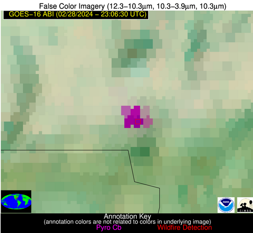
Please consider accessing NGFS detections and satellite imagery through the NOAA/NESDIS Wildland Fire Data Portal: https://fire.data.nesdis.noaa.gov/map/
Wildfire Alert Report
| Date: | 2024-02-28 |
|---|---|
| Time: | 23:06:17 |
| Production Date and Time: | 2024-02-28 23:10:48 UTC |
| Primary Instrument: | GOES-16 ABI |
| Wmo Spacecraft Id: | 152 |
| Location/orbit: | GEO |
| L1 File: | OR_ABI-L1b-RadC-M6C14_G16_s20240592306174_e20240592308547_c20240592309029.nc |
| L1 File(s) - Temporal | OR_ABI-L1b-RadC-M6C14_G16_s20240592301174_e20240592303547_c20240592304021.nc |
| Number Of Thermal Anomaly Alerts: | 4 |
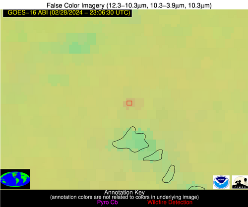
Possible Wildfire
| Basic Information | |
|---|---|
| State/Province(s) | WI |
| Country/Countries | USA |
| County/Locality(s) | Dane County, WI |
| NWS WFO | Milwaukee/Sullivan WI |
| Identification Method | Enhanced Contextual (Clear) |
| Mean Object Date/Time | 2024-02-28 23:06:21UTC |
| Radiative Center (Lat, Lon): | 43.210000°, -89.430000° |
| Nearby Counties (meeting alert criteria): |
|
| Total Radiative Power Anomaly | n/a |
| Total Radiative Power | 3.36 MW |
| Map: | |
| Additional Information | |
| Alert Status | New Feature |
| Type of Event | Nominal Risk |
| Event Priority Ranking | 4 |
| Maximum Observed BT (3.9 um) | 270.78 K |
| Observed - Background BT (3.9 um) | 3.17 K |
| BT Anomaly (3.9 um) | 3.34 K |
| Maximum Observed - Clear RTM BT (3.9 um) | 6.13 K |
| Maximum Observed BTD (3.9-10/11/12 um) | 4.43 K |
| Observed - Background BTD (3.9-10/11/12 um) | 3.18 K |
| BTD Anomaly (3.9-10/11/12 um) | 11.77 K |
| Similar Pixel Count | 1 |
| BT Time Tendency (3.9 um) | -0.10 K |
| Image Interval | 5.00 minutes |
| Fraction of Surrounding LWIR Pixels that are Colder | 0.56 |
| Fraction of Surrounding Red Channel Pixels that are Brighter | 0.99 |
| Maximum Radiative Power | 3.36 MW |
| Maximum Radiative Power Uncertainty | 0.00 MW |
| Total Radiative Power Uncertainty | 0.00 MW |
| Mean Viewing Angle | 52.20° |
| Mean Solar Zenith Angle | 84.30° |
| Mean Glint Angle | 84.00° |
| Water Fraction | 0.00 |
| Total Pixel Area | 7.50 km2 |
| Latest Satellite Imagery: | |
| View all event imagery » | |
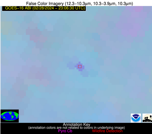
Possible Wildfire
| Basic Information | |
|---|---|
| State/Province(s) | UT |
| Country/Countries | USA |
| County/Locality(s) | Millard County, UT |
| NWS WFO | Salt Lake City UT |
| Identification Method | Enhanced Contextual (Clear) |
| Mean Object Date/Time | 2024-02-28 23:06:49UTC |
| Radiative Center (Lat, Lon): | 39.380000°, -112.660000° |
| Nearby Counties (meeting alert criteria): |
|
| Total Radiative Power Anomaly | n/a |
| Total Radiative Power | 20.05 MW |
| Map: | |
| Additional Information | |
| Alert Status | New Feature |
| Type of Event | Nominal Risk |
| Event Priority Ranking | 4 |
| Maximum Observed BT (3.9 um) | 297.12 K |
| Observed - Background BT (3.9 um) | 7.18 K |
| BT Anomaly (3.9 um) | 11.21 K |
| Maximum Observed - Clear RTM BT (3.9 um) | 18.07 K |
| Maximum Observed BTD (3.9-10/11/12 um) | 11.84 K |
| Observed - Background BTD (3.9-10/11/12 um) | 5.70 K |
| BTD Anomaly (3.9-10/11/12 um) | 12.00 K |
| Similar Pixel Count | 2 |
| BT Time Tendency (3.9 um) | 0.80 K |
| Image Interval | 5.00 minutes |
| Fraction of Surrounding LWIR Pixels that are Colder | 1.00 |
| Fraction of Surrounding Red Channel Pixels that are Brighter | 1.00 |
| Maximum Radiative Power | 20.05 MW |
| Maximum Radiative Power Uncertainty | 0.00 MW |
| Total Radiative Power Uncertainty | 0.00 MW |
| Mean Viewing Angle | 60.00° |
| Mean Solar Zenith Angle | 66.90° |
| Mean Glint Angle | 64.80° |
| Water Fraction | 0.00 |
| Total Pixel Area | 11.30 km2 |
| Latest Satellite Imagery: | |
| View all event imagery » | |
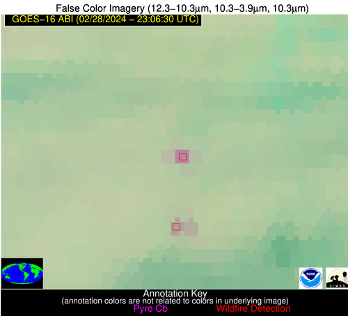
Possible Wildfire
| Basic Information | |
|---|---|
| State/Province(s) | MO |
| Country/Countries | USA |
| County/Locality(s) | Dade County, MO |
| NWS WFO | Springfield MO |
| Identification Method | Enhanced Contextual (Clear) |
| Mean Object Date/Time | 2024-02-28 23:06:50UTC |
| Radiative Center (Lat, Lon): | 37.370000°, -93.960000° |
| Nearby Counties (meeting alert criteria): |
|
| Total Radiative Power Anomaly | n/a |
| Total Radiative Power | 14.68 MW |
| Map: | |
| Additional Information | |
| Alert Status | New Feature |
| Type of Event | Nominal Risk |
| Event Priority Ranking | 4 |
| Maximum Observed BT (3.9 um) | 286.42 K |
| Observed - Background BT (3.9 um) | 9.72 K |
| BT Anomaly (3.9 um) | 15.85 K |
| Maximum Observed - Clear RTM BT (3.9 um) | 15.21 K |
| Maximum Observed BTD (3.9-10/11/12 um) | 11.87 K |
| Observed - Background BTD (3.9-10/11/12 um) | 8.81 K |
| BTD Anomaly (3.9-10/11/12 um) | 11.82 K |
| Similar Pixel Count | 1 |
| BT Time Tendency (3.9 um) | 7.00 K |
| Image Interval | 5.00 minutes |
| Fraction of Surrounding LWIR Pixels that are Colder | 0.90 |
| Fraction of Surrounding Red Channel Pixels that are Brighter | 1.00 |
| Maximum Radiative Power | 14.68 MW |
| Maximum Radiative Power Uncertainty | 0.00 MW |
| Total Radiative Power Uncertainty | 0.00 MW |
| Mean Viewing Angle | 47.80° |
| Mean Solar Zenith Angle | 79.20° |
| Mean Glint Angle | 75.50° |
| Water Fraction | 0.00 |
| Total Pixel Area | 6.90 km2 |
| Latest Satellite Imagery: | |
| View all event imagery » | |
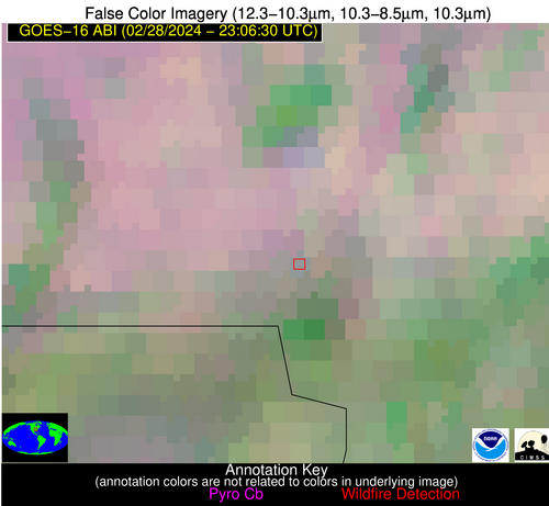
Possible Wildfire
| Basic Information | |
|---|---|
| State/Province(s) | MO |
| Country/Countries | USA |
| County/Locality(s) | Dunklin County, MO |
| NWS WFO | Memphis TN |
| Identification Method | Enhanced Contextual (Cloud) |
| Mean Object Date/Time | 2024-02-28 23:06:51UTC |
| Radiative Center (Lat, Lon): | 36.580000°, -90.120000° |
| Nearby Counties (meeting alert criteria): |
|
| Total Radiative Power Anomaly | n/a |
| Total Radiative Power | 280.89 MW |
| Map: | |
| Additional Information | |
| Alert Status | New Feature |
| Type of Event | Nominal Risk |
| Event Priority Ranking | 4 |
| Maximum Observed BT (3.9 um) | 319.38 K |
| Observed - Background BT (3.9 um) | 42.83 K |
| BT Anomaly (3.9 um) | 41.89 K |
| Maximum Observed - Clear RTM BT (3.9 um) | 44.63 K |
| Maximum Observed BTD (3.9-10/11/12 um) | 47.56 K |
| Observed - Background BTD (3.9-10/11/12 um) | 42.72 K |
| BTD Anomaly (3.9-10/11/12 um) | 43.74 K |
| Similar Pixel Count | 0 |
| BT Time Tendency (3.9 um) | 41.20 K |
| Image Interval | 5.00 minutes |
| Fraction of Surrounding LWIR Pixels that are Colder | 0.51 |
| Fraction of Surrounding Red Channel Pixels that are Brighter | 0.56 |
| Maximum Radiative Power | 280.89 MW |
| Maximum Radiative Power Uncertainty | 0.00 MW |
| Total Radiative Power Uncertainty | 0.00 MW |
| Mean Viewing Angle | 45.50° |
| Mean Solar Zenith Angle | 81.80° |
| Mean Glint Angle | 79.10° |
| Water Fraction | 0.00 |
| Total Pixel Area | 25.60 km2 |
| Latest Satellite Imagery: | |
| View all event imagery » | |

