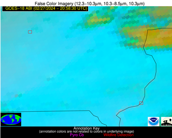
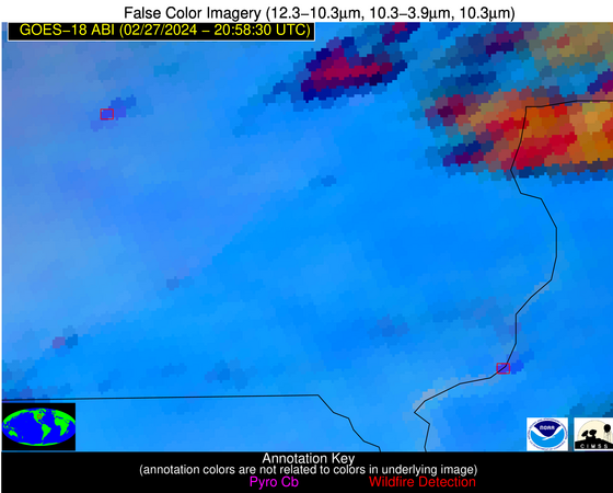
Wildfire Alert Report
| Date: | 2024-02-27 |
|---|---|
| Time: | 20:58:26 |
| Production Date and Time: | 2024-02-27 20:59:09 UTC |
| Primary Instrument: | GOES-18 ABI |
| Wmo Spacecraft Id: | 665 |
| Location/orbit: | GEO |
| L1 File: | OR_ABI-L1b-RadM1-M6C14_G18_s20240582058262_e20240582058319_c20240582058375.nc |
| L1 File(s) - Temporal | OR_ABI-L1b-RadM1-M6C14_G18_s20240582057262_e20240582057319_c20240582057360.nc |
| Number Of Thermal Anomaly Alerts: | 2 |
Possible Wildfire
| Basic Information | |
|---|---|
| State/Province(s) | IA |
| Country/Countries | USA |
| County/Locality(s) | Mahaska County, IA |
| NWS WFO | Des Moines IA |
| Identification Method | Enhanced Contextual (Cloud) |
| Mean Object Date/Time | 2024-02-27 20:58:29UTC |
| Radiative Center (Lat, Lon): | 41.410000°, -92.430000° |
| Nearby Counties (meeting alert criteria): |
|
| Total Radiative Power Anomaly | n/a |
| Total Radiative Power | 71.14 MW |
| Map: | |
| Additional Information | |
| Alert Status | New Feature |
| Type of Event | Nominal Risk |
| Event Priority Ranking | 4 |
| Maximum Observed BT (3.9 um) | 309.63 K |
| Observed - Background BT (3.9 um) | 10.45 K |
| BT Anomaly (3.9 um) | 7.24 K |
| Maximum Observed - Clear RTM BT (3.9 um) | 27.14 K |
| Maximum Observed BTD (3.9-10/11/12 um) | 24.13 K |
| Observed - Background BTD (3.9-10/11/12 um) | 10.16 K |
| BTD Anomaly (3.9-10/11/12 um) | 14.24 K |
| Similar Pixel Count | 0 |
| BT Time Tendency (3.9 um) | 7.20 K |
| Image Interval | 1.00 minutes |
| Fraction of Surrounding LWIR Pixels that are Colder | 0.69 |
| Fraction of Surrounding Red Channel Pixels that are Brighter | 1.00 |
| Maximum Radiative Power | 71.14 MW |
| Maximum Radiative Power Uncertainty | 0.00 MW |
| Total Radiative Power Uncertainty | 0.00 MW |
| Mean Viewing Angle | 66.10° |
| Mean Solar Zenith Angle | 61.60° |
| Mean Glint Angle | 126.50° |
| Water Fraction | 0.00 |
| Total Pixel Area | 16.20 km2 |
| Latest Satellite Imagery: | |
| View all event imagery » | |
Possible Wildfire
| Basic Information | |
|---|---|
| State/Province(s) | IA |
| Country/Countries | USA |
| County/Locality(s) | Lee County, IA |
| NWS WFO | Quad Cities IL |
| Identification Method | Enhanced Contextual (Cloud) |
| Mean Object Date/Time | 2024-02-27 20:58:29UTC |
| Radiative Center (Lat, Lon): | 40.680000°, -91.120000° |
| Nearby Counties (meeting alert criteria): |
|
| Total Radiative Power Anomaly | n/a |
| Total Radiative Power | 158.20 MW |
| Map: | |
| Additional Information | |
| Alert Status | New Feature |
| Type of Event | Nominal Risk |
| Event Priority Ranking | 4 |
| Maximum Observed BT (3.9 um) | 311.03 K |
| Observed - Background BT (3.9 um) | 9.73 K |
| BT Anomaly (3.9 um) | 4.97 K |
| Maximum Observed - Clear RTM BT (3.9 um) | 23.25 K |
| Maximum Observed BTD (3.9-10/11/12 um) | 25.27 K |
| Observed - Background BTD (3.9-10/11/12 um) | 10.37 K |
| BTD Anomaly (3.9-10/11/12 um) | 5.40 K |
| Similar Pixel Count | 0 |
| BT Time Tendency (3.9 um) | 9.30 K |
| Image Interval | 1.00 minutes |
| Fraction of Surrounding LWIR Pixels that are Colder | 0.16 |
| Fraction of Surrounding Red Channel Pixels that are Brighter | 0.99 |
| Maximum Radiative Power | 105.90 MW |
| Maximum Radiative Power Uncertainty | 0.00 MW |
| Total Radiative Power Uncertainty | 0.00 MW |
| Mean Viewing Angle | 66.50° |
| Mean Solar Zenith Angle | 61.80° |
| Mean Glint Angle | 127.20° |
| Water Fraction | 0.00 |
| Total Pixel Area | 33.60 km2 |
| Latest Satellite Imagery: | |
| View all event imagery » | |


