Wildfire Alert Report
| Date: | 2024-02-26 |
|---|---|
| Time: | 21:26:17 |
| Production Date and Time: | 2024-02-26 21:32:58 UTC |
| Primary Instrument: | GOES-16 ABI |
| Wmo Spacecraft Id: | 152 |
| Location/orbit: | GEO |
| L1 File: | OR_ABI-L1b-RadC-M6C14_G16_s20240572126173_e20240572128546_c20240572129009.nc |
| L1 File(s) - Temporal | OR_ABI-L1b-RadC-M6C14_G16_s20240572121173_e20240572123546_c20240572124015.nc |
| Number Of Thermal Anomaly Alerts: | 12 |
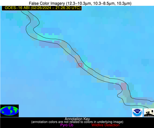
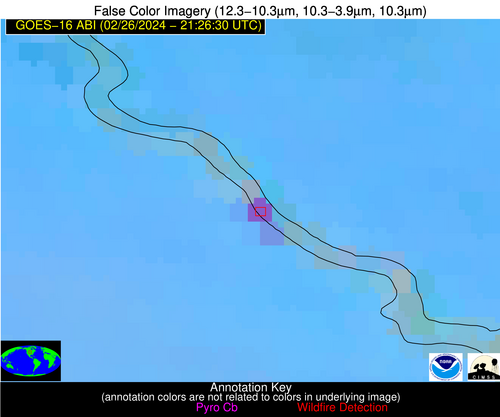
Possible Wildfire
| Basic Information | |
|---|---|
| State/Province(s) | SD |
| Country/Countries | USA |
| County/Locality(s) | Gregory County, SD |
| NWS WFO | Sioux Falls SD |
| Identification Method | Enhanced Contextual (Clear) |
| Mean Object Date/Time | 2024-02-26 21:26:20UTC |
| Radiative Center (Lat, Lon): | 43.330000°, -99.080000° |
| Nearby Counties (meeting alert criteria): |
|
| Total Radiative Power Anomaly | n/a |
| Total Radiative Power | 42.21 MW |
| Map: | |
| Additional Information | |
| Alert Status | New Feature |
| Type of Event | Nominal Risk and Red Flag Warning |
| Event Priority Ranking | 1 |
| Maximum Observed BT (3.9 um) | 300.55 K |
| Observed - Background BT (3.9 um) | 12.54 K |
| BT Anomaly (3.9 um) | 8.43 K |
| Maximum Observed - Clear RTM BT (3.9 um) | 15.40 K |
| Maximum Observed BTD (3.9-10/11/12 um) | 19.12 K |
| Observed - Background BTD (3.9-10/11/12 um) | 12.35 K |
| BTD Anomaly (3.9-10/11/12 um) | 19.70 K |
| Similar Pixel Count | 1 |
| BT Time Tendency (3.9 um) | 7.10 K |
| Image Interval | 5.00 minutes |
| Fraction of Surrounding LWIR Pixels that are Colder | 0.03 |
| Fraction of Surrounding Red Channel Pixels that are Brighter | 1.00 |
| Maximum Radiative Power | 42.21 MW |
| Maximum Radiative Power Uncertainty | 0.00 MW |
| Total Radiative Power Uncertainty | 0.00 MW |
| Mean Viewing Angle | 55.80° |
| Mean Solar Zenith Angle | 63.40° |
| Mean Glint Angle | 85.00° |
| Water Fraction | 0.00 |
| Total Pixel Area | 8.80 km2 |
| Latest Satellite Imagery: | |
| View all event imagery » | |
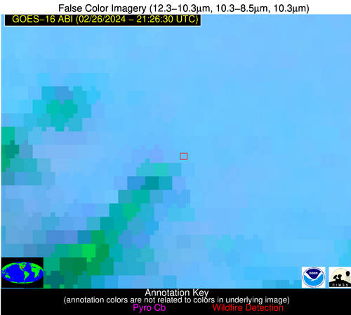
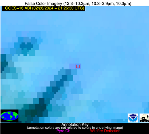
Possible Wildfire
| Basic Information | |
|---|---|
| State/Province(s) | KS |
| Country/Countries | USA |
| County/Locality(s) | Linn County, KS |
| NWS WFO | Kansas City/Pleasant Hill MO |
| Identification Method | Enhanced Contextual (Clear) |
| Mean Object Date/Time | 2024-02-26 21:26:50UTC |
| Radiative Center (Lat, Lon): | 38.290000°, -95.000000° |
| Nearby Counties (meeting alert criteria): |
|
| Total Radiative Power Anomaly | n/a |
| Total Radiative Power | 19.11 MW |
| Map: | |
| Additional Information | |
| Alert Status | New Feature |
| Type of Event | Nominal Risk |
| Event Priority Ranking | 4 |
| Maximum Observed BT (3.9 um) | 303.91 K |
| Observed - Background BT (3.9 um) | 6.19 K |
| BT Anomaly (3.9 um) | 5.65 K |
| Maximum Observed - Clear RTM BT (3.9 um) | 15.60 K |
| Maximum Observed BTD (3.9-10/11/12 um) | 11.34 K |
| Observed - Background BTD (3.9-10/11/12 um) | 5.93 K |
| BTD Anomaly (3.9-10/11/12 um) | 8.27 K |
| Similar Pixel Count | 5 |
| BT Time Tendency (3.9 um) | 3.20 K |
| Image Interval | 5.00 minutes |
| Fraction of Surrounding LWIR Pixels that are Colder | 0.64 |
| Fraction of Surrounding Red Channel Pixels that are Brighter | 0.95 |
| Maximum Radiative Power | 19.11 MW |
| Maximum Radiative Power Uncertainty | 0.00 MW |
| Total Radiative Power Uncertainty | 0.00 MW |
| Mean Viewing Angle | 49.20° |
| Mean Solar Zenith Angle | 62.20° |
| Mean Glint Angle | 79.10° |
| Water Fraction | 0.00 |
| Total Pixel Area | 7.10 km2 |
| Latest Satellite Imagery: | |
| View all event imagery » | |
Possible Wildfire
| Basic Information | |
|---|---|
| State/Province(s) | SC |
| Country/Countries | USA |
| County/Locality(s) | Marion County, SC |
| NWS WFO | Wilmington NC |
| Identification Method | Enhanced Contextual (Clear) |
| Mean Object Date/Time | 2024-02-26 21:27:22UTC |
| Radiative Center (Lat, Lon): | 34.120000°, -79.290000° |
| Nearby Counties (meeting alert criteria): |
|
| Total Radiative Power Anomaly | n/a |
| Total Radiative Power | 9.47 MW |
| Map: | |
| Additional Information | |
| Alert Status | New Feature |
| Type of Event | Nominal Risk |
| Event Priority Ranking | 4 |
| Maximum Observed BT (3.9 um) | 295.97 K |
| Observed - Background BT (3.9 um) | 4.31 K |
| BT Anomaly (3.9 um) | 43.08 K |
| Maximum Observed - Clear RTM BT (3.9 um) | 10.08 K |
| Maximum Observed BTD (3.9-10/11/12 um) | 7.59 K |
| Observed - Background BTD (3.9-10/11/12 um) | 4.30 K |
| BTD Anomaly (3.9-10/11/12 um) | 20.95 K |
| Similar Pixel Count | 3 |
| BT Time Tendency (3.9 um) | 4.00 K |
| Image Interval | 5.00 minutes |
| Fraction of Surrounding LWIR Pixels that are Colder | 0.44 |
| Fraction of Surrounding Red Channel Pixels that are Brighter | 1.00 |
| Maximum Radiative Power | 9.47 MW |
| Maximum Radiative Power Uncertainty | 0.00 MW |
| Total Radiative Power Uncertainty | 0.00 MW |
| Mean Viewing Angle | 40.10° |
| Mean Solar Zenith Angle | 70.60° |
| Mean Glint Angle | 86.70° |
| Water Fraction | 0.00 |
| Total Pixel Area | 5.60 km2 |
| Latest Satellite Imagery: | |
| View all event imagery » | |
Possible Wildfire
| Basic Information | |
|---|---|
| State/Province(s) | GA |
| Country/Countries | USA |
| County/Locality(s) | Warren County, GA |
| NWS WFO | Peachtree City GA |
| Identification Method | Enhanced Contextual (Clear) |
| Mean Object Date/Time | 2024-02-26 21:27:22UTC |
| Radiative Center (Lat, Lon): | 33.360000°, -82.570000° |
| Nearby Counties (meeting alert criteria): |
|
| Total Radiative Power Anomaly | n/a |
| Total Radiative Power | 10.66 MW |
| Map: | |
| Additional Information | |
| Alert Status | New Feature |
| Type of Event | Nominal Risk |
| Event Priority Ranking | 4 |
| Maximum Observed BT (3.9 um) | 298.17 K |
| Observed - Background BT (3.9 um) | 4.45 K |
| BT Anomaly (3.9 um) | 8.71 K |
| Maximum Observed - Clear RTM BT (3.9 um) | 11.40 K |
| Maximum Observed BTD (3.9-10/11/12 um) | 7.83 K |
| Observed - Background BTD (3.9-10/11/12 um) | 4.59 K |
| BTD Anomaly (3.9-10/11/12 um) | 18.19 K |
| Similar Pixel Count | 1 |
| BT Time Tendency (3.9 um) | 3.30 K |
| Image Interval | 5.00 minutes |
| Fraction of Surrounding LWIR Pixels that are Colder | 0.34 |
| Fraction of Surrounding Red Channel Pixels that are Brighter | 1.00 |
| Maximum Radiative Power | 10.66 MW |
| Maximum Radiative Power Uncertainty | 0.00 MW |
| Total Radiative Power Uncertainty | 0.00 MW |
| Mean Viewing Angle | 39.80° |
| Mean Solar Zenith Angle | 67.80° |
| Mean Glint Angle | 82.10° |
| Water Fraction | 0.00 |
| Total Pixel Area | 5.60 km2 |
| Latest Satellite Imagery: | |
| View all event imagery » | |
Possible Wildfire
| Basic Information | |
|---|---|
| State/Province(s) | MS |
| Country/Countries | USA |
| County/Locality(s) | Noxubee County, MS |
| NWS WFO | Jackson MS |
| Identification Method | Enhanced Contextual (Clear) |
| Mean Object Date/Time | 2024-02-26 21:27:21UTC |
| Radiative Center (Lat, Lon): | 33.160000°, -88.720000° |
| Nearby Counties (meeting alert criteria): |
|
| Total Radiative Power Anomaly | n/a |
| Total Radiative Power | 5.99 MW |
| Map: | |
| Additional Information | |
| Alert Status | New Feature |
| Type of Event | Nominal Risk |
| Event Priority Ranking | 4 |
| Maximum Observed BT (3.9 um) | 298.48 K |
| Observed - Background BT (3.9 um) | 2.27 K |
| BT Anomaly (3.9 um) | 4.21 K |
| Maximum Observed - Clear RTM BT (3.9 um) | 8.29 K |
| Maximum Observed BTD (3.9-10/11/12 um) | 8.60 K |
| Observed - Background BTD (3.9-10/11/12 um) | 2.03 K |
| BTD Anomaly (3.9-10/11/12 um) | 3.43 K |
| Similar Pixel Count | 25 |
| BT Time Tendency (3.9 um) | 1.30 K |
| Image Interval | 5.00 minutes |
| Fraction of Surrounding LWIR Pixels that are Colder | 0.63 |
| Fraction of Surrounding Red Channel Pixels that are Brighter | 1.00 |
| Maximum Radiative Power | 5.99 MW |
| Maximum Radiative Power Uncertainty | 0.00 MW |
| Total Radiative Power Uncertainty | 0.00 MW |
| Mean Viewing Angle | 41.40° |
| Mean Solar Zenith Angle | 63.30° |
| Mean Glint Angle | 75.80° |
| Water Fraction | 0.00 |
| Total Pixel Area | 5.90 km2 |
| Latest Satellite Imagery: | |
| View all event imagery » | |
Possible Wildfire
| Basic Information | |
|---|---|
| State/Province(s) | MS |
| Country/Countries | USA |
| County/Locality(s) | Noxubee County, MS |
| NWS WFO | Jackson MS |
| Identification Method | Enhanced Contextual (Clear) |
| Mean Object Date/Time | 2024-02-26 21:27:21UTC |
| Radiative Center (Lat, Lon): | 33.100000°, -88.460000° |
| Nearby Counties (meeting alert criteria): |
|
| Total Radiative Power Anomaly | n/a |
| Total Radiative Power | 14.82 MW |
| Map: | |
| Additional Information | |
| Alert Status | New Feature |
| Type of Event | Nominal Risk |
| Event Priority Ranking | 4 |
| Maximum Observed BT (3.9 um) | 301.65 K |
| Observed - Background BT (3.9 um) | 5.06 K |
| BT Anomaly (3.9 um) | 13.03 K |
| Maximum Observed - Clear RTM BT (3.9 um) | 11.37 K |
| Maximum Observed BTD (3.9-10/11/12 um) | 11.63 K |
| Observed - Background BTD (3.9-10/11/12 um) | 5.24 K |
| BTD Anomaly (3.9-10/11/12 um) | 14.58 K |
| Similar Pixel Count | 4 |
| BT Time Tendency (3.9 um) | 5.00 K |
| Image Interval | 5.00 minutes |
| Fraction of Surrounding LWIR Pixels that are Colder | 0.19 |
| Fraction of Surrounding Red Channel Pixels that are Brighter | 1.00 |
| Maximum Radiative Power | 14.82 MW |
| Maximum Radiative Power Uncertainty | 0.00 MW |
| Total Radiative Power Uncertainty | 0.00 MW |
| Mean Viewing Angle | 41.30° |
| Mean Solar Zenith Angle | 63.50° |
| Mean Glint Angle | 76.00° |
| Water Fraction | 0.00 |
| Total Pixel Area | 5.80 km2 |
| Latest Satellite Imagery: | |
| View all event imagery » | |
Possible Wildfire
| Basic Information | |
|---|---|
| State/Province(s) | AL |
| Country/Countries | USA |
| County/Locality(s) | Tuscaloosa County, AL |
| NWS WFO | Birmingham AL |
| Identification Method | Enhanced Contextual (Clear) |
| Mean Object Date/Time | 2024-02-26 21:27:21UTC |
| Radiative Center (Lat, Lon): | 33.090000°, -87.600000° |
| Nearby Counties (meeting alert criteria): |
|
| Total Radiative Power Anomaly | n/a |
| Total Radiative Power | 15.12 MW |
| Map: | |
| Additional Information | |
| Alert Status | New Feature |
| Type of Event | Nominal Risk |
| Event Priority Ranking | 4 |
| Maximum Observed BT (3.9 um) | 301.49 K |
| Observed - Background BT (3.9 um) | 5.22 K |
| BT Anomaly (3.9 um) | 7.75 K |
| Maximum Observed - Clear RTM BT (3.9 um) | 12.21 K |
| Maximum Observed BTD (3.9-10/11/12 um) | 12.06 K |
| Observed - Background BTD (3.9-10/11/12 um) | 6.07 K |
| BTD Anomaly (3.9-10/11/12 um) | 6.04 K |
| Similar Pixel Count | 2 |
| BT Time Tendency (3.9 um) | 3.30 K |
| Image Interval | 5.00 minutes |
| Fraction of Surrounding LWIR Pixels that are Colder | 0.21 |
| Fraction of Surrounding Red Channel Pixels that are Brighter | 1.00 |
| Maximum Radiative Power | 15.12 MW |
| Maximum Radiative Power Uncertainty | 0.00 MW |
| Total Radiative Power Uncertainty | 0.00 MW |
| Mean Viewing Angle | 40.90° |
| Mean Solar Zenith Angle | 64.10° |
| Mean Glint Angle | 76.70° |
| Water Fraction | 0.00 |
| Total Pixel Area | 5.80 km2 |
| Latest Satellite Imagery: | |
| View all event imagery » | |
Possible Wildfire
| Basic Information | |
|---|---|
| State/Province(s) | AL |
| Country/Countries | USA |
| County/Locality(s) | Marengo County, AL |
| NWS WFO | Birmingham AL |
| Identification Method | Enhanced Contextual (Clear) |
| Mean Object Date/Time | 2024-02-26 21:27:21UTC |
| Radiative Center (Lat, Lon): | 32.300000°, -87.560000° |
| Nearby Counties (meeting alert criteria): |
|
| Total Radiative Power Anomaly | n/a |
| Total Radiative Power | 8.61 MW |
| Map: | |
| Additional Information | |
| Alert Status | New Feature |
| Type of Event | Nominal Risk |
| Event Priority Ranking | 4 |
| Maximum Observed BT (3.9 um) | 300.13 K |
| Observed - Background BT (3.9 um) | 3.44 K |
| BT Anomaly (3.9 um) | 7.49 K |
| Maximum Observed - Clear RTM BT (3.9 um) | 10.70 K |
| Maximum Observed BTD (3.9-10/11/12 um) | 9.15 K |
| Observed - Background BTD (3.9-10/11/12 um) | 3.45 K |
| BTD Anomaly (3.9-10/11/12 um) | 10.21 K |
| Similar Pixel Count | 5 |
| BT Time Tendency (3.9 um) | 1.10 K |
| Image Interval | 5.00 minutes |
| Fraction of Surrounding LWIR Pixels that are Colder | 0.38 |
| Fraction of Surrounding Red Channel Pixels that are Brighter | 1.00 |
| Maximum Radiative Power | 8.61 MW |
| Maximum Radiative Power Uncertainty | 0.00 MW |
| Total Radiative Power Uncertainty | 0.00 MW |
| Mean Viewing Angle | 40.10° |
| Mean Solar Zenith Angle | 63.70° |
| Mean Glint Angle | 75.70° |
| Water Fraction | 0.00 |
| Total Pixel Area | 5.70 km2 |
| Latest Satellite Imagery: | |
| View all event imagery » | |
Possible Wildfire
| Basic Information | |
|---|---|
| State/Province(s) | LA |
| Country/Countries | USA |
| County/Locality(s) | St. Bernard Parish, LA |
| NWS WFO | New Orleans LA |
| Identification Method | Enhanced Contextual (Clear) |
| Mean Object Date/Time | 2024-02-26 21:27:51UTC |
| Radiative Center (Lat, Lon): | 29.880000°, -89.860000° |
| Nearby Counties (meeting alert criteria): |
|
| Total Radiative Power Anomaly | n/a |
| Total Radiative Power | 7.49 MW |
| Map: | |
| Additional Information | |
| Alert Status | New Feature |
| Type of Event | Nominal Risk |
| Event Priority Ranking | 4 |
| Maximum Observed BT (3.9 um) | 300.84 K |
| Observed - Background BT (3.9 um) | 4.86 K |
| BT Anomaly (3.9 um) | 2.55 K |
| Maximum Observed - Clear RTM BT (3.9 um) | 7.86 K |
| Maximum Observed BTD (3.9-10/11/12 um) | 8.90 K |
| Observed - Background BTD (3.9-10/11/12 um) | 3.87 K |
| BTD Anomaly (3.9-10/11/12 um) | 3.66 K |
| Similar Pixel Count | 3 |
| BT Time Tendency (3.9 um) | 0.90 K |
| Image Interval | 5.00 minutes |
| Fraction of Surrounding LWIR Pixels that are Colder | 0.88 |
| Fraction of Surrounding Red Channel Pixels that are Brighter | 1.00 |
| Maximum Radiative Power | 7.49 MW |
| Maximum Radiative Power Uncertainty | 0.00 MW |
| Total Radiative Power Uncertainty | 0.00 MW |
| Mean Viewing Angle | 38.50° |
| Mean Solar Zenith Angle | 60.70° |
| Mean Glint Angle | 70.10° |
| Water Fraction | 0.00 |
| Total Pixel Area | 5.60 km2 |
| Latest Satellite Imagery: | |
| View all event imagery » | |
Possible Wildfire
| Basic Information | |
|---|---|
| State/Province(s) | Unknown |
| Country/Countries | Cuba |
| County/Locality(s) | Cuba |
| NWS WFO | N/A |
| Identification Method | Enhanced Contextual (Clear) |
| Mean Object Date/Time | 2024-02-26 21:28:21UTC |
| Radiative Center (Lat, Lon): | 22.540000°, -83.230000° |
| Nearby Counties (meeting alert criteria): |
|
| Total Radiative Power Anomaly | n/a |
| Total Radiative Power | 13.70 MW |
| Map: | |
| Additional Information | |
| Alert Status | New Feature |
| Type of Event | Nominal Risk |
| Event Priority Ranking | 4 |
| Maximum Observed BT (3.9 um) | 304.10 K |
| Observed - Background BT (3.9 um) | 5.40 K |
| BT Anomaly (3.9 um) | 3.44 K |
| Maximum Observed - Clear RTM BT (3.9 um) | 11.21 K |
| Maximum Observed BTD (3.9-10/11/12 um) | 10.42 K |
| Observed - Background BTD (3.9-10/11/12 um) | 5.20 K |
| BTD Anomaly (3.9-10/11/12 um) | 3.87 K |
| Similar Pixel Count | 4 |
| BT Time Tendency (3.9 um) | 2.50 K |
| Image Interval | 5.00 minutes |
| Fraction of Surrounding LWIR Pixels that are Colder | 0.56 |
| Fraction of Surrounding Red Channel Pixels that are Brighter | 1.00 |
| Maximum Radiative Power | 13.70 MW |
| Maximum Radiative Power Uncertainty | 0.00 MW |
| Total Radiative Power Uncertainty | 0.00 MW |
| Mean Viewing Angle | 28.00° |
| Mean Solar Zenith Angle | 62.50° |
| Mean Glint Angle | 67.80° |
| Water Fraction | 0.00 |
| Total Pixel Area | 4.70 km2 |
| Latest Satellite Imagery: | |
| View all event imagery » | |
Possible Wildfire
| Basic Information | |
|---|---|
| State/Province(s) | Unknown |
| Country/Countries | Dominican Republic |
| County/Locality(s) | Dominican Republic |
| NWS WFO | N/A |
| Identification Method | Enhanced Contextual (Clear) |
| Mean Object Date/Time | 2024-02-26 21:28:23UTC |
| Radiative Center (Lat, Lon): | 19.760000°, -71.640000° |
| Nearby Counties (meeting alert criteria): |
|
| Total Radiative Power Anomaly | n/a |
| Total Radiative Power | 6.46 MW |
| Map: | |
| Additional Information | |
| Alert Status | New Feature |
| Type of Event | Nominal Risk |
| Event Priority Ranking | 4 |
| Maximum Observed BT (3.9 um) | 301.57 K |
| Observed - Background BT (3.9 um) | 3.70 K |
| BT Anomaly (3.9 um) | 4.26 K |
| Maximum Observed - Clear RTM BT (3.9 um) | 5.11 K |
| Maximum Observed BTD (3.9-10/11/12 um) | 9.88 K |
| Observed - Background BTD (3.9-10/11/12 um) | 3.14 K |
| BTD Anomaly (3.9-10/11/12 um) | 4.81 K |
| Similar Pixel Count | 22 |
| BT Time Tendency (3.9 um) | 1.70 K |
| Image Interval | 5.00 minutes |
| Fraction of Surrounding LWIR Pixels that are Colder | 0.77 |
| Fraction of Surrounding Red Channel Pixels that are Brighter | 0.96 |
| Maximum Radiative Power | 6.46 MW |
| Maximum Radiative Power Uncertainty | 0.00 MW |
| Total Radiative Power Uncertainty | 0.00 MW |
| Mean Viewing Angle | 23.60° |
| Mean Solar Zenith Angle | 71.70° |
| Mean Glint Angle | 83.60° |
| Water Fraction | 0.00 |
| Total Pixel Area | 4.50 km2 |
| Latest Satellite Imagery: | |
| View all event imagery » | |
Possible Wildfire
| Basic Information | |
|---|---|
| State/Province(s) | Unknown |
| Country/Countries | Haiti |
| County/Locality(s) | Haiti |
| NWS WFO | N/A |
| Identification Method | Enhanced Contextual (Clear) |
| Mean Object Date/Time | 2024-02-26 21:28:53UTC |
| Radiative Center (Lat, Lon): | 19.360000°, -72.310000° |
| Nearby Counties (meeting alert criteria): |
|
| Total Radiative Power Anomaly | n/a |
| Total Radiative Power | 28.21 MW |
| Map: | |
| Additional Information | |
| Alert Status | New Feature |
| Type of Event | Nominal Risk |
| Event Priority Ranking | 4 |
| Maximum Observed BT (3.9 um) | 304.61 K |
| Observed - Background BT (3.9 um) | 6.47 K |
| BT Anomaly (3.9 um) | 3.99 K |
| Maximum Observed - Clear RTM BT (3.9 um) | 6.88 K |
| Maximum Observed BTD (3.9-10/11/12 um) | 14.05 K |
| Observed - Background BTD (3.9-10/11/12 um) | 6.74 K |
| BTD Anomaly (3.9-10/11/12 um) | 8.33 K |
| Similar Pixel Count | 4 |
| BT Time Tendency (3.9 um) | 2.00 K |
| Image Interval | 5.00 minutes |
| Fraction of Surrounding LWIR Pixels that are Colder | 0.63 |
| Fraction of Surrounding Red Channel Pixels that are Brighter | 0.99 |
| Maximum Radiative Power | 16.75 MW |
| Maximum Radiative Power Uncertainty | 0.00 MW |
| Total Radiative Power Uncertainty | 0.00 MW |
| Mean Viewing Angle | 23.00° |
| Mean Solar Zenith Angle | 71.00° |
| Mean Glint Angle | 82.10° |
| Water Fraction | 0.00 |
| Total Pixel Area | 9.00 km2 |
| Latest Satellite Imagery: | |
| View all event imagery » | |
