Wildfire Alert Report
| Date: | 2024-02-24 |
|---|---|
| Time: | 19:21:17 |
| Production Date and Time: | 2024-02-24 19:25:57 UTC |
| Primary Instrument: | GOES-18 ABI |
| Wmo Spacecraft Id: | 665 |
| Location/orbit: | GEO |
| L1 File: | OR_ABI-L1b-RadC-M6C14_G18_s20240551921178_e20240551923551_c20240551924042.nc |
| L1 File(s) - Temporal | OR_ABI-L1b-RadC-M6C14_G18_s20240551916178_e20240551918551_c20240551919042.nc |
| Number Of Thermal Anomaly Alerts: | 1 |
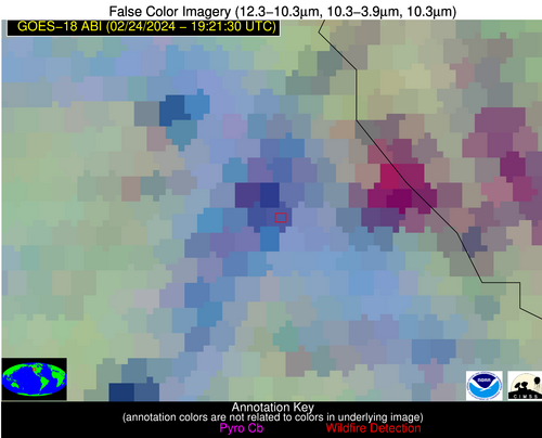
Possible Wildfire
| Basic Information | |
|---|---|
| State/Province(s) | ID |
| Country/Countries | USA |
| County/Locality(s) | Lemhi County, ID |
| NWS WFO | Missoula MT |
| Identification Method | Enhanced Contextual (Cloud) |
| Mean Object Date/Time | 2024-02-24 19:21:23UTC |
| Radiative Center (Lat, Lon): | 45.200°, -113.830° |
| Nearby Counties (meeting alert criteria): |
|
| Total Radiative Power Anomaly | n/a |
| Total Radiative Power | 25.97 MW |
| Map: | |
| Additional Information | |
| Alert Status | New Feature |
| Type of Event | Nominal Risk |
| Event Priority Ranking | 4 |
| Maximum Observed BT (3.9 um) | 292.40 K |
| Observed - Background BT (3.9 um) | 12.49 K |
| BT Anomaly (3.9 um) | 3.82 K |
| Maximum Observed - Clear RTM BT (3.9 um) | 17.62 K |
| Maximum Observed BTD (3.9-10/11/12 um) | 20.90 K |
| Observed - Background BTD (3.9-10/11/12 um) | 12.62 K |
| BTD Anomaly (3.9-10/11/12 um) | 4.22 K |
| Similar Pixel Count | 0 |
| BT Time Tendency (3.9 um) | 2.10 K |
| Image Interval | 5.00 minutes |
| Fraction of Surrounding LWIR Pixels that are Colder | 0.39 |
| Fraction of Surrounding Red Channel Pixels that are Brighter | 0.34 |
| Maximum Radiative Power | 25.97 MW |
| Maximum Radiative Power Uncertainty | 0.00 MW |
| Total Radiative Power Uncertainty | 0.00 MW |
| Mean Viewing Angle | 57.20° |
| Mean Solar Zenith Angle | 55.40° |
| Mean Glint Angle | 103.20° |
| Water Fraction | 0.00 |
| Total Pixel Area | 9.20 km2 |
| Latest Satellite Imagery: | |
| View all event imagery » | |


