Wildfire Alert Report
| Date: | 2024-02-20 |
|---|---|
| Time: | 23:02:54 |
| Production Date and Time: | 2024-02-20 23:03:52 UTC |
| Primary Instrument: | GOES-16 ABI |
| Wmo Spacecraft Id: | 152 |
| Location/orbit: | GEO |
| L1 File: | OR_ABI-L1b-RadM2-M6C14_G16_s20240512302549_e20240512303006_c20240512303054.nc |
| L1 File(s) - Temporal | OR_ABI-L1b-RadM2-M6C14_G16_s20240512259549_e20240512300008_c20240512300054.nc |
| Number Of Thermal Anomaly Alerts: | 6 |
Possible Wildfire
| Basic Information | |
|---|---|
| State/Province(s) | MO |
| Country/Countries | USA |
| County/Locality(s) | Douglas County, MO |
| NWS WFO | Springfield MO |
| Identification Method | Enhanced Contextual (Clear) |
| Mean Object Date/Time | 2024-02-20 23:02:58UTC |
| Radiative Center (Lat, Lon): | 36.920000°, -92.390000° |
| Nearby Counties (meeting alert criteria): |
|
| Total Radiative Power Anomaly | n/a |
| Total Radiative Power | 18.69 MW |
| Map: | |
| Additional Information | |
| Alert Status | New Feature |
| Type of Event | Nominal Risk |
| Event Priority Ranking | 4 |
| Maximum Observed BT (3.9 um) | 290.80 K |
| Observed - Background BT (3.9 um) | 6.00 K |
| BT Anomaly (3.9 um) | 6.35 K |
| Maximum Observed - Clear RTM BT (3.9 um) | 11.42 K |
| Maximum Observed BTD (3.9-10/11/12 um) | 6.85 K |
| Observed - Background BTD (3.9-10/11/12 um) | 5.56 K |
| BTD Anomaly (3.9-10/11/12 um) | 17.25 K |
| Similar Pixel Count | 2 |
| BT Time Tendency (3.9 um) | 2.50 K |
| Image Interval | 3.00 minutes |
| Fraction of Surrounding LWIR Pixels that are Colder | 0.68 |
| Fraction of Surrounding Red Channel Pixels that are Brighter | 1.00 |
| Maximum Radiative Power | 10.72 MW |
| Maximum Radiative Power Uncertainty | 0.00 MW |
| Total Radiative Power Uncertainty | 0.00 MW |
| Mean Viewing Angle | 46.70° |
| Mean Solar Zenith Angle | 81.20° |
| Mean Glint Angle | 79.70° |
| Water Fraction | 0.00 |
| Total Pixel Area | 13.30 km2 |
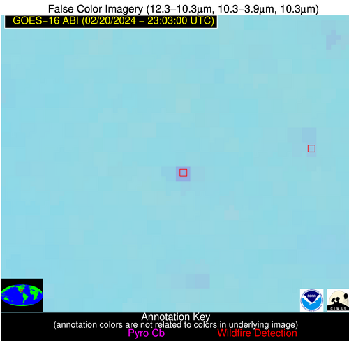
| Latest Satellite Imagery: | |
| View all event imagery » | |
Possible Wildfire
| Basic Information | |
|---|---|
| State/Province(s) | AR |
| Country/Countries | USA |
| County/Locality(s) | Independence County, AR |
| NWS WFO | Little Rock AR |
| Identification Method | Enhanced Contextual (Clear) |
| Mean Object Date/Time | 2024-02-20 23:02:58UTC |
| Radiative Center (Lat, Lon): | 35.610000°, -91.600000° |
| Nearby Counties (meeting alert criteria): |
|
| Total Radiative Power Anomaly | n/a |
| Total Radiative Power | 6.39 MW |
| Map: | |
| Additional Information | |
| Alert Status | New Feature |
| Type of Event | Nominal Risk |
| Event Priority Ranking | 4 |
| Maximum Observed BT (3.9 um) | 290.03 K |
| Observed - Background BT (3.9 um) | 3.69 K |
| BT Anomaly (3.9 um) | 6.89 K |
| Maximum Observed - Clear RTM BT (3.9 um) | 8.24 K |
| Maximum Observed BTD (3.9-10/11/12 um) | 4.79 K |
| Observed - Background BTD (3.9-10/11/12 um) | 3.28 K |
| BTD Anomaly (3.9-10/11/12 um) | 7.78 K |
| Similar Pixel Count | 1 |
| BT Time Tendency (3.9 um) | 0.80 K |
| Image Interval | 3.00 minutes |
| Fraction of Surrounding LWIR Pixels that are Colder | 0.88 |
| Fraction of Surrounding Red Channel Pixels that are Brighter | 1.00 |
| Maximum Radiative Power | 6.39 MW |
| Maximum Radiative Power Uncertainty | 0.00 MW |
| Total Radiative Power Uncertainty | 0.00 MW |
| Mean Viewing Angle | 45.10° |
| Mean Solar Zenith Angle | 81.30° |
| Mean Glint Angle | 79.50° |
| Water Fraction | 0.00 |
| Total Pixel Area | 6.40 km2 |
| Latest Satellite Imagery: | |
| View all event imagery » | |
Possible Wildfire
| Basic Information | |
|---|---|
| State/Province(s) | GA |
| Country/Countries | USA |
| County/Locality(s) | Jasper County, GA |
| NWS WFO | Peachtree City GA |
| Identification Method | Enhanced Contextual (Clear) |
| Mean Object Date/Time | 2024-02-20 23:02:59UTC |
| Radiative Center (Lat, Lon): | 33.280000°, -83.780000° |
| Nearby Counties (meeting alert criteria): |
|
| Total Radiative Power Anomaly | n/a |
| Total Radiative Power | 8.55 MW |
| Map: | |
| Additional Information | |
| Alert Status | New Feature |
| Type of Event | Nominal Risk |
| Event Priority Ranking | 4 |
| Maximum Observed BT (3.9 um) | 287.96 K |
| Observed - Background BT (3.9 um) | 5.93 K |
| BT Anomaly (3.9 um) | 14.13 K |
| Maximum Observed - Clear RTM BT (3.9 um) | 8.18 K |
| Maximum Observed BTD (3.9-10/11/12 um) | 6.40 K |
| Observed - Background BTD (3.9-10/11/12 um) | 5.42 K |
| BTD Anomaly (3.9-10/11/12 um) | 37.43 K |
| Similar Pixel Count | 1 |
| BT Time Tendency (3.9 um) | 3.90 K |
| Image Interval | 3.00 minutes |
| Fraction of Surrounding LWIR Pixels that are Colder | 0.90 |
| Fraction of Surrounding Red Channel Pixels that are Brighter | 0.95 |
| Maximum Radiative Power | 8.55 MW |
| Maximum Radiative Power Uncertainty | 0.00 MW |
| Total Radiative Power Uncertainty | 0.00 MW |
| Mean Viewing Angle | 40.00° |
| Mean Solar Zenith Angle | 86.80° |
| Mean Glint Angle | 87.70° |
| Water Fraction | 0.00 |
| Total Pixel Area | 5.70 km2 |
| Latest Satellite Imagery: | |
| View all event imagery » | |
Possible Wildfire
| Basic Information | |
|---|---|
| State/Province(s) | SC |
| Country/Countries | USA |
| County/Locality(s) | Jasper County, SC |
| NWS WFO | Charleston SC |
| Identification Method | Enhanced Contextual (Clear) |
| Mean Object Date/Time | 2024-02-20 23:03:00UTC |
| Radiative Center (Lat, Lon): | 32.600000°, -81.020000° |
| Nearby Counties (meeting alert criteria): |
|
| Total Radiative Power Anomaly | n/a |
| Total Radiative Power | 42.01 MW |
| Map: | |
| Additional Information | |
| Alert Status | New Feature |
| Type of Event | Nominal Risk |
| Event Priority Ranking | 4 |
| Maximum Observed BT (3.9 um) | 291.67 K |
| Observed - Background BT (3.9 um) | 11.86 K |
| BT Anomaly (3.9 um) | 11.01 K |
| Maximum Observed - Clear RTM BT (3.9 um) | 10.36 K |
| Maximum Observed BTD (3.9-10/11/12 um) | 15.01 K |
| Observed - Background BTD (3.9-10/11/12 um) | 11.75 K |
| BTD Anomaly (3.9-10/11/12 um) | 16.22 K |
| Similar Pixel Count | 4 |
| BT Time Tendency (3.9 um) | 8.80 K |
| Image Interval | 3.00 minutes |
| Fraction of Surrounding LWIR Pixels that are Colder | 0.87 |
| Fraction of Surrounding Red Channel Pixels that are Brighter | 1.00 |
| Maximum Radiative Power | 42.01 MW |
| Maximum Radiative Power Uncertainty | 0.00 MW |
| Total Radiative Power Uncertainty | 0.00 MW |
| Mean Viewing Angle | 38.60° |
| Mean Solar Zenith Angle | 88.80° |
| Mean Glint Angle | 91.20° |
| Water Fraction | 0.00 |
| Total Pixel Area | 16.50 km2 |
| Latest Satellite Imagery: | |
| View all event imagery » | |
Possible Wildfire
| Basic Information | |
|---|---|
| State/Province(s) | MS |
| Country/Countries | USA |
| County/Locality(s) | Covington County, MS |
| NWS WFO | Jackson MS |
| Identification Method | Enhanced Contextual (Clear) |
| Mean Object Date/Time | 2024-02-20 23:02:58UTC |
| Radiative Center (Lat, Lon): | 31.460000°, -89.580000° |
| Nearby Counties (meeting alert criteria): |
|
| Total Radiative Power Anomaly | n/a |
| Total Radiative Power | 10.70 MW |
| Map: | |
| Additional Information | |
| Alert Status | New Feature |
| Type of Event | Nominal Risk |
| Event Priority Ranking | 4 |
| Maximum Observed BT (3.9 um) | 293.32 K |
| Observed - Background BT (3.9 um) | 5.34 K |
| BT Anomaly (3.9 um) | 18.85 K |
| Maximum Observed - Clear RTM BT (3.9 um) | 10.57 K |
| Maximum Observed BTD (3.9-10/11/12 um) | 7.28 K |
| Observed - Background BTD (3.9-10/11/12 um) | 5.50 K |
| BTD Anomaly (3.9-10/11/12 um) | 44.57 K |
| Similar Pixel Count | 1 |
| BT Time Tendency (3.9 um) | 4.90 K |
| Image Interval | 3.00 minutes |
| Fraction of Surrounding LWIR Pixels that are Colder | 0.20 |
| Fraction of Surrounding Red Channel Pixels that are Brighter | 1.00 |
| Maximum Radiative Power | 10.70 MW |
| Maximum Radiative Power Uncertainty | 0.00 MW |
| Total Radiative Power Uncertainty | 0.00 MW |
| Mean Viewing Angle | 40.00° |
| Mean Solar Zenith Angle | 81.50° |
| Mean Glint Angle | 78.80° |
| Water Fraction | 0.00 |
| Total Pixel Area | 5.70 km2 |
| Latest Satellite Imagery: | |
| View all event imagery » | |
Possible Wildfire
| Basic Information | |
|---|---|
| State/Province(s) | GA |
| Country/Countries | USA |
| County/Locality(s) | Ware County, GA |
| NWS WFO | Jacksonville FL |
| Identification Method | Enhanced Contextual (Clear) |
| Mean Object Date/Time | 2024-02-20 23:03:00UTC |
| Radiative Center (Lat, Lon): | 31.140000°, -82.240000° |
| Nearby Counties (meeting alert criteria): |
|
| Total Radiative Power Anomaly | n/a |
| Total Radiative Power | 19.74 MW |
| Map: | |
| Additional Information | |
| Alert Status | New Feature |
| Type of Event | Nominal Risk |
| Event Priority Ranking | 4 |
| Maximum Observed BT (3.9 um) | 290.75 K |
| Observed - Background BT (3.9 um) | 7.00 K |
| BT Anomaly (3.9 um) | 11.74 K |
| Maximum Observed - Clear RTM BT (3.9 um) | 8.04 K |
| Maximum Observed BTD (3.9-10/11/12 um) | 8.80 K |
| Observed - Background BTD (3.9-10/11/12 um) | 7.19 K |
| BTD Anomaly (3.9-10/11/12 um) | 24.50 K |
| Similar Pixel Count | 2 |
| BT Time Tendency (3.9 um) | 4.00 K |
| Image Interval | 3.00 minutes |
| Fraction of Surrounding LWIR Pixels that are Colder | 0.37 |
| Fraction of Surrounding Red Channel Pixels that are Brighter | 1.00 |
| Maximum Radiative Power | 19.74 MW |
| Maximum Radiative Power Uncertainty | 0.00 MW |
| Total Radiative Power Uncertainty | 0.00 MW |
| Mean Viewing Angle | 37.20° |
| Mean Solar Zenith Angle | 87.40° |
| Mean Glint Angle | 88.80° |
| Water Fraction | 0.00 |
| Total Pixel Area | 10.80 km2 |
| Latest Satellite Imagery: | |
| View all event imagery » | |

