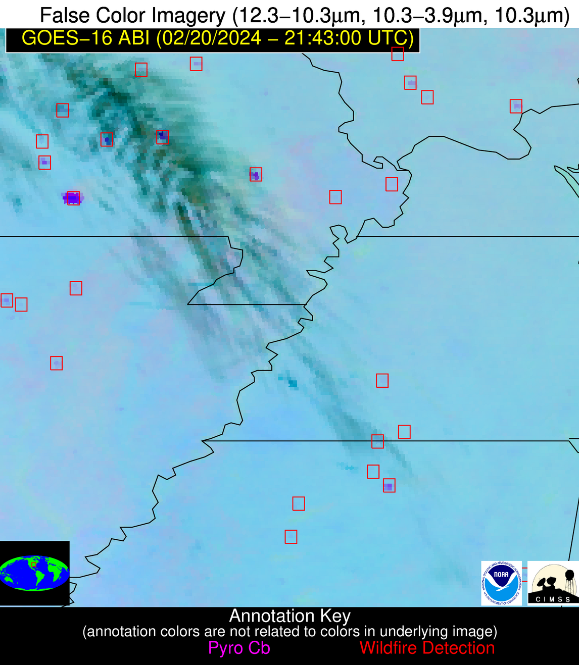
Wildfire Alert Report
| Date: | 2024-02-20 |
|---|---|
| Time: | 21:42:54 |
| Production Date and Time: | 2024-02-20 21:43:49 UTC |
| Primary Instrument: | GOES-16 ABI |
| Wmo Spacecraft Id: | 152 |
| Location/orbit: | GEO |
| L1 File: | OR_ABI-L1b-RadM2-M6C14_G16_s20240512142549_e20240512143006_c20240512143067.nc |
| L1 File(s) - Temporal | OR_ABI-L1b-RadM2-M6C14_G16_s20240512139549_e20240512140008_c20240512140053.nc |
| Number Of Thermal Anomaly Alerts: | 4 |
Possible Wildfire
| Basic Information | |
|---|---|
| State/Province(s) | MO |
| Country/Countries | USA |
| County/Locality(s) | St. Francois County, MO |
| NWS WFO | St Louis MO |
| Identification Method | Enhanced Contextual (Clear) |
| Mean Object Date/Time | 2024-02-20 21:42:55UTC |
| Radiative Center (Lat, Lon): | 37.770°, -90.330° |
| Nearby Counties (meeting alert criteria): |
|
| Total Radiative Power Anomaly | n/a |
| Total Radiative Power | 29.39 MW |
| Map: | |
| Additional Information | |
| Alert Status | New Feature |
| Type of Event | Nominal Risk |
| Event Priority Ranking | 4 |
| Maximum Observed BT (3.9 um) | 296.02 K |
| Observed - Background BT (3.9 um) | 7.43 K |
| BT Anomaly (3.9 um) | 7.66 K |
| Maximum Observed - Clear RTM BT (3.9 um) | 15.00 K |
| Maximum Observed BTD (3.9-10/11/12 um) | 11.05 K |
| Observed - Background BTD (3.9-10/11/12 um) | 7.32 K |
| BTD Anomaly (3.9-10/11/12 um) | 11.98 K |
| Similar Pixel Count | 2 |
| BT Time Tendency (3.9 um) | 5.70 K |
| Image Interval | 3.00 minutes |
| Fraction of Surrounding LWIR Pixels that are Colder | 0.46 |
| Fraction of Surrounding Red Channel Pixels that are Brighter | 1.00 |
| Maximum Radiative Power | 29.39 MW |
| Maximum Radiative Power Uncertainty | 0.00 MW |
| Total Radiative Power Uncertainty | 0.00 MW |
| Mean Viewing Angle | 46.80° |
| Mean Solar Zenith Angle | 69.00° |
| Mean Glint Angle | 82.90° |
| Water Fraction | 0.00 |
| Total Pixel Area | 13.20 km2 |
| Latest Satellite Imagery: | |
| View all event imagery » | |
Possible Wildfire
| Basic Information | |
|---|---|
| State/Province(s) | AR |
| Country/Countries | USA |
| County/Locality(s) | Jackson County, AR |
| NWS WFO | Little Rock AR |
| Identification Method | Enhanced Contextual (Clear) |
| Mean Object Date/Time | 2024-02-20 21:42:58UTC |
| Radiative Center (Lat, Lon): | 35.570°, -91.130° |
| Nearby Counties (meeting alert criteria): |
|
| Total Radiative Power Anomaly | n/a |
| Total Radiative Power | 21.46 MW |
| Map: | |
| Additional Information | |
| Alert Status | New Feature |
| Type of Event | Nominal Risk |
| Event Priority Ranking | 4 |
| Maximum Observed BT (3.9 um) | 296.41 K |
| Observed - Background BT (3.9 um) | 5.26 K |
| BT Anomaly (3.9 um) | 6.18 K |
| Maximum Observed - Clear RTM BT (3.9 um) | 12.61 K |
| Maximum Observed BTD (3.9-10/11/12 um) | 9.70 K |
| Observed - Background BTD (3.9-10/11/12 um) | 5.44 K |
| BTD Anomaly (3.9-10/11/12 um) | 14.29 K |
| Similar Pixel Count | 3 |
| BT Time Tendency (3.9 um) | 2.20 K |
| Image Interval | 3.00 minutes |
| Fraction of Surrounding LWIR Pixels that are Colder | 0.34 |
| Fraction of Surrounding Red Channel Pixels that are Brighter | 1.00 |
| Maximum Radiative Power | 21.46 MW |
| Maximum Radiative Power Uncertainty | 0.00 MW |
| Total Radiative Power Uncertainty | 0.00 MW |
| Mean Viewing Angle | 44.80° |
| Mean Solar Zenith Angle | 67.20° |
| Mean Glint Angle | 79.40° |
| Water Fraction | 0.00 |
| Total Pixel Area | 12.70 km2 |
| Latest Satellite Imagery: | |
| View all event imagery » | |
Possible Wildfire
| Basic Information | |
|---|---|
| State/Province(s) | MS |
| Country/Countries | USA |
| County/Locality(s) | Monroe County, MS |
| NWS WFO | Memphis TN |
| Identification Method | Enhanced Contextual (Clear) |
| Mean Object Date/Time | 2024-02-20 21:42:58UTC |
| Radiative Center (Lat, Lon): | 34.020°, -88.440° |
| Nearby Counties (meeting alert criteria): |
|
| Total Radiative Power Anomaly | n/a |
| Total Radiative Power | 11.07 MW |
| Map: | |
| Additional Information | |
| Alert Status | New Feature |
| Type of Event | Nominal Risk |
| Event Priority Ranking | 4 |
| Maximum Observed BT (3.9 um) | 295.63 K |
| Observed - Background BT (3.9 um) | 5.47 K |
| BT Anomaly (3.9 um) | 11.14 K |
| Maximum Observed - Clear RTM BT (3.9 um) | 12.20 K |
| Maximum Observed BTD (3.9-10/11/12 um) | 8.39 K |
| Observed - Background BTD (3.9-10/11/12 um) | 5.11 K |
| BTD Anomaly (3.9-10/11/12 um) | 16.04 K |
| Similar Pixel Count | 2 |
| BT Time Tendency (3.9 um) | 2.30 K |
| Image Interval | 3.00 minutes |
| Fraction of Surrounding LWIR Pixels that are Colder | 0.93 |
| Fraction of Surrounding Red Channel Pixels that are Brighter | 1.00 |
| Maximum Radiative Power | 11.07 MW |
| Maximum Radiative Power Uncertainty | 0.00 MW |
| Total Radiative Power Uncertainty | 0.00 MW |
| Mean Viewing Angle | 42.20° |
| Mean Solar Zenith Angle | 68.20° |
| Mean Glint Angle | 79.60° |
| Water Fraction | 0.00 |
| Total Pixel Area | 6.00 km2 |
| Latest Satellite Imagery: | |
| View all event imagery » | |
Possible Wildfire
| Basic Information | |
|---|---|
| State/Province(s) | MS |
| Country/Countries | USA |
| County/Locality(s) | Franklin County, MS |
| NWS WFO | Jackson MS |
| Identification Method | Enhanced Contextual (Clear) |
| Mean Object Date/Time | 2024-02-20 21:42:58UTC |
| Radiative Center (Lat, Lon): | 31.520°, -90.960° |
| Nearby Counties (meeting alert criteria): |
|
| Total Radiative Power Anomaly | n/a |
| Total Radiative Power | 7.29 MW |
| Map: | |
| Additional Information | |
| Alert Status | New Feature |
| Type of Event | Nominal Risk |
| Event Priority Ranking | 4 |
| Maximum Observed BT (3.9 um) | 296.74 K |
| Observed - Background BT (3.9 um) | 3.47 K |
| BT Anomaly (3.9 um) | 10.96 K |
| Maximum Observed - Clear RTM BT (3.9 um) | 11.56 K |
| Maximum Observed BTD (3.9-10/11/12 um) | 6.27 K |
| Observed - Background BTD (3.9-10/11/12 um) | 2.99 K |
| BTD Anomaly (3.9-10/11/12 um) | 10.71 K |
| Similar Pixel Count | 4 |
| BT Time Tendency (3.9 um) | 2.20 K |
| Image Interval | 3.00 minutes |
| Fraction of Surrounding LWIR Pixels that are Colder | 0.98 |
| Fraction of Surrounding Red Channel Pixels that are Brighter | 1.00 |
| Maximum Radiative Power | 7.29 MW |
| Maximum Radiative Power Uncertainty | 0.00 MW |
| Total Radiative Power Uncertainty | 0.00 MW |
| Mean Viewing Angle | 40.70° |
| Mean Solar Zenith Angle | 65.10° |
| Mean Glint Angle | 73.90° |
| Water Fraction | 0.00 |
| Total Pixel Area | 5.80 km2 |
| Latest Satellite Imagery: | |
| View all event imagery » | |


