Wildfire Alert Report
| Date: | 2024-02-18 |
|---|---|
| Time: | 00:01:17 |
| Production Date and Time: | 2024-02-18 00:05:47 UTC |
| Primary Instrument: | GOES-16 ABI |
| Wmo Spacecraft Id: | 152 |
| Location/orbit: | GEO |
| L1 File: | OR_ABI-L1b-RadC-M6C14_G16_s20240490001176_e20240490003549_c20240490004048.nc |
| L1 File(s) - Temporal | OR_ABI-L1b-RadC-M6C14_G16_s20240482356176_e20240482358549_c20240482359017.nc |
| Number Of Thermal Anomaly Alerts: | 3 |
Possible Wildfire
| Basic Information | |
|---|---|
| State/Province(s) | WY |
| Country/Countries | USA |
| County/Locality(s) | Johnson County, WY |
| NWS WFO | Riverton WY |
| Identification Method | Enhanced Contextual (Clear) |
| Mean Object Date/Time | 2024-02-18 00:01:19UTC |
| Radiative Center (Lat, Lon): | 43.870000°, -106.930000° |
| Nearby Counties (meeting alert criteria): |
|
| Total Radiative Power Anomaly | n/a |
| Total Radiative Power | 34.32 MW |
| Map: | |
| Additional Information | |
| Alert Status | New Feature |
| Type of Event | Nominal Risk |
| Event Priority Ranking | 4 |
| Maximum Observed BT (3.9 um) | 281.07 K |
| Observed - Background BT (3.9 um) | 16.12 K |
| BT Anomaly (3.9 um) | 10.68 K |
| Maximum Observed - Clear RTM BT (3.9 um) | 18.20 K |
| Maximum Observed BTD (3.9-10/11/12 um) | 17.49 K |
| Observed - Background BTD (3.9-10/11/12 um) | 16.42 K |
| BTD Anomaly (3.9-10/11/12 um) | 48.81 K |
| Similar Pixel Count | 1 |
| BT Time Tendency (3.9 um) | 2.30 K |
| Image Interval | 5.00 minutes |
| Fraction of Surrounding LWIR Pixels that are Colder | 0.44 |
| Fraction of Surrounding Red Channel Pixels that are Brighter | 0.91 |
| Maximum Radiative Power | 34.32 MW |
| Maximum Radiative Power Uncertainty | 0.00 MW |
| Total Radiative Power Uncertainty | 0.00 MW |
| Mean Viewing Angle | 60.10° |
| Mean Solar Zenith Angle | 84.30° |
| Mean Glint Angle | 70.60° |
| Water Fraction | 0.00 |
| Total Pixel Area | 21.80 km2 |
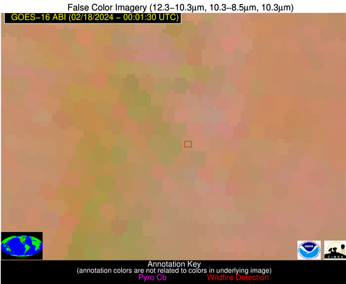
| Latest Satellite Imagery: | |
| View all event imagery » | |
Possible Wildfire
| Basic Information | |
|---|---|
| State/Province(s) | MO |
| Country/Countries | USA |
| County/Locality(s) | Osage County, MO |
| NWS WFO | St Louis MO |
| Identification Method | Enhanced Contextual (Clear) |
| Mean Object Date/Time | 2024-02-18 00:01:51UTC |
| Radiative Center (Lat, Lon): | 38.580000°, -91.960000° |
| Nearby Counties (meeting alert criteria): |
|
| Total Radiative Power Anomaly | n/a |
| Total Radiative Power | 9.82 MW |
| Map: | |
| Additional Information | |
| Alert Status | New Feature |
| Type of Event | Nominal Risk |
| Event Priority Ranking | 4 |
| Maximum Observed BT (3.9 um) | 270.65 K |
| Observed - Background BT (3.9 um) | 5.91 K |
| BT Anomaly (3.9 um) | 7.62 K |
| Maximum Observed - Clear RTM BT (3.9 um) | 8.46 K |
| Maximum Observed BTD (3.9-10/11/12 um) | 6.25 K |
| Observed - Background BTD (3.9-10/11/12 um) | 6.03 K |
| BTD Anomaly (3.9-10/11/12 um) | 22.50 K |
| Similar Pixel Count | 2 |
| BT Time Tendency (3.9 um) | 1.10 K |
| Image Interval | 5.00 minutes |
| Fraction of Surrounding LWIR Pixels that are Colder | 0.86 |
| Fraction of Surrounding Red Channel Pixels that are Brighter | 1.00 |
| Maximum Radiative Power | 5.28 MW |
| Maximum Radiative Power Uncertainty | 0.00 MW |
| Total Radiative Power Uncertainty | 0.00 MW |
| Mean Viewing Angle | 48.20° |
| Mean Solar Zenith Angle | 93.50° |
| Mean Glint Angle | 82.50° |
| Water Fraction | 0.00 |
| Total Pixel Area | 13.70 km2 |
| Latest Satellite Imagery: | |
| View all event imagery » | |
Possible Wildfire
| Basic Information | |
|---|---|
| State/Province(s) | AR |
| Country/Countries | USA |
| County/Locality(s) | Sharp County, AR |
| NWS WFO | Little Rock AR |
| Identification Method | Enhanced Contextual (Clear) |
| Mean Object Date/Time | 2024-02-18 00:02:21UTC |
| Radiative Center (Lat, Lon): | 35.960000°, -91.590000° |
| Nearby Counties (meeting alert criteria): |
|
| Total Radiative Power Anomaly | n/a |
| Total Radiative Power | 9.61 MW |
| Map: | |
| Additional Information | |
| Alert Status | New Feature |
| Type of Event | Nominal Risk |
| Event Priority Ranking | 4 |
| Maximum Observed BT (3.9 um) | 278.76 K |
| Observed - Background BT (3.9 um) | 8.71 K |
| BT Anomaly (3.9 um) | 11.95 K |
| Maximum Observed - Clear RTM BT (3.9 um) | 9.09 K |
| Maximum Observed BTD (3.9-10/11/12 um) | 10.50 K |
| Observed - Background BTD (3.9-10/11/12 um) | 8.83 K |
| BTD Anomaly (3.9-10/11/12 um) | 9.20 K |
| Similar Pixel Count | 1 |
| BT Time Tendency (3.9 um) | 8.10 K |
| Image Interval | 5.00 minutes |
| Fraction of Surrounding LWIR Pixels that are Colder | 0.50 |
| Fraction of Surrounding Red Channel Pixels that are Brighter | 1.00 |
| Maximum Radiative Power | 9.61 MW |
| Maximum Radiative Power Uncertainty | 0.00 MW |
| Total Radiative Power Uncertainty | 0.00 MW |
| Mean Viewing Angle | 45.40° |
| Mean Solar Zenith Angle | 93.20° |
| Mean Glint Angle | 82.20° |
| Water Fraction | 0.00 |
| Total Pixel Area | 6.40 km2 |
| Latest Satellite Imagery: | |
| View all event imagery » | |


