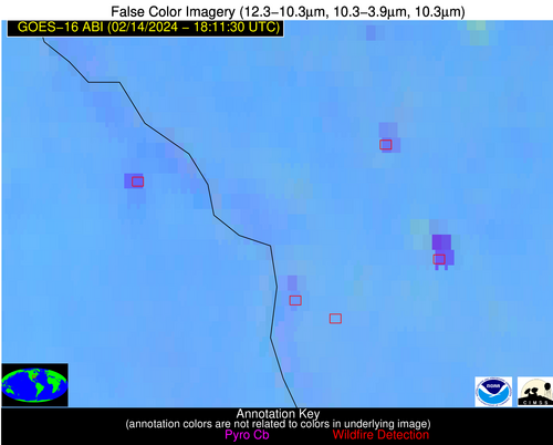
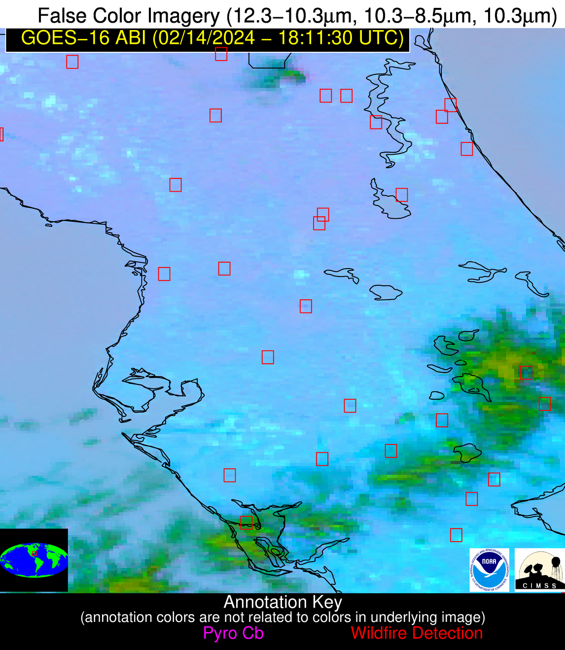
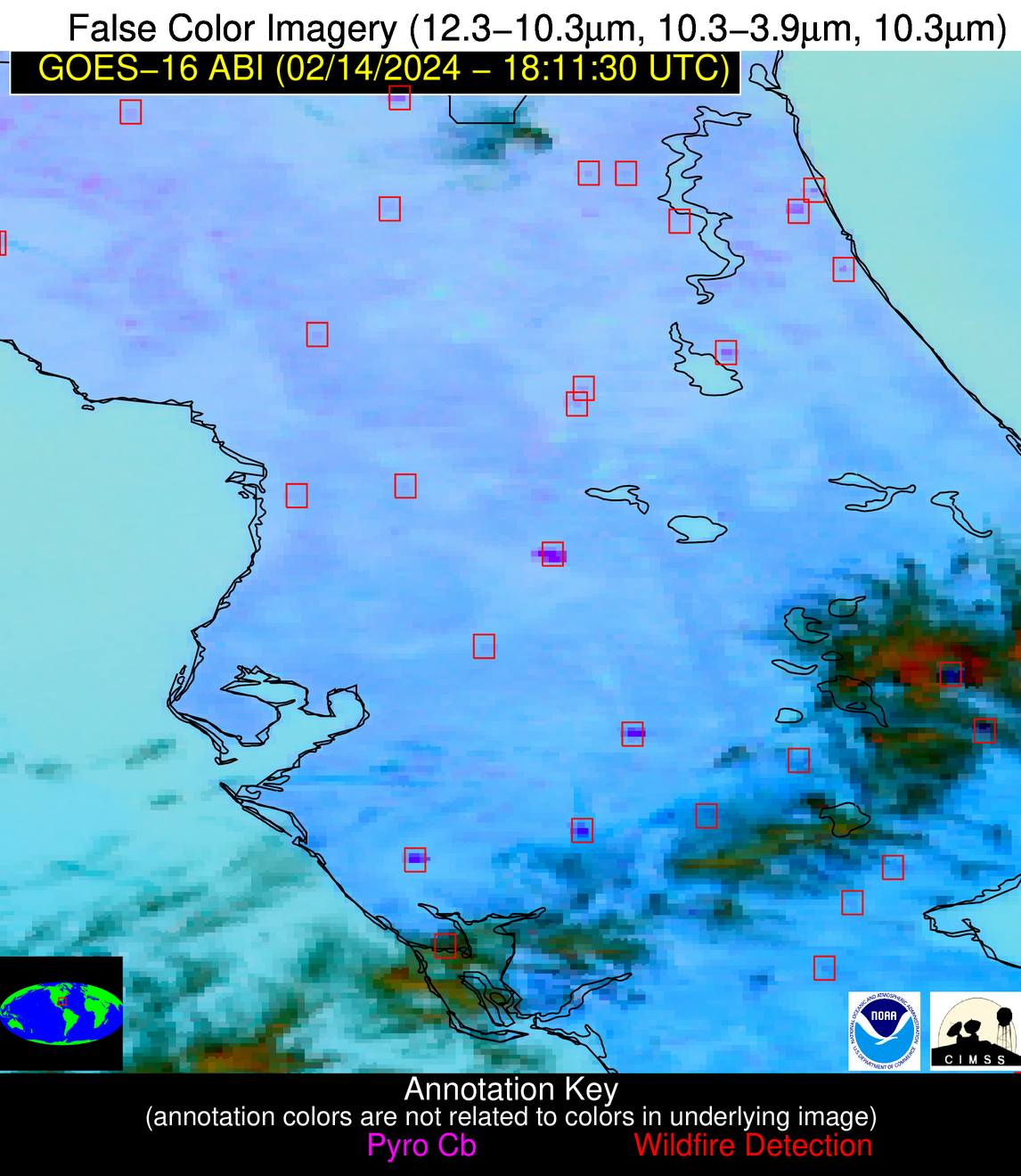
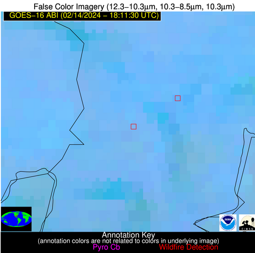
Wildfire Alert Report
| Date: | 2024-02-14 |
|---|---|
| Time: | 18:11:17 |
| Production Date and Time: | 2024-02-14 18:15:57 UTC |
| Primary Instrument: | GOES-16 ABI |
| Wmo Spacecraft Id: | 152 |
| Location/orbit: | GEO |
| L1 File: | OR_ABI-L1b-RadC-M6C14_G16_s20240451811174_e20240451813547_c20240451814045.nc |
| L1 File(s) - Temporal | OR_ABI-L1b-RadC-M6C14_G16_s20240451806174_e20240451808547_c20240451809040.nc |
| Number Of Thermal Anomaly Alerts: | 8 |
Possible Wildfire
| Basic Information | |
|---|---|
| State/Province(s) | MO |
| Country/Countries | USA |
| County/Locality(s) | Perry County, MO |
| NWS WFO | Paducah KY |
| Identification Method | Enhanced Contextual (Clear) |
| Mean Object Date/Time | 2024-02-14 18:11:51UTC |
| Radiative Center (Lat, Lon): | 37.800000°, -89.870000° |
| Nearby Counties (meeting alert criteria): |
|
| Total Radiative Power Anomaly | n/a |
| Total Radiative Power | 71.66 MW |
| Map: | |
| Additional Information | |
| Alert Status | New Feature |
| Type of Event | Nominal Risk |
| Event Priority Ranking | 4 |
| Maximum Observed BT (3.9 um) | 309.42 K |
| Observed - Background BT (3.9 um) | 10.36 K |
| BT Anomaly (3.9 um) | 9.00 K |
| Maximum Observed - Clear RTM BT (3.9 um) | 22.78 K |
| Maximum Observed BTD (3.9-10/11/12 um) | 19.02 K |
| Observed - Background BTD (3.9-10/11/12 um) | 10.32 K |
| BTD Anomaly (3.9-10/11/12 um) | 14.52 K |
| Similar Pixel Count | 2 |
| BT Time Tendency (3.9 um) | 9.50 K |
| Image Interval | 5.00 minutes |
| Fraction of Surrounding LWIR Pixels that are Colder | 0.47 |
| Fraction of Surrounding Red Channel Pixels that are Brighter | 0.09 |
| Maximum Radiative Power | 37.92 MW |
| Maximum Radiative Power Uncertainty | 0.00 MW |
| Total Radiative Power Uncertainty | 0.00 MW |
| Mean Viewing Angle | 46.70° |
| Mean Solar Zenith Angle | 51.10° |
| Mean Glint Angle | 95.30° |
| Water Fraction | 0.00 |
| Total Pixel Area | 13.20 km2 |
| Latest Satellite Imagery: | |
| View all event imagery » | |
Possible Wildfire
| Basic Information | |
|---|---|
| State/Province(s) | IL |
| Country/Countries | USA |
| County/Locality(s) | Williamson County, IL |
| NWS WFO | Paducah KY |
| Identification Method | Enhanced Contextual (Cloud) |
| Mean Object Date/Time | 2024-02-14 18:11:51UTC |
| Radiative Center (Lat, Lon): | 37.680000°, -89.070000° |
| Nearby Counties (meeting alert criteria): |
|
| Total Radiative Power Anomaly | n/a |
| Total Radiative Power | 44.97 MW |
| Map: | |
| Additional Information | |
| Alert Status | New Feature |
| Type of Event | Nominal Risk, Known Incident: HAMPTON RX (MEDIUM, tdiff=0.07885 days, POINT) |
| Event Priority Ranking | 4 |
| Maximum Observed BT (3.9 um) | 310.24 K |
| Observed - Background BT (3.9 um) | 12.42 K |
| BT Anomaly (3.9 um) | 10.73 K |
| Maximum Observed - Clear RTM BT (3.9 um) | 24.26 K |
| Maximum Observed BTD (3.9-10/11/12 um) | 20.62 K |
| Observed - Background BTD (3.9-10/11/12 um) | 12.51 K |
| BTD Anomaly (3.9-10/11/12 um) | 14.85 K |
| Similar Pixel Count | 0 |
| BT Time Tendency (3.9 um) | 3.00 K |
| Image Interval | 5.00 minutes |
| Fraction of Surrounding LWIR Pixels that are Colder | 0.43 |
| Fraction of Surrounding Red Channel Pixels that are Brighter | 1.00 |
| Maximum Radiative Power | 44.97 MW |
| Maximum Radiative Power Uncertainty | 0.00 MW |
| Total Radiative Power Uncertainty | 0.00 MW |
| Mean Viewing Angle | 46.30° |
| Mean Solar Zenith Angle | 51.00° |
| Mean Glint Angle | 94.80° |
| Water Fraction | 0.00 |
| Total Pixel Area | 6.50 km2 |
| Latest Satellite Imagery: | |
| View all event imagery » | |
Possible Wildfire
| Basic Information | |
|---|---|
| State/Province(s) | FL |
| Country/Countries | USA |
| County/Locality(s) | Hamilton County, FL |
| NWS WFO | Jacksonville FL |
| Identification Method | Enhanced Contextual (Clear) |
| Mean Object Date/Time | 2024-02-14 18:12:21UTC |
| Radiative Center (Lat, Lon): | 30.420000°, -82.940000° |
| Nearby Counties (meeting alert criteria): |
|
| Total Radiative Power Anomaly | n/a |
| Total Radiative Power | 13.73 MW |
| Map: | |
| Additional Information | |
| Alert Status | New Feature |
| Type of Event | Nominal Risk |
| Event Priority Ranking | 4 |
| Maximum Observed BT (3.9 um) | 302.00 K |
| Observed - Background BT (3.9 um) | 2.90 K |
| BT Anomaly (3.9 um) | 1.53 K |
| Maximum Observed - Clear RTM BT (3.9 um) | 11.05 K |
| Maximum Observed BTD (3.9-10/11/12 um) | 8.54 K |
| Observed - Background BTD (3.9-10/11/12 um) | 2.90 K |
| BTD Anomaly (3.9-10/11/12 um) | 3.64 K |
| Similar Pixel Count | 10 |
| BT Time Tendency (3.9 um) | 2.50 K |
| Image Interval | 5.00 minutes |
| Fraction of Surrounding LWIR Pixels that are Colder | 0.50 |
| Fraction of Surrounding Red Channel Pixels that are Brighter | 1.00 |
| Maximum Radiative Power | 7.33 MW |
| Maximum Radiative Power Uncertainty | 0.00 MW |
| Total Radiative Power Uncertainty | 0.00 MW |
| Mean Viewing Angle | 36.60° |
| Mean Solar Zenith Angle | 44.10° |
| Mean Glint Angle | 78.60° |
| Water Fraction | 0.00 |
| Total Pixel Area | 10.70 km2 |
| Latest Satellite Imagery: | |
| View all event imagery » | |
Possible Wildfire
| Basic Information | |
|---|---|
| State/Province(s) | FL |
| Country/Countries | USA |
| County/Locality(s) | Union County, FL |
| NWS WFO | Jacksonville FL |
| Identification Method | Enhanced Contextual (Clear) |
| Mean Object Date/Time | 2024-02-14 18:12:52UTC |
| Radiative Center (Lat, Lon): | 30.000000°, -82.340000° |
| Nearby Counties (meeting alert criteria): |
|
| Total Radiative Power Anomaly | n/a |
| Total Radiative Power | 6.18 MW |
| Map: | |
| Additional Information | |
| Alert Status | New Feature |
| Type of Event | Nominal Risk |
| Event Priority Ranking | 4 |
| Maximum Observed BT (3.9 um) | 301.04 K |
| Observed - Background BT (3.9 um) | 3.32 K |
| BT Anomaly (3.9 um) | 1.69 K |
| Maximum Observed - Clear RTM BT (3.9 um) | 9.19 K |
| Maximum Observed BTD (3.9-10/11/12 um) | 7.83 K |
| Observed - Background BTD (3.9-10/11/12 um) | 2.96 K |
| BTD Anomaly (3.9-10/11/12 um) | 3.82 K |
| Similar Pixel Count | 16 |
| BT Time Tendency (3.9 um) | 1.00 K |
| Image Interval | 5.00 minutes |
| Fraction of Surrounding LWIR Pixels that are Colder | 0.64 |
| Fraction of Surrounding Red Channel Pixels that are Brighter | 1.00 |
| Maximum Radiative Power | 6.18 MW |
| Maximum Radiative Power Uncertainty | 0.00 MW |
| Total Radiative Power Uncertainty | 0.00 MW |
| Mean Viewing Angle | 36.00° |
| Mean Solar Zenith Angle | 43.80° |
| Mean Glint Angle | 77.80° |
| Water Fraction | 0.00 |
| Total Pixel Area | 5.30 km2 |
| Latest Satellite Imagery: | |
| View all event imagery » | |
Possible Wildfire
| Basic Information | |
|---|---|
| State/Province(s) | LA |
| Country/Countries | USA |
| County/Locality(s) | Calcasieu Parish, LA |
| NWS WFO | Lake Charles LA |
| Identification Method | Enhanced Contextual (Clear) |
| Mean Object Date/Time | 2024-02-14 18:12:50UTC |
| Radiative Center (Lat, Lon): | 30.090000°, -93.590000° |
| Nearby Counties (meeting alert criteria): |
|
| Total Radiative Power Anomaly | n/a |
| Total Radiative Power | 15.24 MW |
| Map: | |
| Additional Information | |
| Alert Status | New Feature |
| Type of Event | Nominal Risk |
| Event Priority Ranking | 4 |
| Maximum Observed BT (3.9 um) | 301.16 K |
| Observed - Background BT (3.9 um) | 4.93 K |
| BT Anomaly (3.9 um) | 1.86 K |
| Maximum Observed - Clear RTM BT (3.9 um) | 10.80 K |
| Maximum Observed BTD (3.9-10/11/12 um) | 11.96 K |
| Observed - Background BTD (3.9-10/11/12 um) | 4.94 K |
| BTD Anomaly (3.9-10/11/12 um) | 2.52 K |
| Similar Pixel Count | 5 |
| BT Time Tendency (3.9 um) | 1.00 K |
| Image Interval | 5.00 minutes |
| Fraction of Surrounding LWIR Pixels that are Colder | 0.54 |
| Fraction of Surrounding Red Channel Pixels that are Brighter | 0.98 |
| Maximum Radiative Power | 15.24 MW |
| Maximum Radiative Power Uncertainty | 0.00 MW |
| Total Radiative Power Uncertainty | 0.00 MW |
| Mean Viewing Angle | 40.60° |
| Mean Solar Zenith Angle | 43.60° |
| Mean Glint Angle | 81.30° |
| Water Fraction | 0.00 |
| Total Pixel Area | 5.80 km2 |
| Latest Satellite Imagery: | |
| View all event imagery » | |
Possible Wildfire
| Basic Information | |
|---|---|
| State/Province(s) | FL |
| Country/Countries | USA |
| County/Locality(s) | Hillsborough County, FL |
| NWS WFO | Tampa Bay Ruskin FL |
| Identification Method | Enhanced Contextual (Clear) |
| Mean Object Date/Time | 2024-02-14 18:12:52UTC |
| Radiative Center (Lat, Lon): | 28.120000°, -82.120000° |
| Nearby Counties (meeting alert criteria): |
|
| Total Radiative Power Anomaly | n/a |
| Total Radiative Power | 15.04 MW |
| Map: | |
| Additional Information | |
| Alert Status | New Feature |
| Type of Event | Nominal Risk |
| Event Priority Ranking | 4 |
| Maximum Observed BT (3.9 um) | 305.75 K |
| Observed - Background BT (3.9 um) | 2.22 K |
| BT Anomaly (3.9 um) | 1.05 K |
| Maximum Observed - Clear RTM BT (3.9 um) | 12.88 K |
| Maximum Observed BTD (3.9-10/11/12 um) | 10.00 K |
| Observed - Background BTD (3.9-10/11/12 um) | 2.70 K |
| BTD Anomaly (3.9-10/11/12 um) | 2.80 K |
| Similar Pixel Count | 15 |
| BT Time Tendency (3.9 um) | 2.00 K |
| Image Interval | 5.00 minutes |
| Fraction of Surrounding LWIR Pixels that are Colder | 0.29 |
| Fraction of Surrounding Red Channel Pixels that are Brighter | 1.00 |
| Maximum Radiative Power | 15.04 MW |
| Maximum Radiative Power Uncertainty | 0.00 MW |
| Total Radiative Power Uncertainty | 0.00 MW |
| Mean Viewing Angle | 33.80° |
| Mean Solar Zenith Angle | 42.00° |
| Mean Glint Angle | 73.80° |
| Water Fraction | 0.00 |
| Total Pixel Area | 10.20 km2 |
| Latest Satellite Imagery: | |
| View all event imagery » | |
Possible Wildfire
| Basic Information | |
|---|---|
| State/Province(s) | FL |
| Country/Countries | USA |
| County/Locality(s) | Hendry County, FL |
| NWS WFO | Miami FL |
| Identification Method | Enhanced Contextual (Clear) |
| Mean Object Date/Time | 2024-02-14 18:12:52UTC |
| Radiative Center (Lat, Lon): | 26.520000°, -81.150000° |
| Nearby Counties (meeting alert criteria): |
|
| Total Radiative Power Anomaly | n/a |
| Total Radiative Power | 8.90 MW |
| Map: | |
| Additional Information | |
| Alert Status | New Feature |
| Type of Event | Nominal Risk |
| Event Priority Ranking | 4 |
| Maximum Observed BT (3.9 um) | 307.31 K |
| Observed - Background BT (3.9 um) | 3.77 K |
| BT Anomaly (3.9 um) | 1.85 K |
| Maximum Observed - Clear RTM BT (3.9 um) | 10.59 K |
| Maximum Observed BTD (3.9-10/11/12 um) | 12.44 K |
| Observed - Background BTD (3.9-10/11/12 um) | 3.50 K |
| BTD Anomaly (3.9-10/11/12 um) | 3.04 K |
| Similar Pixel Count | 15 |
| BT Time Tendency (3.9 um) | 2.00 K |
| Image Interval | 5.00 minutes |
| Fraction of Surrounding LWIR Pixels that are Colder | 0.59 |
| Fraction of Surrounding Red Channel Pixels that are Brighter | 1.00 |
| Maximum Radiative Power | 8.90 MW |
| Maximum Radiative Power Uncertainty | 0.00 MW |
| Total Radiative Power Uncertainty | 0.00 MW |
| Mean Viewing Angle | 31.80° |
| Mean Solar Zenith Angle | 40.60° |
| Mean Glint Angle | 70.40° |
| Water Fraction | 0.00 |
| Total Pixel Area | 5.00 km2 |
| Latest Satellite Imagery: | |
| View all event imagery » | |
Possible Wildfire
| Basic Information | |
|---|---|
| State/Province(s) | Unknown |
| Country/Countries | Bahamas |
| County/Locality(s) | Bahamas |
| NWS WFO | N/A |
| Identification Method | Enhanced Contextual (Clear) |
| Mean Object Date/Time | 2024-02-14 18:12:52UTC |
| Radiative Center (Lat, Lon): | 24.620000°, -78.060000° |
| Nearby Counties (meeting alert criteria): |
|
| Total Radiative Power Anomaly | n/a |
| Total Radiative Power | 20.37 MW |
| Map: | |
| Additional Information | |
| Alert Status | New Feature |
| Type of Event | Nominal Risk |
| Event Priority Ranking | 4 |
| Maximum Observed BT (3.9 um) | 310.00 K |
| Observed - Background BT (3.9 um) | 7.52 K |
| BT Anomaly (3.9 um) | 4.09 K |
| Maximum Observed - Clear RTM BT (3.9 um) | 4.33 K |
| Maximum Observed BTD (3.9-10/11/12 um) | 18.41 K |
| Observed - Background BTD (3.9-10/11/12 um) | 6.78 K |
| BTD Anomaly (3.9-10/11/12 um) | 4.80 K |
| Similar Pixel Count | 16 |
| BT Time Tendency (3.9 um) | 3.40 K |
| Image Interval | 5.00 minutes |
| Fraction of Surrounding LWIR Pixels that are Colder | 0.85 |
| Fraction of Surrounding Red Channel Pixels that are Brighter | 1.00 |
| Maximum Radiative Power | 20.37 MW |
| Maximum Radiative Power Uncertainty | 0.00 MW |
| Total Radiative Power Uncertainty | 0.00 MW |
| Mean Viewing Angle | 29.10° |
| Mean Solar Zenith Angle | 39.50° |
| Mean Glint Angle | 66.90° |
| Water Fraction | 0.00 |
| Total Pixel Area | 4.80 km2 |
| Latest Satellite Imagery: | |
| View all event imagery » | |

