Wildfire Alert Report
| Date: | 2023-11-17 |
|---|---|
| Time: | 19:01:17 |
| Production Date and Time: | 2023-11-17 19:05:56 UTC |
| Primary Instrument: | GOES-16 ABI |
| Wmo Spacecraft Id: | 152 |
| Location/orbit: | GEO |
| L1 File: | OR_ABI-L1b-RadC-M6C14_G16_s20233211901173_e20233211903546_c20233211904026.nc |
| L1 File(s) - Temporal | OR_ABI-L1b-RadC-M6C14_G16_s20233211856173_e20233211858546_c20233211859002.nc |
| Number Of Thermal Anomaly Alerts: | 3 |
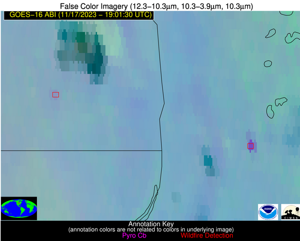
Possible Wildfire
| Basic Information | |
|---|---|
| State/Province(s) | ND |
| Country/Countries | USA |
| County/Locality(s) | Sargent County, ND |
| NWS WFO | Grand Forks ND |
| Identification Method | Enhanced Contextual (Clear) |
| Mean Object Date/Time | 2023-11-17 19:01:20UTC |
| Radiative Center (Lat, Lon): | 46.110000°, -97.300000° |
| Nearby Counties (meeting alert criteria): |
|
| Total Radiative Power Anomaly | n/a |
| Total Radiative Power | 7.82 MW |
| Map: | |
| Additional Information | |
| Alert Status | New Feature |
| Type of Event | Nominal Risk |
| Event Priority Ranking | 4 |
| Maximum Observed BT (3.9 um) | 290.21 K |
| Observed - Background BT (3.9 um) | 3.28 K |
| BT Anomaly (3.9 um) | 3.62 K |
| Maximum Observed - Clear RTM BT (3.9 um) | 13.19 K |
| Maximum Observed BTD (3.9-10/11/12 um) | 11.16 K |
| Observed - Background BTD (3.9-10/11/12 um) | 2.94 K |
| BTD Anomaly (3.9-10/11/12 um) | 5.72 K |
| Similar Pixel Count | 25 |
| BT Time Tendency (3.9 um) | 2.60 K |
| Image Interval | 5.00 minutes |
| Fraction of Surrounding LWIR Pixels that are Colder | 0.78 |
| Fraction of Surrounding Red Channel Pixels that are Brighter | 0.99 |
| Maximum Radiative Power | 7.82 MW |
| Maximum Radiative Power Uncertainty | 0.00 MW |
| Total Radiative Power Uncertainty | 0.00 MW |
| Mean Viewing Angle | 57.70° |
| Mean Solar Zenith Angle | 65.70° |
| Mean Glint Angle | 110.80° |
| Water Fraction | 0.00 |
| Total Pixel Area | 9.30 km2 |
| Latest Satellite Imagery: | |
| View all event imagery » | |
Possible Wildfire
| Basic Information | |
|---|---|
| State/Province(s) | MN |
| Country/Countries | USA |
| County/Locality(s) | Grant County, MN |
| NWS WFO | Grand Forks ND |
| Identification Method | Enhanced Contextual (Cloud) |
| Mean Object Date/Time | 2023-11-17 19:01:20UTC |
| Radiative Center (Lat, Lon): | 45.950000°, -95.950000° |
| Nearby Counties (meeting alert criteria): |
|
| Total Radiative Power Anomaly | n/a |
| Total Radiative Power | 43.63 MW |
| Map: | |
| Additional Information | |
| Alert Status | New Feature |
| Type of Event | Nominal Risk |
| Event Priority Ranking | 4 |
| Maximum Observed BT (3.9 um) | 301.24 K |
| Observed - Background BT (3.9 um) | 14.02 K |
| BT Anomaly (3.9 um) | 13.30 K |
| Maximum Observed - Clear RTM BT (3.9 um) | 25.06 K |
| Maximum Observed BTD (3.9-10/11/12 um) | 21.84 K |
| Observed - Background BTD (3.9-10/11/12 um) | 13.25 K |
| BTD Anomaly (3.9-10/11/12 um) | 25.54 K |
| Similar Pixel Count | 0 |
| BT Time Tendency (3.9 um) | 13.20 K |
| Image Interval | 5.00 minutes |
| Fraction of Surrounding LWIR Pixels that are Colder | 0.86 |
| Fraction of Surrounding Red Channel Pixels that are Brighter | 1.00 |
| Maximum Radiative Power | 43.63 MW |
| Maximum Radiative Power Uncertainty | 0.00 MW |
| Total Radiative Power Uncertainty | 0.00 MW |
| Mean Viewing Angle | 57.00° |
| Mean Solar Zenith Angle | 65.80° |
| Mean Glint Angle | 110.50° |
| Water Fraction | 0.00 |
| Total Pixel Area | 9.00 km2 |
| Latest Satellite Imagery: | |
| View all event imagery » | |
Possible Wildfire
| Basic Information | |
|---|---|
| State/Province(s) | KS |
| Country/Countries | USA |
| County/Locality(s) | Marshall County, KS |
| NWS WFO | Topeka KS |
| Identification Method | Enhanced Contextual (Clear) |
| Mean Object Date/Time | 2023-11-17 19:01:50UTC |
| Radiative Center (Lat, Lon): | 39.660000°, -96.360000° |
| Nearby Counties (meeting alert criteria): |
|
| Total Radiative Power Anomaly | n/a |
| Total Radiative Power | 20.49 MW |
| Map: | |
| Additional Information | |
| Alert Status | New Feature |
| Type of Event | Nominal Risk |
| Event Priority Ranking | 4 |
| Maximum Observed BT (3.9 um) | 298.57 K |
| Observed - Background BT (3.9 um) | 2.79 K |
| BT Anomaly (3.9 um) | 2.44 K |
| Maximum Observed - Clear RTM BT (3.9 um) | 13.19 K |
| Maximum Observed BTD (3.9-10/11/12 um) | 10.68 K |
| Observed - Background BTD (3.9-10/11/12 um) | 3.32 K |
| BTD Anomaly (3.9-10/11/12 um) | 5.30 K |
| Similar Pixel Count | 24 |
| BT Time Tendency (3.9 um) | 1.10 K |
| Image Interval | 5.00 minutes |
| Fraction of Surrounding LWIR Pixels that are Colder | 0.08 |
| Fraction of Surrounding Red Channel Pixels that are Brighter | 1.00 |
| Maximum Radiative Power | 11.61 MW |
| Maximum Radiative Power Uncertainty | 0.00 MW |
| Total Radiative Power Uncertainty | 0.00 MW |
| Mean Viewing Angle | 51.10° |
| Mean Solar Zenith Angle | 59.60° |
| Mean Glint Angle | 98.90° |
| Water Fraction | 0.00 |
| Total Pixel Area | 15.10 km2 |
| Latest Satellite Imagery: | |
| View all event imagery » | |


