Wildfire Alert Report
| Date: | 2023-11-14 |
|---|---|
| Time: | 19:51:17 |
| Production Date and Time: | 2023-11-14 19:56:02 UTC |
| Primary Instrument: | GOES-16 ABI |
| Wmo Spacecraft Id: | 152 |
| Location/orbit: | GEO |
| L1 File: | OR_ABI-L1b-RadC-M6C14_G16_s20233181951171_e20233181953544_c20233181954002.nc |
| L1 File(s) - Temporal | OR_ABI-L1b-RadC-M6C14_G16_s20233181946171_e20233181948544_c20233181949017.nc |
| Number Of Thermal Anomaly Alerts: | 7 |
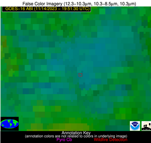
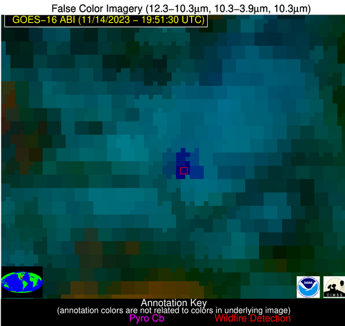
Possible Wildfire
| Basic Information | |
|---|---|
| State/Province(s) | Unknown |
| Country/Countries | Canada |
| County/Locality(s) | Canada |
| NWS WFO | N/A |
| Identification Method | Enhanced Contextual (Clear) |
| Mean Object Date/Time | 2023-11-14 19:51:20UTC |
| Radiative Center (Lat, Lon): | 49.720000°, -100.910000° |
| Nearby Counties (meeting alert criteria): |
|
| Total Radiative Power Anomaly | n/a |
| Total Radiative Power | 11.29 MW |
| Map: | |
| Additional Information | |
| Alert Status | New Feature |
| Type of Event | Nominal Risk |
| Event Priority Ranking | 4 |
| Maximum Observed BT (3.9 um) | 286.07 K |
| Observed - Background BT (3.9 um) | 4.94 K |
| BT Anomaly (3.9 um) | 3.90 K |
| Maximum Observed - Clear RTM BT (3.9 um) | 11.51 K |
| Maximum Observed BTD (3.9-10/11/12 um) | 10.06 K |
| Observed - Background BTD (3.9-10/11/12 um) | 4.53 K |
| BTD Anomaly (3.9-10/11/12 um) | 6.60 K |
| Similar Pixel Count | 9 |
| BT Time Tendency (3.9 um) | 3.10 K |
| Image Interval | 5.00 minutes |
| Fraction of Surrounding LWIR Pixels that are Colder | 0.75 |
| Fraction of Surrounding Red Channel Pixels that are Brighter | 0.96 |
| Maximum Radiative Power | 11.29 MW |
| Maximum Radiative Power Uncertainty | 0.00 MW |
| Total Radiative Power Uncertainty | 0.00 MW |
| Mean Viewing Angle | 62.40° |
| Mean Solar Zenith Angle | 70.20° |
| Mean Glint Angle | 109.90° |
| Water Fraction | 0.00 |
| Total Pixel Area | 11.40 km2 |
| Latest Satellite Imagery: | |
| View all event imagery » | |
Possible Wildfire
| Basic Information | |
|---|---|
| State/Province(s) | ND |
| Country/Countries | USA |
| County/Locality(s) | Traill County, ND |
| NWS WFO | Grand Forks ND |
| Identification Method | Enhanced Contextual (Clear) |
| Mean Object Date/Time | 2023-11-14 19:51:20UTC |
| Radiative Center (Lat, Lon): | 47.440000°, -97.340000° |
| Nearby Counties (meeting alert criteria): |
|
| Total Radiative Power Anomaly | n/a |
| Total Radiative Power | 91.67 MW |
| Map: | |
| Additional Information | |
| Alert Status | New Feature |
| Type of Event | Nominal Risk |
| Event Priority Ranking | 4 |
| Maximum Observed BT (3.9 um) | 303.50 K |
| Observed - Background BT (3.9 um) | 13.05 K |
| BT Anomaly (3.9 um) | 12.42 K |
| Maximum Observed - Clear RTM BT (3.9 um) | 22.02 K |
| Maximum Observed BTD (3.9-10/11/12 um) | 19.72 K |
| Observed - Background BTD (3.9-10/11/12 um) | 12.42 K |
| BTD Anomaly (3.9-10/11/12 um) | 24.53 K |
| Similar Pixel Count | 5 |
| BT Time Tendency (3.9 um) | 0.60 K |
| Image Interval | 5.00 minutes |
| Fraction of Surrounding LWIR Pixels that are Colder | 0.89 |
| Fraction of Surrounding Red Channel Pixels that are Brighter | 0.77 |
| Maximum Radiative Power | 48.88 MW |
| Maximum Radiative Power Uncertainty | 0.00 MW |
| Total Radiative Power Uncertainty | 0.00 MW |
| Mean Viewing Angle | 58.90° |
| Mean Solar Zenith Angle | 69.00° |
| Mean Glint Angle | 106.70° |
| Water Fraction | 0.00 |
| Total Pixel Area | 19.40 km2 |
| Latest Satellite Imagery: | |
| View all event imagery » | |
Possible Wildfire
| Basic Information | |
|---|---|
| State/Province(s) | IL |
| Country/Countries | USA |
| County/Locality(s) | Lee County, IL |
| NWS WFO | Chicago IL |
| Identification Method | Enhanced Contextual (Cloud) |
| Mean Object Date/Time | 2023-11-14 19:51:51UTC |
| Radiative Center (Lat, Lon): | 41.880000°, -89.320000° |
| Nearby Counties (meeting alert criteria): |
|
| Total Radiative Power Anomaly | n/a |
| Total Radiative Power | 42.90 MW |
| Map: | |
| Additional Information | |
| Alert Status | New Feature |
| Type of Event | Nominal Risk |
| Event Priority Ranking | 4 |
| Maximum Observed BT (3.9 um) | 306.02 K |
| Observed - Background BT (3.9 um) | 14.00 K |
| BT Anomaly (3.9 um) | 12.44 K |
| Maximum Observed - Clear RTM BT (3.9 um) | 22.92 K |
| Maximum Observed BTD (3.9-10/11/12 um) | 18.69 K |
| Observed - Background BTD (3.9-10/11/12 um) | 13.53 K |
| BTD Anomaly (3.9-10/11/12 um) | 23.49 K |
| Similar Pixel Count | 0 |
| BT Time Tendency (3.9 um) | 10.60 K |
| Image Interval | 5.00 minutes |
| Fraction of Surrounding LWIR Pixels that are Colder | 0.69 |
| Fraction of Surrounding Red Channel Pixels that are Brighter | 1.00 |
| Maximum Radiative Power | 42.90 MW |
| Maximum Radiative Power Uncertainty | 0.00 MW |
| Total Radiative Power Uncertainty | 0.00 MW |
| Mean Viewing Angle | 50.70° |
| Mean Solar Zenith Angle | 66.90° |
| Mean Glint Angle | 99.60° |
| Water Fraction | 0.00 |
| Total Pixel Area | 7.20 km2 |
| Latest Satellite Imagery: | |
| View all event imagery » | |
Possible Wildfire
| Basic Information | |
|---|---|
| State/Province(s) | VA |
| Country/Countries | USA |
| County/Locality(s) | Westmoreland County, VA |
| NWS WFO | Wakefield VA |
| Identification Method | Enhanced Contextual (Clear) |
| Mean Object Date/Time | 2023-11-14 19:51:52UTC |
| Radiative Center (Lat, Lon): | 38.190000°, -77.040000° |
| Nearby Counties (meeting alert criteria): |
|
| Total Radiative Power Anomaly | n/a |
| Total Radiative Power | 11.33 MW |
| Map: | |
| Additional Information | |
| Alert Status | New Feature |
| Type of Event | Nominal Risk |
| Event Priority Ranking | 4 |
| Maximum Observed BT (3.9 um) | 293.32 K |
| Observed - Background BT (3.9 um) | 6.20 K |
| BT Anomaly (3.9 um) | 5.94 K |
| Maximum Observed - Clear RTM BT (3.9 um) | 10.63 K |
| Maximum Observed BTD (3.9-10/11/12 um) | 8.39 K |
| Observed - Background BTD (3.9-10/11/12 um) | 5.66 K |
| BTD Anomaly (3.9-10/11/12 um) | 14.42 K |
| Similar Pixel Count | 1 |
| BT Time Tendency (3.9 um) | 1.10 K |
| Image Interval | 5.00 minutes |
| Fraction of Surrounding LWIR Pixels that are Colder | 0.76 |
| Fraction of Surrounding Red Channel Pixels that are Brighter | 0.91 |
| Maximum Radiative Power | 11.33 MW |
| Maximum Radiative Power Uncertainty | 0.00 MW |
| Total Radiative Power Uncertainty | 0.00 MW |
| Mean Viewing Angle | 44.50° |
| Mean Solar Zenith Angle | 70.10° |
| Mean Glint Angle | 101.30° |
| Water Fraction | 0.00 |
| Total Pixel Area | 6.10 km2 |
| Latest Satellite Imagery: | |
| View all event imagery » | |
Possible Wildfire
| Basic Information | |
|---|---|
| State/Province(s) | OK |
| Country/Countries | USA |
| County/Locality(s) | Noble County, OK |
| NWS WFO | Norman OK |
| Identification Method | Enhanced Contextual (Clear) |
| Mean Object Date/Time | 2023-11-14 19:51:50UTC |
| Radiative Center (Lat, Lon): | 36.470000°, -97.240000° |
| Nearby Counties (meeting alert criteria): |
|
| Total Radiative Power Anomaly | n/a |
| Total Radiative Power | 27.15 MW |
| Map: | |
| Additional Information | |
| Alert Status | New Feature |
| Type of Event | Nominal Risk |
| Event Priority Ranking | 4 |
| Maximum Observed BT (3.9 um) | 303.47 K |
| Observed - Background BT (3.9 um) | 4.81 K |
| BT Anomaly (3.9 um) | 8.71 K |
| Maximum Observed - Clear RTM BT (3.9 um) | 14.47 K |
| Maximum Observed BTD (3.9-10/11/12 um) | 10.64 K |
| Observed - Background BTD (3.9-10/11/12 um) | 4.61 K |
| BTD Anomaly (3.9-10/11/12 um) | 10.43 K |
| Similar Pixel Count | 4 |
| BT Time Tendency (3.9 um) | 4.30 K |
| Image Interval | 5.00 minutes |
| Fraction of Surrounding LWIR Pixels that are Colder | 0.71 |
| Fraction of Surrounding Red Channel Pixels that are Brighter | 1.00 |
| Maximum Radiative Power | 15.09 MW |
| Maximum Radiative Power Uncertainty | 0.00 MW |
| Total Radiative Power Uncertainty | 0.00 MW |
| Mean Viewing Angle | 48.50° |
| Mean Solar Zenith Angle | 59.20° |
| Mean Glint Angle | 88.10° |
| Water Fraction | 0.00 |
| Total Pixel Area | 14.10 km2 |
| Latest Satellite Imagery: | |
| View all event imagery » | |
Possible Wildfire
| Basic Information | |
|---|---|
| State/Province(s) | TN |
| Country/Countries | USA |
| County/Locality(s) | Chester County, TN |
| NWS WFO | Memphis TN |
| Identification Method | Enhanced Contextual (Cloud) |
| Mean Object Date/Time | 2023-11-14 19:52:21UTC |
| Radiative Center (Lat, Lon): | 35.300000°, -88.760000° |
| Nearby Counties (meeting alert criteria): |
|
| Total Radiative Power Anomaly | n/a |
| Total Radiative Power | 107.28 MW |
| Map: | |
| Additional Information | |
| Alert Status | New Feature |
| Type of Event | Nominal Risk |
| Event Priority Ranking | 4 |
| Maximum Observed BT (3.9 um) | 298.93 K |
| Observed - Background BT (3.9 um) | 16.05 K |
| BT Anomaly (3.9 um) | 16.41 K |
| Maximum Observed - Clear RTM BT (3.9 um) | 10.75 K |
| Maximum Observed BTD (3.9-10/11/12 um) | 38.51 K |
| Observed - Background BTD (3.9-10/11/12 um) | 16.25 K |
| BTD Anomaly (3.9-10/11/12 um) | 12.56 K |
| Similar Pixel Count | 0 |
| BT Time Tendency (3.9 um) | 10.80 K |
| Image Interval | 5.00 minutes |
| Fraction of Surrounding LWIR Pixels that are Colder | 0.83 |
| Fraction of Surrounding Red Channel Pixels that are Brighter | 0.98 |
| Maximum Radiative Power | 66.85 MW |
| Maximum Radiative Power Uncertainty | 0.00 MW |
| Total Radiative Power Uncertainty | 0.00 MW |
| Mean Viewing Angle | 43.70° |
| Mean Solar Zenith Angle | 61.80° |
| Mean Glint Angle | 88.60° |
| Water Fraction | 0.00 |
| Total Pixel Area | 12.30 km2 |
| Latest Satellite Imagery: | |
| View all event imagery » | |
Possible Wildfire
| Basic Information | |
|---|---|
| State/Province(s) | TX |
| Country/Countries | USA |
| County/Locality(s) | Coleman County, TX |
| NWS WFO | San Angelo TX |
| Identification Method | Enhanced Contextual (Clear) |
| Mean Object Date/Time | 2023-11-14 19:52:20UTC |
| Radiative Center (Lat, Lon): | 31.460000°, -99.280000° |
| Nearby Counties (meeting alert criteria): |
|
| Total Radiative Power Anomaly | n/a |
| Total Radiative Power | 9.18 MW |
| Map: | |
| Additional Information | |
| Alert Status | New Feature |
| Type of Event | Nominal Risk |
| Event Priority Ranking | 4 |
| Maximum Observed BT (3.9 um) | 299.75 K |
| Observed - Background BT (3.9 um) | 2.90 K |
| BT Anomaly (3.9 um) | 2.51 K |
| Maximum Observed - Clear RTM BT (3.9 um) | 10.40 K |
| Maximum Observed BTD (3.9-10/11/12 um) | 10.94 K |
| Observed - Background BTD (3.9-10/11/12 um) | 2.93 K |
| BTD Anomaly (3.9-10/11/12 um) | 4.49 K |
| Similar Pixel Count | 14 |
| BT Time Tendency (3.9 um) | 1.00 K |
| Image Interval | 5.00 minutes |
| Fraction of Surrounding LWIR Pixels that are Colder | 0.57 |
| Fraction of Surrounding Red Channel Pixels that are Brighter | 1.00 |
| Maximum Radiative Power | 9.18 MW |
| Maximum Radiative Power Uncertainty | 0.00 MW |
| Total Radiative Power Uncertainty | 0.00 MW |
| Mean Viewing Angle | 45.20° |
| Mean Solar Zenith Angle | 53.90° |
| Mean Glint Angle | 78.80° |
| Water Fraction | 0.00 |
| Total Pixel Area | 6.50 km2 |
| Latest Satellite Imagery: | |
| View all event imagery » | |
