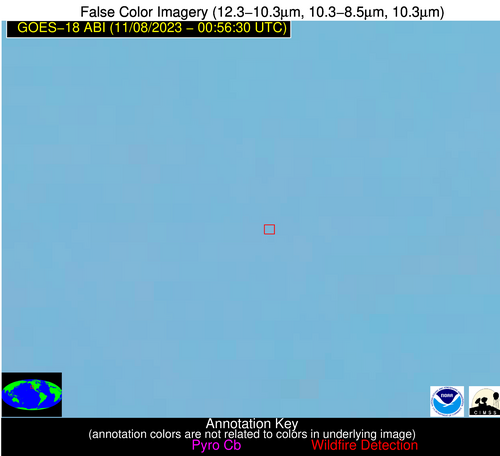
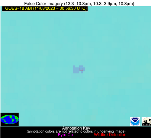
Wildfire Alert Report
| Date: | 2023-11-08 |
|---|---|
| Time: | 00:56:18 |
| Production Date and Time: | 2023-11-08 01:01:13 UTC |
| Primary Instrument: | GOES-18 ABI |
| Wmo Spacecraft Id: | 665 |
| Location/orbit: | GEO |
| L1 File: | OR_ABI-L1b-RadC-M6C14_G18_s20233120056186_e20233120058559_c20233120059040.nc |
| L1 File(s) - Temporal | OR_ABI-L1b-RadC-M6C14_G18_s20233120051186_e20233120053559_c20233120054007.nc |
| Number Of Thermal Anomaly Alerts: | 7 |
Possible Wildfire
| Basic Information | |
|---|---|
| State/Province(s) | Unknown |
| Country/Countries | Canada |
| County/Locality(s) | Canada |
| NWS WFO | N/A |
| Identification Method | Enhanced Contextual (Clear) |
| Mean Object Date/Time | 2023-11-08 00:56:24UTC |
| Radiative Center (Lat, Lon): | 49.920°, -118.660° |
| Nearby Counties (meeting alert criteria): |
|
| Total Radiative Power Anomaly | n/a |
| Total Radiative Power | 10.36 MW |
| Map: | |
| Additional Information | |
| Alert Status | New Feature |
| Type of Event | Nominal Risk |
| Event Priority Ranking | 4 |
| Maximum Observed BT (3.9 um) | 271.68 K |
| Observed - Background BT (3.9 um) | 6.69 K |
| BT Anomaly (3.9 um) | 5.58 K |
| Maximum Observed - Clear RTM BT (3.9 um) | 2.02 K |
| Maximum Observed BTD (3.9-10/11/12 um) | 7.27 K |
| Observed - Background BTD (3.9-10/11/12 um) | 7.32 K |
| BTD Anomaly (3.9-10/11/12 um) | 12.33 K |
| Similar Pixel Count | 1 |
| BT Time Tendency (3.9 um) | 10.40 K |
| Image Interval | 5.00 minutes |
| Fraction of Surrounding LWIR Pixels that are Colder | 0.43 |
| Fraction of Surrounding Red Channel Pixels that are Brighter | 1.00 |
| Maximum Radiative Power | 10.36 MW |
| Maximum Radiative Power Uncertainty | 0.00 MW |
| Total Radiative Power Uncertainty | 0.00 MW |
| Mean Viewing Angle | 60.20° |
| Mean Solar Zenith Angle | 95.90° |
| Mean Glint Angle | 128.90° |
| Water Fraction | 0.00 |
| Total Pixel Area | 9.90 km2 |
| Latest Satellite Imagery: | |
| View all event imagery » | |
Possible Wildfire
| Basic Information | |
|---|---|
| State/Province(s) | Unknown |
| Country/Countries | Canada |
| County/Locality(s) | Canada |
| NWS WFO | N/A |
| Identification Method | Enhanced Contextual (Clear) |
| Mean Object Date/Time | 2023-11-08 00:56:24UTC |
| Radiative Center (Lat, Lon): | 49.190°, -117.260° |
| Nearby Counties (meeting alert criteria): |
|
| Total Radiative Power Anomaly | n/a |
| Total Radiative Power | 15.40 MW |
| Map: | |
| Additional Information | |
| Alert Status | New Feature |
| Type of Event | Nominal Risk |
| Event Priority Ranking | 4 |
| Maximum Observed BT (3.9 um) | 278.11 K |
| Observed - Background BT (3.9 um) | 9.74 K |
| BT Anomaly (3.9 um) | 6.02 K |
| Maximum Observed - Clear RTM BT (3.9 um) | 5.04 K |
| Maximum Observed BTD (3.9-10/11/12 um) | 13.98 K |
| Observed - Background BTD (3.9-10/11/12 um) | 14.25 K |
| BTD Anomaly (3.9-10/11/12 um) | 9.27 K |
| Similar Pixel Count | 1 |
| BT Time Tendency (3.9 um) | 4.50 K |
| Image Interval | 5.00 minutes |
| Fraction of Surrounding LWIR Pixels that are Colder | 0.98 |
| Fraction of Surrounding Red Channel Pixels that are Brighter | 1.00 |
| Maximum Radiative Power | 15.40 MW |
| Maximum Radiative Power Uncertainty | 0.00 MW |
| Total Radiative Power Uncertainty | 0.00 MW |
| Mean Viewing Angle | 59.90° |
| Mean Solar Zenith Angle | 96.50° |
| Mean Glint Angle | 129.90° |
| Water Fraction | 0.00 |
| Total Pixel Area | 9.80 km2 |
| Latest Satellite Imagery: | |
| View all event imagery » | |
Possible Wildfire
| Basic Information | |
|---|---|
| State/Province(s) | MT |
| Country/Countries | USA |
| County/Locality(s) | Lincoln County, MT |
| NWS WFO | Missoula MT |
| Identification Method | Enhanced Contextual (Clear) |
| Mean Object Date/Time | 2023-11-08 00:56:24UTC |
| Radiative Center (Lat, Lon): | 48.080°, -115.510° |
| Nearby Counties (meeting alert criteria): |
|
| Total Radiative Power Anomaly | n/a |
| Total Radiative Power | 15.29 MW |
| Map: | |
| Additional Information | |
| Alert Status | New Feature |
| Type of Event | Nominal Risk |
| Event Priority Ranking | 4 |
| Maximum Observed BT (3.9 um) | 275.48 K |
| Observed - Background BT (3.9 um) | 10.72 K |
| BT Anomaly (3.9 um) | 12.38 K |
| Maximum Observed - Clear RTM BT (3.9 um) | 5.01 K |
| Maximum Observed BTD (3.9-10/11/12 um) | 12.28 K |
| Observed - Background BTD (3.9-10/11/12 um) | 10.84 K |
| BTD Anomaly (3.9-10/11/12 um) | 13.15 K |
| Similar Pixel Count | 4 |
| BT Time Tendency (3.9 um) | 9.80 K |
| Image Interval | 5.00 minutes |
| Fraction of Surrounding LWIR Pixels that are Colder | 0.98 |
| Fraction of Surrounding Red Channel Pixels that are Brighter | 1.00 |
| Maximum Radiative Power | 15.29 MW |
| Maximum Radiative Power Uncertainty | 0.00 MW |
| Total Radiative Power Uncertainty | 0.00 MW |
| Mean Viewing Angle | 59.40° |
| Mean Solar Zenith Angle | 97.30° |
| Mean Glint Angle | 131.30° |
| Water Fraction | 0.00 |
| Total Pixel Area | 9.80 km2 |
| Latest Satellite Imagery: | |
| View all event imagery » | |
Possible Wildfire
| Basic Information | |
|---|---|
| State/Province(s) | OR |
| Country/Countries | USA |
| County/Locality(s) | Columbia County, OR |
| NWS WFO | Portland OR |
| Identification Method | Enhanced Contextual (Clear) |
| Mean Object Date/Time | 2023-11-08 00:56:23UTC |
| Radiative Center (Lat, Lon): | 45.910°, -123.090° |
| Nearby Counties (meeting alert criteria): |
|
| Total Radiative Power Anomaly | n/a |
| Total Radiative Power | 17.23 MW |
| Map: | |
| Additional Information | |
| Alert Status | New Feature |
| Type of Event | Nominal Risk |
| Event Priority Ranking | 4 |
| Maximum Observed BT (3.9 um) | 284.40 K |
| Observed - Background BT (3.9 um) | 10.30 K |
| BT Anomaly (3.9 um) | 8.80 K |
| Maximum Observed - Clear RTM BT (3.9 um) | 7.81 K |
| Maximum Observed BTD (3.9-10/11/12 um) | 10.12 K |
| Observed - Background BTD (3.9-10/11/12 um) | 9.57 K |
| BTD Anomaly (3.9-10/11/12 um) | 13.55 K |
| Similar Pixel Count | 1 |
| BT Time Tendency (3.9 um) | 0.80 K |
| Image Interval | 5.00 minutes |
| Fraction of Surrounding LWIR Pixels that are Colder | 0.95 |
| Fraction of Surrounding Red Channel Pixels that are Brighter | 1.00 |
| Maximum Radiative Power | 17.23 MW |
| Maximum Radiative Power Uncertainty | 0.00 MW |
| Total Radiative Power Uncertainty | 0.00 MW |
| Mean Viewing Angle | 54.90° |
| Mean Solar Zenith Angle | 91.70° |
| Mean Glint Angle | 123.60° |
| Water Fraction | 0.00 |
| Total Pixel Area | 8.10 km2 |
| Latest Satellite Imagery: | |
| View all event imagery » | |
Possible Wildfire
| Basic Information | |
|---|---|
| State/Province(s) | OR |
| Country/Countries | USA |
| County/Locality(s) | Wasco County, OR |
| NWS WFO | Pendleton OR |
| Identification Method | Enhanced Contextual (Clear) |
| Mean Object Date/Time | 2023-11-08 00:56:24UTC |
| Radiative Center (Lat, Lon): | 45.240°, -121.440° |
| Nearby Counties (meeting alert criteria): |
|
| Total Radiative Power Anomaly | n/a |
| Total Radiative Power | 4.25 MW |
| Map: | |
| Additional Information | |
| Alert Status | New Feature |
| Type of Event | Nominal Risk |
| Event Priority Ranking | 4 |
| Maximum Observed BT (3.9 um) | 277.36 K |
| Observed - Background BT (3.9 um) | 3.00 K |
| BT Anomaly (3.9 um) | 3.54 K |
| Maximum Observed - Clear RTM BT (3.9 um) | 2.96 K |
| Maximum Observed BTD (3.9-10/11/12 um) | 2.57 K |
| Observed - Background BTD (3.9-10/11/12 um) | 2.59 K |
| BTD Anomaly (3.9-10/11/12 um) | 5.75 K |
| Similar Pixel Count | 1 |
| BT Time Tendency (3.9 um) | 0.10 K |
| Image Interval | 5.00 minutes |
| Fraction of Surrounding LWIR Pixels that are Colder | 0.76 |
| Fraction of Surrounding Red Channel Pixels that are Brighter | 1.00 |
| Maximum Radiative Power | 4.25 MW |
| Maximum Radiative Power Uncertainty | 0.00 MW |
| Total Radiative Power Uncertainty | 0.00 MW |
| Mean Viewing Angle | 54.60° |
| Mean Solar Zenith Angle | 92.60° |
| Mean Glint Angle | 125.00° |
| Water Fraction | 0.00 |
| Total Pixel Area | 8.10 km2 |
| Latest Satellite Imagery: | |
| View all event imagery » | |
Possible Wildfire
| Basic Information | |
|---|---|
| State/Province(s) | OR |
| Country/Countries | USA |
| County/Locality(s) | Lane County, OR |
| NWS WFO | Portland OR |
| Identification Method | Enhanced Contextual (Clear) |
| Mean Object Date/Time | 2023-11-08 00:56:23UTC |
| Radiative Center (Lat, Lon): | 43.870°, -123.480° |
| Nearby Counties (meeting alert criteria): |
|
| Total Radiative Power Anomaly | n/a |
| Total Radiative Power | 19.88 MW |
| Map: | |
| Additional Information | |
| Alert Status | New Feature |
| Type of Event | Nominal Risk |
| Event Priority Ranking | 4 |
| Maximum Observed BT (3.9 um) | 287.98 K |
| Observed - Background BT (3.9 um) | 9.67 K |
| BT Anomaly (3.9 um) | 6.59 K |
| Maximum Observed - Clear RTM BT (3.9 um) | 9.84 K |
| Maximum Observed BTD (3.9-10/11/12 um) | 10.04 K |
| Observed - Background BTD (3.9-10/11/12 um) | 9.63 K |
| BTD Anomaly (3.9-10/11/12 um) | 6.63 K |
| Similar Pixel Count | 1 |
| BT Time Tendency (3.9 um) | 0.20 K |
| Image Interval | 5.00 minutes |
| Fraction of Surrounding LWIR Pixels that are Colder | 0.58 |
| Fraction of Surrounding Red Channel Pixels that are Brighter | 1.00 |
| Maximum Radiative Power | 19.88 MW |
| Maximum Radiative Power Uncertainty | 0.00 MW |
| Total Radiative Power Uncertainty | 0.00 MW |
| Mean Viewing Angle | 52.60° |
| Mean Solar Zenith Angle | 90.70° |
| Mean Glint Angle | 122.20° |
| Water Fraction | 0.00 |
| Total Pixel Area | 7.60 km2 |
| Latest Satellite Imagery: | |
| View all event imagery » | |
Possible Wildfire
| Basic Information | |
|---|---|
| State/Province(s) | Unknown |
| Country/Countries | Unknown |
| County/Locality(s) | Unknown |
| NWS WFO | N/A |
| Identification Method | Enhanced Contextual (Clear) |
| Mean Object Date/Time | 2023-11-08 00:56:54UTC |
| Radiative Center (Lat, Lon): | 36.590°, -123.210° |
| Nearby Counties (meeting alert criteria): |
|
| Total Radiative Power Anomaly | n/a |
| Total Radiative Power | 20.76 MW |
| Map: | |
| Additional Information | |
| Alert Status | New Feature |
| Type of Event | Nominal Risk |
| Event Priority Ranking | 4 |
| Maximum Observed BT (3.9 um) | 290.74 K |
| Observed - Background BT (3.9 um) | 5.28 K |
| BT Anomaly (3.9 um) | 19.91 K |
| Maximum Observed - Clear RTM BT (3.9 um) | 4.99 K |
| Maximum Observed BTD (3.9-10/11/12 um) | 7.23 K |
| Observed - Background BTD (3.9-10/11/12 um) | 5.38 K |
| BTD Anomaly (3.9-10/11/12 um) | 50.40 K |
| Similar Pixel Count | 2 |
| BT Time Tendency (3.9 um) | 5.40 K |
| Image Interval | 5.00 minutes |
| Fraction of Surrounding LWIR Pixels that are Colder | 0.12 |
| Fraction of Surrounding Red Channel Pixels that are Brighter | 1.00 |
| Maximum Radiative Power | 11.05 MW |
| Maximum Radiative Power Uncertainty | 0.00 MW |
| Total Radiative Power Uncertainty | 0.00 MW |
| Mean Viewing Angle | 45.10° |
| Mean Solar Zenith Angle | 88.10° |
| Mean Glint Angle | 118.20° |
| Water Fraction | 1.00 |
| Total Pixel Area | 12.60 km2 |
| Latest Satellite Imagery: | |
| View all event imagery » | |
