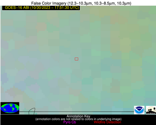
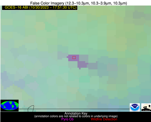
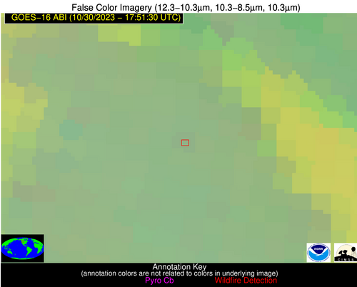
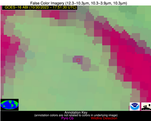
Wildfire Alert Report
| Date: | 2023-10-30 |
|---|---|
| Time: | 17:51:17 |
| Production Date and Time: | 2023-10-30 17:55:49 UTC |
| Primary Instrument: | GOES-16 ABI |
| Wmo Spacecraft Id: | 152 |
| Location/orbit: | GEO |
| L1 File: | OR_ABI-L1b-RadC-M6C14_G16_s20233031751171_e20233031753544_c20233031753599.nc |
| L1 File(s) - Temporal | OR_ABI-L1b-RadC-M6C14_G16_s20233031746171_e20233031748544_c20233031749029.nc |
| Number Of Thermal Anomaly Alerts: | 5 |
Possible Wildfire
| Basic Information | |
|---|---|
| State/Province(s) | Unknown |
| Country/Countries | Canada |
| County/Locality(s) | Canada |
| NWS WFO | N/A |
| Identification Method | Enhanced Contextual (Clear) |
| Mean Object Date/Time | 2023-10-30 17:51:19UTC |
| Radiative Center (Lat, Lon): | 49.260000°, -120.840000° |
| Nearby Counties (meeting alert criteria): |
|
| Total Radiative Power Anomaly | n/a |
| Total Radiative Power | 78.87 MW |
| Map: | |
| Additional Information | |
| Alert Status | New Feature |
| Type of Event | Nominal Risk |
| Event Priority Ranking | 4 |
| Maximum Observed BT (3.9 um) | 291.38 K |
| Observed - Background BT (3.9 um) | 10.78 K |
| BT Anomaly (3.9 um) | 5.94 K |
| Maximum Observed - Clear RTM BT (3.9 um) | 12.57 K |
| Maximum Observed BTD (3.9-10/11/12 um) | 14.61 K |
| Observed - Background BTD (3.9-10/11/12 um) | 10.41 K |
| BTD Anomaly (3.9-10/11/12 um) | 6.27 K |
| Similar Pixel Count | 2 |
| BT Time Tendency (3.9 um) | 3.50 K |
| Image Interval | 5.00 minutes |
| Fraction of Surrounding LWIR Pixels that are Colder | 0.66 |
| Fraction of Surrounding Red Channel Pixels that are Brighter | 0.34 |
| Maximum Radiative Power | 47.18 MW |
| Maximum Radiative Power Uncertainty | 0.00 MW |
| Total Radiative Power Uncertainty | 0.00 MW |
| Mean Viewing Angle | 71.60° |
| Mean Solar Zenith Angle | 67.90° |
| Mean Glint Angle | 133.70° |
| Water Fraction | 0.00 |
| Total Pixel Area | 48.30 km2 |
| Latest Satellite Imagery: | |
| View all event imagery » | |
Possible Wildfire
| Basic Information | |
|---|---|
| State/Province(s) | MT |
| Country/Countries | USA |
| County/Locality(s) | Lincoln County, MT |
| NWS WFO | Missoula MT |
| Identification Method | Enhanced Contextual (Clear) |
| Mean Object Date/Time | 2023-10-30 17:51:19UTC |
| Radiative Center (Lat, Lon): | 48.500000°, -114.860000° |
| Nearby Counties (meeting alert criteria): |
|
| Total Radiative Power Anomaly | n/a |
| Total Radiative Power | 34.54 MW |
| Map: | |
| Additional Information | |
| Alert Status | New Feature |
| Type of Event | Nominal Risk |
| Event Priority Ranking | 4 |
| Maximum Observed BT (3.9 um) | 285.86 K |
| Observed - Background BT (3.9 um) | 11.60 K |
| BT Anomaly (3.9 um) | 5.01 K |
| Maximum Observed - Clear RTM BT (3.9 um) | 15.71 K |
| Maximum Observed BTD (3.9-10/11/12 um) | 17.60 K |
| Observed - Background BTD (3.9-10/11/12 um) | 11.04 K |
| BTD Anomaly (3.9-10/11/12 um) | 4.04 K |
| Similar Pixel Count | 2 |
| BT Time Tendency (3.9 um) | 1.50 K |
| Image Interval | 5.00 minutes |
| Fraction of Surrounding LWIR Pixels that are Colder | 0.82 |
| Fraction of Surrounding Red Channel Pixels that are Brighter | 0.96 |
| Maximum Radiative Power | 34.54 MW |
| Maximum Radiative Power Uncertainty | 0.00 MW |
| Total Radiative Power Uncertainty | 0.00 MW |
| Mean Viewing Angle | 67.80° |
| Mean Solar Zenith Angle | 65.40° |
| Mean Glint Angle | 128.10° |
| Water Fraction | 0.00 |
| Total Pixel Area | 17.40 km2 |
| Latest Satellite Imagery: | |
| View all event imagery » | |
Possible Wildfire
| Basic Information | |
|---|---|
| State/Province(s) | IL |
| Country/Countries | USA |
| County/Locality(s) | LaSalle County, IL |
| NWS WFO | Chicago IL |
| Identification Method | Enhanced Contextual (Clear) |
| Mean Object Date/Time | 2023-10-30 17:51:51UTC |
| Radiative Center (Lat, Lon): | 41.550000°, -88.940000° |
| Nearby Counties (meeting alert criteria): |
|
| Total Radiative Power Anomaly | n/a |
| Total Radiative Power | 4.64 MW |
| Map: | |
| Additional Information | |
| Alert Status | New Feature |
| Type of Event | Nominal Risk |
| Event Priority Ranking | 4 |
| Maximum Observed BT (3.9 um) | 291.90 K |
| Observed - Background BT (3.9 um) | 2.64 K |
| BT Anomaly (3.9 um) | 3.01 K |
| Maximum Observed - Clear RTM BT (3.9 um) | 14.27 K |
| Maximum Observed BTD (3.9-10/11/12 um) | 11.23 K |
| Observed - Background BTD (3.9-10/11/12 um) | 2.03 K |
| BTD Anomaly (3.9-10/11/12 um) | 2.93 K |
| Similar Pixel Count | 25 |
| BT Time Tendency (3.9 um) | 1.60 K |
| Image Interval | 5.00 minutes |
| Fraction of Surrounding LWIR Pixels that are Colder | 0.87 |
| Fraction of Surrounding Red Channel Pixels that are Brighter | 1.00 |
| Maximum Radiative Power | 4.64 MW |
| Maximum Radiative Power Uncertainty | 0.00 MW |
| Total Radiative Power Uncertainty | 0.00 MW |
| Mean Viewing Angle | 50.30° |
| Mean Solar Zenith Angle | 55.20° |
| Mean Glint Angle | 102.30° |
| Water Fraction | 0.00 |
| Total Pixel Area | 7.20 km2 |
| Latest Satellite Imagery: | |
| View all event imagery » | |
Possible Wildfire
| Basic Information | |
|---|---|
| State/Province(s) | AZ |
| Country/Countries | USA |
| County/Locality(s) | Coconino County, AZ |
| NWS WFO | Flagstaff AZ |
| Identification Method | Enhanced Contextual (Clear) |
| Mean Object Date/Time | 2023-10-30 17:52:18UTC |
| Radiative Center (Lat, Lon): | 34.770000°, -111.460000° |
| Nearby Counties (meeting alert criteria): |
|
| Total Radiative Power Anomaly | n/a |
| Total Radiative Power | 22.97 MW |
| Map: | |
| Additional Information | |
| Alert Status | New Feature |
| Type of Event | Nominal Risk |
| Event Priority Ranking | 4 |
| Maximum Observed BT (3.9 um) | 291.84 K |
| Observed - Background BT (3.9 um) | 4.91 K |
| BT Anomaly (3.9 um) | 3.11 K |
| Maximum Observed - Clear RTM BT (3.9 um) | 9.02 K |
| Maximum Observed BTD (3.9-10/11/12 um) | 10.45 K |
| Observed - Background BTD (3.9-10/11/12 um) | 4.89 K |
| BTD Anomaly (3.9-10/11/12 um) | 9.13 K |
| Similar Pixel Count | 4 |
| BT Time Tendency (3.9 um) | 4.00 K |
| Image Interval | 5.00 minutes |
| Fraction of Surrounding LWIR Pixels that are Colder | 0.26 |
| Fraction of Surrounding Red Channel Pixels that are Brighter | 1.00 |
| Maximum Radiative Power | 11.56 MW |
| Maximum Radiative Power Uncertainty | 0.00 MW |
| Total Radiative Power Uncertainty | 0.00 MW |
| Mean Viewing Angle | 56.00° |
| Mean Solar Zenith Angle | 51.80° |
| Mean Glint Angle | 103.40° |
| Water Fraction | 0.00 |
| Total Pixel Area | 19.00 km2 |
| Latest Satellite Imagery: | |
| View all event imagery » | |
Possible Wildfire
| Basic Information | |
|---|---|
| State/Province(s) | AZ |
| Country/Countries | USA |
| County/Locality(s) | Greenlee County, AZ |
| NWS WFO | Tucson AZ |
| Identification Method | Enhanced Contextual (Clear) |
| Mean Object Date/Time | 2023-10-30 17:52:19UTC |
| Radiative Center (Lat, Lon): | 33.690000°, -109.440000° |
| Nearby Counties (meeting alert criteria): |
|
| Total Radiative Power Anomaly | n/a |
| Total Radiative Power | 10.07 MW |
| Map: | |
| Additional Information | |
| Alert Status | New Feature |
| Type of Event | Nominal Risk, Known Incident: FISH CREEK (HIGH, tdiff=0.77146 days, POINT) |
| Event Priority Ranking | 4 |
| Maximum Observed BT (3.9 um) | 298.26 K |
| Observed - Background BT (3.9 um) | 3.23 K |
| BT Anomaly (3.9 um) | 1.58 K |
| Maximum Observed - Clear RTM BT (3.9 um) | 11.36 K |
| Maximum Observed BTD (3.9-10/11/12 um) | 9.87 K |
| Observed - Background BTD (3.9-10/11/12 um) | 2.66 K |
| BTD Anomaly (3.9-10/11/12 um) | 2.91 K |
| Similar Pixel Count | 14 |
| BT Time Tendency (3.9 um) | 1.60 K |
| Image Interval | 5.00 minutes |
| Fraction of Surrounding LWIR Pixels that are Colder | 0.78 |
| Fraction of Surrounding Red Channel Pixels that are Brighter | 1.00 |
| Maximum Radiative Power | 10.07 MW |
| Maximum Radiative Power Uncertainty | 0.00 MW |
| Total Radiative Power Uncertainty | 0.00 MW |
| Mean Viewing Angle | 53.80° |
| Mean Solar Zenith Angle | 50.20° |
| Mean Glint Angle | 99.60° |
| Water Fraction | 0.00 |
| Total Pixel Area | 8.70 km2 |
| Latest Satellite Imagery: | |
| View all event imagery » | |
