Wildfire Alert Report
| Date: | 2023-10-27 |
|---|---|
| Time: | 22:01:17 |
| Production Date and Time: | 2023-10-27 22:05:48 UTC |
| Primary Instrument: | GOES-16 ABI |
| Wmo Spacecraft Id: | 152 |
| Location/orbit: | GEO |
| L1 File: | OR_ABI-L1b-RadC-M6C14_G16_s20233002201176_e20233002203549_c20233002204033.nc |
| L1 File(s) - Temporal | OR_ABI-L1b-RadC-M6C14_G16_s20233002156176_e20233002158549_c20233002159035.nc |
| Number Of Thermal Anomaly Alerts: | 4 |
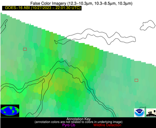
Possible Wildfire
| Basic Information | |
|---|---|
| State/Province(s) | Unknown |
| Country/Countries | Canada |
| County/Locality(s) | Canada |
| NWS WFO | N/A |
| Identification Method | Enhanced Contextual (Cloud) |
| Mean Object Date/Time | 2023-10-27 22:01:19UTC |
| Radiative Center (Lat, Lon): | 53.730000°, -124.970000° |
| Nearby Counties (meeting alert criteria): |
|
| Total Radiative Power Anomaly | n/a |
| Total Radiative Power | 134.33 MW |
| Map: | |
| Additional Information | |
| Alert Status | New Feature |
| Type of Event | Nominal Risk |
| Event Priority Ranking | 4 |
| Maximum Observed BT (3.9 um) | 286.90 K |
| Observed - Background BT (3.9 um) | 12.37 K |
| BT Anomaly (3.9 um) | 11.14 K |
| Maximum Observed - Clear RTM BT (3.9 um) | 19.16 K |
| Maximum Observed BTD (3.9-10/11/12 um) | 15.73 K |
| Observed - Background BTD (3.9-10/11/12 um) | 11.42 K |
| BTD Anomaly (3.9-10/11/12 um) | 13.46 K |
| Similar Pixel Count | 0 |
| BT Time Tendency (3.9 um) | 1.20 K |
| Image Interval | 5.00 minutes |
| Fraction of Surrounding LWIR Pixels that are Colder | 0.95 |
| Fraction of Surrounding Red Channel Pixels that are Brighter | 0.47 |
| Maximum Radiative Power | 70.63 MW |
| Maximum Radiative Power Uncertainty | 0.00 MW |
| Total Radiative Power Uncertainty | 0.00 MW |
| Mean Viewing Angle | 76.80° |
| Mean Solar Zenith Angle | 70.90° |
| Mean Glint Angle | 89.20° |
| Water Fraction | 0.00 |
| Total Pixel Area | 81.10 km2 |
| Latest Satellite Imagery: | |
| View all event imagery » | |
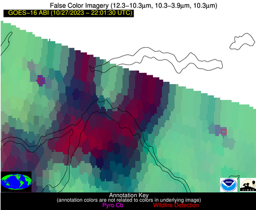
Possible Wildfire
| Basic Information | |
|---|---|
| State/Province(s) | Unknown |
| Country/Countries | Canada |
| County/Locality(s) | Canada |
| NWS WFO | N/A |
| Identification Method | Enhanced Contextual (Clear) |
| Mean Object Date/Time | 2023-10-27 22:01:19UTC |
| Radiative Center (Lat, Lon): | 53.930000°, -127.090000° |
| Nearby Counties (meeting alert criteria): |
|
| Total Radiative Power Anomaly | n/a |
| Total Radiative Power | 139.31 MW |
| Map: | |
| Additional Information | |
| Alert Status | New Feature |
| Type of Event | Nominal Risk |
| Event Priority Ranking | 4 |
| Maximum Observed BT (3.9 um) | 292.84 K |
| Observed - Background BT (3.9 um) | 19.64 K |
| BT Anomaly (3.9 um) | 8.96 K |
| Maximum Observed - Clear RTM BT (3.9 um) | 26.09 K |
| Maximum Observed BTD (3.9-10/11/12 um) | 25.62 K |
| Observed - Background BTD (3.9-10/11/12 um) | 20.01 K |
| BTD Anomaly (3.9-10/11/12 um) | 6.23 K |
| Similar Pixel Count | 5 |
| BT Time Tendency (3.9 um) | 3.20 K |
| Image Interval | 5.00 minutes |
| Fraction of Surrounding LWIR Pixels that are Colder | 0.78 |
| Fraction of Surrounding Red Channel Pixels that are Brighter | 0.81 |
| Maximum Radiative Power | 139.31 MW |
| Maximum Radiative Power Uncertainty | 0.00 MW |
| Total Radiative Power Uncertainty | 0.00 MW |
| Mean Viewing Angle | 78.10° |
| Mean Solar Zenith Angle | 70.50° |
| Mean Glint Angle | 89.80° |
| Water Fraction | 0.00 |
| Total Pixel Area | 48.40 km2 |
| Latest Satellite Imagery: | |
| View all event imagery » | |
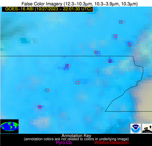
Possible Wildfire
| Basic Information | |
|---|---|
| State/Province(s) | MO |
| Country/Countries | USA |
| County/Locality(s) | Butler County, MO |
| NWS WFO | Paducah KY |
| Identification Method | Enhanced Contextual (Clear) |
| Mean Object Date/Time | 2023-10-27 22:01:51UTC |
| Radiative Center (Lat, Lon): | 36.680000°, -90.300000° |
| Nearby Counties (meeting alert criteria): |
|
| Total Radiative Power Anomaly | n/a |
| Total Radiative Power | 31.74 MW |
| Map: | |
| Additional Information | |
| Alert Status | New Feature |
| Type of Event | Nominal Risk |
| Event Priority Ranking | 4 |
| Maximum Observed BT (3.9 um) | 301.73 K |
| Observed - Background BT (3.9 um) | 5.98 K |
| BT Anomaly (3.9 um) | 4.37 K |
| Maximum Observed - Clear RTM BT (3.9 um) | 9.35 K |
| Maximum Observed BTD (3.9-10/11/12 um) | 12.72 K |
| Observed - Background BTD (3.9-10/11/12 um) | 5.55 K |
| BTD Anomaly (3.9-10/11/12 um) | 3.94 K |
| Similar Pixel Count | 4 |
| BT Time Tendency (3.9 um) | 1.90 K |
| Image Interval | 5.00 minutes |
| Fraction of Surrounding LWIR Pixels that are Colder | 0.77 |
| Fraction of Surrounding Red Channel Pixels that are Brighter | 0.90 |
| Maximum Radiative Power | 18.89 MW |
| Maximum Radiative Power Uncertainty | 0.00 MW |
| Total Radiative Power Uncertainty | 0.00 MW |
| Mean Viewing Angle | 45.60° |
| Mean Solar Zenith Angle | 77.80° |
| Mean Glint Angle | 82.80° |
| Water Fraction | 0.00 |
| Total Pixel Area | 12.90 km2 |
| Latest Satellite Imagery: | |
| View all event imagery » | |
Possible Wildfire
| Basic Information | |
|---|---|
| State/Province(s) | AR |
| Country/Countries | USA |
| County/Locality(s) | Lawrence County, AR |
| NWS WFO | Little Rock AR |
| Identification Method | Enhanced Contextual (Clear) |
| Mean Object Date/Time | 2023-10-27 22:02:21UTC |
| Radiative Center (Lat, Lon): | 36.040000°, -90.930000° |
| Nearby Counties (meeting alert criteria): |
|
| Total Radiative Power Anomaly | n/a |
| Total Radiative Power | 44.44 MW |
| Map: | |
| Additional Information | |
| Alert Status | New Feature |
| Type of Event | Nominal Risk |
| Event Priority Ranking | 4 |
| Maximum Observed BT (3.9 um) | 308.51 K |
| Observed - Background BT (3.9 um) | 11.86 K |
| BT Anomaly (3.9 um) | 14.65 K |
| Maximum Observed - Clear RTM BT (3.9 um) | 14.69 K |
| Maximum Observed BTD (3.9-10/11/12 um) | 19.37 K |
| Observed - Background BTD (3.9-10/11/12 um) | 11.87 K |
| BTD Anomaly (3.9-10/11/12 um) | 17.58 K |
| Similar Pixel Count | 1 |
| BT Time Tendency (3.9 um) | 7.80 K |
| Image Interval | 5.00 minutes |
| Fraction of Surrounding LWIR Pixels that are Colder | 0.41 |
| Fraction of Surrounding Red Channel Pixels that are Brighter | 0.42 |
| Maximum Radiative Power | 44.44 MW |
| Maximum Radiative Power Uncertainty | 0.00 MW |
| Total Radiative Power Uncertainty | 0.00 MW |
| Mean Viewing Angle | 45.20° |
| Mean Solar Zenith Angle | 77.10° |
| Mean Glint Angle | 81.50° |
| Water Fraction | 0.00 |
| Total Pixel Area | 6.40 km2 |
| Latest Satellite Imagery: | |
| View all event imagery » | |


