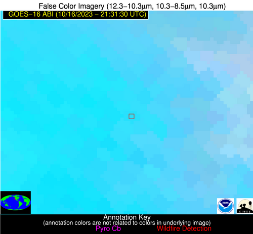
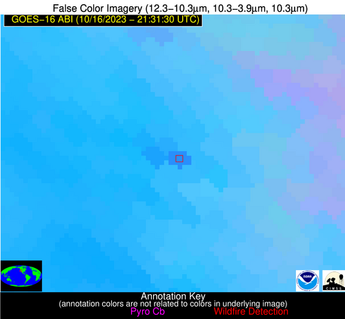
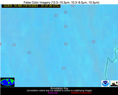
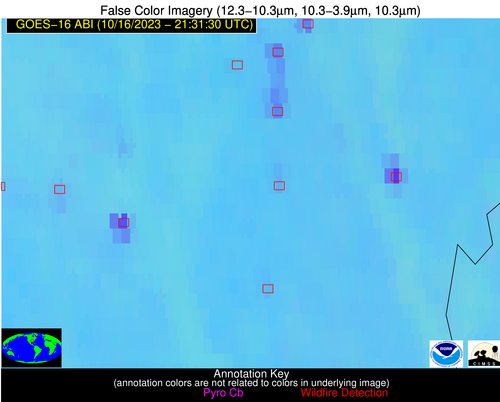
Wildfire Alert Report
| Date: | 2023-10-16 |
|---|---|
| Time: | 21:31:17 |
| Production Date and Time: | 2023-10-16 21:35:51 UTC |
| Primary Instrument: | GOES-16 ABI |
| Wmo Spacecraft Id: | 152 |
| Location/orbit: | GEO |
| L1 File: | OR_ABI-L1b-RadC-M6C14_G16_s20232892131171_e20232892133544_c20232892134024.nc |
| L1 File(s) - Temporal | OR_ABI-L1b-RadC-M6C14_G16_s20232892121171_e20232892123544_c20232892124027.nc |
| Number Of Thermal Anomaly Alerts: | 10 |
Possible Wildfire
| Basic Information | |
|---|---|
| State/Province(s) | Unknown |
| Country/Countries | Canada |
| County/Locality(s) | Canada |
| NWS WFO | N/A |
| Identification Method | Enhanced Contextual (Clear) |
| Mean Object Date/Time | 2023-10-16 21:31:20UTC |
| Radiative Center (Lat, Lon): | 49.550000°, -99.920000° |
| Nearby Counties (meeting alert criteria): |
|
| Total Radiative Power Anomaly | n/a |
| Total Radiative Power | 23.99 MW |
| Map: | |
| Additional Information | |
| Alert Status | New Feature |
| Type of Event | Nominal Risk |
| Event Priority Ranking | 4 |
| Maximum Observed BT (3.9 um) | 295.28 K |
| Observed - Background BT (3.9 um) | 3.73 K |
| BT Anomaly (3.9 um) | 5.70 K |
| Maximum Observed - Clear RTM BT (3.9 um) | 12.72 K |
| Maximum Observed BTD (3.9-10/11/12 um) | 9.98 K |
| Observed - Background BTD (3.9-10/11/12 um) | 3.69 K |
| BTD Anomaly (3.9-10/11/12 um) | 8.63 K |
| Similar Pixel Count | 5 |
| BT Time Tendency (3.9 um) | 1.50 K |
| Image Interval | 10.00 minutes |
| Fraction of Surrounding LWIR Pixels that are Colder | 0.52 |
| Fraction of Surrounding Red Channel Pixels that are Brighter | 1.00 |
| Maximum Radiative Power | 13.64 MW |
| Maximum Radiative Power Uncertainty | 0.00 MW |
| Total Radiative Power Uncertainty | 0.00 MW |
| Mean Viewing Angle | 61.90° |
| Mean Solar Zenith Angle | 71.00° |
| Mean Glint Angle | 89.10° |
| Water Fraction | 0.00 |
| Total Pixel Area | 22.20 km2 |
| Latest Satellite Imagery: | |
| View all event imagery » | |
Possible Wildfire
| Basic Information | |
|---|---|
| State/Province(s) | Unknown |
| Country/Countries | Canada |
| County/Locality(s) | Canada |
| NWS WFO | N/A |
| Identification Method | Enhanced Contextual (Clear) |
| Mean Object Date/Time | 2023-10-16 21:31:20UTC |
| Radiative Center (Lat, Lon): | 49.540000°, -102.970000° |
| Nearby Counties (meeting alert criteria): |
|
| Total Radiative Power Anomaly | n/a |
| Total Radiative Power | 17.20 MW |
| Map: | |
| Additional Information | |
| Alert Status | New Feature |
| Type of Event | Nominal Risk |
| Event Priority Ranking | 4 |
| Maximum Observed BT (3.9 um) | 296.07 K |
| Observed - Background BT (3.9 um) | 4.13 K |
| BT Anomaly (3.9 um) | 8.26 K |
| Maximum Observed - Clear RTM BT (3.9 um) | 13.22 K |
| Maximum Observed BTD (3.9-10/11/12 um) | 15.13 K |
| Observed - Background BTD (3.9-10/11/12 um) | 4.41 K |
| BTD Anomaly (3.9-10/11/12 um) | 3.62 K |
| Similar Pixel Count | 19 |
| BT Time Tendency (3.9 um) | 4.90 K |
| Image Interval | 10.00 minutes |
| Fraction of Surrounding LWIR Pixels that are Colder | 0.41 |
| Fraction of Surrounding Red Channel Pixels that are Brighter | 1.00 |
| Maximum Radiative Power | 17.20 MW |
| Maximum Radiative Power Uncertainty | 0.00 MW |
| Total Radiative Power Uncertainty | 0.00 MW |
| Mean Viewing Angle | 63.10° |
| Mean Solar Zenith Angle | 69.50° |
| Mean Glint Angle | 88.20° |
| Water Fraction | 0.00 |
| Total Pixel Area | 12.00 km2 |
| Latest Satellite Imagery: | |
| View all event imagery » | |
Possible Wildfire
| Basic Information | |
|---|---|
| State/Province(s) | ND |
| Country/Countries | USA |
| County/Locality(s) | Rolette County, ND |
| NWS WFO | Bismarck ND |
| Identification Method | Enhanced Contextual (Clear) |
| Mean Object Date/Time | 2023-10-16 21:31:20UTC |
| Radiative Center (Lat, Lon): | 48.770000°, -99.620000° |
| Nearby Counties (meeting alert criteria): |
|
| Total Radiative Power Anomaly | n/a |
| Total Radiative Power | 25.73 MW |
| Map: | |
| Additional Information | |
| Alert Status | New Feature |
| Type of Event | Nominal Risk |
| Event Priority Ranking | 4 |
| Maximum Observed BT (3.9 um) | 298.22 K |
| Observed - Background BT (3.9 um) | 7.31 K |
| BT Anomaly (3.9 um) | 4.91 K |
| Maximum Observed - Clear RTM BT (3.9 um) | 16.04 K |
| Maximum Observed BTD (3.9-10/11/12 um) | 12.74 K |
| Observed - Background BTD (3.9-10/11/12 um) | 6.93 K |
| BTD Anomaly (3.9-10/11/12 um) | 10.40 K |
| Similar Pixel Count | 1 |
| BT Time Tendency (3.9 um) | 6.00 K |
| Image Interval | 10.00 minutes |
| Fraction of Surrounding LWIR Pixels that are Colder | 0.54 |
| Fraction of Surrounding Red Channel Pixels that are Brighter | 1.00 |
| Maximum Radiative Power | 25.73 MW |
| Maximum Radiative Power Uncertainty | 0.00 MW |
| Total Radiative Power Uncertainty | 0.00 MW |
| Mean Viewing Angle | 61.10° |
| Mean Solar Zenith Angle | 70.70° |
| Mean Glint Angle | 88.30° |
| Water Fraction | 0.00 |
| Total Pixel Area | 10.70 km2 |
| Latest Satellite Imagery: | |
| View all event imagery » | |
Possible Wildfire
| Basic Information | |
|---|---|
| State/Province(s) | ND |
| Country/Countries | USA |
| County/Locality(s) | Eddy County, ND |
| NWS WFO | Grand Forks ND |
| Identification Method | Enhanced Contextual (Clear) |
| Mean Object Date/Time | 2023-10-16 21:31:20UTC |
| Radiative Center (Lat, Lon): | 47.650000°, -98.850000° |
| Nearby Counties (meeting alert criteria): |
|
| Total Radiative Power Anomaly | n/a |
| Total Radiative Power | 30.60 MW |
| Map: | |
| Additional Information | |
| Alert Status | New Feature |
| Type of Event | Nominal Risk |
| Event Priority Ranking | 4 |
| Maximum Observed BT (3.9 um) | 295.53 K |
| Observed - Background BT (3.9 um) | 4.95 K |
| BT Anomaly (3.9 um) | 5.59 K |
| Maximum Observed - Clear RTM BT (3.9 um) | 12.66 K |
| Maximum Observed BTD (3.9-10/11/12 um) | 10.66 K |
| Observed - Background BTD (3.9-10/11/12 um) | 4.79 K |
| BTD Anomaly (3.9-10/11/12 um) | 12.46 K |
| Similar Pixel Count | 8 |
| BT Time Tendency (3.9 um) | 4.40 K |
| Image Interval | 10.00 minutes |
| Fraction of Surrounding LWIR Pixels that are Colder | 0.57 |
| Fraction of Surrounding Red Channel Pixels that are Brighter | 1.00 |
| Maximum Radiative Power | 16.63 MW |
| Maximum Radiative Power Uncertainty | 0.00 MW |
| Total Radiative Power Uncertainty | 0.00 MW |
| Mean Viewing Angle | 59.70° |
| Mean Solar Zenith Angle | 70.30° |
| Mean Glint Angle | 87.20° |
| Water Fraction | 0.00 |
| Total Pixel Area | 20.20 km2 |
| Latest Satellite Imagery: | |
| View all event imagery » | |
Possible Wildfire
| Basic Information | |
|---|---|
| State/Province(s) | OK |
| Country/Countries | USA |
| County/Locality(s) | Payne County, OK |
| NWS WFO | Norman OK |
| Identification Method | Enhanced Contextual (Clear) |
| Mean Object Date/Time | 2023-10-16 21:32:20UTC |
| Radiative Center (Lat, Lon): | 36.090000°, -97.320000° |
| Nearby Counties (meeting alert criteria): |
|
| Total Radiative Power Anomaly | n/a |
| Total Radiative Power | 21.98 MW |
| Map: | |
| Additional Information | |
| Alert Status | New Feature |
| Type of Event | Nominal Risk |
| Event Priority Ranking | 4 |
| Maximum Observed BT (3.9 um) | 301.24 K |
| Observed - Background BT (3.9 um) | 7.13 K |
| BT Anomaly (3.9 um) | 6.01 K |
| Maximum Observed - Clear RTM BT (3.9 um) | 15.98 K |
| Maximum Observed BTD (3.9-10/11/12 um) | 11.23 K |
| Observed - Background BTD (3.9-10/11/12 um) | 7.38 K |
| BTD Anomaly (3.9-10/11/12 um) | 15.92 K |
| Similar Pixel Count | 2 |
| BT Time Tendency (3.9 um) | 6.20 K |
| Image Interval | 10.00 minutes |
| Fraction of Surrounding LWIR Pixels that are Colder | 0.29 |
| Fraction of Surrounding Red Channel Pixels that are Brighter | 1.00 |
| Maximum Radiative Power | 21.98 MW |
| Maximum Radiative Power Uncertainty | 0.00 MW |
| Total Radiative Power Uncertainty | 0.00 MW |
| Mean Viewing Angle | 48.20° |
| Mean Solar Zenith Angle | 64.40° |
| Mean Glint Angle | 72.80° |
| Water Fraction | 0.00 |
| Total Pixel Area | 7.00 km2 |
| Latest Satellite Imagery: | |
| View all event imagery » | |
Possible Wildfire
| Basic Information | |
|---|---|
| State/Province(s) | CA |
| Country/Countries | USA |
| County/Locality(s) | Tulare County, CA |
| NWS WFO | Hanford CA |
| Identification Method | Enhanced Contextual (Clear) |
| Mean Object Date/Time | 2023-10-16 21:32:18UTC |
| Radiative Center (Lat, Lon): | 36.470000°, -118.820000° |
| Nearby Counties (meeting alert criteria): |
|
| Total Radiative Power Anomaly | n/a |
| Total Radiative Power | 36.66 MW |
| Map: | |
| Additional Information | |
| Alert Status | New Feature |
| Type of Event | Nominal Risk |
| Event Priority Ranking | 4 |
| Maximum Observed BT (3.9 um) | 308.12 K |
| Observed - Background BT (3.9 um) | 6.24 K |
| BT Anomaly (3.9 um) | 2.47 K |
| Maximum Observed - Clear RTM BT (3.9 um) | 9.95 K |
| Maximum Observed BTD (3.9-10/11/12 um) | 14.10 K |
| Observed - Background BTD (3.9-10/11/12 um) | 6.27 K |
| BTD Anomaly (3.9-10/11/12 um) | 5.60 K |
| Similar Pixel Count | 4 |
| BT Time Tendency (3.9 um) | 4.80 K |
| Image Interval | 10.00 minutes |
| Fraction of Surrounding LWIR Pixels that are Colder | 0.66 |
| Fraction of Surrounding Red Channel Pixels that are Brighter | 0.99 |
| Maximum Radiative Power | 36.66 MW |
| Maximum Radiative Power Uncertainty | 0.00 MW |
| Total Radiative Power Uncertainty | 0.00 MW |
| Mean Viewing Angle | 62.50° |
| Mean Solar Zenith Angle | 52.10° |
| Mean Glint Angle | 70.90° |
| Water Fraction | 0.00 |
| Total Pixel Area | 13.20 km2 |
| Latest Satellite Imagery: | |
| View all event imagery » | |
Possible Wildfire
| Basic Information | |
|---|---|
| State/Province(s) | AR |
| Country/Countries | USA |
| County/Locality(s) | Lee County, AR |
| NWS WFO | Memphis TN |
| Identification Method | Enhanced Contextual (Cloud) |
| Mean Object Date/Time | 2023-10-16 21:32:21UTC |
| Radiative Center (Lat, Lon): | 34.860000°, -90.720000° |
| Nearby Counties (meeting alert criteria): |
|
| Total Radiative Power Anomaly | n/a |
| Total Radiative Power | 66.33 MW |
| Map: | |
| Additional Information | |
| Alert Status | New Feature |
| Type of Event | Nominal Risk |
| Event Priority Ranking | 4 |
| Maximum Observed BT (3.9 um) | 313.31 K |
| Observed - Background BT (3.9 um) | 20.78 K |
| BT Anomaly (3.9 um) | 15.60 K |
| Maximum Observed - Clear RTM BT (3.9 um) | 26.64 K |
| Maximum Observed BTD (3.9-10/11/12 um) | 25.05 K |
| Observed - Background BTD (3.9-10/11/12 um) | 20.03 K |
| BTD Anomaly (3.9-10/11/12 um) | 32.21 K |
| Similar Pixel Count | 0 |
| BT Time Tendency (3.9 um) | 18.10 K |
| Image Interval | 10.00 minutes |
| Fraction of Surrounding LWIR Pixels that are Colder | 0.82 |
| Fraction of Surrounding Red Channel Pixels that are Brighter | 0.63 |
| Maximum Radiative Power | 66.33 MW |
| Maximum Radiative Power Uncertainty | 0.00 MW |
| Total Radiative Power Uncertainty | 0.00 MW |
| Mean Viewing Angle | 44.00° |
| Mean Solar Zenith Angle | 68.30° |
| Mean Glint Angle | 76.30° |
| Water Fraction | 0.00 |
| Total Pixel Area | 6.20 km2 |
| Latest Satellite Imagery: | |
| View all event imagery » | |
Possible Wildfire
| Basic Information | |
|---|---|
| State/Province(s) | AR |
| Country/Countries | USA |
| County/Locality(s) | Prairie County, AR |
| NWS WFO | Little Rock AR |
| Identification Method | Enhanced Contextual (Clear) |
| Mean Object Date/Time | 2023-10-16 21:32:21UTC |
| Radiative Center (Lat, Lon): | 34.790000°, -91.500000° |
| Nearby Counties (meeting alert criteria): |
|
| Total Radiative Power Anomaly | n/a |
| Total Radiative Power | 81.26 MW |
| Map: | |
| Additional Information | |
| Alert Status | New Feature |
| Type of Event | Nominal Risk |
| Event Priority Ranking | 4 |
| Maximum Observed BT (3.9 um) | 310.24 K |
| Observed - Background BT (3.9 um) | 17.89 K |
| BT Anomaly (3.9 um) | 14.28 K |
| Maximum Observed - Clear RTM BT (3.9 um) | 23.23 K |
| Maximum Observed BTD (3.9-10/11/12 um) | 21.72 K |
| Observed - Background BTD (3.9-10/11/12 um) | 17.10 K |
| BTD Anomaly (3.9-10/11/12 um) | 24.36 K |
| Similar Pixel Count | 2 |
| BT Time Tendency (3.9 um) | 16.50 K |
| Image Interval | 10.00 minutes |
| Fraction of Surrounding LWIR Pixels that are Colder | 0.86 |
| Fraction of Surrounding Red Channel Pixels that are Brighter | 0.18 |
| Maximum Radiative Power | 52.64 MW |
| Maximum Radiative Power Uncertainty | 0.00 MW |
| Total Radiative Power Uncertainty | 0.00 MW |
| Mean Viewing Angle | 44.20° |
| Mean Solar Zenith Angle | 67.70° |
| Mean Glint Angle | 75.50° |
| Water Fraction | 0.00 |
| Total Pixel Area | 12.50 km2 |
| Latest Satellite Imagery: | |
| View all event imagery » | |
Possible Wildfire
| Basic Information | |
|---|---|
| State/Province(s) | TX |
| Country/Countries | USA |
| County/Locality(s) | Gregg County, TX |
| NWS WFO | Shreveport LA |
| Identification Method | Enhanced Contextual (Clear) |
| Mean Object Date/Time | 2023-10-16 21:32:20UTC |
| Radiative Center (Lat, Lon): | 32.410000°, -94.940000° |
| Nearby Counties (meeting alert criteria): |
|
| Total Radiative Power Anomaly | n/a |
| Total Radiative Power | 15.99 MW |
| Map: | |
| Additional Information | |
| Alert Status | New Feature |
| Type of Event | Nominal Risk |
| Event Priority Ranking | 4 |
| Maximum Observed BT (3.9 um) | 298.08 K |
| Observed - Background BT (3.9 um) | 6.44 K |
| BT Anomaly (3.9 um) | 11.73 K |
| Maximum Observed - Clear RTM BT (3.9 um) | 13.01 K |
| Maximum Observed BTD (3.9-10/11/12 um) | 9.53 K |
| Observed - Background BTD (3.9-10/11/12 um) | 6.58 K |
| BTD Anomaly (3.9-10/11/12 um) | 23.13 K |
| Similar Pixel Count | 2 |
| BT Time Tendency (3.9 um) | 3.40 K |
| Image Interval | 10.00 minutes |
| Fraction of Surrounding LWIR Pixels that are Colder | 0.37 |
| Fraction of Surrounding Red Channel Pixels that are Brighter | 1.00 |
| Maximum Radiative Power | 15.99 MW |
| Maximum Radiative Power Uncertainty | 0.00 MW |
| Total Radiative Power Uncertainty | 0.00 MW |
| Mean Viewing Angle | 43.50° |
| Mean Solar Zenith Angle | 64.00° |
| Mean Glint Angle | 69.40° |
| Water Fraction | 0.00 |
| Total Pixel Area | 6.20 km2 |
| Latest Satellite Imagery: | |
| View all event imagery » | |
Possible Wildfire
| Basic Information | |
|---|---|
| State/Province(s) | TX |
| Country/Countries | USA |
| County/Locality(s) | Orange County, TX |
| NWS WFO | Lake Charles LA |
| Identification Method | Enhanced Contextual (Clear) |
| Mean Object Date/Time | 2023-10-16 21:32:50UTC |
| Radiative Center (Lat, Lon): | 30.150000°, -94.020000° |
| Nearby Counties (meeting alert criteria): |
|
| Total Radiative Power Anomaly | n/a |
| Total Radiative Power | 30.92 MW |
| Map: | |
| Additional Information | |
| Alert Status | New Feature |
| Type of Event | Nominal Risk, Known Incident: ORANGE 4338 (MEDIUM, tdiff=0.16336 days, POINT) |
| Event Priority Ranking | 4 |
| Maximum Observed BT (3.9 um) | 300.26 K |
| Observed - Background BT (3.9 um) | 7.01 K |
| BT Anomaly (3.9 um) | 4.19 K |
| Maximum Observed - Clear RTM BT (3.9 um) | 11.34 K |
| Maximum Observed BTD (3.9-10/11/12 um) | 9.76 K |
| Observed - Background BTD (3.9-10/11/12 um) | 6.62 K |
| BTD Anomaly (3.9-10/11/12 um) | 8.65 K |
| Similar Pixel Count | 2 |
| BT Time Tendency (3.9 um) | 1.60 K |
| Image Interval | 10.00 minutes |
| Fraction of Surrounding LWIR Pixels that are Colder | 0.75 |
| Fraction of Surrounding Red Channel Pixels that are Brighter | 1.00 |
| Maximum Radiative Power | 16.25 MW |
| Maximum Radiative Power Uncertainty | 0.00 MW |
| Total Radiative Power Uncertainty | 0.00 MW |
| Mean Viewing Angle | 40.90° |
| Mean Solar Zenith Angle | 63.60° |
| Mean Glint Angle | 67.10° |
| Water Fraction | 0.00 |
| Total Pixel Area | 11.80 km2 |
| Latest Satellite Imagery: | |
| View all event imagery » | |
