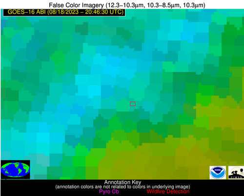
Wildfire Alert Report
| Date: | 2023-08-18 |
|---|---|
| Time: | 20:46:17 |
| Production Date and Time: | 2023-08-18 20:51:47 UTC |
| Primary Instrument: | GOES-16 ABI |
| Wmo Spacecraft Id: | 152 |
| Location/orbit: | GEO |
| L1 File: | OR_ABI-L1b-RadC-M6C14_G16_s20232302046174_e20232302048547_c20232302049038.nc |
| L1 File(s) - Temporal | OR_ABI-L1b-RadC-M6C14_G16_s20232302036174_e20232302038547_c20232302039025.nc |
| Number Of Thermal Anomaly Alerts: | 3 |
Possible Wildfire
| Basic Information | |
|---|---|
| State/Province(s) | MT |
| Country/Countries | USA |
| County/Locality(s) | Sanders County, MT |
| NWS WFO | Missoula MT |
| Identification Method | Enhanced Contextual (Cloud) |
| Mean Object Date/Time | 2023-08-18 20:46:19UTC |
| Radiative Center (Lat, Lon): | 47.390000°, -114.810000° |
| Nearby Counties (meeting alert criteria): |
|
| Total Radiative Power Anomaly | n/a |
| Total Radiative Power | 288.09 MW |
| Map: | |
| Additional Information | |
| Alert Status | New Feature |
| Type of Event | Elevated SPC Risk and Red Flag Warning, Known Incident: RIVER ROAD EAST (HIGH, tdiff=0.02623 days, P |
| Event Priority Ranking | 1 |
| Maximum Observed BT (3.9 um) | 312.87 K |
| Observed - Background BT (3.9 um) | 21.90 K |
| BT Anomaly (3.9 um) | 10.23 K |
| Maximum Observed - Clear RTM BT (3.9 um) | 16.45 K |
| Maximum Observed BTD (3.9-10/11/12 um) | 46.09 K |
| Observed - Background BTD (3.9-10/11/12 um) | 21.54 K |
| BTD Anomaly (3.9-10/11/12 um) | 8.65 K |
| Similar Pixel Count | 0 |
| BT Time Tendency (3.9 um) | 16.40 K |
| Image Interval | 10.00 minutes |
| Fraction of Surrounding LWIR Pixels that are Colder | 0.76 |
| Fraction of Surrounding Red Channel Pixels that are Brighter | 0.87 |
| Maximum Radiative Power | 241.59 MW |
| Maximum Radiative Power Uncertainty | 0.00 MW |
| Total Radiative Power Uncertainty | 0.00 MW |
| Mean Viewing Angle | 67.00° |
| Mean Solar Zenith Angle | 36.30° |
| Mean Glint Angle | 80.10° |
| Water Fraction | 0.00 |
| Total Pixel Area | 33.00 km2 |
| Latest Satellite Imagery: | |
| View all event imagery » | |
Possible Wildfire
| Basic Information | |
|---|---|
| State/Province(s) | MS |
| Country/Countries | USA |
| County/Locality(s) | Hinds County, MS |
| NWS WFO | Jackson MS |
| Identification Method | Enhanced Contextual (Clear) |
| Mean Object Date/Time | 2023-08-18 20:47:21UTC |
| Radiative Center (Lat, Lon): | 32.440000°, -90.440000° |
| Nearby Counties (meeting alert criteria): |
|
| Total Radiative Power Anomaly | n/a |
| Total Radiative Power | 31.83 MW |
| Map: | |
| Additional Information | |
| Alert Status | New Feature |
| Type of Event | Nominal Risk |
| Event Priority Ranking | 4 |
| Maximum Observed BT (3.9 um) | 316.18 K |
| Observed - Background BT (3.9 um) | 7.26 K |
| BT Anomaly (3.9 um) | 4.13 K |
| Maximum Observed - Clear RTM BT (3.9 um) | 8.62 K |
| Maximum Observed BTD (3.9-10/11/12 um) | 19.39 K |
| Observed - Background BTD (3.9-10/11/12 um) | 7.26 K |
| BTD Anomaly (3.9-10/11/12 um) | 5.05 K |
| Similar Pixel Count | 5 |
| BT Time Tendency (3.9 um) | 3.60 K |
| Image Interval | 10.00 minutes |
| Fraction of Surrounding LWIR Pixels that are Colder | 0.52 |
| Fraction of Surrounding Red Channel Pixels that are Brighter | 1.00 |
| Maximum Radiative Power | 31.83 MW |
| Maximum Radiative Power Uncertainty | 0.00 MW |
| Total Radiative Power Uncertainty | 0.00 MW |
| Mean Viewing Angle | 41.40° |
| Mean Solar Zenith Angle | 41.20° |
| Mean Glint Angle | 50.60° |
| Water Fraction | 0.00 |
| Total Pixel Area | 5.90 km2 |
| Latest Satellite Imagery: | |
| View all event imagery » | |
Possible Wildfire
| Basic Information | |
|---|---|
| State/Province(s) | MS |
| Country/Countries | USA |
| County/Locality(s) | Forrest County, MS |
| NWS WFO | Jackson MS |
| Identification Method | Enhanced Contextual (Clear) |
| Mean Object Date/Time | 2023-08-18 20:47:21UTC |
| Radiative Center (Lat, Lon): | 31.010000°, -89.290000° |
| Nearby Counties (meeting alert criteria): |
|
| Total Radiative Power Anomaly | n/a |
| Total Radiative Power | 26.05 MW |
| Map: | |
| Additional Information | |
| Alert Status | New Feature |
| Type of Event | Nominal Risk |
| Event Priority Ranking | 4 |
| Maximum Observed BT (3.9 um) | 316.06 K |
| Observed - Background BT (3.9 um) | 5.83 K |
| BT Anomaly (3.9 um) | 5.38 K |
| Maximum Observed - Clear RTM BT (3.9 um) | 9.78 K |
| Maximum Observed BTD (3.9-10/11/12 um) | 18.99 K |
| Observed - Background BTD (3.9-10/11/12 um) | 6.14 K |
| BTD Anomaly (3.9-10/11/12 um) | 7.61 K |
| Similar Pixel Count | 12 |
| BT Time Tendency (3.9 um) | 5.10 K |
| Image Interval | 10.00 minutes |
| Fraction of Surrounding LWIR Pixels that are Colder | 0.23 |
| Fraction of Surrounding Red Channel Pixels that are Brighter | 1.00 |
| Maximum Radiative Power | 26.05 MW |
| Maximum Radiative Power Uncertainty | 0.00 MW |
| Total Radiative Power Uncertainty | 0.00 MW |
| Mean Viewing Angle | 39.40° |
| Mean Solar Zenith Angle | 41.70° |
| Mean Glint Angle | 49.10° |
| Water Fraction | 0.00 |
| Total Pixel Area | 5.70 km2 |
| Latest Satellite Imagery: | |
| View all event imagery » | |


