Wildfire Alert Report
| Date: | 2023-08-16 |
|---|---|
| Time: | 20:41:17 |
| Production Date and Time: | 2023-08-16 20:45:48 UTC |
| Primary Instrument: | GOES-16 ABI |
| Wmo Spacecraft Id: | 152 |
| Location/orbit: | GEO |
| L1 File: | OR_ABI-L1b-RadC-M6C14_G16_s20232282041174_e20232282043546_c20232282044031.nc |
| L1 File(s) - Temporal | OR_ABI-L1b-RadC-M6C14_G16_s20232282036174_e20232282038546_c20232282039032.nc |
| Number Of Thermal Anomaly Alerts: | 5 |
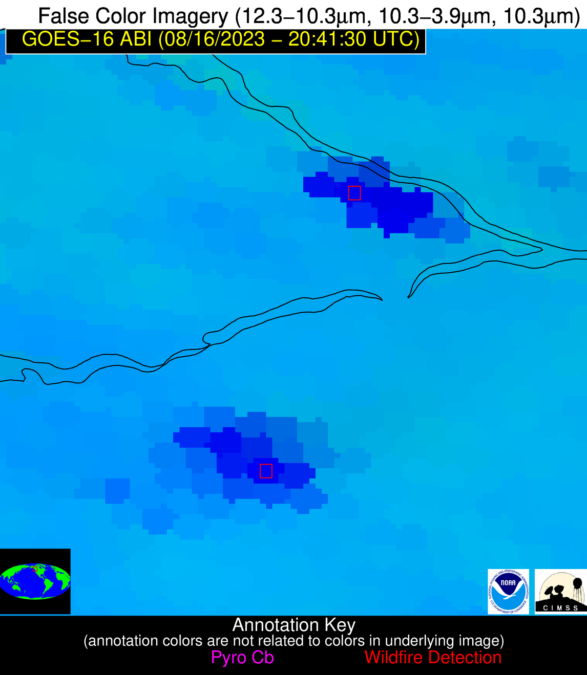
Possible Wildfire
| Basic Information | |
|---|---|
| State/Province(s) | Unknown |
| Country/Countries | Canada |
| County/Locality(s) | Canada |
| NWS WFO | N/A |
| Identification Method | Enhanced Contextual (Cloud) |
| Mean Object Date/Time | 2023-08-16 20:41:19UTC |
| Radiative Center (Lat, Lon): | 53.530000°, -125.640000° |
| Nearby Counties (meeting alert criteria): |
|
| Total Radiative Power Anomaly | n/a |
| Total Radiative Power | 4598.58 MW |
| Map: | |
| Additional Information | |
| Alert Status | New Feature |
| Type of Event | Nominal Risk |
| Event Priority Ranking | 4 |
| Maximum Observed BT (3.9 um) | 346.18 K |
| Observed - Background BT (3.9 um) | 51.06 K |
| BT Anomaly (3.9 um) | 15.82 K |
| Maximum Observed - Clear RTM BT (3.9 um) | 55.06 K |
| Maximum Observed BTD (3.9-10/11/12 um) | 63.59 K |
| Observed - Background BTD (3.9-10/11/12 um) | 50.35 K |
| BTD Anomaly (3.9-10/11/12 um) | 18.11 K |
| Similar Pixel Count | 0 |
| BT Time Tendency (3.9 um) | 24.10 K |
| Image Interval | 5.00 minutes |
| Fraction of Surrounding LWIR Pixels that are Colder | 0.75 |
| Fraction of Surrounding Red Channel Pixels that are Brighter | 0.20 |
| Maximum Radiative Power | 1488.74 MW |
| Maximum Radiative Power Uncertainty | 0.00 MW |
| Total Radiative Power Uncertainty | 0.00 MW |
| Mean Viewing Angle | 77.00° |
| Mean Solar Zenith Angle | 39.40° |
| Mean Glint Angle | 96.70° |
| Water Fraction | 0.00 |
| Total Pixel Area | 209.20 km2 |
| Latest Satellite Imagery: | |
| View all event imagery » | |
Possible Wildfire
| Basic Information | |
|---|---|
| State/Province(s) | Unknown |
| Country/Countries | Canada |
| County/Locality(s) | Canada |
| NWS WFO | N/A |
| Identification Method | Enhanced Contextual (Cloud) |
| Mean Object Date/Time | 2023-08-16 20:41:19UTC |
| Radiative Center (Lat, Lon): | 53.060000°, -125.850000° |
| Nearby Counties (meeting alert criteria): |
|
| Total Radiative Power Anomaly | n/a |
| Total Radiative Power | 2079.68 MW |
| Map: | |
| Additional Information | |
| Alert Status | New Feature |
| Type of Event | Nominal Risk |
| Event Priority Ranking | 4 |
| Maximum Observed BT (3.9 um) | 327.62 K |
| Observed - Background BT (3.9 um) | 29.49 K |
| BT Anomaly (3.9 um) | 10.69 K |
| Maximum Observed - Clear RTM BT (3.9 um) | 35.81 K |
| Maximum Observed BTD (3.9-10/11/12 um) | 43.29 K |
| Observed - Background BTD (3.9-10/11/12 um) | 29.16 K |
| BTD Anomaly (3.9-10/11/12 um) | 14.52 K |
| Similar Pixel Count | 0 |
| BT Time Tendency (3.9 um) | -1.00 K |
| Image Interval | 5.00 minutes |
| Fraction of Surrounding LWIR Pixels that are Colder | 0.65 |
| Fraction of Surrounding Red Channel Pixels that are Brighter | 0.08 |
| Maximum Radiative Power | 666.79 MW |
| Maximum Radiative Power Uncertainty | 0.00 MW |
| Total Radiative Power Uncertainty | 0.00 MW |
| Mean Viewing Angle | 76.90° |
| Mean Solar Zenith Angle | 39.00° |
| Mean Glint Angle | 96.40° |
| Water Fraction | 0.00 |
| Total Pixel Area | 208.30 km2 |
| Latest Satellite Imagery: | |
| View all event imagery » | |
Possible Wildfire
| Basic Information | |
|---|---|
| State/Province(s) | ID |
| Country/Countries | USA |
| County/Locality(s) | Idaho County, ID |
| NWS WFO | Missoula MT |
| Identification Method | Enhanced Contextual (Clear) |
| Mean Object Date/Time | 2023-08-16 20:41:19UTC |
| Radiative Center (Lat, Lon): | 46.490000°, -114.960000° |
| Nearby Counties (meeting alert criteria): |
|
| Total Radiative Power Anomaly | n/a |
| Total Radiative Power | 49.26 MW |
| Map: | |
| Additional Information | |
| Alert Status | New Feature |
| Type of Event | Nominal Risk, Known Incident: LITTLE BEAR (MEDIUM, tdiff=1.42674 days, PERIMETER) |
| Event Priority Ranking | 4 |
| Maximum Observed BT (3.9 um) | 306.23 K |
| Observed - Background BT (3.9 um) | 3.52 K |
| BT Anomaly (3.9 um) | 2.13 K |
| Maximum Observed - Clear RTM BT (3.9 um) | 5.30 K |
| Maximum Observed BTD (3.9-10/11/12 um) | 11.30 K |
| Observed - Background BTD (3.9-10/11/12 um) | 3.49 K |
| BTD Anomaly (3.9-10/11/12 um) | 2.88 K |
| Similar Pixel Count | 17 |
| BT Time Tendency (3.9 um) | 3.90 K |
| Image Interval | 5.00 minutes |
| Fraction of Surrounding LWIR Pixels that are Colder | 0.50 |
| Fraction of Surrounding Red Channel Pixels that are Brighter | 1.00 |
| Maximum Radiative Power | 29.45 MW |
| Maximum Radiative Power Uncertainty | 0.00 MW |
| Total Radiative Power Uncertainty | 0.00 MW |
| Mean Viewing Angle | 66.50° |
| Mean Solar Zenith Angle | 34.40° |
| Mean Glint Angle | 79.30° |
| Water Fraction | 0.00 |
| Total Pixel Area | 32.00 km2 |
| Latest Satellite Imagery: | |
| View all event imagery » | |
Possible Wildfire
| Basic Information | |
|---|---|
| State/Province(s) | KS |
| Country/Countries | USA |
| County/Locality(s) | Sumner County, KS |
| NWS WFO | Wichita KS |
| Identification Method | Enhanced Contextual (Clear) |
| Mean Object Date/Time | 2023-08-16 20:41:50UTC |
| Radiative Center (Lat, Lon): | 37.130000°, -97.330000° |
| Nearby Counties (meeting alert criteria): |
|
| Total Radiative Power Anomaly | n/a |
| Total Radiative Power | 27.24 MW |
| Map: | |
| Additional Information | |
| Alert Status | New Feature |
| Type of Event | Nominal Risk |
| Event Priority Ranking | 4 |
| Maximum Observed BT (3.9 um) | 312.08 K |
| Observed - Background BT (3.9 um) | 5.02 K |
| BT Anomaly (3.9 um) | 3.42 K |
| Maximum Observed - Clear RTM BT (3.9 um) | 9.60 K |
| Maximum Observed BTD (3.9-10/11/12 um) | 15.97 K |
| Observed - Background BTD (3.9-10/11/12 um) | 5.43 K |
| BTD Anomaly (3.9-10/11/12 um) | 5.64 K |
| Similar Pixel Count | 20 |
| BT Time Tendency (3.9 um) | 3.60 K |
| Image Interval | 5.00 minutes |
| Fraction of Surrounding LWIR Pixels that are Colder | 0.27 |
| Fraction of Surrounding Red Channel Pixels that are Brighter | 0.99 |
| Maximum Radiative Power | 27.24 MW |
| Maximum Radiative Power Uncertainty | 0.00 MW |
| Total Radiative Power Uncertainty | 0.00 MW |
| Mean Viewing Angle | 49.20° |
| Mean Solar Zenith Angle | 36.50° |
| Mean Glint Angle | 56.40° |
| Water Fraction | 0.00 |
| Total Pixel Area | 7.20 km2 |
| Latest Satellite Imagery: | |
| View all event imagery » | |
Possible Wildfire
| Basic Information | |
|---|---|
| State/Province(s) | LA |
| Country/Countries | USA |
| County/Locality(s) | Madison Parish, LA |
| NWS WFO | Jackson MS |
| Identification Method | Enhanced Contextual (Cloud) |
| Mean Object Date/Time | 2023-08-16 20:42:20UTC |
| Radiative Center (Lat, Lon): | 32.260000°, -91.490000° |
| Nearby Counties (meeting alert criteria): |
|
| Total Radiative Power Anomaly | n/a |
| Total Radiative Power | 102.92 MW |
| Map: | |
| Additional Information | |
| Alert Status | New Feature |
| Type of Event | Nominal Risk |
| Event Priority Ranking | 4 |
| Maximum Observed BT (3.9 um) | 327.73 K |
| Observed - Background BT (3.9 um) | 20.94 K |
| BT Anomaly (3.9 um) | 9.55 K |
| Maximum Observed - Clear RTM BT (3.9 um) | 23.43 K |
| Maximum Observed BTD (3.9-10/11/12 um) | 30.91 K |
| Observed - Background BTD (3.9-10/11/12 um) | 20.17 K |
| BTD Anomaly (3.9-10/11/12 um) | 10.67 K |
| Similar Pixel Count | 0 |
| BT Time Tendency (3.9 um) | 18.50 K |
| Image Interval | 5.00 minutes |
| Fraction of Surrounding LWIR Pixels that are Colder | 0.86 |
| Fraction of Surrounding Red Channel Pixels that are Brighter | 0.73 |
| Maximum Radiative Power | 102.92 MW |
| Maximum Radiative Power Uncertainty | 0.00 MW |
| Total Radiative Power Uncertainty | 0.00 MW |
| Mean Viewing Angle | 41.70° |
| Mean Solar Zenith Angle | 38.80° |
| Mean Glint Angle | 49.10° |
| Water Fraction | 0.00 |
| Total Pixel Area | 5.90 km2 |
| Latest Satellite Imagery: | |
| View all event imagery » | |


